High Sierra
Backpacking
Trail Guide
Forums
Sierra
Weather
WeatherNotes Northern
Sierra Weather
Gear
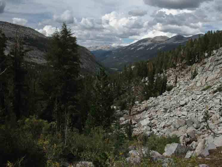
Trail Segment
JMT-PCT
Ireland Lake Trail Junction
in
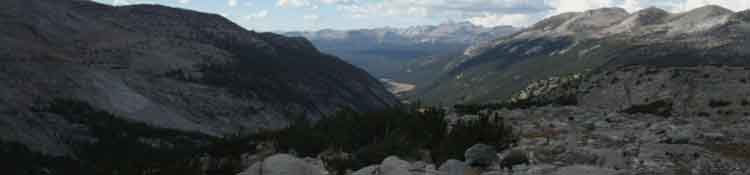
Lyell Canyon
to
Donohue Pass
Trail Section
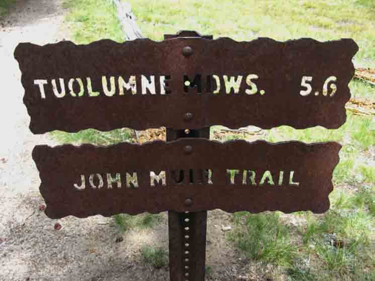
Tuolumne Meadows to Reds Meadow
BACKPACKING
YOSEMITE NATIONAL PARK
Section Hiking
The John Muir Trail
South
to
Reds Meadow
Languages
Trail Skills
Mountain
Safety
Food
Planning
Trail Arts
More
Information
Social
Trail Guide |
Trail |
Trail |
Trail |
7.5 min Topo Map Tuolumne Meadows MAP |
30 min |
Tuolumne Meadows to Reds Meadow MILES and ELES |
TOPO MAP INDEX Tuolumne Meadows to Reds Meadow |
Resupply South |
Forest |
Two-Way
The John Muir Trail
Trail Junction
To
Ireland Lake
&
Vogelsang High Sierra Camp
or
Donohue Pass
Lyell Canyon
Maps, Miles, & Elevation
Central & South
Backpacker Resources
Lakg the Tahoe to Yosemite Trail. |
|||||||||||||||||||||||||||||||||||||
John Muir Trail
North & South
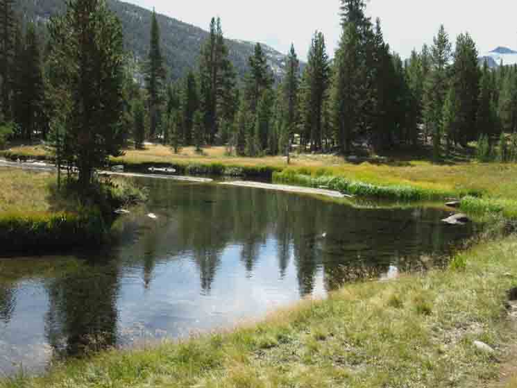
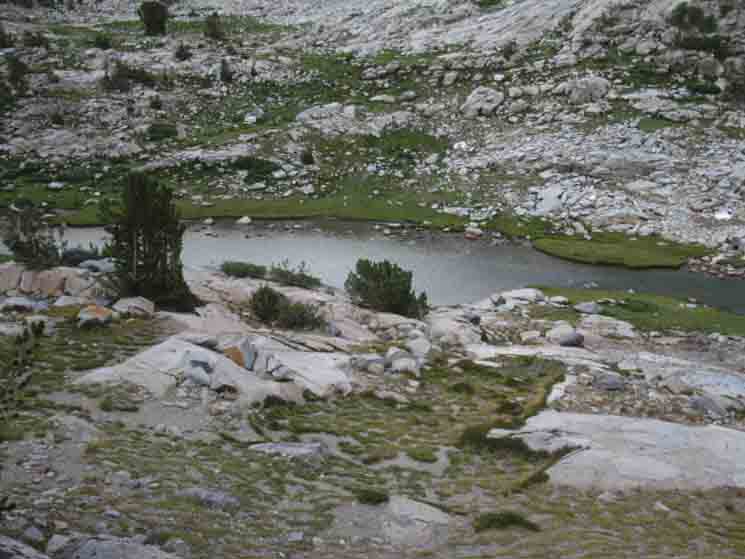
Ireland Creek Trail Junction Lyell Canyon,
6.24 miles
6.45 miles
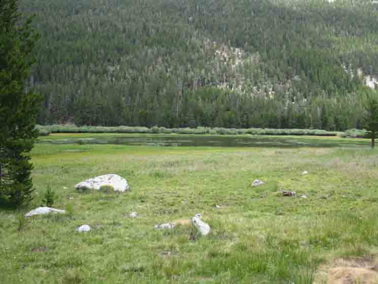
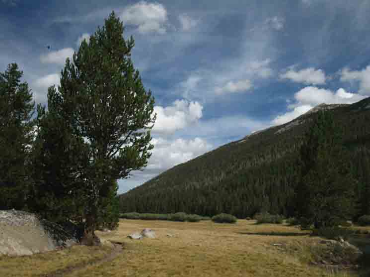
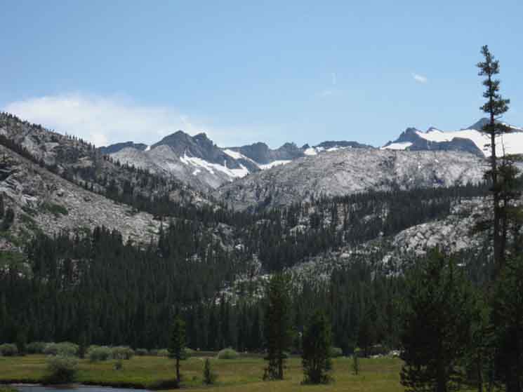
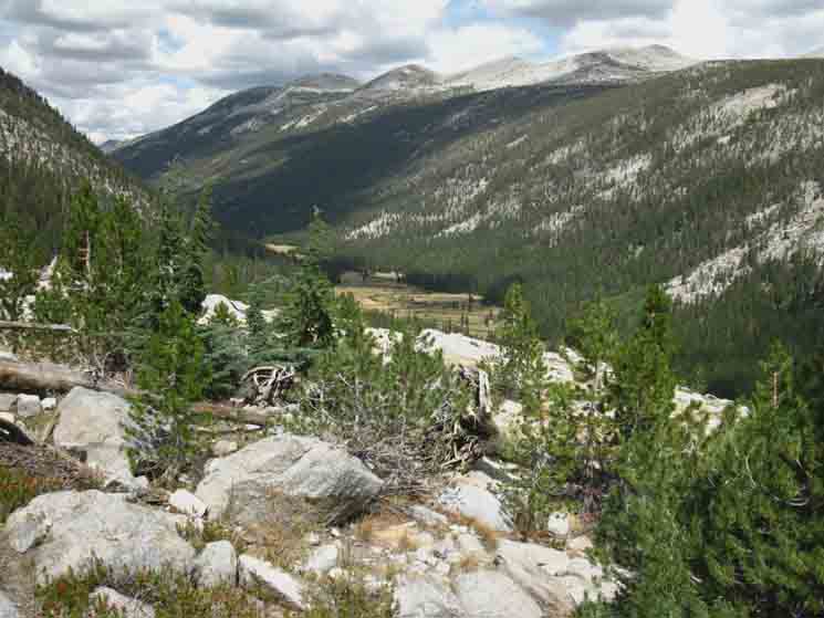
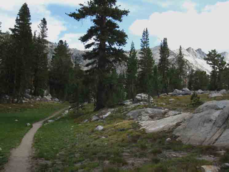
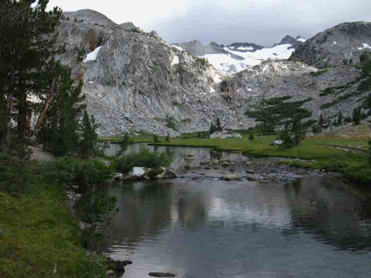
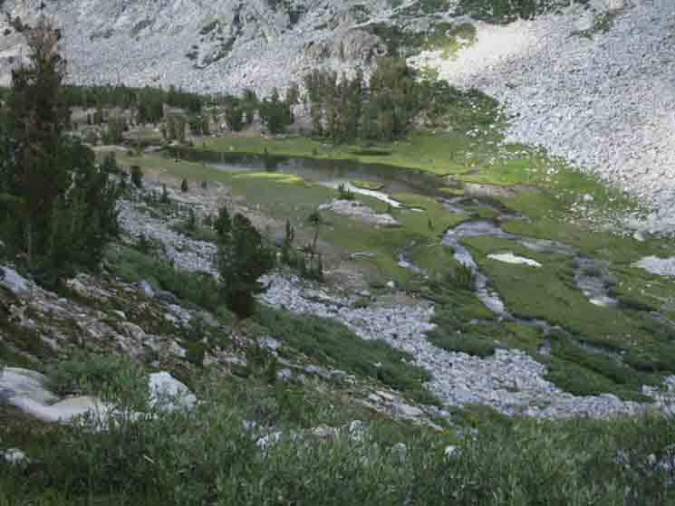
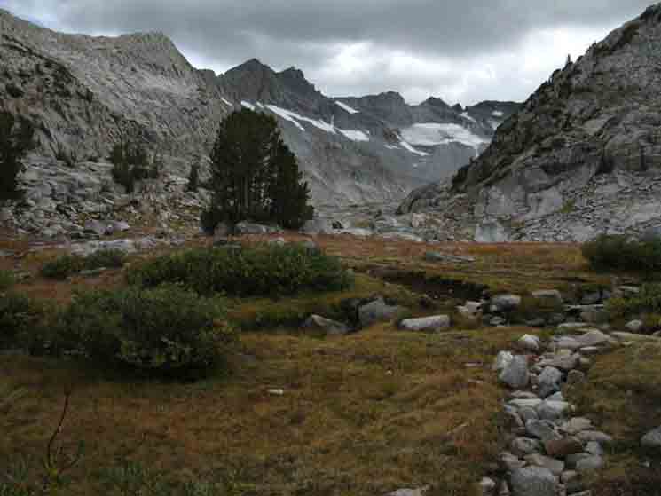
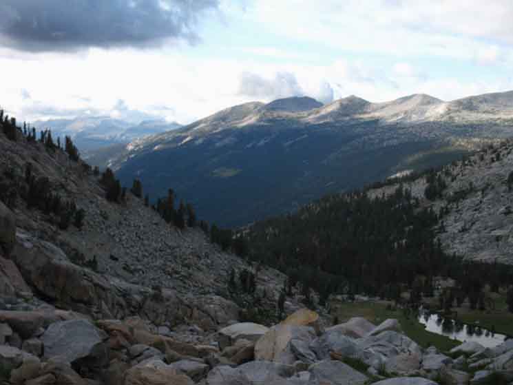
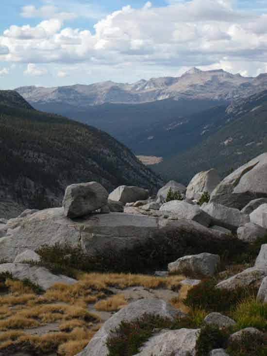
Ireland Lake-Vogelsang Here we find a trail branching off the John Muir Trail Southwest, first up to another trail breaking off to Ireland Lake in its expansive basin wedged into the Eastern Flank of the Cathedral Range under a spur off the Cathedral Crestline, composed of Amelia Earhart Peak reaching down to Potter Point, the monumental feature marking this junction near the top of Lyell Canyon. Previous Page We can continue to follow the John Muir Trail South to Donohue Pass on the page below, or we can turn Southwest at this trail up to Vogelsang High Sierra Camp, depicted on the trail guide page linked to below, which is one of the series tracking our hike to the John Muir Trail in Lyell Canyon from the Happy Isles Trailhead in Yosemite Valley.
Trail Southwest Vogelsang High Sierra Camp
Vogelsang HSC is situated in a picturesque location towards the Southern end of the crestline of the Cathedral Range of Yosemite National Park.
Trail North Tuolumne Meadow
The Tuolumne Meadows Post Office, Store, and Grill facilities are located 6.24 miles to our North traveling downriver in Lyell Canyon from the Ireland Lake trail junction. The point where the John Muir Trail meets the wilderness boundary at the end of the car campground road is 5.63 miles
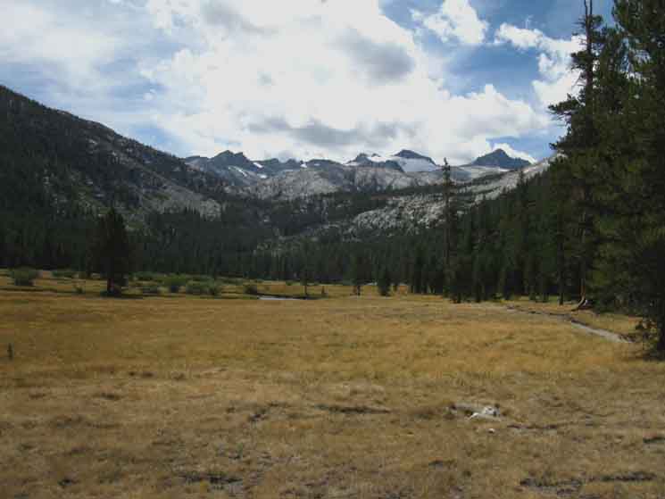
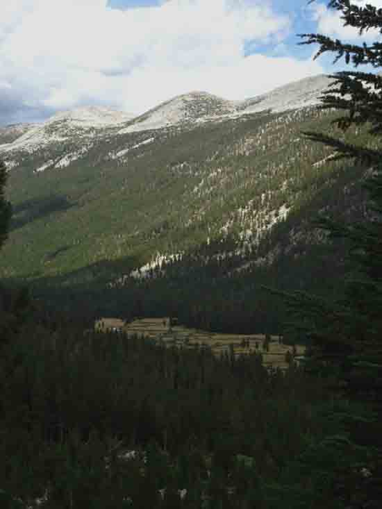
We Continue South This will be our last segment of trail in Yosemite since entering Yosemite what seems so long ago, when we hiked through Bond Pass on the Tahoe to Yosemite Trail into the top of Jack Main Canyon (map) in the far Northwestern Corner of the Park. Since then we've crossed the North Yosemite Backcountry, followed the John Muir Trail "backwards" down to Yosemite Valley, and now have climbed back to the Sierra Crest and the John Muir Trail via the Merced River to Merced Lake, from where we crossed the Cathedral Range into Lyell Canyon via Vogelsang High Sierra Camp.
The Long View It was and is a good idea!
Lyell Canyon Junction
Maps & Miles
Map North
30 min Maps
Location
SOUTH
OF 6.24 miles 5.6 miles 4.17 miles
TO 6.45 miles 28.01 miles
SOUTHWEST (Lyell Canyon to Vogelsang)
6.09 miles 25.94 miles
|
North to Tuolumne Meadows
Wilderness Boundary
 |
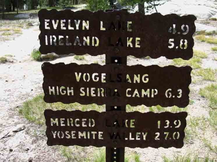
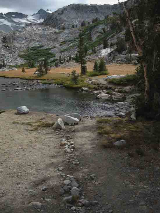
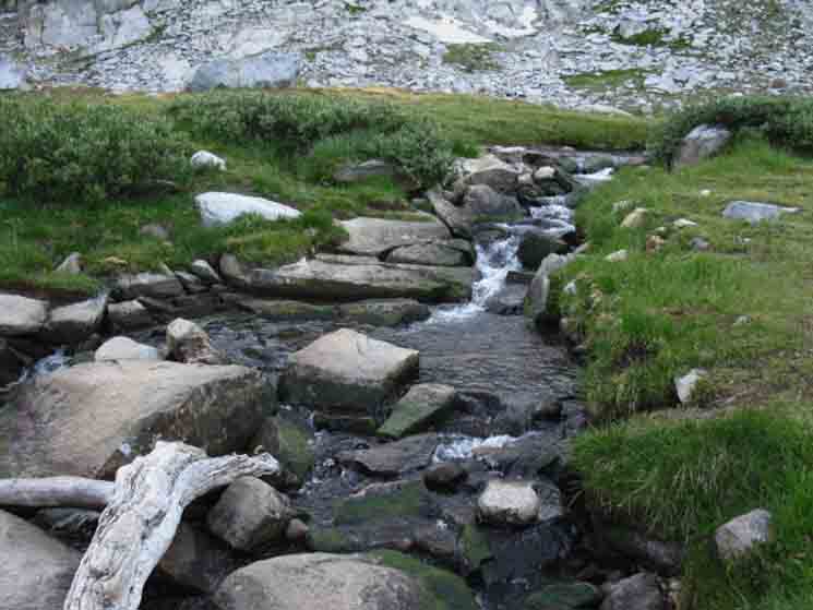
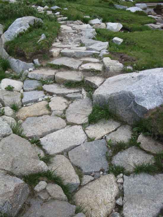
Down Lyell Canyon One of the three trail signs at the Ireland Creek trail junction in Lyell Canyon. The trail branching off from this junction climbs Southwest up to Ireland and Evelyn Lakes on its way up to Vogelsang High Sierra Camp. The sign above indicates the distance on the JMT down Lyell Canyon to the Wilderness Boundary located on the Southeastern-most end of the Tuolumne Meadows Car Campground. From that point we can get on the campground roads for the most direct line to the Post Office, Store, and Grill, which is a total of 6.24 miles.
Tuolumne Meadow Backpacker Resupply Facilities
Tuolumne Meadows Backpacker Permits
|
To the
Southwest
is our
Second Vogelsang Trail Junction
via
Ireland and Evelyn Lakes to Vogelsang
 |
||
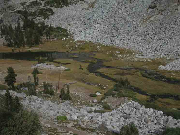
Climbing Out of Lyell Canyon Miles sign at the trail junction leading Southwest up to Vogelsang HSC via Ireland and Evelyn Lakes. For us Southbound hikers out of Tuolumne Meadows we passed by our first trail option for hiking up to Vogelsang back at the Rafferty Creek trail junction, 4.17 miles to our North, further down Lyell Canyon. That route to Vogelsang through Tuolumne Pass is much more direct than this option. Together, they compose a nice loop route out of Tuolumne Meadows. Trail Section Forum
|
South
John Muir Trail
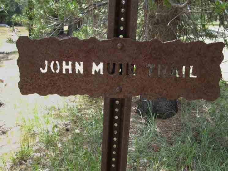 |
Southbound John Muir Trail sign at Ireland Lake trail junction in Lyell Canyon. This is the only "plate" on this post for Southbound hikers. It feels like this post is missing its miles plate.
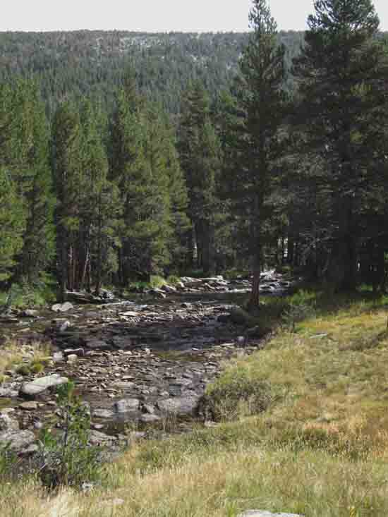
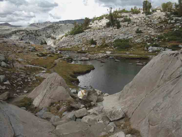
Trail miles South from this trail junction 2.88 miles to the end of Lyell Canyon, where we exit the flat but tilted floor 4.84 miles to First Flat-Pooling area, the "Lower Basin." 5.5 miles to Second Flat-Pooling area, the "Upper Basin." 6.45 miles to Donohue Pass.
Merced Lake to Lyell Canyon to Island Pass
South PCT & JMT
|
South on the John Muir Trail
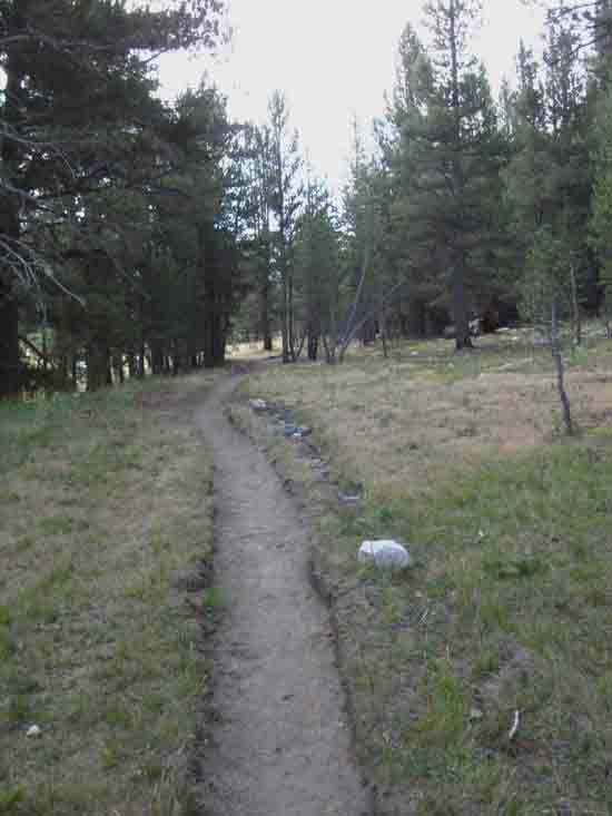 |
Trail to the end of Lyell Canyon from Ireland Creek trail junction. |
Deer well Covered
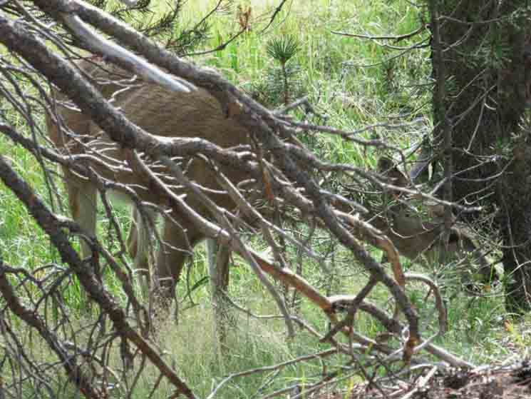 |
A lot of wildlife accesses the lushness in the top of Lyell Canyon.
|
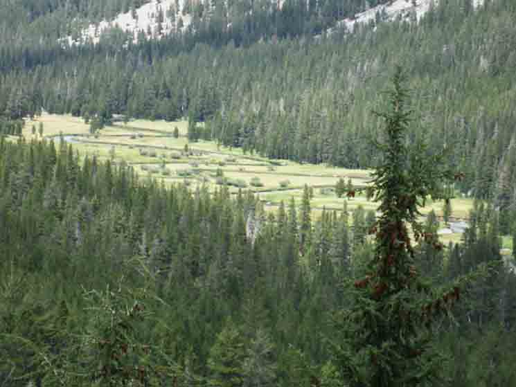
Marshy Meadow Upper Lyell Canyon
 |
||
Earlier in the Summer hiking season. Trail Section Forum
|
Marshy Meadow Upper Lyell Canyon
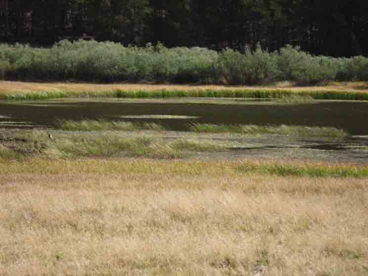 |
Later, and further South, we come up along the marshy pool above the Ireland Lake trail junction. |
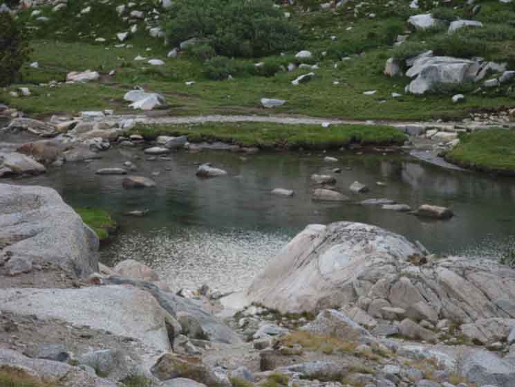
Pool along the Tuolumne River
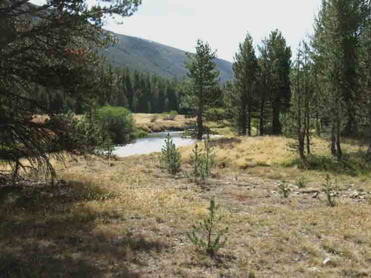 |
Nice pool along the Tuolumne River in Upper Lyell Canyon.
|
Slower, Wider section of the Upper Tuolumne River
 |
||
Only the Western bends of the ribbon like course of the Tuolumne River up here even come close to the trail. Trail Section Forum
|
Deer Watch
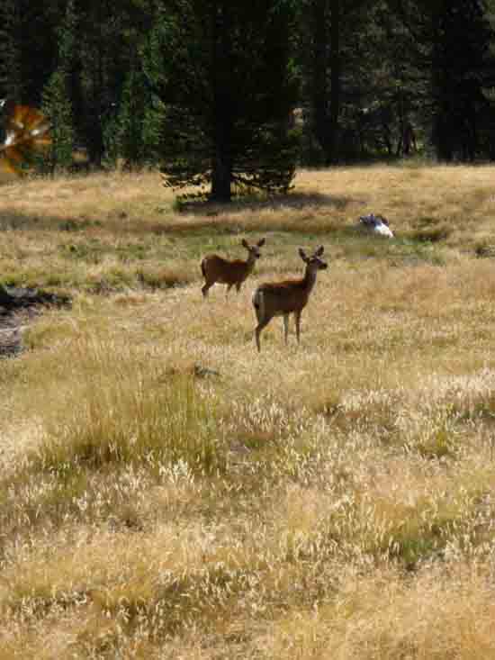 |
Spring or Fall, I find more wildlife in the upper portion of Lyell Canyon than the lower.
|
Snake in the Grass
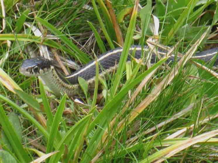 |
The garter snakes were thick. This one was particularly curious, as you can see. Most garter snakes don't come in to say, "hi."
|
Last Bend of Lyell Canyon
 |
||
Last rise of the trail off the floor of Lyell Canyon before climbing out of the canyon. Trail Section Forum
|
Check Out that Snake
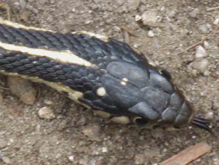 |
Yet another Garter Snake.
|
View North down Lyell Canyon
 |
View down Lyell Canyon as we come closer and closer to the top of this amazing canyon.
|
Tuolumne River in Upper Lyell Canyon
 |
The upper run of the Tuolumne River in Lyell Canyon.
|
Exclamation Blaze
 |
||
Exclamation blaze amusing, rather than guiding backpackers in Upper Lyell Canyon. Interestingly, this blaze still fits the "rectangle and square" specification, if it does knock them a bit askew. Trail Section Forum
|
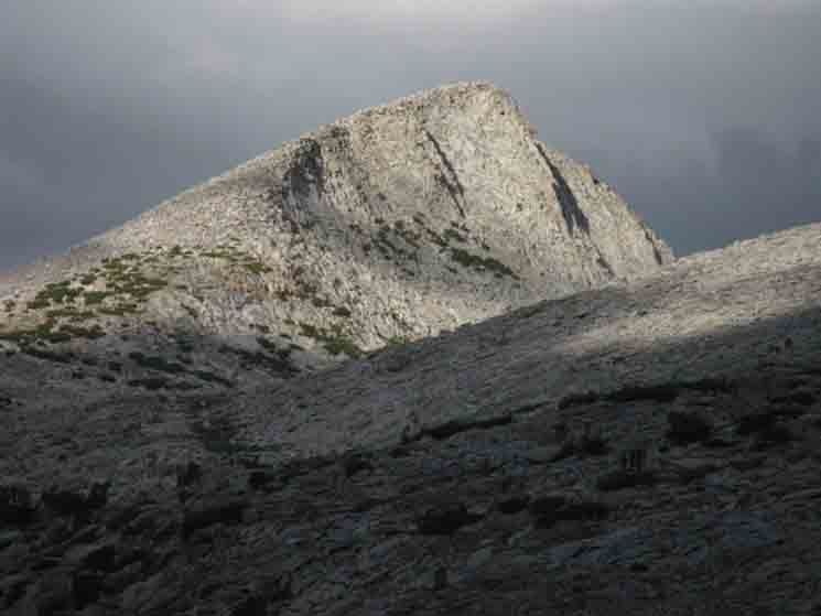
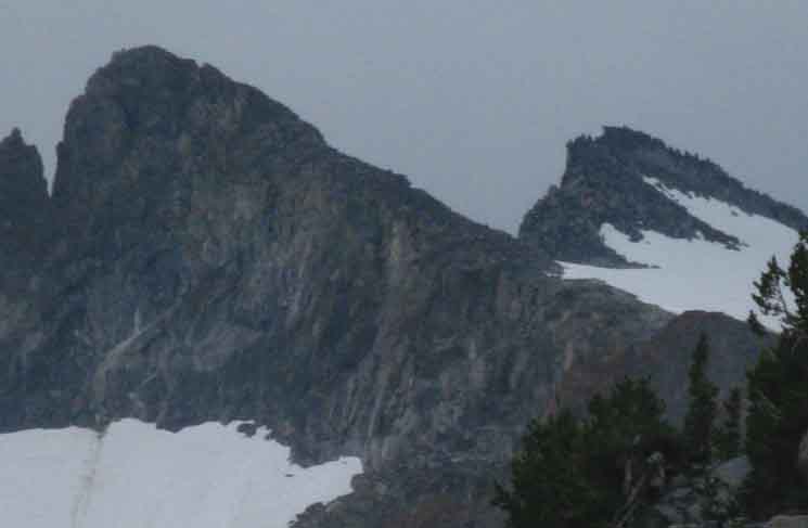
Peak 12356
 |
||
Iconic Peak 12356 along the South end of the Cathedral Range comes into view. This is the double peak we see on the Southernmost end of the crestline holding Lyell and Maclure, being the high point before the crestline turns East and descends to Donohue Pass. I identify Peak 12356 as the Left of these sawtooth twins. Trail Section Forum
|
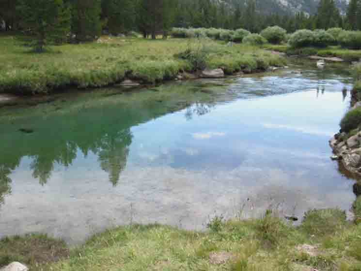
Lazy Bends of Upper Tuolumne River
 |
Next to us we hike past the uppermost pools along the Tuolumne River. |
Trout Fry
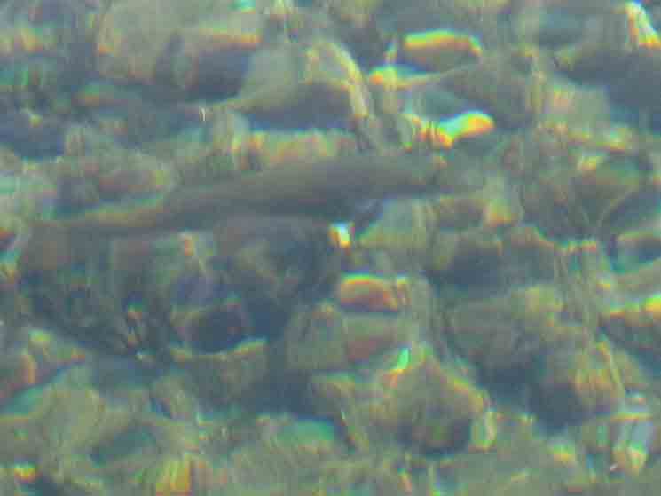 |
Backpacking with the fish on the John Muir Trail along the Upper Tuolumne River.
|
Trail Branch
 |
Trail branching off to our East at the top of lyell Canyon. I figure there is a set of nice camps over there, where this trail breaks off at the top of the uppermost section of meadows running up the floor of Lyell Canyon.
|
Trail in Uppermost Lyell Canyon
 |
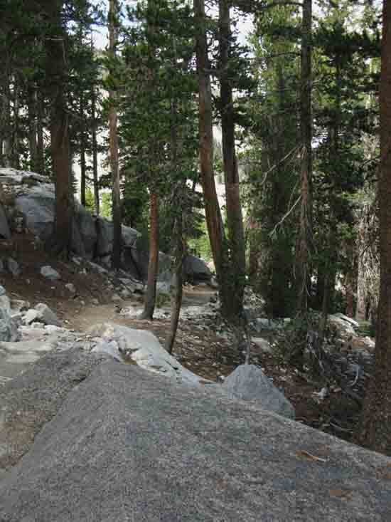
One more line of rock solid trail up across trees and rock off the floor of Lyell Canyon before we come up on the end of the canyon floor. We've seen the endless variations of the old trail routes recovering and being reclaimed by meadow and forest even as new scars are cut. But here trail remains on these impenetrable islands of granite. |
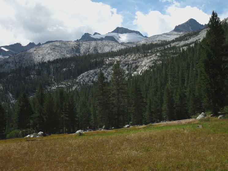
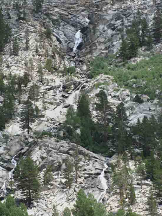
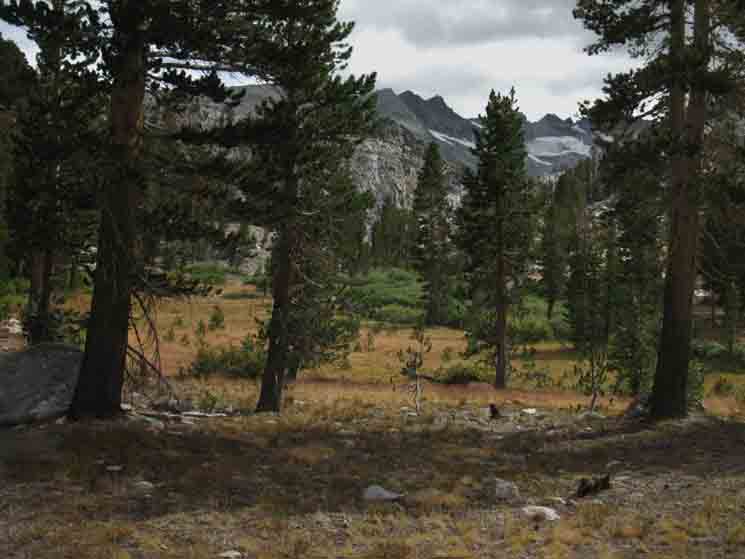
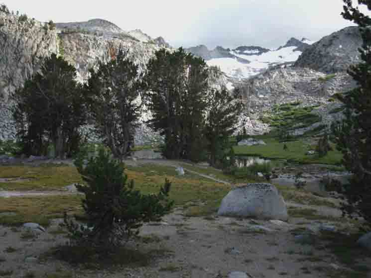
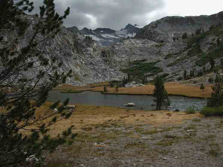
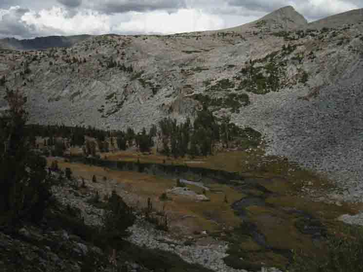
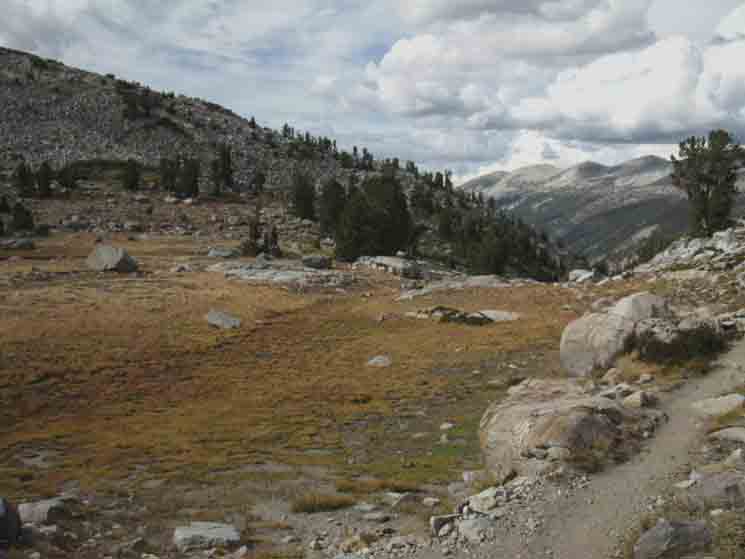
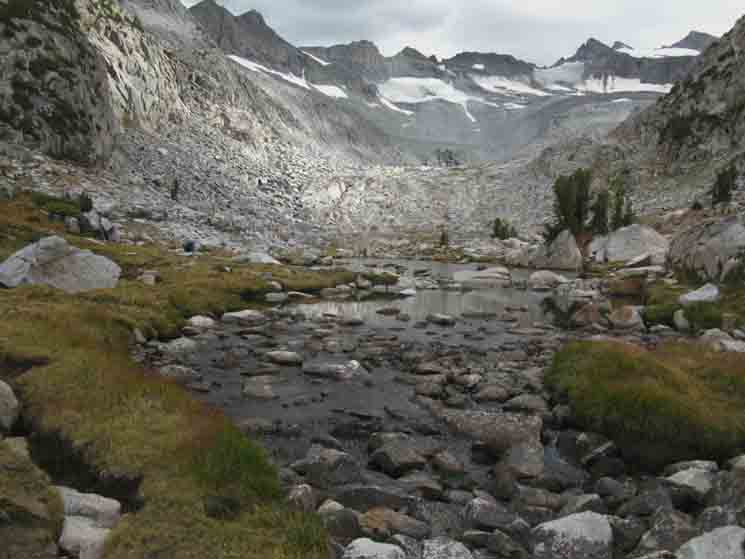
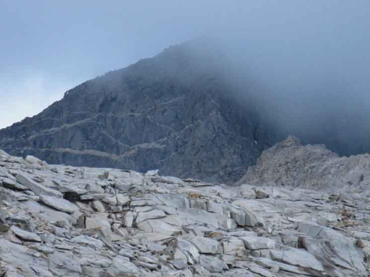
Upper End of Lyell Canyon In the next two images below we can see the South end of the run of Lyell Canyon's meadows. That point I measure out to be 9.12 miles South of the Tuolumne Meadows Post Office. But we are not quite there, yet. We've a few hundred more yards to cross until we begin to climb in earnest towards Donohue Pass and our Southern exit from Yosemite National Park. And we've still got a few more sights to see as we hike up to the top very top-end of Lyell Canyon.
End of Lyell Canyon
Maps & Miles
Map North
30 min Maps
SOUTH
OF 9.12 miles 8.51 miles 7.05 miles
TO 3.57 miles 25.13 miles
|
End of Lyell Canyon
 |
||
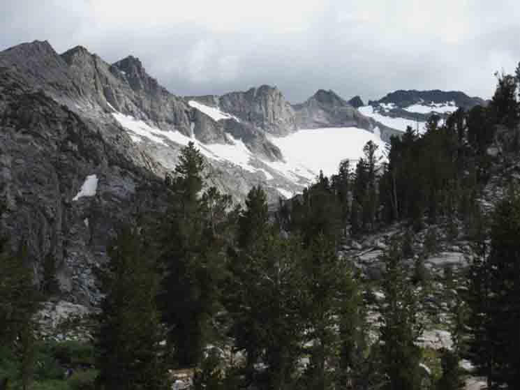
The South end of the Cathedral Range with Mount Lyell on the far Right and Peak 12356 on the furthest Left. Trail Section Forum
|
End of Lyell Canyon
 |
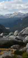
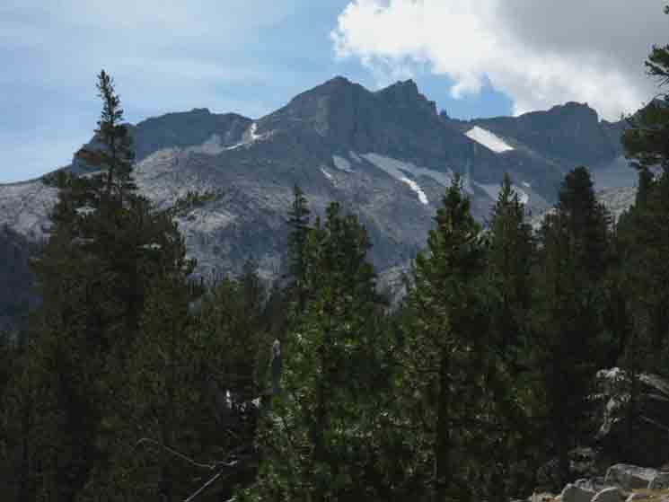
The South end of the Cathedral Range with Mount Maclure on the far Right, Mount Lyell to its Left, and the twin sawtooth peaks of "Mount Lyell Number Two" to the Left of the main mass of Mount Lyell. Peak 12356 is the tallest and furthest Left of the sawtooth twins on the almost-furthest Left of the Cathedral Crestline ahead.
|
Mount Lyell
 |
||
We get clear views of Mount Lyell taking our last steps across the top of its namesake canyon. Trail Section Forum
|
View
South-Southwest
Mounts Lyell and Maclure
 |
Mount Lyell and Mount Maclure come into view at the top of our hike up Lyell Canyon. |
View West
East Flank of Amelia Earhart Peak
 |
The creek coming down the East Flank of Amelia Earhart Peak.
|
NOW
I put the point below, where we step out of the meadows at the top of Lyell Canyon to begin climbing on rock up to Donohue Pass at 9.12 miles South of the Tuolumne Meadows Post Office. We are there.
End of Lyell Canyon
Next Let the serious climbing begin. This is a hard one. Our first segment of climbing is 1.06 miles up 640 feet of elevation up to the footbridge. We'll find campsites on the other side of the bridge running downstream, and more once we climb into a lightly forested flat above the footbridge.
Maps & Miles
Map North
30 min Maps
SOUTH
OF 9.12 miles 8.51 miles 7.05 miles
TO 3.57 miles 25.13 miles
|
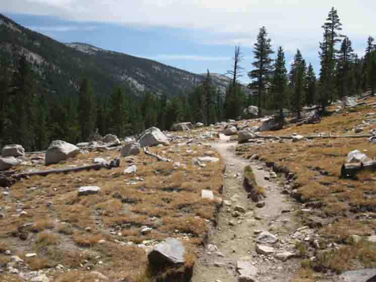
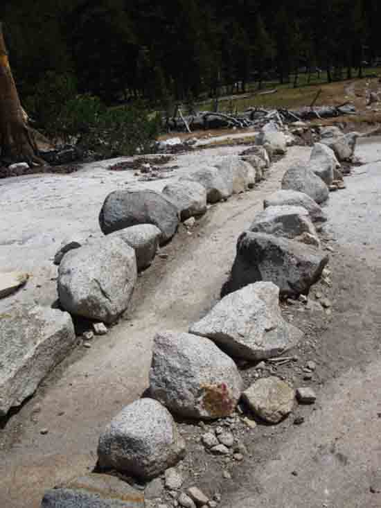
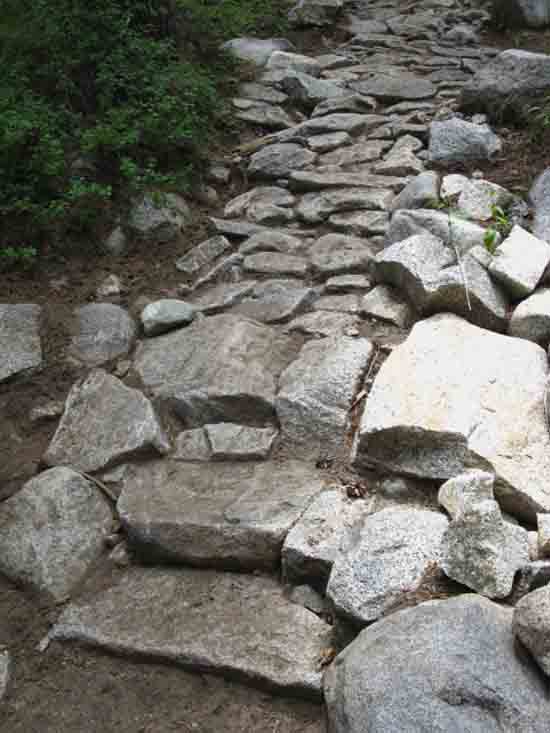
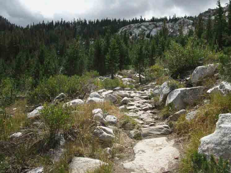
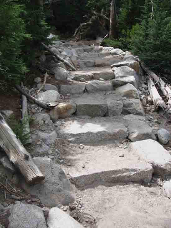
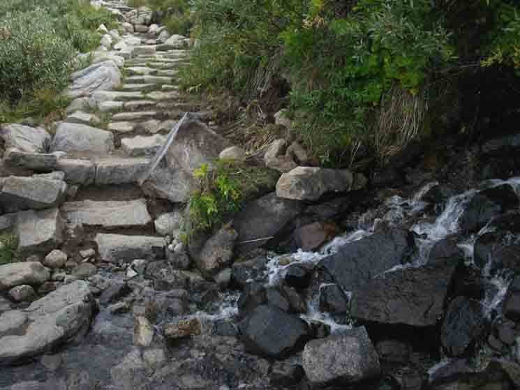
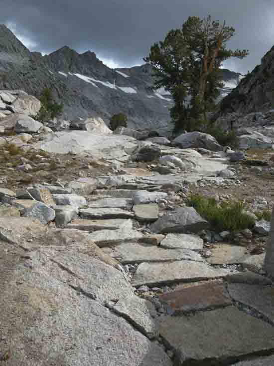
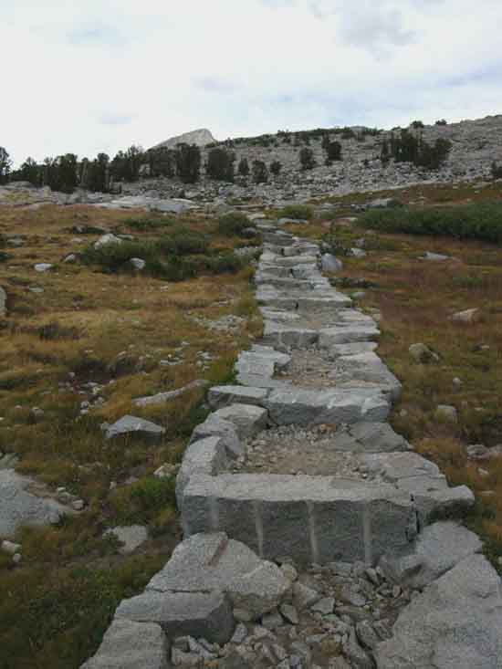
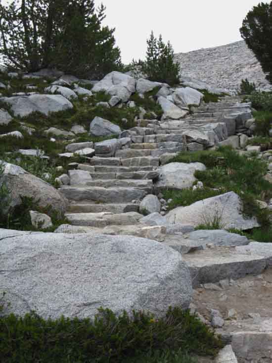
Stone Trail Begins
 |
||
The John Muir Trail climbs out of the South end of Lyell Canyon. Trail Section Forum
|
Moving Up & In
 |
Moving up into the throat of the upper canyon. |
Bria Coming into Lyell Canyon
 |
Bria coming down into the top of Lyell Canyon as she comes to the end of her hike from Mono Pass to Tuolumne Meadows. |
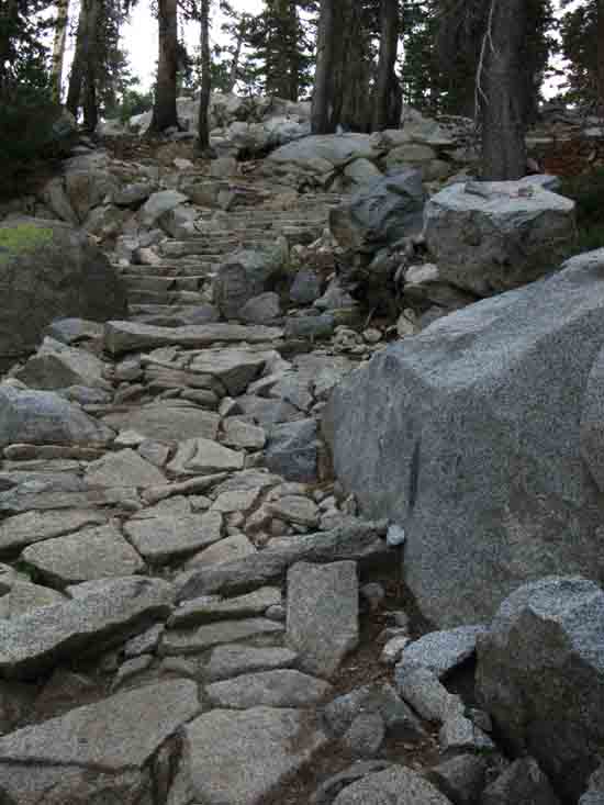
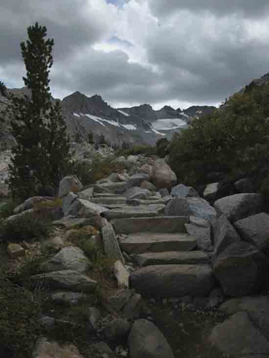
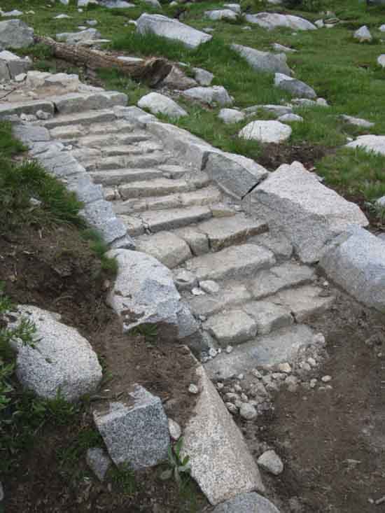
Granite Staircase
 |
||
Lots of stairs and granite steps to Donohue Pass. These are a few of them. Nice granite staircase. Trail Section Forum
|
Moving Up & In
 |
Climbing a bit we start to get long views North up Lyell Canyon.
|
Granite Waves
 |
||
We can almost detect motion as we look at the line of the Kuna Crest as a series of ocean waves running up the Sierra Crestline above the upper meadow in Lyell Canyon as this tranquil but dynamic scene comes into view as we climb higher. Never forget to look back, as well as forward. Both views are in constant flux. Ironically, the Kuna Crest is more related to ocean waves than one might first think. We can still see this set of granite waves left behind by ancient waves on the bottom of an ocean of ice flowing over its surface for centuries. Here we see a clean example of some serious pressure waves up against some seriously hard rock, and the shape of their ultimate compromise of forces. Trail Section Forum
|
Upper Lyell Canyon Meadow
 |
Climbing a bit we start to get long views North up Lyell Canyon.
|
Upper Lyell Canyon and the Kuna Crest
 |
||
Perspective on how the North-South alignment of the Upper Lyell Canyon bends Northwest under the Kuna Crest, shaping an interesting bend and shoulder, which is perfectly highlighted be by the shadow. Trail Section Forum
|
Trail South
 |
A nice but short segment of flat John Muir Trail above Lyell Canyon as we're first climbing to the footbridge under Donohue Pass.
|
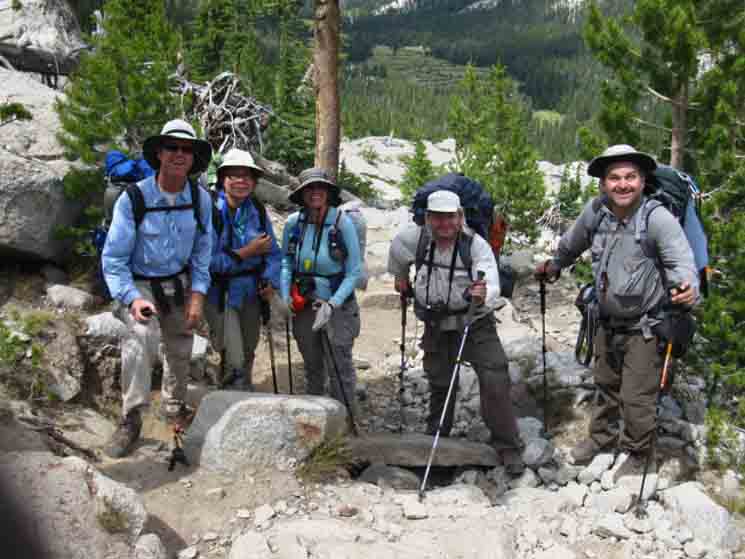
Hiking Team
 |
||
A Northbound Hiking Team Mono Pass to Tuolumne Meadows. A delightful group. My only negative was that we were going in opposite directions, so we could not tarry too long to enjoy each other's company in the face of the demands of our paces.
Trail Section Forum
|
Llamas!
Llamas Kicking Back
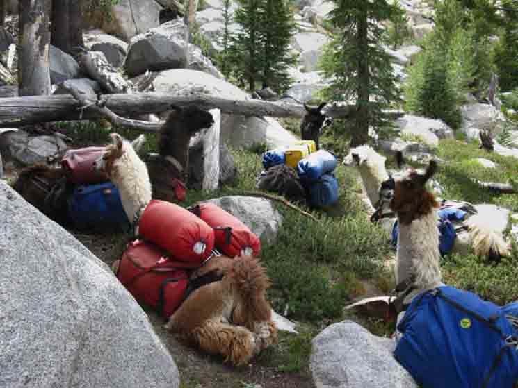 |
Coming around a bend in the trail I noted these five llamas laid out in the rest position, along a narrow section of trail. They got a bit nervous seeing me, so I sweet-talked them, trying to calm them enough to get past without sparking them to all jump up in fear. My sweet talk did not make them friendly, only less scared, and not needing to get up, which was just fine. Now, llamas are tough critters, and seem to enjoy spitting and biting as much any of their other activities, so I always use caution and observe them carefully when in proximity. Since my sweet talk prevented them from getting up, there was not much of a spitting and biting threat. Except the closest one. He was looking a bit peckish, like he did not trust my sweet-talking, and was ready to put me in place if necessary. I was ready to dodge spit. My Approach is Simple: My point is we must be ready to play our role well, when the Game of Life is on the trail. Life on the trail can get very serious very quickly. |
Llama Packers on the Pacific Crest Trail
 |
||||
The llama packers were Ray and Marion Davidson. Ray and Marion seemed a bit like me, but with llamas. They appeared to spend every Summer doing a big section of the PCT, which they loved, and Winters making money and tending llamas to be ready for the next Summer's PCT Section.
Trail Section Forum
|
Southbound
Climbing to Donohue Pass
 |
A fully reinforced granite staircase climbing along the uppermost section of the Lyell Fork of the Tuolumne River. Approaching a hundred years of heavy use have had their toll. |
View South
Cathedral Crestline through the Forest
 |
||
Closer Locate Donohue Pass Donohue Pass and the route of John Muir Trail through it runs across the Sierra Crestline at the base of the Right side of that low granite rise along the distant Sierra Crest. That's Donohue Pass, if but we could clearly see it! The tree almost exactly marking the position of Donohue Pass also masks its position, to some extent. Note the location of the white peak to its Southwest (Right), then peak 12356 immediately to its further Right. We could even say that peak in the center of the image locates the very South end of the Cathedral Range, actually marking the end of the spur ridge running East, a spur ridge connecting the South end of the Cathedral Range to the Sierra Crestline coming across Donohue Pass from its path South along the Kuna Crest. South of that peak in the center of the image above the Sierra Crest runs South across the top of the Ritter Range. Trail Section Forum
|
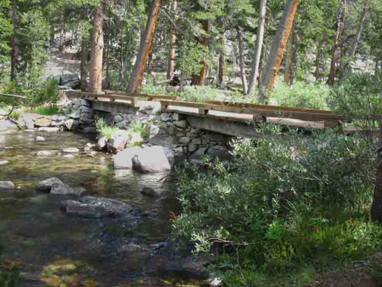
Our first segment of climbing was 1.06 miles up 640 feet of elevation from the end of meadow in Lyell Canyon to this footbridge. We'll find campsites on the other side of the bridge running downstream, and more once we climb into a lightly forested flat above the footbridge.
I put the footbridge at 10.18 miles South of the Tuolumne Meadows Post Office.
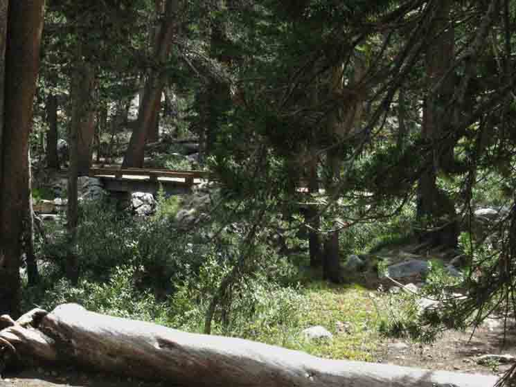
Footbridge
Maps & Miles
Map North
30 min Maps
SOUTH
OF 10.18 miles 9.57 miles 8.11 miles
TO 2.51 miles 24.07 miles
Next Two Basins We've a short .3 of a mile climb up to what I call the meadow, then another .6 of a mile up to the First Basin, where we've got not much in the way of camping. It does have an array of campsites, and a very nice custom flat with Whitebark Pines, but the lower basin always appears full during the high Summer backpacking season. Another climb twice as long and high beyond the meadow brings us into the first basin, for a total of .9 of a mile South from the footbridge. The first basin is the first of two upcoming segments where the route of the John Muir Trail crosses the Tuolumne River as it runs through two majestic granite basins as it makes its first steps running off the Cathedral Crestline under Lyell Peak. Both basins are small, each offers only a few campsites, but I always figure each deserves a break adequate to appreciate their beauty. Plus, we explore the alternative campsites in proximity to the basins, so we can access their beauties, if not camp in them.
|
Uppermost Footbridge on the Tuolumne River
 |
||
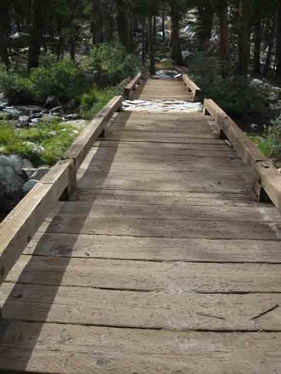
Finishing the first set of brutal switchbacks, climbs, and little flats is marked by our arrival on a little flat mixture of meadow and forest where we find the uppermost footbridge over the Lyell Fork of the Tuolumne River. Trail Section Forum
|
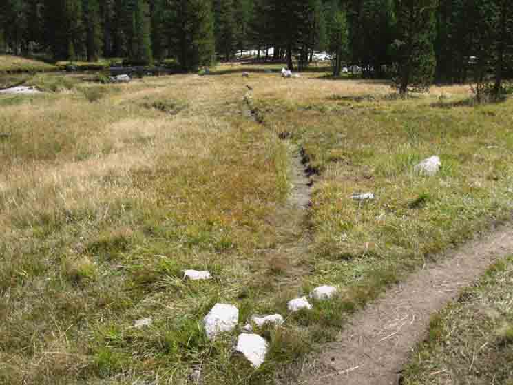
Restoration World
 |
||
As we approach the bridge we notice that the flat around the bridge is compressed, compressed by the feet of so many folks. We have noticed this compression almost everywhere in Yosemite National Park. Along with this compression we also note the cycle of trails. The cycle of trails is the rotation of the trail bed across a given piece of soft terrain over time. After a certain amount of time soft trails become degraded and must either be moved or reinforced. We see examples of reinforcement where moving the trail is impossible. Therefore we find many segments of fully granite-clad trails in Yosemite, who's work and reinforcement by nearly a century of trail crew work has had the long term effect of "paving" many of Yosemite's trails in granite. Many meadow trails are now triple tracked, with two or three abandoned trails slowly recovering, next to the current trail. The warming and drying trends we are experiencing will slow the recovery of damaged meadow trails. Armored & Triple Tracked The American Contradiction we've evolved and expressed with and through Yosemite is that our own success, our growth, wealth, and power has been based on our absolutely ravaging Nature and our Natural Environment. Asset-stripping a whole continent. Our wholesale physical destruction of Nature and our social loss of Natural Experience and Engagement has caused many of us to to put greater and greater value on those places that preserve a small slice of the mental and physical spaces of what we've lost. Trail Section Forum
|
Uppermost Bridge over the Tuolumne River
 |
Uppermost footbridge John Muir Trail along the Lyell Fork of the Tuolumne River as we climb to Donohue Pass. Page Index |
Bridge
 |
||
The uppermost footbridge over the Lyell Fork of the Tuolumne River. Trail Section Forum
|
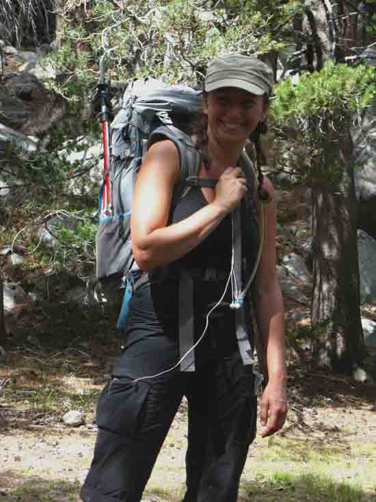
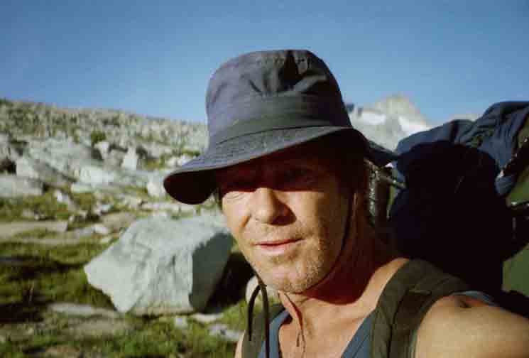
Backpacker
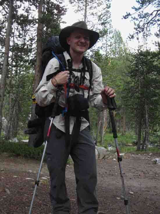 |
Robert Hildebrandt hiking on the John Muir Trail.
|
Wilderness Ranger
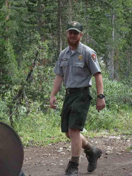 |
||
The 2012 Yosemite Wilderness Ranger in the uppermost Lyell Canyon. Trail Section Forum
|
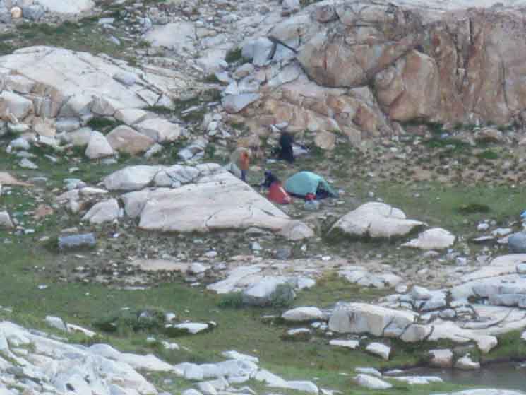
California Conservation Corps
Trail Camp
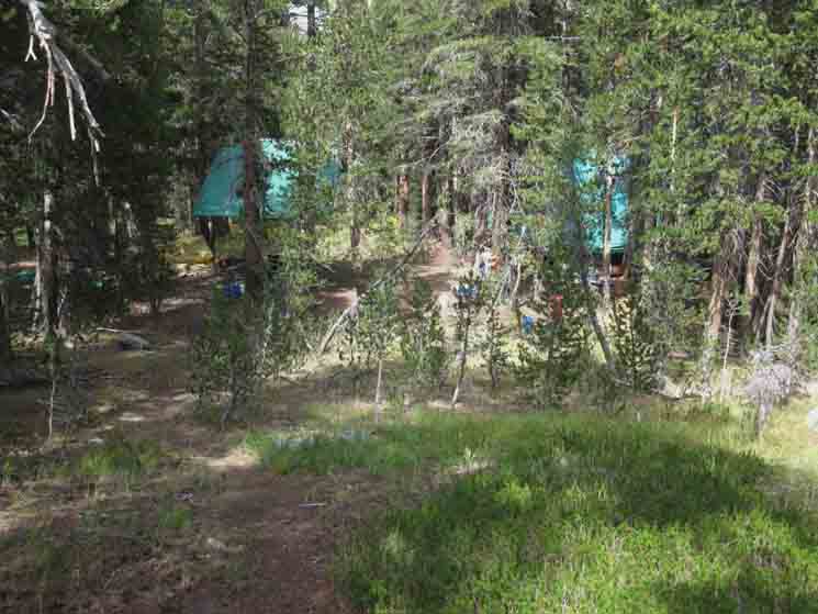 |
California Conservation Corps campsite in Upper Lyell Canyon near the footbridge. The site is hidden and not visible from the trail, but I was alerted to its presence by Erin Anders when I ran through his Office in Yosemite Valley during a 2012 Tahoe to Whitney backpacking trip. Erin suggested I visit this camp, giving me instructions on just how to find its hidden delights in the apron of forest between the meadows on the floor of Lyell Canyon and the granite running up to the Cathedral Range Crestline. This is an ideal camp.
|
California Conservation Corps
Trail Camp
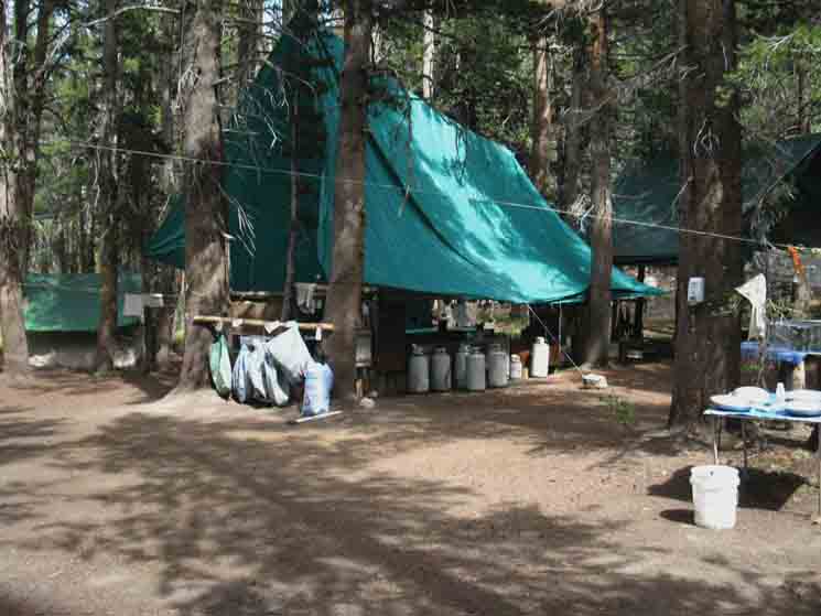 |
||
California Conservation Corps Yosemite Trail Crew Camp in uppermost Lyell Canyon 2012. I was perplexed by the complete lack of personnel. CCC crews don't have extensive weekend-leave privileges, and all Trail Crew Camps maintain a 24 hour per day, 7 day a week "guard." I could find neither crew members or guard on-site. Both I and the Wilderness Ranger were perplexed. Other than that, this was a super-clean, totally "tight" camp. Everything was in its place and in good order. But where was the crew? I left a note, and hit the trail South. Trail Section Forum
|
Up to the First Basin
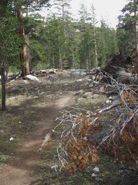 |
We've beginning the climb up to the meadow above the bridge, up there about a third of a mile South. |
Looking North
Dirt Trail
 |
After reaching and crossing the meadow flat above the bridge we execute an even steeper and longer climb. Above we're looking back at the rough trail we've been climbing up from the meadow above the bridge.
|
View North into Lyell Canyon
 |
||
Reaching a break in the terrain and tree cover gives us one of our best views North on our hike up Lyell Canyon to Donohue, so far. The mass of white rock in the far center distance is Mount Conness. Now we turn around to hike South into the apron of meadow and forest in the mouth of the first basin in the Lyell Fork's final run up under its namesake peak. Trail Section Forum
|
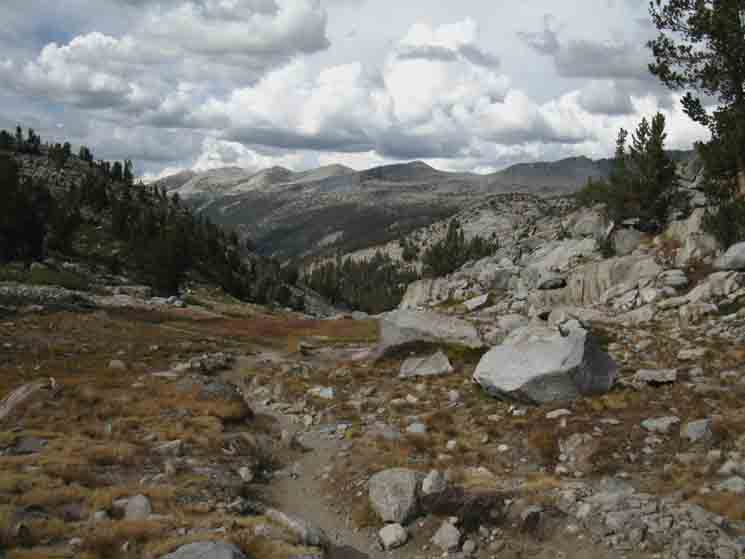
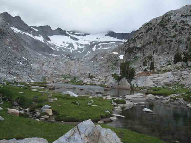
First, Lower Basin below Mount Lyell In the next two images below we have finished climbing up to the altitude of the First, or Lower Basin, but are passing through some nice meadow and light forest before entering the majestic basin itself. That point to the ford in the lower basin I measure out to be 11.08 miles South of the Tuolumne Meadows Post Office. But we are not quite there, yet. We've a few hundred more yards of meadow and forest to cross until we get into the beauty of the basin. After that we have a short climb in earnest, up and over to the second basin. towards Donohue Pass and our Southern exit from Yosemite National Park. And we've still got a few more sights to see as we hike up to the top very top-end of Lyell Canyon.
Lower Basin
Maps & Miles
Map North
30 min Maps
SOUTH
OF 11.08 miles 10.47 miles 4.84 miles
TO .66 miles 1.61 miles 23.17 miles
|
South End of the Cathedral Range
 |
||
Springtime moving towards the mouth of the lower basin. Trail Section Forum
|
Meadow at the Mouth of the Lowest Basin
 |
Crossing Fall colored meadow as we approach the mouth of the upper basin.
|
Basin Backdrop
 |
That's the South End of the Cathedral Range. Peak 12356 on the South end of the Cathedral Range. I identify 12356 as the first dark peak on the far left of the crestline, the third peak from the Left. |
Into the Lowest Basin
 |
Fording Point We hiked into the basin on the other side of the Lyell Fork, then crossed over to this little campsite area to kick back and have a break while enjoying the view of the South end of the Cathedral Range. Our Southbound John Muir Trail continues South on the other side of the ford.
|
The Lowest Basin
 |
||
Quite Scenic Because these potential campsites up here are all illegal, being too close to the banks of this upper section of the Lyell Fork of the Tuolumne River, the best camping is below this position, behind us in the meadow leading into the basin. To our Right we identify the compressed surface indicative of long use as a campsite. Trail Section Forum
|
Campsite
 |
Campsite in the first basin.
|
South End of the Cathedral Range
 |
||
Peak 12356 is the third peak from the left-edge of the crestline. Trail Section Forum
|
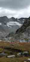
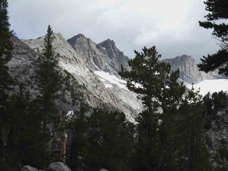
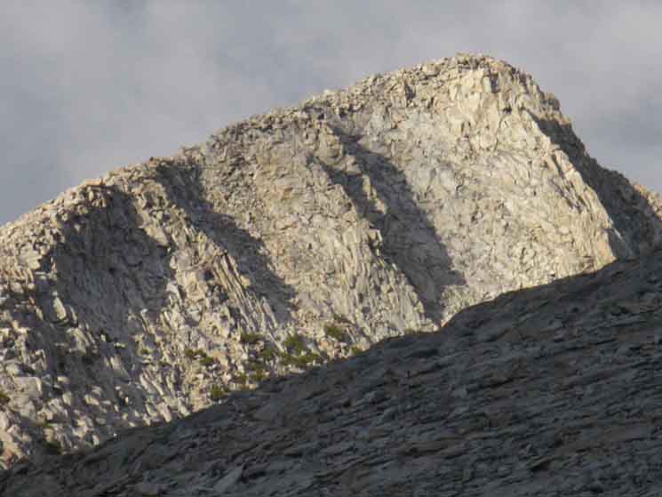
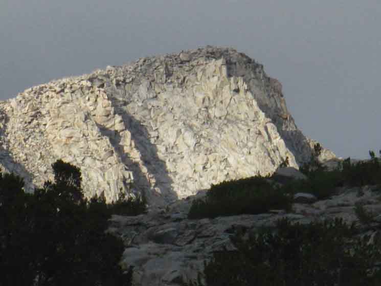
Lyell Glacier
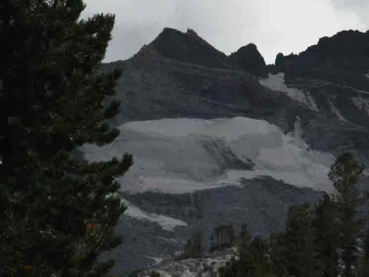 |
The Lyell Glacier remnant just South down the Cathedral Crestline from Mount Lyell Number Two.
|
Trail
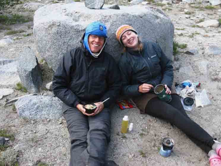 |
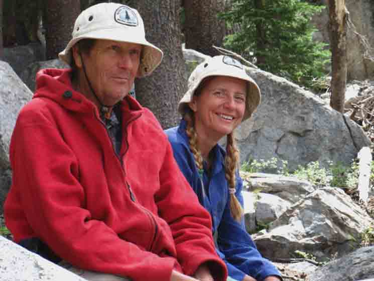
Delightful couple having lunch in the lowest basin. Is this "Giggles" the PCT hiker and her Dad, enjoying some trail time together? We hung out and enjoyed the remarkable terrain, but I cannot precisely locate their names in my notes, but the delightful shared experiences caused me to dub them the, "delightful couple having lunch."
|
Trail South and to Mount Lyell
 |
||
Here we can see the route of the John Muir Trail continuing South on the other side of the river. We'll cross over and continue climbing South to Donohue Pass after enjoying this place, this very sweet spot, this fine juxtaposition of light, rock, water, plants, and a few people, for a while. Our route climbs for the slot at the base of the granite bulge on the upper-right of the image above. Folks looking to climb Mount Lyell will continue South up the Tuolumne River with the John Muir Trail up into the upper basin. From there I understand those targeting Lyell and Maclure continue up stream where the route of the John Muir Trail finally turns away from the line of the Tuolumne River for Donohue Pass. Trail Section Forum
|
Seasons through Years
 |
Hiking South towards Mount Lyell Number Two, which I identify as the furthest-right of the double peaks along the Cathedral Crestline, as seen from the lower basin as Fall approaches. |
Backpacking Yosemite
 |
||
Eric Hansen and Joe Fragassi returning after climbing Mount Lyell. Trail Section Forum
|
Lower Basin We've a short .66 of a mile climbing a total of 320 feet of elevation above the lower basin before we descend into the upper basin, down to the ford point across the open end of the upper basin. The upper basin ford is only 280 higher than the ford point in the lower basin.
Lower Basin
.66 mile
320 climbing feet, 280 total between ford points.
Maps & Miles
Map North
30 min Maps
.66 mile
|
Looking Back
Climbing out of the Lower Basin
 |
||
Turning around to take a look at the lower basin as we climb Southbound towards the upper basin. Trail Section Forum
|
Lower Basin
 |
Above the first and lowest basin under Mount Lyell along the uppermost segment of the Tuolumne River just below its headwaters under the Southernmost end of the Cathedral Range. |
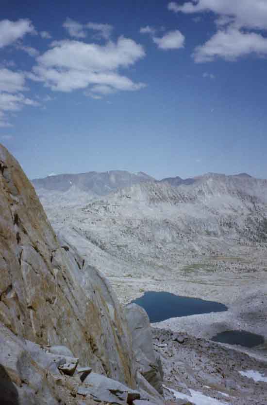
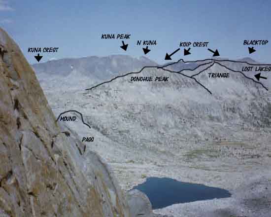
View Northeast
Koip Crest and Donohue Peak
 |
To our Northeast On the distant Left we can see the line of the Koip Crest, before it's obscured by much closer East wall of the lower basin. On the furthest top-Right of the image we can see the rising mound of granite we've observed since entering Lyell Canyon. The line of our combined John Muir-Pacific Crest Trail crosses Donohue Pass when passing around the Right flank of that low granite mound.
|
Uppermost Branch of the Tuolumne
 |
||
Climbing above the lower basin we cross this, the highest and last tributary of the Lyell Fork of the Tuolumne River. This uppermost tributary reaches higher up the Cathedral Flank than the main line of the river in the main canyon. Trail Section Forum
|
Southbound JMT
To the Upper Basin
 |
Crossing the uppermost tributary of the Lyell Fork of the Tuolumne River as we climb between the lower and upper basins.
|
View Northeast
Donohue Peak
 |
||
To our Northeast Trail Section Forum
|
Trail South
 |
||
Climbing through the slot approaching the upper basin under the South end of the Cathedral Range along the course of the Lyell Fork of the Tuolumne River.
|
Approaching Highest Point
along
Lyell Fork of Tuolumne River
 |
||
Hiking South to the highest point between the two basins. Trail Section Forum
|
Granite Plate Paved Trail
 |
Making our way to the top of our hike along the Tuolumne River.
|
Approaching Highest Point
of the
John Muir & Pacific Crest Trails
along
Lyell Fork of Tuolumne River
 |
||
As we are climbing to the highest point between the two basins, these two uppermost fording points across the Tuolumne River, we hit a sweet spot along the trail where we climb out from behind the obscuring wall of the canyon to our North into a position with a view across the very top of Lyell Canyon at the point where the South end of the Kuna Crest of the Sierra Crest magically transforms from massive rolling granite waves into the remarkably slashed sheer granite cliffs of the Koip Crest. Who says granite is not "flexible," or "malleable?" Not me! So far we've seen granite formed up and shaped into about every configuration possible since hiking South from Lake Tahoe, and we are only just now entering the South Sierra, which is a frigging granite wonderland. Our range of granite experiences are going to get much bigger, higher, and steeper with each step South towards Mount Whitney, the great granite block in the sky. Trail Section Forum
|
VIEW NORTH
But, note that
Our Southbound Trail Trail turns Northeast,
Down to the Upper Basin
 |
||
Highest Point along the Tuolumne River Our whole hike through Yosemite along the Sierra Crestline has been within the watershed of the Lyell Fork of the Tuolumne River. Unless we diverted off the Sierra Crest to take the Golden Triangle (forum) route down into Yosemite Valley and back again to the Crest. In that case we inspected a roughly fifty mile triangular slice of the Merced Watershed centered in Yosemite Valley reaching North to Tuolumne Meadows through Cathedral Pass and South down to our return to the Sierra Crestline Trails through Tuolumne Pass, more or less. Now, on our way out the South end of Yosemite National Park we're climbing up into and through these two stunningly-beautiful upper headwaters bowls, which has given us the opportunity to observe and inspect the mother flanks and peaks of this great river where they touch, and pull the river's water right out of the sky. Commonplace "Magic?" But there's something else interesting in this image above. At our feet we can see the Southbound JMT has turned Northeast, indicating we are just about to begin descending into the upper basin, once we get over the top of the low rise to our Right.
|
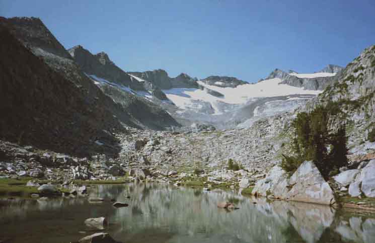
The Upper Basin The point measuring the location of the Upper Basin is at the ford point.
Upper Basin
Maps & Miles
Map North
30 min Maps
SOUTH (numbers not done) OF 11.74 miles 2.62 miles .66 miles
TO .66 miles .95 miles 22.51 miles |
Tuolumne River
in the
Upper Basin
 |
||
Dropping down to the last and highest ford of the JMT over the Tuolumne River. Trail Section Forum
|
South to the Ford
 |
In the distance to our Northeast in the upper Left corner of the image we can see Kuna Peak at the South end of the Kuna Crest. To the South of Kuna Peak, its Right, we can see the North end of the Koip Crest. We can see the trail at our feet running down to the great pile of rocks comprising the ford. Page Index |
Upper Basin Ford
 |
The ford is on the far Left of the image, and we can see the Southbound John Muir Trail doubling back upstream, on the other bank, before it begins its climb out of the basin for Donohue Pass.
|
Upriver
View up the Upper Basin
 |
||
Looking up mountain from the ford. We're under the South end of the Cathedral Crest. We can see the granite ramp ahead running up to yet another annex of this basin, what I call the, "upper-upper" basin, holding another flat with a couple of nice lakes up there, up closer yet to Mount Lyell for those who may have the top of either Mount Lyell or Maclure as their destination. But that would not be us. We're turning Left, Southwest by our compass to begin our final climb to Donohue Pass. Triple Departure Point But first, we are going to check out the view North from here. Trail Section Forum
|
Unique Overlook
The Lower Basin and the Kuna Crest
 |
Observing carefully while crossing the tiny Tuolumne River up here in the upper basin, we take note of a faint use trail continuing downriver below the South bank of the ford. Curious, we follow it North to the mouth of the upper basin. As we approach the end of the line we first get fine views North of Mount Conness beyond Lyell Canyon, then we note that we are overlooking the lower basin, getting fine views down of the lower basin and our route through it up to here.
Image Now, we'll turn around and hike back up to the JMT, after soaking in this fine view for a while.
|
Back to the Uppermost Ford
in
The Upper Basin
 |
||
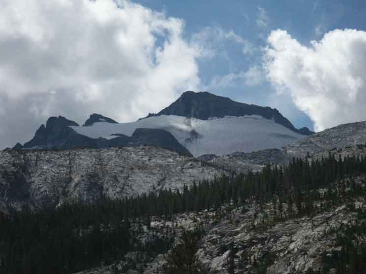
Mount Lyell obscured by cloud from almost the same position as the image above, except taken from below the ford, rather than above it. We've noticed that there is not much in the way of campsites here, with a few scattered along both banks of the Tuolumne running South up to the granite ramp. This is not the best place to depend on finding a campsite, unless you want to scramble a little. Ten Years earlier, on a clear day:
|
The High Point
 |
||
Unobscured. Mount Lyell and Lyell Number Two. Mount Lyell Climber's Access Here we can see the ramp of granite ahead, at the top of which we will find an extensive "upper-upper" basin with many more campsite locations than down here, here in the narrow cuts of these two lower and upper basins along the John Muir Trail. A few of the times I've hiked up here there were too many folks here to camp here. My solution is typically to push over Donohue and attempt to get to the hidden lake off to the South of the Pass before it gets too dark to hike. Our other solution is to push out of this upper basin along the John Muir Trail by hiking/scrambling up that ramp we see upriver, to enter the "upper-upper" basin at the top of the granite ramp. Once we start climbing to our South on the JMT, out of this upper basin towards Donohue Pass, we are going to get some views into that "upper-upper" basin, and be able to see if there are any backpackers camping up there, almost directly under the surrounding shoulders of the South end of the Cathedral Range. My point for providing this information is to urge those of you planning on camping up here to give yourselves enough time to make the scramble up to the "upper-upper" basin if the upper and lower basins along the John Muir Trail are full of backpackers. Then we camp in the "upper-upper" basin. Options are good to have. Trail Section Forum
|
Mount Lyell Number Two
 |
The USGS Mount Lyell Topographic Map of the South end of the Cathedral Range labels the peak on the Left, the South side of the image, as Mount Lyell Number Two. These are the two saw tooth Peaks immediately West of the main mass of Mount Lyell along the Cathedral Range we see in the next image above.
|
Climbing South Upper Basin
.95 mile 560 climbing feet.
Donohue Pass
Maps & Miles
Map North
30 min Maps
|
Trail
 |
||
Armored trail along the soft South bank of the Tuolumne. Trail Section Forum
|
Trail
 |
Armored stairway beginning to move up and away from the soft South bank of the Tuolumne. Page Index |
Trail
 |
Climbing almost directly Southeast while pointed almost directly at Donohue Peak.
|
Downriver
View North
Mount Conness beyond Lyell Canyon
 |
||
Climbing Northeast out of the upper basin brings us out onto an exposed traverse, where we begin to get views opening up to the North-Northeast. Great views open up once we climb out to the furthest Northeastern reach of the trail, to where it turns just a bit East of South for our final climb to Donohue Pass. Trail Section Forum
|
Trail
 |
Turning around to look almost directly West across the gorge holding the Tuolumne River reveals the switchbacks along the John Muir Trail climbing from the lower basin up to the upper basin.
|
Whitebark Pines below Donohue Pass
 |
Trail South running us up to a stand of Whitebarks below the North Flank of Donohue Pass.
|
Looking into
the
"Upper-Upper"
Basin
 |
||
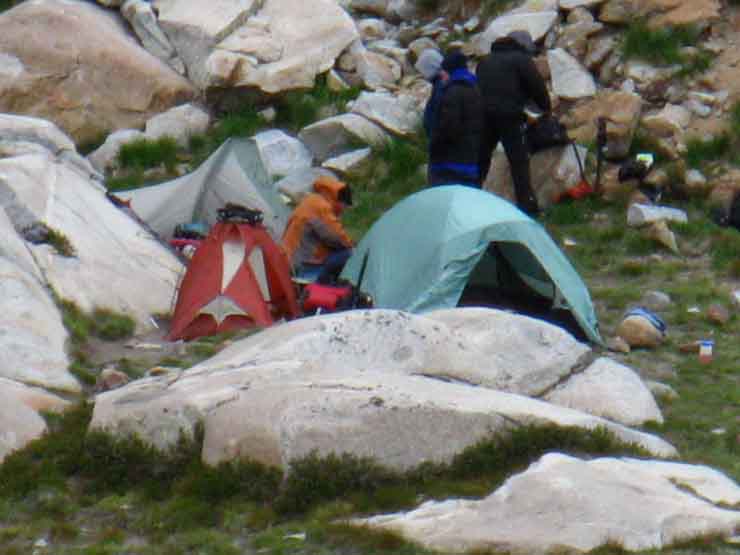
Climbing high enough South out of the upper basin allows us to get a view into the "upper-upper" basin, where we can see a party of camping backpackers Trail Section Forum
|
Through the Whitebarks
into the
Talus
 |
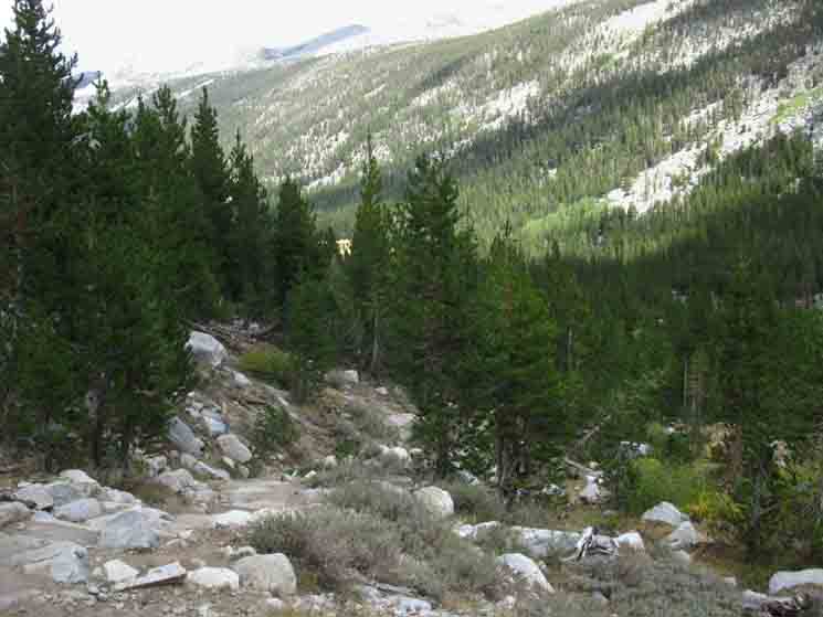
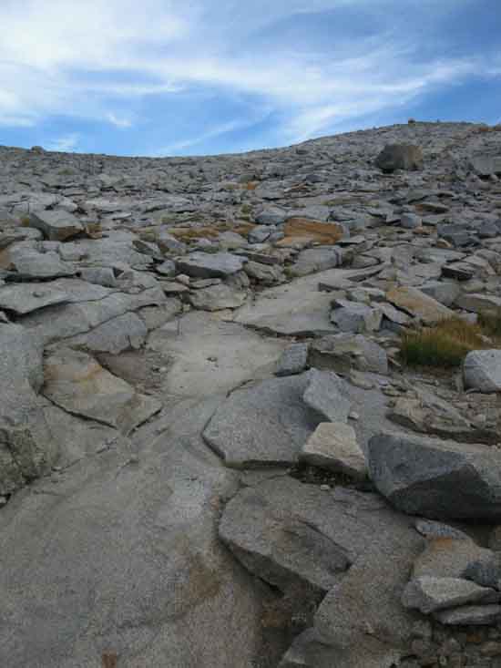
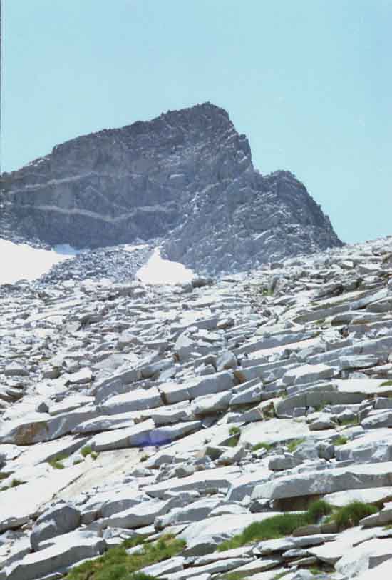
The shade this line of Whitebarks provides is so nice because it is so rare and so short. We can see an ocean of granite ahead. This "drops" composing the surface of this granite ocean consist of every type, shape, and size of shattered granite. Sheets, plates, flakes, boulders, everything. The remarkable thing is how easy it is to hike through this near perfectly maintained trail across this massive ocean of talus, how much energy the trail is saving each of us. This terrain is much more foreboding than many hikers realize, hiking on the trail. This type of talus surface/terrain is very hard to cross in its natural state, without a trail broken through.
|
Ocean of Talus
 |
||
Wow. An ocean of broken rock. While there's an ocean of talus below North Flank of Donohue Pass, below the South Flank we find solid granite excellent for a high speed descent. This talus on the North Flank slows both ascent and descent, despite the excellent level and quality of trail work. Yosemite Trail Crews are Excellent. Trail Section Forum
|
Northeast
Shadow & Light on Donohue Peak
 |
Donohue Peak from just below North Flank of Donohue Pass, in light and shadow. Page Index |
More Light than Shadow
on
Donohue Peak
 |
||
Donohue Peak from just below North Flank of Donohue Pass, in more light than shadow. Trail Section Forum
|
South-Southwest
 |
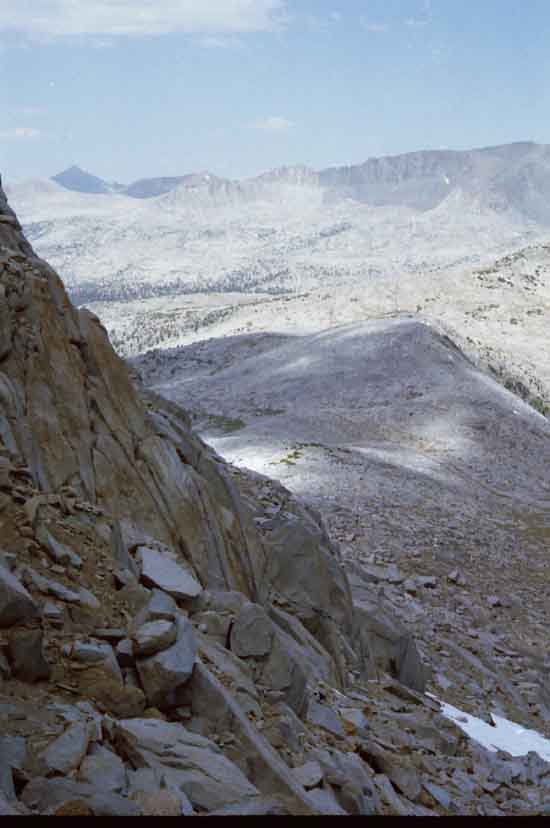
View Southwest approaching Donohue Pass. Looking across Donohue Pass and the Sierra Crestline, over at the end of the spur branch of the Cathedral Range reaching East out to the Sierra Crest across Donohue Pass.
|
View Further West of South
 |
||||
View Southwest into the highest, upper-upper basin of the Lyell Fork of the Tuolumne River. This would be where we end up if we climb up the ramp at the top of the upper basin, getting up into this "upper-upper" basin. We only get this view above to our Southwest into this, "upper-upper" basin as our hike out of the upper basin reaches its most Northeastern extent, before turning South for the final climb up to Donohue Pass. Then, seeing this custom area for camping, we realise that we are getting a look into the "upper-upper" basin, only accessible by following the course of the Tuolumne River upriver, up the granite ramp from the upper basin.
Approaching Donohue Pass
Trail Section Forum
|
Through Donohue Pass
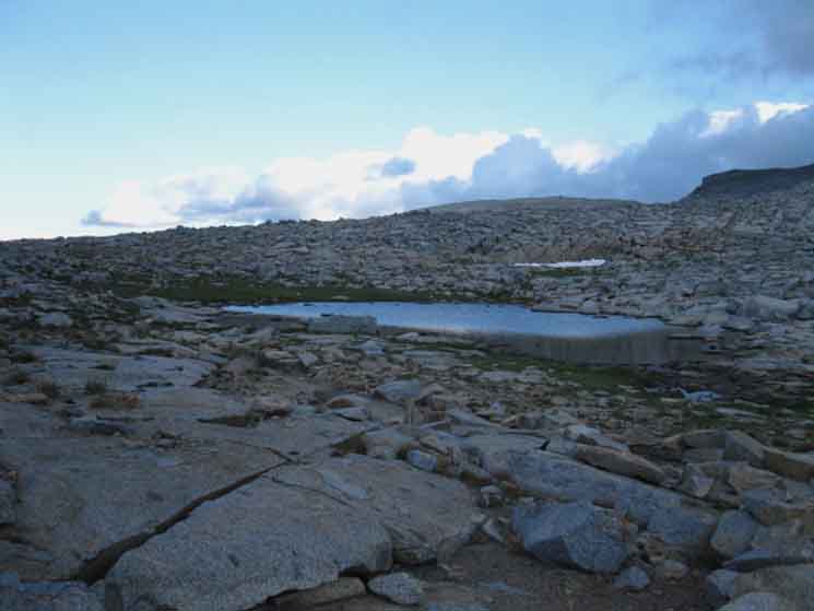 |
Pond at Donohue Pass passing from Yosemite South into Ansel Adams Wilderness Area. Main Pond at the Yosemite Boundary. I get water here, but move on to the smaller pool for my break at the top before descending or moving to set up a campsite.
|
Southbound into Ansel Adams Wilderness
Donohue Pass
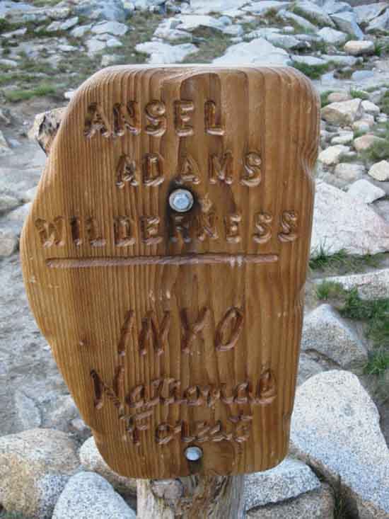 |
||
The sign intact. Trail Section Forum
|
Donohue Pass Wilderness Boundary
 |
Donohue Pass with a damaged and repaired Ansel Adams Wilderness sign. Some parachute Cord to keep it together.
|
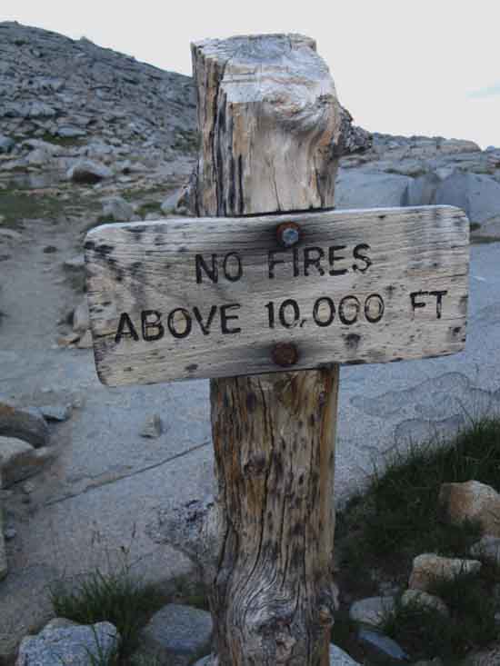
No Fires
 |
||
We're over 10, 000 feet here, but most wilderness cut off fires at 9000 feet. Donohue Pass is situated at 11040 feet. Trail Section Forum
|
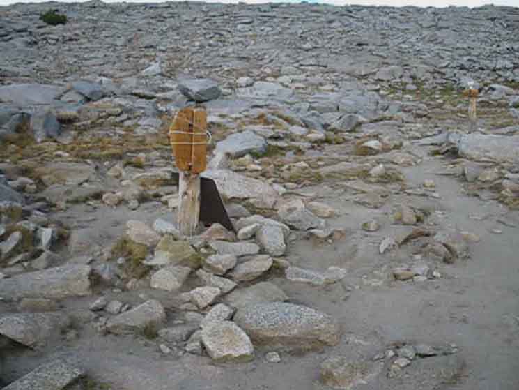
Tiny Pond Beyond, just South of Boundary
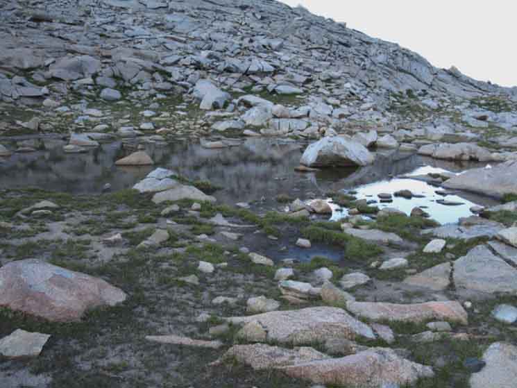 |
Continuing South beyond the main pond we come to this second, tiny pond. This pond has been shrunk by the drought of 2012-16. It's size will reflect the nature of recent seasons.
|
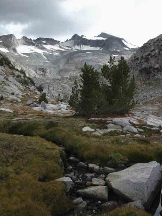
| Donohue Pass along the John Muir Trail What we are doing after reaching Donohue Pass depends on when we reach it, and how that fits into our overall plans. I am typically continuing South from Tuolumne Meadows on the John Muir Trail after finishing the Tahoe to Yosemite Trail. I've also come over the Cathedral Crest into Lyell Canyon to reconnect the Golden Triangle route with the Southbound JMT-PCT in Lyell Canyon. In either case our objective is typically Donohue Pass. Why Donohue Pass? Donohue Pass is our first point we can camp approaching 11000 feet. It is about the right distance for my first day out of a resupply stop, and it has beautiful campsites on both its North and South Flanks, if each has complications. The complication on the North Flank is the camping in the upper and lower basins is limited. At the upper basin we have the option of scrambling a bit upriver, following the Tuolumne off the line of the JMT crossing the upper basin into the "upper-upper" basin. We can always find a nice campsite up there. There is not much in the way of attractive camping at Donohue Pass itself. Though I've camped nearby, and a short ways down the South Flank below Donohue Pass, by far my favorite place to camp is by the two lakes nestled under the Crestline off the South Flank of Donohue Pass. A short but challenging little scramble brings us over to the two lakes wedged up under the Sierra Crestline.
Donohue Pass
Next Guide Page
Maps & Miles
Map North
30 min Maps
Donohue Pass SOUTH
OF 12.69 miles 12.08 miles 10.62 miles 6.45 miles 3.57 miles
Donohue Pass SOUTH
3.25 miles 4.67 miles 6.39 miles 21.56 miles
|
Trail
Breaktime Donohue Pass Sometimes I push down to the top of the verdant green swath of moss and meadows running up Rush Creek. I figure its less than 1.5 miles down the steepest part of our descent to the top of this lushness, and descending less that 2 miles will put us into the thick of it, with all sorts of custom, awesome campsites to choose from. I've planned trips to arrive at the lushness at the top of Rush Creek after only a half day of hiking, so that I could camp there and spend the other half of the day walking around on the moss, and sitting next to crystal reflecting pools along Rush Creek watching rippling reflections of the Forces of Life in these magic mountains in complete tranquility. So, I'm going to take a break at the top, even if I am only proceeding a couple of miles South from here to camp. Donohue Pass is a significant high point, so I am going to kick back and enjoy it for a while. Plus, I almost always meet some critters up here, mostly birds screwing around in the rocks.
|

Considering At, or Just South Flank of Donohue Pass Before continuing South some of us are going to spend the night up here. I figure I'm going to find my way off the John Muir Trail almost directly South of Donohue Pass to the two little lakes wedged in under the crestline. I have it in my mind that it's best to descend just a little down the South Flank below Donohue Pass before cutting South off the trail. It's harder to get over from the top. But, don't descend too far. We want to traverse over to the lakes, not climb!
Maps & Miles
Map North
30 min Maps
|
| OFF THE TRAIL to the Two Lakes |
View South-Southwest
Scrambling Off Trail
South by the Compass
across
South Flank below Donohue Pass
 |
||
After beginning to descend off the South Flank of Donohue Pass, we turned South off the John Muir Trail for some scrambling to find the two lakes under the Sierra Crestline located over there. This is the same wall we observed from the North Flank while climbing into Donohue Pass. Note we are now observing it from the other flank. Note the terrain. This is challenging terrain. There is no certain footing. A short distance crossing this trailess terrain shows us just how much energy and work well-maintained trails save backpackers. Trail Section Forum
|
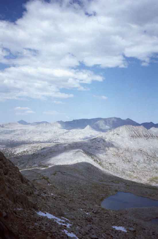
View Northeast
 |
Up against the Wall; Below us is Donohue Pass, Mount Dana is the great dark pyramid in the distant Left, and the Koip Crest runs South across most of the top of the image.
|
View Northeast
 |
||
Donohue Pass is located at the peak of the shadow wrapping around the lakes. That peak of shadow is on the South Flank of the low granite mound we've been observing since the middle of Lyell Canyon. That's it, now from above it. Mount Dana is the most distant dark mountain on the Left, while a notch on the Koip Crest is the most distinctive feature on the far Right. Note the location of the two lakes. I hiked over, dropped pack, set up camp and then scrambled up to get this overview of Donohue Pass and its two hidden lakes. Trail Section Forum
|
View Northeast
 |
||
View of my campsite near Donohue Pass. Kuna Peak is just to the Left of the pointy peak in the middle of the image. The pointy peak is actually part of Kuna Peak, being the ridge running North off of Kuna Peak. The dark notch to its Right is along the Koip Crest, while the dark triangle we see on the far Right of the image is Blacktop Peak rising above the line of the Koip Crest.
All right. Back to camp by the lake, then tomorrow morning we'll go down and explore the lushness along the top of Rush Creek before making the easy low climb over Island Pass into the wonderland-for-camping-and-scrambling area wrapping around to the North and West of Thousand Island Lake, creating what is essentially an elevated shelf below the crest and above Thousand Island Lake all the way from Island Pass up around the backside, the West Shore of Thousand Island Lake to give access to the backsides of Banner and Ritter. For me, this means that we are going to spend tomorrow night at one of the unnamed lakes just a bit South of Island Pass, so that we can take the next full day off the trail to scramble around the backside of Thousand Island Lake up the backside of Banner Peak.
DETAILED HIKING MAP
END OF PAGE Trail Section Forum
|
| Next
Crossing Down!
WE cross into the hard rock wonderland on the South Flank below Donohue Pass until we descend far enough that we can make out the top of a finger of mossy green verdant life pushing its way up Rush Creek to meet us. Upon closer inspection we find exactly what I described above: A zone of dense moss and "spongy" meadow punctuated with sculpted stands of Whitebark Pines, all cracking through and covering up the vast surrounding sheet of granite, excepting the mounds and stands of shattered granite, looking like monuments to a long lost civilization. Needless to say, this juxtaposition of life forces here creates a whole different, other-worldly, and quite a deep, peaceful serene wonderland zone. The range and depth, the span of the physical and biological wonders we experience (to put it crudely) hiking along the Sierra Crestline for so long gives us vivid demonstrations of the range and complexity of each and every aspect of the spirit of life around us, especially when we understand that all of this we see around us, everything, started as simple Hydrogen. All of this came out of one thing. |
Backpacking |
Over Donohue Pass Yosemite is a large National Park that I break down into North, Central, and South regions for the convenience of the Long Distance Backpacker. We hike into the most Northwestern region of Yosemite through Bond or Dorothy Lake Passes on the Tahoe to Yosemite and Pacific Crest Trails, respectively. To our East-Northeast are the Hoover Wilderness Trailheads, to our South-Southwest lays the Grand Canyon of the Tuolumne River. We hiked South on the Sierra Crestline to Tuolumne Meadows. We arrive at roughly the center of the Sierra Nevada when we arrive at Tuolumne Meadows. Here the end of the Tahoe to Yosemite Trail is supplanted by the John Muir Trail heading South along the Sierra Crest from Tuolumne Meadows. Donohue Pass Permit Quotas The Hoover and Yosemite restrictions have prevented backpackers who were trying to skirt the John Muir Trail permit lottery from gaming the system, which is a good thing. But it appears that the Yosemite Park Managers are going beyond restricting the issuance of permits in their own park. As of 2017 the Lake Tahoe Basin Management Unit was refusing to issue permits that passed out of their own unit, let alone issue a permit from Lake Tahoe to Mount Whitney, unless it stayed on the Pacific Crest Trail route. This breaks a long tradition of National Forests issuing permits for the length of the trip, independent of how far out of its Forest the trip ends, and how far off the beaten path it wanders. A long distance backpacker will have to draw permits from every National Forest their unique route crosses, If this crazy "PCT only" policy is sustained, and copied by other Forests. It eliminates the possibility of hiking the Tahoe to Yosemite Trail on one permit.
THIS PAGE IS UNDER CONSTRUCTION: STAY TUNED FOR MUCH MORE! COME ON BACK NOW, 'YA HEAR?
7.5 Map:
30 min Map
|
Backpacking Trail Guide PCT-TYT North Glen Aulin |
 |
Backpacking Trail Guide JMT South |
Backpacker ForumsHave a great trip or story to relate about Yosemite or in the Sierra Nevada? Post it on Above we come to the Front Page of the High Backpacking Trails and Topics Forums. Below we break the forums down into categories:
The Trails Forum acts as your place to put up input, comments, relate your experiences, or ask questions about each segment and spot along the length of our combined TYT-PCT-JMT trails. The Forum is your place to supplement the trail guide. Anyone can post text comments in the existing forums, but only members can post up new topics, along with images, maps, and formatting. If you have experiences, comments, questions, or pictures and videos of the Pacific Crest Trail between Sonora Pass and Tuolumne Meadows, post up here as an unknown hiker or as a member: Forum Section
|
Trailhead
Contact
Alex Wierbinski

Backpacking Lake Tahoe to Mount Whitney
Your Guide to the High Sierra Crest, including the Tahoe to Yosemite, Pacific Crest, and John Muir Trails
