

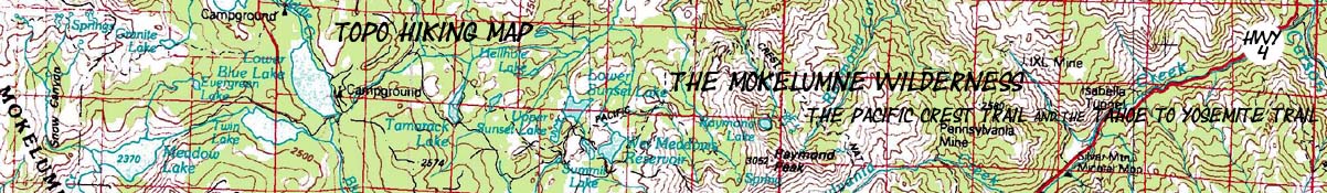

Mokelumne Wilderness Topo Hiking Map
Backpacking
The Pacific Crest Trail and The Tahoe to Yosemite Trail across the Mokelumne Wilderness
Four
7.5 minute USGS Backpacking Maps

Maps |
Trail Guide |
Map |
Map |
Trail Guide |
30 min |
Miles and Elevations |
Permits |
Weather |
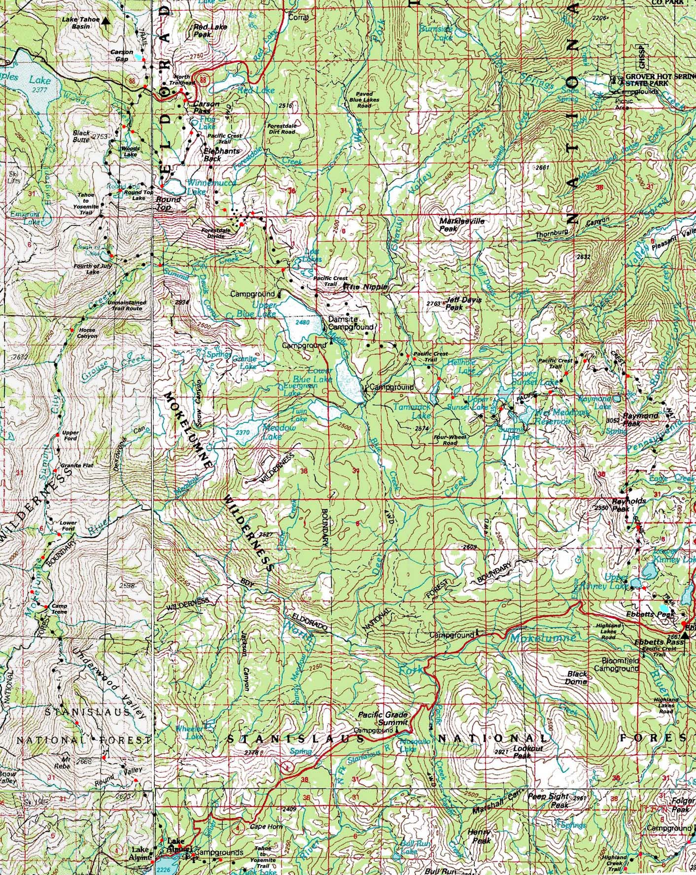
Highway 88 and Carson Pass on the North Flank of the Mokelumne Wilderness to Highway 4 and Lake Alpine and Ebbetts Pass on the South Flank
Click the Black Dotted Trail Route for Detailed Maps Click Red Dots for Trail Guide Information
| North Topo Map Carson Pass Region Backpacking Map |
North: Enter Tahoe Basin Meiss Roadless Area Map |
South Topo Map Lake Alpine Backpacking Map |
South Topo Map Carson Iceberg Wilderness Map |
|
Mapology |
||||
MAP NOTE What's important for our general reference purpose is that each side of a square is 1000 meters, or a Kilometer. From my point of view that is 1093.6 yards or .62 of a mile. Diagonal: 1414.22 meters, if my trig is correct. That converts the diagonal distance into 4,639.8 feet or .88 of a mile.
|
Location |
Main Features Exiting the Tahoe Basin through the Carson Gap brings a series of related choices along with the changing terrain. Do we swing Southwest along the Tahoe to Yosemite Trail or Southeast along the Pacific Crest Trail? This is also a choice between granite or volcanic terrain, between no trail at all and well-worn trails, between plunging deep into the canyons along the Western flank or staying high on the barren Eastern flank of the Sierra Crest. These are the conditions you select when you select your route South from the Carson Gap. The Tahoe to Yosemite Trail brings the former options, the Pacific Crest Trail the latter. |
CARSON PASS REGION ROAD MAP ROAD MAP Carson Pass (PCT) and Carson Pass Management Area (TYT) This is a road map for highway access to the trailheads on the North end of the trail map above. Centered On
|
ROAD MAP Ebbetts Pass (PCT) and Lake Alpine (TYT) This is a road map for highway access to the trailheads on the South end of the trail map above. Centered On
|
Mapping, Mileage, and National Forest Permit Information |
|
Backpacking permitting authorities National Forests West and Northwest Southwest
Wilderness AreaFED LINKS Mokelumne Wilderness, TOY Mokelumne Wilderness, EL DOR Physical locationNorth Sierra below Tahoe and above the
|
Maps NW: Placerville Calif, 1976, USGS 30x60 SW: San Andreas Calif, 1993, USGS 30x60 NE: Smith Valley Calif, 1985, USGS 30x60 SE: Bridgeport Calif, 1985, USGS 30x60
Compass Offset
scale Contours |
North map: Meiss Roadless Area Map South map: Carson Iceberg Wilderness Map
| Elevations | More Information | ||
Round Top: 10 381 feet Camp Irene: 5280 feet Mount Reba: 8720 feet |
Trail Guide, Section: Highway 88 to Highway 4 Trail Guide, Segment: TYT or PCT? Google Maps: Above |
||
Map Credit |
U.S. Geological Survey, Department of the Interior: Move the Map to the Sierras. Select size of Maps you wish to locate. Click "Mark Point" on map to see the USGS map grid of the selected map scale. |