The Trails
Guide
Maps
Miles/Ele
Permits
Resupply
Forum
Current Weather Conditions
Weather Notes
Northern High Sierras
Central High Sierras
Southern High Sierras
Gear
Gear List
Gettin Started
Layering
Discussion
Testing yourself and your gear
Gear Reviews
Backpacking
Telephone Gulch
to the
Campsites South
of the
Upper Summit City Creek Ford
Hiking
the
Tahoe to Yosemite Trail
across the
Mokelumne Wilderness
Languages
Languages
Trail Arts
The art of walking
Physical Preperation
Trail Skills
The trail
Off the trail
Scrambling
Maps
Navigation
Camp skills
Food
Resupply
Food
Other
Photo Catagories
Trail Stories
Trail Culture
News and Science
Links
Groups
Books
Terms and Conditions of Use
| Trail Guide INDEX Carson Gap to Lake Alpine |
TYT North Guide Summit City Creek |
TYT South Guide Lower Summit City Creek Ford |
North Topo MAP Carson Pass Region |
Big 7.5 min Topo MAP Summit City Creek to Mount Reba |
Detail 7.5 Topo MAP Tele Gulch thru Lower Ford |
30 min Topo Hiking MAP Echo Summit to Lake Alpine |
TYT |
TYT Map Index Carson Gap to Lake Alpine |
EL Dorado National Forest |
Tahoe to Whitney on You Tube |
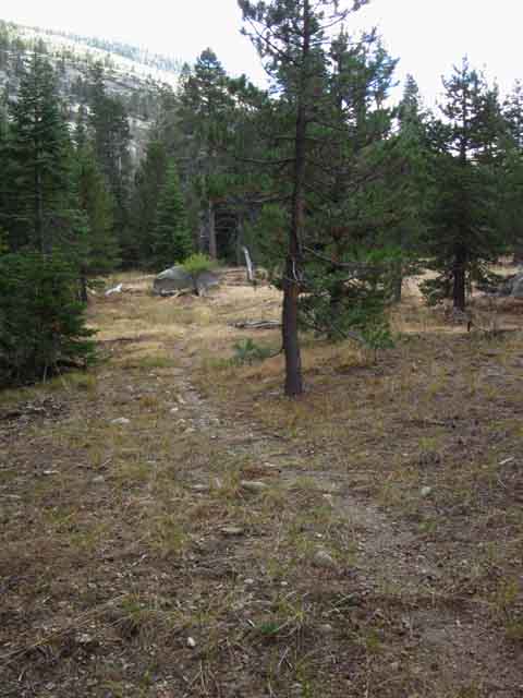
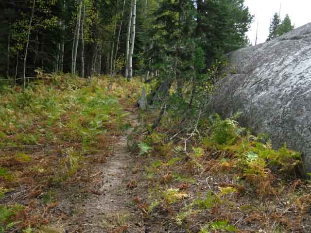
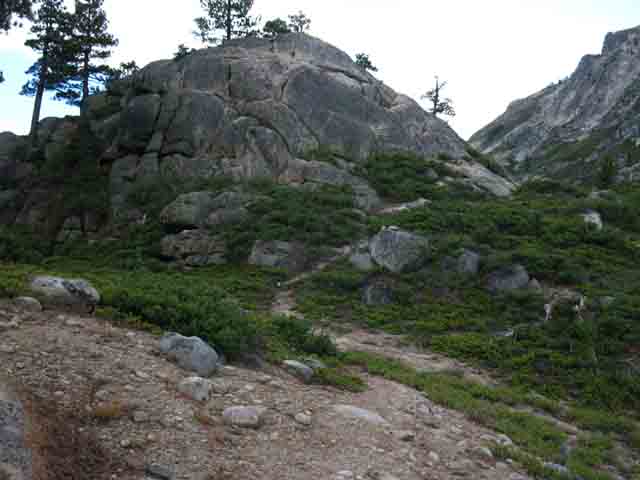
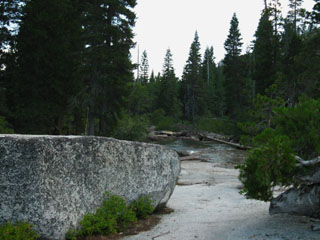
Telephone Gulch
through the
Campsites South
of the
Upper Ford
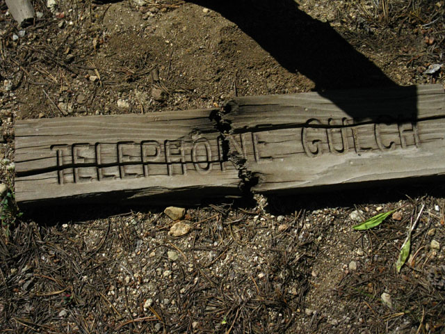
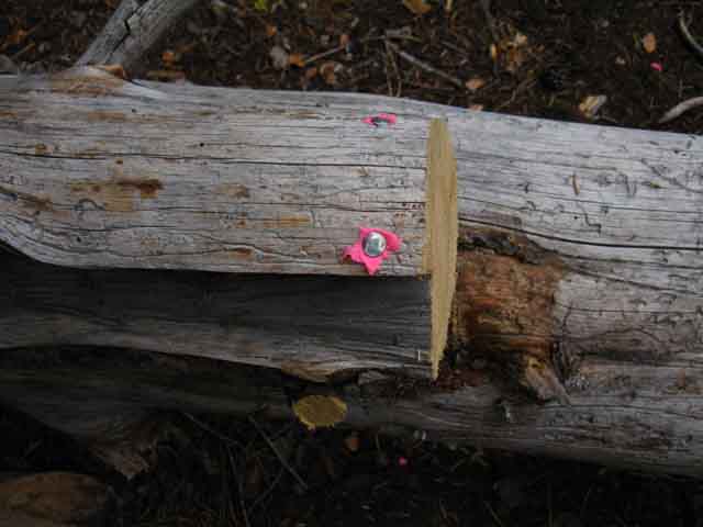
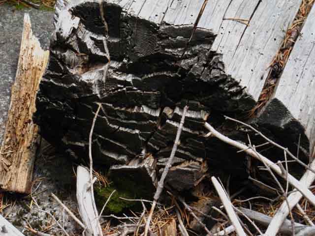
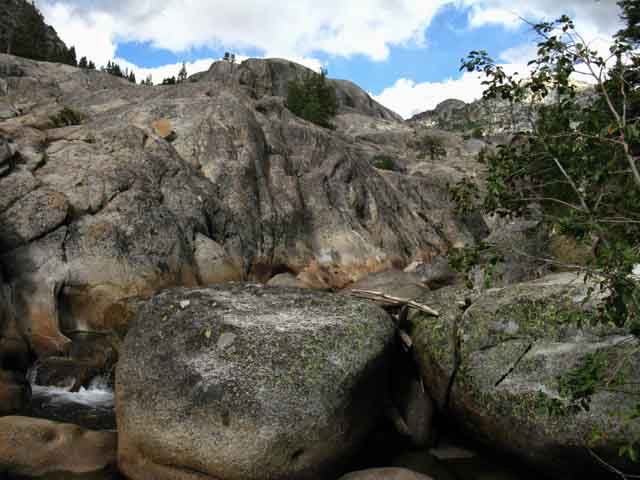
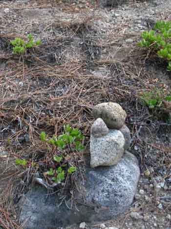
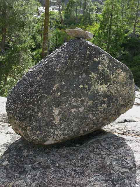
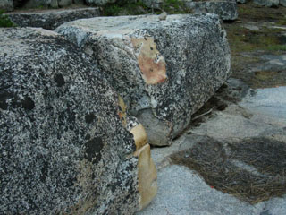
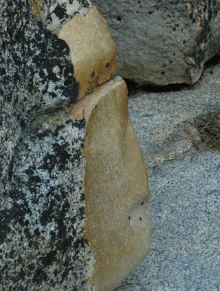
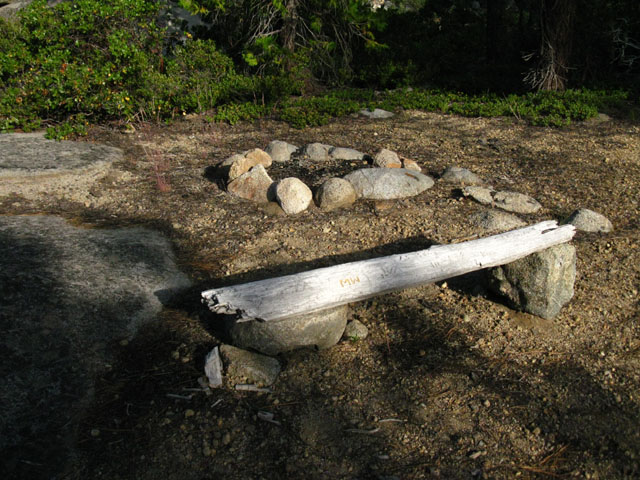
I found and reunited the sign parts at their post.
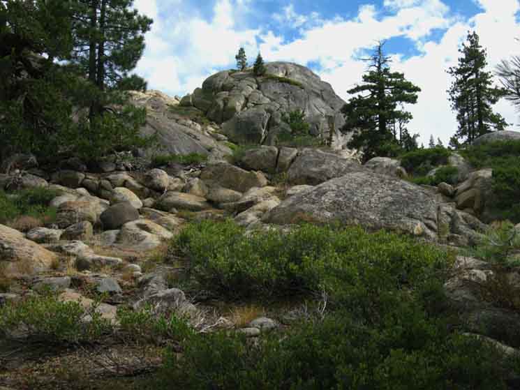
Telephone Gulch This guide reports conditions changes between 1997 and the present (through forum updates), which is only a small window into a very long history. Looking at an ocean through a porthole, so to speak. Prior to 1997 a faint but stable route was maintained by light backpacker traffic. Manzanita growth and tree falls were the framework of change. The catastrophic thaw of 1997 changed all that. Destruction of the trail around Camp Irene, the trail through the Enchanted Forest, and the devastation of the Lower Ford really choked off backpacker traffic. Besides the extreme damage this area of catastrophic flooding experienced, the Thaw of '97 also degraded and damaged trail and terrain up and down the Sierra, and especially this unmaintained section of trail through Summit City down to Camp Irene. Even trail outside of the flood damaged zones were degraded by the heavy rains, avalanches, and huge runoff. The damage brought huge regrowth, which further obscured the route. The damage and growth turned around hikers, and the lack of hikers deepened and expanded the whole unmaintained section. Sometime after 2002 the El Dorado National Forest stopped maintaining the section of trail South from the Summit City Creek trail junction down to Horse Canyon. This added another 2.43 miles to the length of the already unmaintaind section of trail. Between 2002 and 2012 the whole section of trail from the Summit City Canyon trail junction to Camp Irene degraded. It was great! This section is the perfect lab to generate and evolve route finding skills, and a quiet refuge from the constant flow of hikers up and down the Pacific Crest Trail. It's also a great place to get lost or hurt, so be very careful. After crossing this un maintained section, we still have challenging route-finding ahead in the Carson Iceberg Wilderness where we hike through Clarks Meadow up to Saint Marys Pass. For students of cross-country travel the next step in learning route-finding is located along the East Fork of the Carson River. After mastering that I figure you are good to go to scout and craft your own Summertime routes. An excellent place to begin exploring cross country scrambling and route-finding to your own custom destinations and campsites is Granite Chief along Summit Creek on the Tahoe to Yosemite Trail through Emigrant Wilderness. Once you've begun accessing your cross-country navigation skills during Summertime you might want to start expanding into snow conditions with some early Spring backpacking. Your evolving route-finding skills are the basis of snow navigation. Once you've mastered finding route without trails your enhanced navigation skills allow you to begin picking up Springtime snow camping skills, working gradually to earlier Spring trips, then Fall trips (much more risky because of the risk of early-season fierce Winter storms), then mid-Winter capabilities. The end point of these evolving Summer route-finding and expanding snow skills is being able to navigate the High Sierra during mid-Winter. That makes you a four-season High Sierra Backpacker. That's bad-assed. That's the Holy Grail, with you covering the Alpha and Omega, the whole annual cycle of High Sierra backpacking. The Summer of 2013 has brought considerable trail work along the whole un maintained route from Summit City Canyon to Camp Irene. Let's review the 2009 report, because it still well represents the basic route and the lower end of the range of conditions we find along this route. But, some recent trail work has improved the poor trail conditions described during 2009, which now represents a much smaller percentage of this section of trail as during 2013.
TRACK Here: Tahoe to Yosemite Unmaintained Trail
Also See
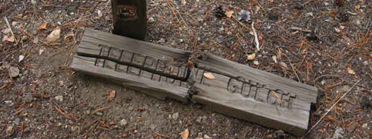
2009: The trail used to be maintained from the Summit City trail junction down to Telephone Gulch, but no longer. Now fully un maintained trail stretches down from the Summit City trail junction to Telephone Gulch. As of 2009 the recently un maintained trail North of Telephone Gulch is in better shape than the trail South of Telephone Gulch, which has long lacked maintenance. Telephone Gulch Telephone Gulch is strange. There is no trail junction here, only the remnants of a trail sign. The two pieces were widely separated before I reunited them. The uneasiness may also be a product of the end of the trail traces that have led to Telephone Gulch from the Summit City Creek trail junction below Fourth of July Lake. Traces of "trail" South of Telephone Gulch were hard to find in July 2009. 2013: The basic character elements of the route through Telephone Gulch have not changed. Despite recent light maintenance work our route degrades the further South we hike from the Summit City Canyon trail junction. The trail degrades the closer we get to Telephone Gulch, and degrades more South of Telephone Gulch. The route still improves North of Telephone Gulch and degrades to its South. Yet it is still a route, requiring keen observation to remain on track. A trail guide written for the long term use must cover the range of conditions we can experience along this route over the long term. This section of trail from Summit City trail junction has recently gotten some light trail work. This segment of trail has been "brushed out," small fallen timber has been cut, the larger tree falls routed around, and ducks and blazes have been added or accentuated. This work was executed during the Spring and Summer of 2013. Yet all of this trail work can and will quickly melt away, leaving nothing more than your knowledge that there is a route through the terrain to guide you. And the many signs of route that will remain embedded in the terrain these recent trail works will leave, along with bits of established trail bed. Even when the trail degrades the cut branches and sawed fallen trees still identify the route. I'm figuring that conditions will improve during the next five to seven years out from now, 2013, out to 2018 or 20, then begin to degrade again, achieving a long-term (decadal) equilibrium about equal to the faint route that existed prior to 1997. The money and attention the El Dorado National Forest can focus on this section will draw down. But something greater is at work here: The Relentless Power of Nature. This power is overt at times, throwing down a relentless stream of occasional blights, Summer and Wintertime avalanches, punctuated by amazingly catastrophic Spring thaws. All of these will relentlessly sweep away various bits and pieces of the trail over the years and decades. Great rushes of ferns, lodge pole pines, and manzanita will grow across the route. The sloppy wetness of Spring meadows surging with life growing out of wet oozing soils that can't hold trail will inevitably degrade trail conditions over the medium and long terms. All of this means that during any particular year we should expect some degree of physical and route finding challenges. There will be more challenges as the trail degrades into route, and less as the route is maintained up to trail status. At this point in time, at the end of 2013, the route is on a slow upward trajectory of improvement. Independent of the particular ratio of route to trail you experience, there will be challenging sections. To keep our understanding up with changing conditions we have the This forum collects recent hiker's experiences and general impressions about the character and conditions they experienced hiking through the unmaintained section between the Summit City Canyon trail junction and Camp Irene. Your information is valuable. Your experiences and information will inform and update others, so share it. To all of you who have contributed, questioned, or commented: Thanks!
Backpacker's Information
Miles
All backpackers can post text comments about the following section of trail through the comments links on all the trail guide pages. Registered Members can post up stand alone posts about the trail with words, images, maps and videos in the Trails Forum that supplements this section of the Trail Guide. This section has a special forum for updates on the status of the un maintained trail section between Summit City Creek and Camp Irene. Post up your updates and information on this challenging route here. Check out the Tahoe to Whitney .org Backpacking Trails and Topics forums |
||||||||||||||||||||||||||||||||||||||
| VIDEO HORSE CANYON TO UPPER FORD OF SUMMIT CITY CREEK |
||
This video gives us a gander at the terrain and trail of one of the most challenging sections of our Tahoe to Yosemite Trail route laying between Horse Canyon and the Upper Ford of Summit City Creek. An important thing to remember while hiking through here is that there is a "route," an easiest way through the terrain, even during eras when little maintained trail is visible or well connected. The easiest way through this section is achieved by recognizing the sections of untrailed route and efficiently connecting them to the lengths of recognizable trail. This means that even when we lose signs of trail we know that making the correct route-finding decisions will quickly bring us back to recognizable trail. If we do not find indications of trail, ducks, or blazes after 50 to 70 yards of hiking we have likely lost the optimal route through the terrain, and we will begin to look for it. The route is either Left, Right, or we are on it. It is much easier to cross terrain on an old unmaintained trail route than it is to hike cross-country. It behooves us to stay on, or as close to the original route of the trail as possible. Success at staying on-route will save us thousands of calories and lots of time. As this video shows, unmaintained trail requires much more work and attention than maintained trails. Horse Canyon to Telephone Gulch: Start of video to 4:50.
|
Telephone GulchElevation South of Telephone Gulch the range of trail conditions we experience widens. We are now noticing a pattern: The further downstream we hike the fainter the trail gets, the more frequently that treefalls cross the trail and the number of decision points increase. Decision points are locations where we are unsure about the direction of the continuing trail. These points require us to determine the most likely place we will reacquire the trail. South of Telephone Gulch our number of decision points, as well as the locations where we have to closely observe the terrain to just to stay on route increases. But not to worry. These faint and untrailed sections quickly bring us to sections of easily recognizable trail or signs of the route, if we are properly reading the terrain. If we hike more than 50 to 70 yards without finding some indications of the route we are likely not observing well, not pushing towards the correct direction to reacquire the the route, or completely off-route. If we are pushing through dense thickets of fallen snags, breaking through bush no one has broken through for decades, or otherwise struggling physically and psychologically, I have the following advice. Though we still find sections of fine trail and sections of faint trail, even while staying on-route we find that the number of obstacles blocking the route increases and we are confronted with many ambiguous route decisions. Time to keep the eyes wide open! |
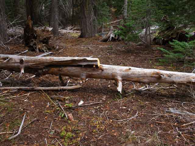
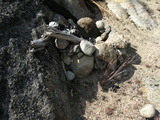
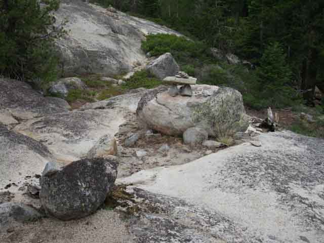
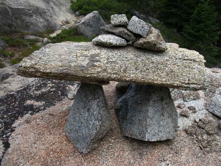
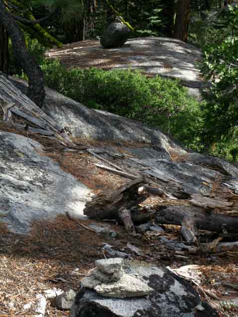
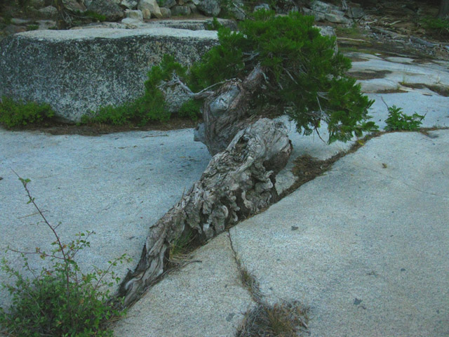
| Remnants of the sign marking Telephone Gulch | ||
 |
||
The sign post is casting the shadow. I hunted around in 2009 to find the pieces of this sign and then fit them back together at the base of their old post.
|
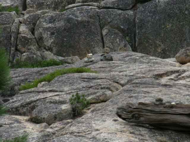
Telephone Gulch Elevation Telephone Gulch is .8 of a mile South of Horse Canyon.
3.23 miles South of the Summit City Junction.
Telephone Gulch is 1.71 miles North of the Upper Ford of Summit City Creek. 6.26 miles North of Camp Irene, where maintained trails resume.
Click red dots on map. |
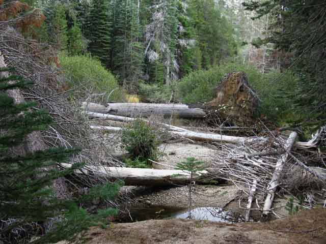
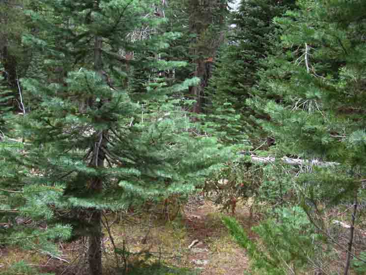
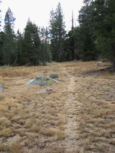
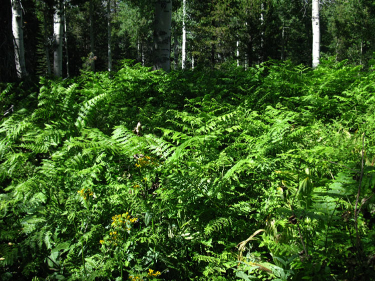
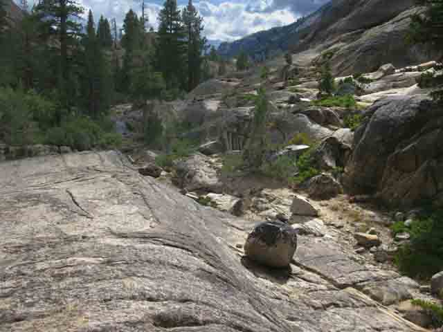
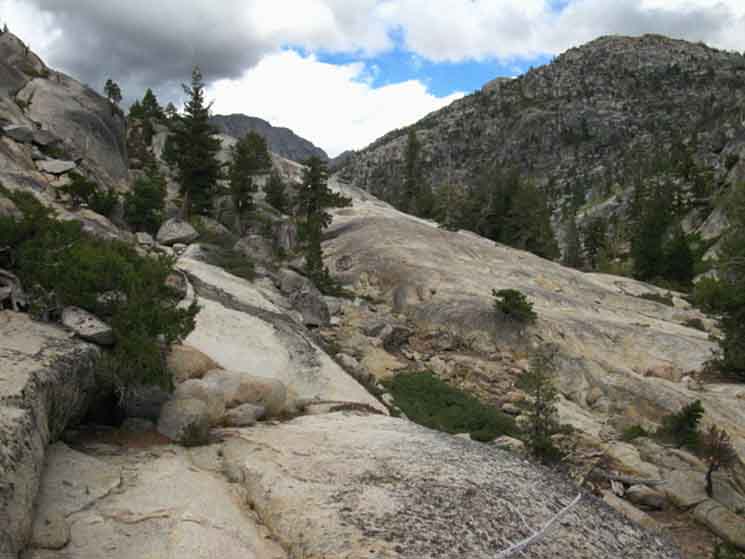
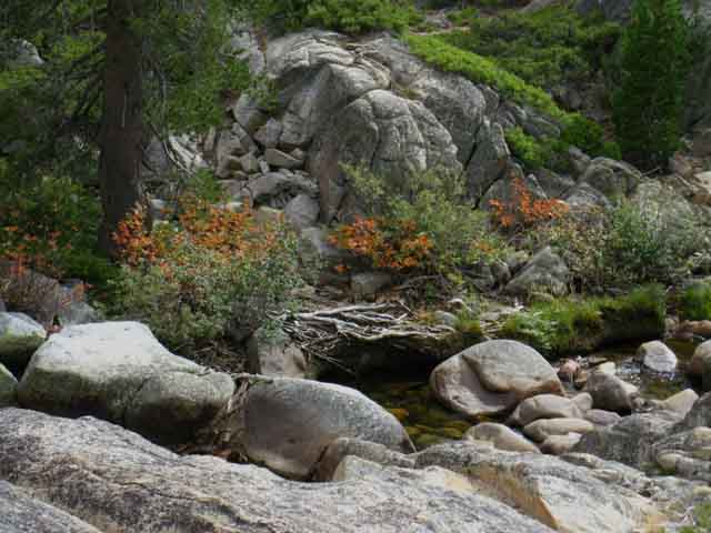
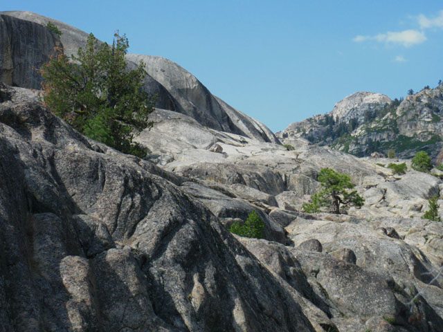
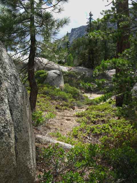
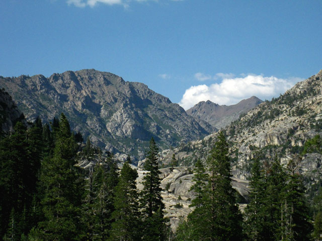
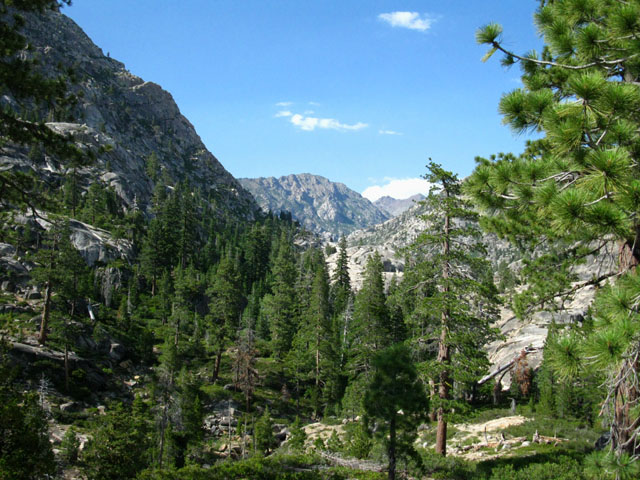
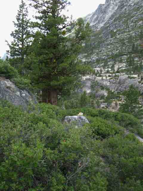
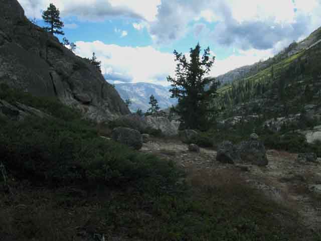
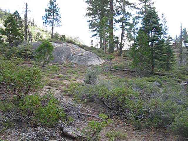
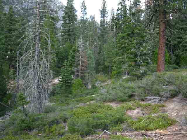
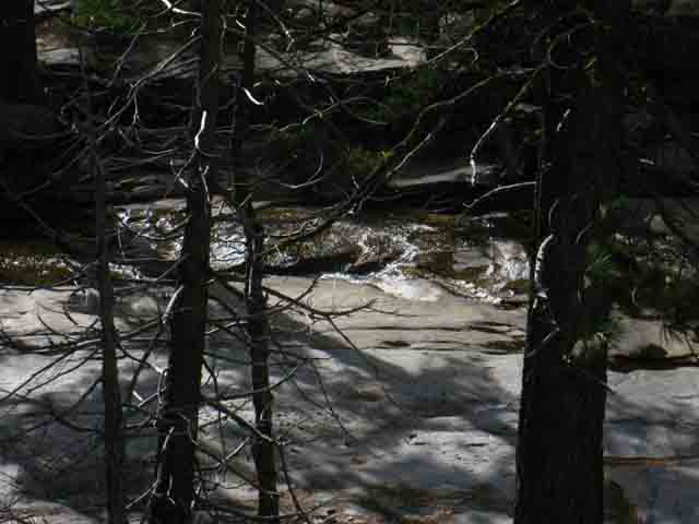
The Tahoe to Yosemite TrailTelephone Gulch South of Telephone Gulch we are entering the heart of the unmaintained trail section of the Tahoe to Yosemite Trail. We have already hiked 3.23 South along Summit City Creek through moderately difficult un maintained trails from the Summit City Canyon trail junction down to Telephone Gulch. South of Telephone Gulch trail conditions deteriorate further. And it is getting hotter and hotter as we descend down Summit City Canyon. From our 9360 foot elevation coming across Round Top we have now dropped down 2640 feet to 6720 feet. We are hiking down into a heat wave as we lose elevation. I've experienced high '80s and low '90s through here many times. As the image above shows, moist shaded locations along our route protect temperate zones decorated by lush ferns. We have 6.29 miles of HOT un maintained trails remaining to our South between our current position at Telephone Gulch to Camp Irene, where maintained trail resumes. This upcoming section contains the most difficult segments of the whole Tahoe to Yosemite trail. Well, it's a toss up between this section and the section of un trailed route from the South edge of Clarks Fork Meadow to Saint Marys Pass.
Expansion of Un maintained Trail Section
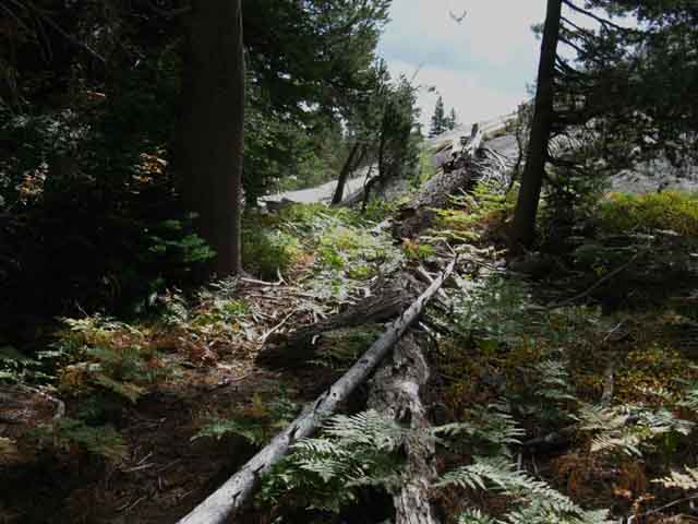
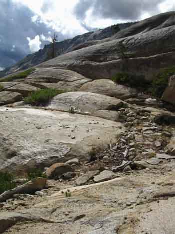
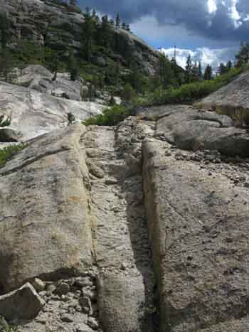
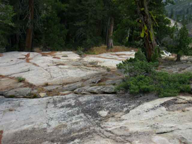
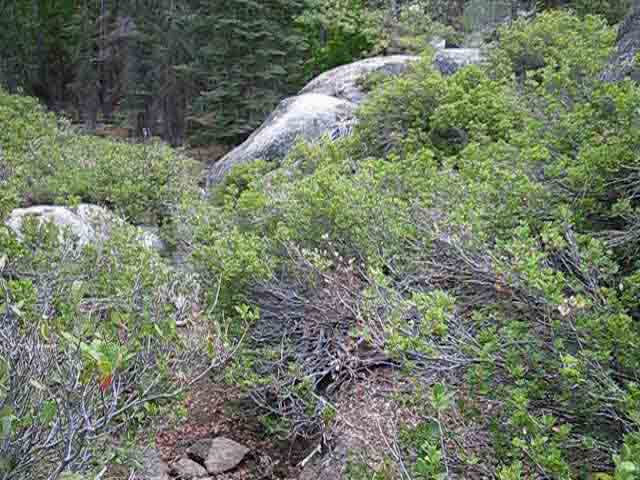
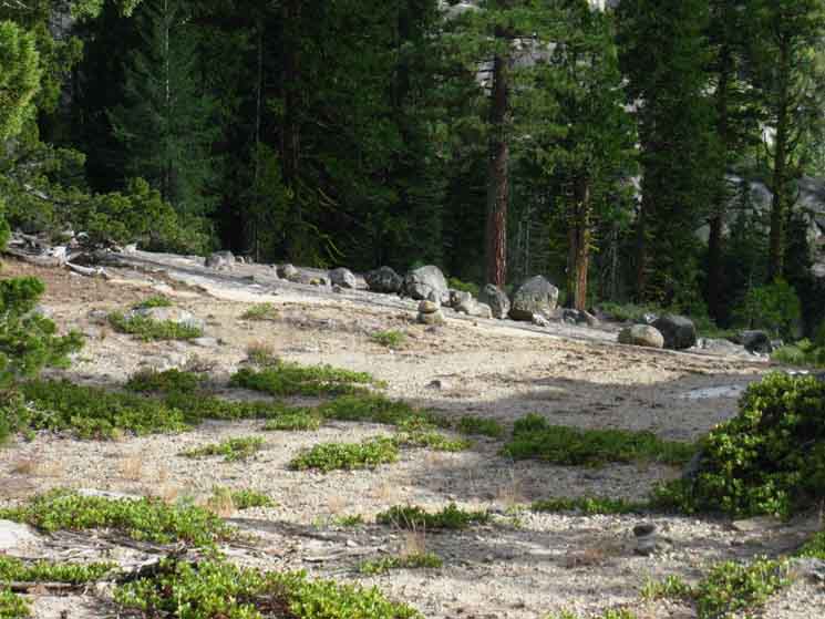
About 7 years ago (early 2000's) the trail was maintained from the trail junction at Summit City Creek below Fourth of July Lake South to Telephone Gulch. This is no longer the case. As of July 2009 the un maintained section now begins at the Summit City Creek trail junction where it intersects with the trail South from Fourth of July Lake. 2013 Update There were sufficient trail bed remnants to follow bits of the old trail route South from the Summit City Creek trail junction to Horse Canyon without too much difficulty. Fallen trees, moderate overgrowth, and small sections devoid of any indications of trail whatsoever was the extent of trail deterioration as of July 2009. Down to Horse Canyon the trail bed is still cut deep into the terrain. South of Horse Canyon, which sits .8 of a mile North of Telephone Gulch, the route becomes significantly less discernable, becoming much rougher as you approach Telephone Gulch.
2013 Update
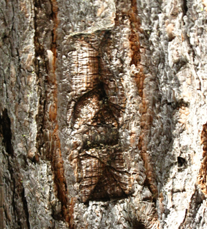
South of Telephone Gulch the going gets considerably worse. Serious obstacles block our progress, and most of the remaining bits of trail bed have faded into the forest floor. The trees have absorbed the ancient blazes cut into them, leaving little more than faint rectangular sections incised into their bark that looks little different from the random bark patterns on the rest of the trees.
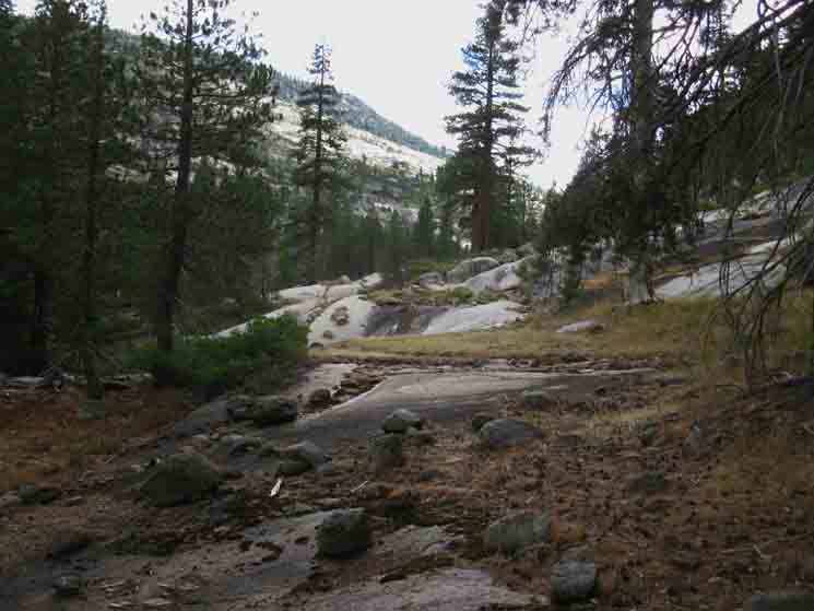
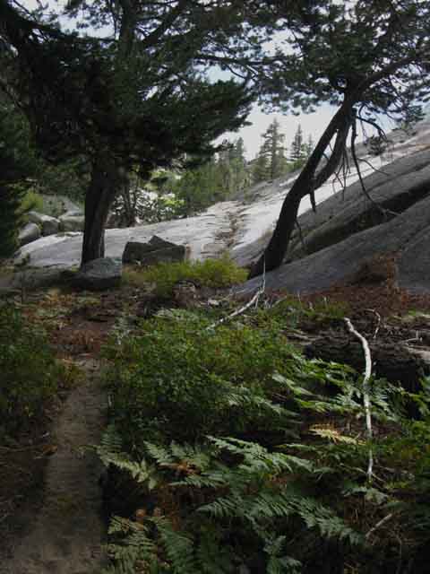
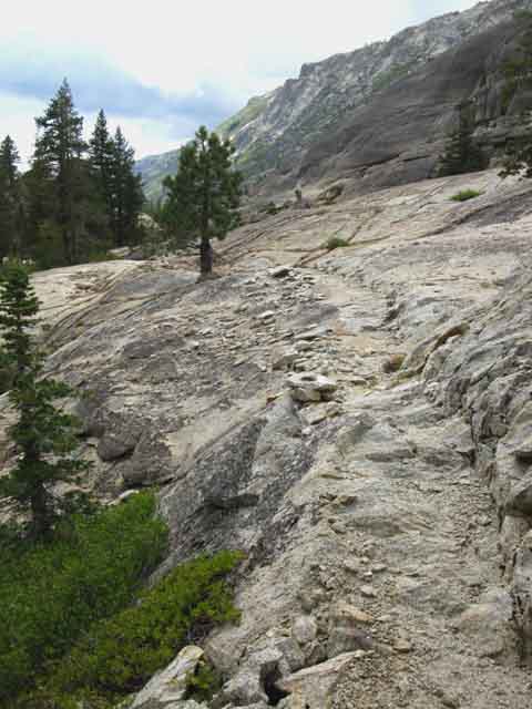
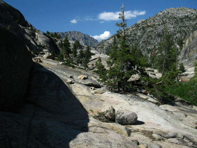
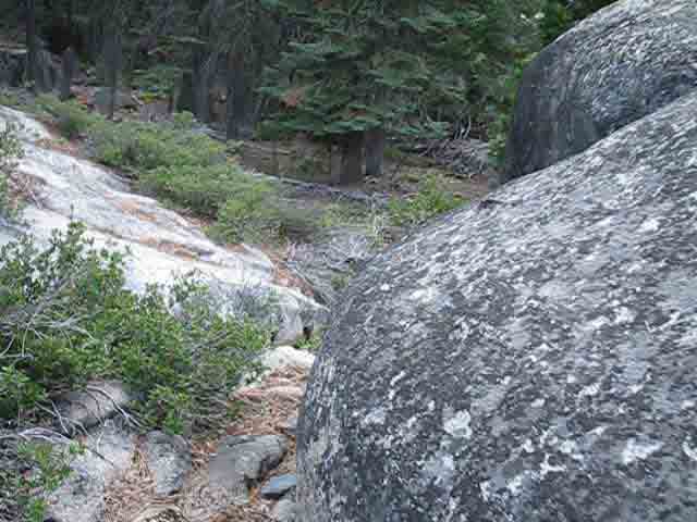
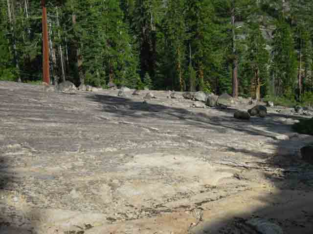
Faint ancient blaze being being absorbed by a tree. This is a good, fairly observable blaze for this segment of our trail! 2013 Update It is Rough Going South of Telephone Gulch, but our slow path finding through dark forest will soon brighten considerably. The last section of our route down to the upper ford of Summit City Creek we will cross a beautiful open section of exposed granite. This open section is quite a relief from the labors of forest travel. It's interesting that after an extended period on unstable soft forest floor, our feet find great relief on hard rock. After miles of traveling on hard rock, our feet love the softness of forest floor travel. Those feet are never happy! After navigation through the forest we finally enter the open granite, which brings us down to the upper ford of Summit City Creek. 2013 Update Just North of the Upper ford (the North ford) of Summit City Creek you will find an old improved campsite. Later Updates: Unmaintained
Freshness and Quality The Ancient Terrain around and Within You The conditions described here are based on conditions observed between the early 1990s to the present date, if I am still alive. Rest assured the terrain is under constant pressures pushing change. Each season's rain, snow, and runoff alters conditions. Every Spring's Bloom intrudes a bit deeper into the remaining bits of trailbed. Snags constantly fall in the forest across the route, their effects always felt by the living, if not philosophically heard by thunderously stupid educated idiots. "If a tree falls in a forest and no one is around to hear it, does it make a sound?" It, the Web of Life around us, exists and changes if we hear it or not, see it or not, or if we do or don't get splinters climbing over it. It, being reality, exists and changes with and without our knowledge. All things move in the Web of Life when one thing moves. Our ignorance does not measure or limit the movements of nature, it measures and limits us, and our perception of the movements of life. Our arrogance, that things hidden in the shadow of our ignorance do not exist, is absurd. The cascading effects of all things interacting created us without our knowledge or consent. Hiding in the shadow of our own ignorance is equal to hiding in plain sight. Making the choice to stand in the shadow of ignorance does not protect us from the consequences of unseen forces, but makes us yet more vunerable. Unseen things can kill us as quickly as the seen. It, the Web of Life, has lived long before us, and It will continue long after we have crashed and burned. Understanding this is akin to a spider reading the ancient vibes of life moving through time along their particular strands of the web of life, connecting-up with the rest of the strands, revealing the vibes of sounds not heard, sights not seen, a range of forces not readily visible through the gates of its physical perceptions, but only percieved through the "spiritual" dimensions of perception. Some folks have closed the gates of perception and meaning long before they hear the sound of them closing, while some never close them, and "gates" are just a formality. This is because some see Life Itself is the basis of existence, not its result, while other don't, or can't understand this. These self-centered social definitions of man as the source of life and reality are backwards. Our internal perceptive compass is as skewed as our external perceptions are perfectly tuned to, and created by our environment to reflect our environment. Our distortion and dysfunction are centered on the contradiction between our self-centric definitions of ourselves as the center of life against the plain fact that humans are not the center, the cause, nor the end purpose of life. Once we "get-over" ourselves clarity ensues. That is easier said than done... And, clarity does not feed the greedy. Getting crushed by a falling snag in a grove of trees in the forest will suffice to teach ignorant post-modernists about the felt effects of things not heard, seen, or experienced... Understanding the logic and meaning of life blows with the breezes through the growing trees, flows with the waters down Summit City Creek, and is exercised and exemplified by every movement of the Web of Life. You can choose to open yourself up to it or not. Psychobabble idiots and their smarmy paradoxes melt in the burning reality of real things, when they even dare to go outside, and get outside the self-created realities they and their massive cities require to exist. These ignorant "thought-bubbles" will only exist as long as the physical structures necessary to support them, which are composed of vast cities of disconnected urban populations, exists. Does a human exist in the forest if nature does not see them, or they not see it? Can a society consuming the web of life by devouring whole ecosystems in pursuit of a very gross pornographic style of mass consumption and self-gratification continue to exist? I say "not for long." If we exist in disharmony with nature we will disappear. Unseen lightening strikes as does the seen. Unseen snags crush unsuspecting hikers as do the seen. If a snap or lightening kills me before I see them, did either I or the lightening ever exist? That expresses the nonesensical contradictions of the nonsensical self-centered reality so many humans negate their lives within. Thus it is with the Rock, Air, Fire and Water surrounding us: all are expressions of previously unseen ancient forces moving through complex processes within, with, and without us, if we know them or not. It is our arrogance of consciousness that permits fools to believe existence itself is created by or for human perception. That's back-asswards. Human perception itself is a product of nature. Brains existed and worked in lizards long before brains were known or understood in humans. Understanding still fails to enlighten our knowledge. Let me offer some context. The deeper we peer into the workings of nature the more clearly we see the reflection of our own eye. But it is us that is the reflection, a real-time reflection of the timeless living spark of life within and energizing all things. Reality is not an expression of our perception, we are an expression of Its. As such, nature endows humans with the inherent tools to precisely perceive, understand, and the power to choose to navigate It to greater beauty or greater brutality than nature itself exercises. Humans are the icing on the cake of life, not the cake itself. Nature created a driver's seat and a driver. It's our choice where we take it. Humans are the driver and the icing, not the car nor the cake. Our perception created none of it. Our misperceptions have in fact unbalanced ourselves and Nature. It's Big This short length of unmaintained trail in Summit City Canyon is one of many Infinite Temples of Life inviting your spirit to find balance between its beginning and end along the longer trail of your life by drawing out your fundamental Natural life skills. The Art of Walking is the Art of Life Back to the Trail In any case, with any perspective, or any approach we take to nature, this human-constructed trail is constantly changing, if we see it or not. The rhythms of life may have significantly degraded parts of the trail, but there's a natural route across the terrain if there's a trail carved across it or not. Observe carefully. Analyze accurately. Act accordingly. Your perceptive and analytical route finding skills must be close enough to forming-up within you that this terrain draws them out. Thus you should be an experienced backpacker with a good understanding of trail and terrain before venturing off the beaten path. These skills are there inside you. We are designed to carry heavy loads at high speed over a variety of terrains while observing, analyzing, and deciding on upcoming route in all weather, at all altitudes, while being chased or chasing. That's in the design and expression of our DNA. Nonetheless, humans' role in nature is quite a bit more amazing than the educated idiots think it is, and the development of "consumer culture" would indicate. The sophistication of humans over time has depended on drawing out and using the most sophisticated elements and tools of nature long before the educated idiots could describe them.
SIERRA SNAG: DAVID MAXIM WATERCOLOR
2013 Update Thanks, yall! Just don't overdo it! The charm of this route has always been intertwined with its route finding and physical demands. Too much trail through here would be a tragedy.
Why you should
Gear Note Light boots and tennis shoe type hikers are not recommended. Consider the high potential for missteps resulting in extreme pressure on your feet. This can result in trips, falls, and sprained ankles as well as upper body damage from the fall. The density of the brush through here will also test the quality and thickness of your fabrics, from clothes to pack. Light gear can get torn up hiking this section of trail.
|
Tahoe to Yosemite Trail
|
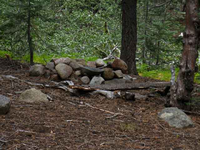
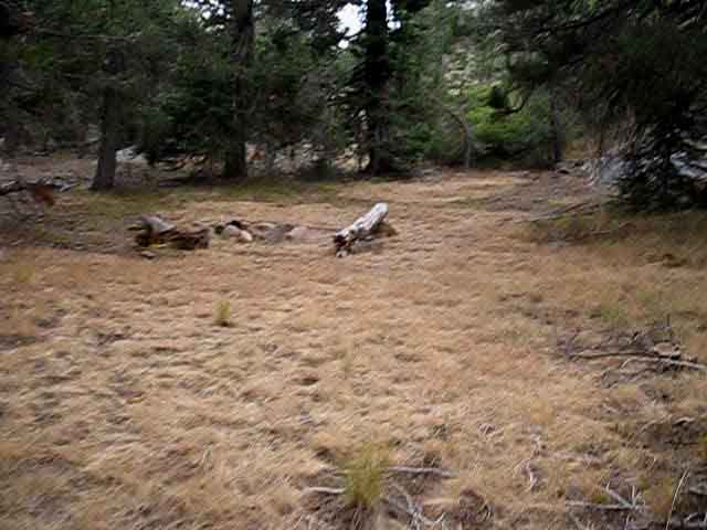
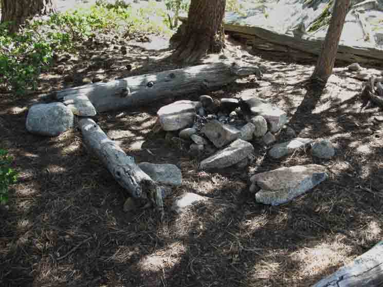
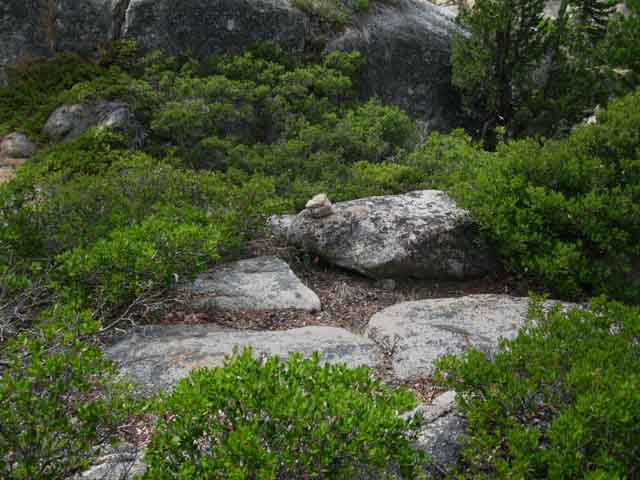
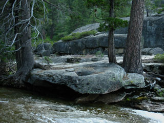
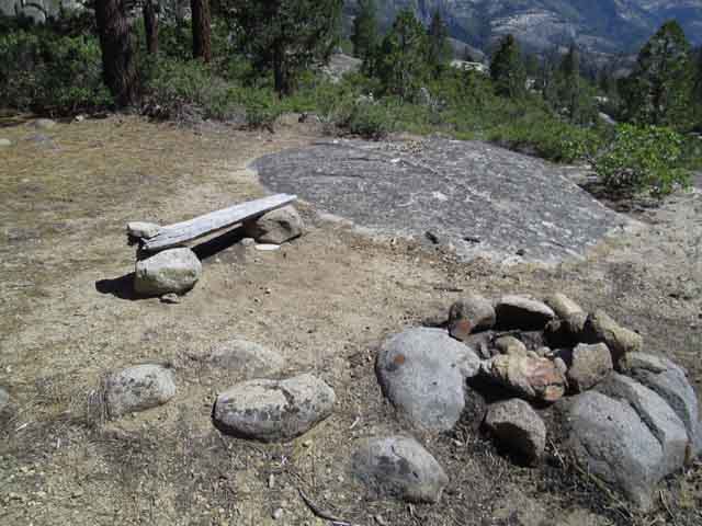
| Hiking a short ways South of the Telephone Gulch trail post and sign we come to this campsite.
|
| Campsite South of Telephone Gulch 2013 CAMPSITE |
||
 |
||
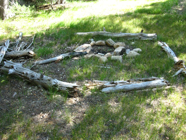
As we hike South we will come across a series of regular "improved" campsites that are quite neglected. Well, , most of them have been falling slowly into disrepair. On the other hand, we also see many intriguing locations that a little exploration will reveal splendid primitive sites as well as old "improved" sites not visible from the route of the trail. I've got to urge backpackers through here to explore. Well, backpackers through here are "exploring" as they strain to follow the route itself, yet there are many hidden delights that only a bit more exploration will reveal. Most of the sites along our "trail" show all the signs of infrequent use. The campsite above shows the newly rebuilt-up campfire ring and recently restored primitive benches. But the forest floor litter does not lie: Though this site has been recently restored and used, this use is a blip in a long period of disuse, as the layer of crispy forest floor litter around the fire ring as well as covering the sleeping flats do not lie. A little bit of recent use does not turn back or alter the signs of the rising tide of natural reclamation this site most prominently displays.
|
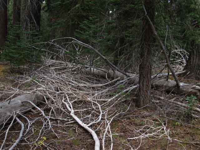 |
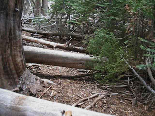
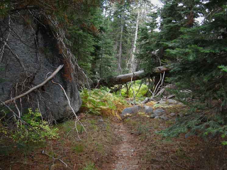
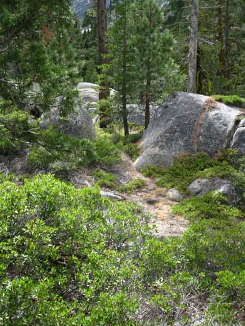
We see the mess of fallen snags that constantly cross our route. |
 |
Though there is a lack of established trail bed remaining here we pick up the route by recent trail work. |
 |
||
Trail Slug and his pal marked parts of the trail with tape. Though I appreciate the work on the trail, the tape defeats the purposes of terrain observation and analysis that makes this segment of trail so special. I found most of the tape removed when I hiked through late in 2013. I removed all the remaining nails and fragments of tape that I could pry out of the trees and fallen snags. A bit of trail work and subtle ducking is perfectly acceptable. Though done with good intentions, taping this route defeats the purpose of this route by seriously degrading the cross-country observation and route-finding experience that this special route is famous for.
|
 |
||
Coming back down to Summit City Creek the trail bends South, to our Right to parallel the creek.
|
 |
Not quite degraded into a route, neither a trail, we follow the remnants of the trailbed. |
 |
||
Line of snags swept down and/or fallen across Summit City Creek. This looks like sections of our upcoming unmaintained trail...
|
Movement
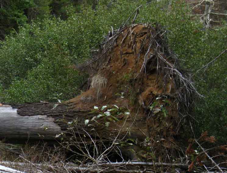 |
Wow. This massive snag took a huge rootball up when it went down. |
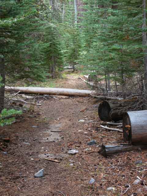 |
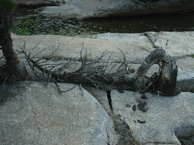
The last big timber was cut off the trail route here a long time ago. |
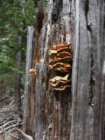
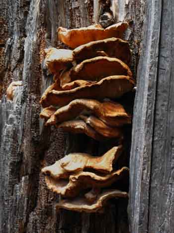
The Fungus be Tripping
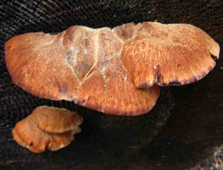 |
Fungus. |
Faint Romantic Route
 |
||
Our route actually passes between these two trees... Is it mysterous? Is it spooky? Is it the mystery of the correct route, or is it you not knowing it? Something gets this place under my skin, in a really pleasant way.
|
Obstacle Course
 |
JUMP |
 |
 |
Fungus. |
|
 |
Very old hand axe cut tree. |
 |
||
Nice trailbed leads us through new and old elements of this living forest.
|
 |
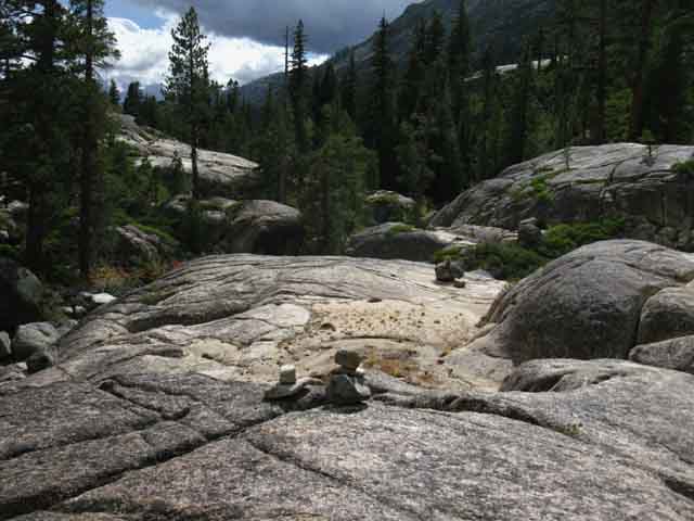
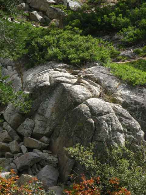
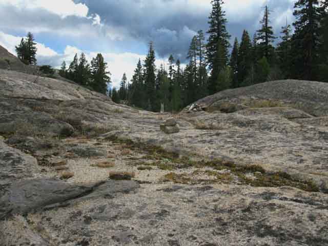
We're at the rocky open space representing the high point of this section climbing away from Summit City Creek. Now we'll find and follow a few ducks across this short rocky section to find the faint trail back down into forest towards the creek. |
 |
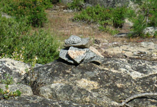
Good ducks mark out route through here as of 2013. But notice that these ducks will not withstand the Winter snow and thaw. |
Aspects of Telephone Gulch along
the
Tahoe to Yosemite Trail
 |
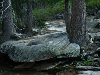
"Last" Campsite. Well, not really. But I've always called it that because the trail typically fades out South of here. Not so much in 2009. Independent of the status of the unmaintained trail through here, the route deterorites South of here and improves to the North. |
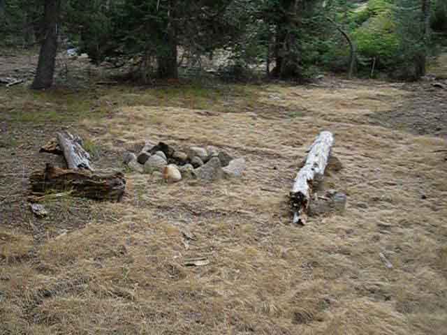 |
Old campsite with old benches. |
| Campsite South of Telephone Gulch 2009 CAMPSITE |
||
 |
||
Campsite South of Telephone Gulch 2009. Old and degraded. Not used during the 2009 hiking season.
|
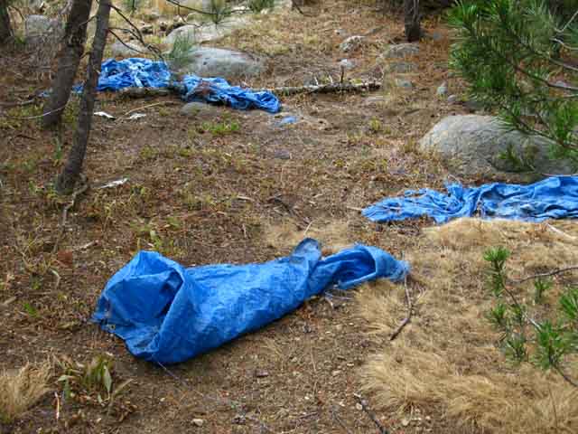 |
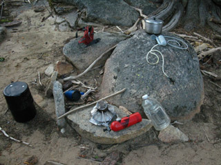
Abandoned tarps, 2013. I believe that this was part of the tools and gear that Eric found and carried out early in the Summer of 2013. |
October Scene
 |
||
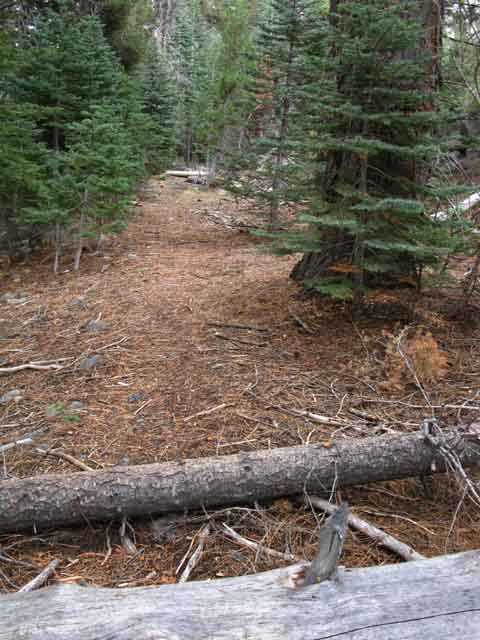
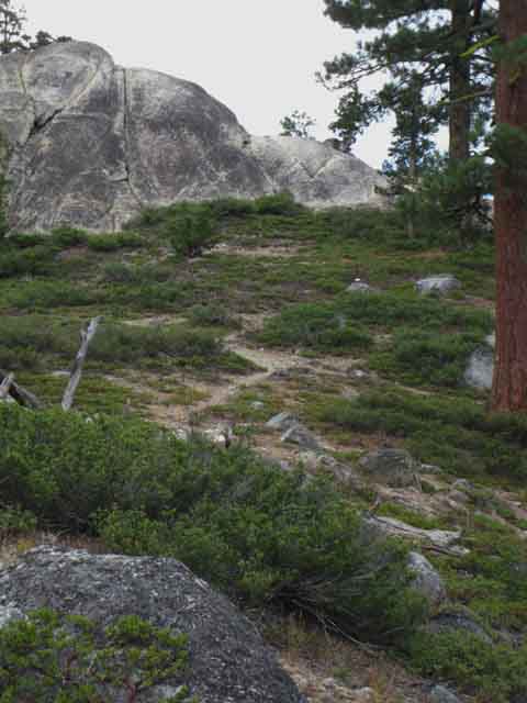
Hiking South from this "last camp" before trail conditions potentially degrade we've got some reasonable quality trail across dry meadow. This is likely a result of the long series of dry Winters we've experienced. As soon as we get a wet Spring meadow saturation, movement, and growth will begin to obscure the trail.
|
 |
Moving South and East across crispy meadow towards forest. |
 |
||
Entering the Fern Zone between Telephone Gulch and rock Zone above the Upper Ford. We're now low enough in elevation (around 6600 feet) to get zones of temperate forest conditions.
|
 |
Ferns, fallen trees, and faint use trail coming around the fern zone approaching the next set of granite slabs above Upper Ford of Summit City Creek. |
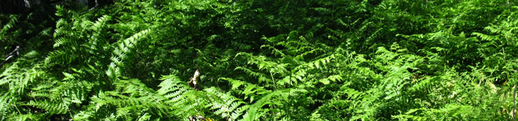
A wall of ferns blocked the Tahoe to Yosemite route just South of Telephone Gulch, 2009.
THE GREEN MONSTER
 |
||
A short ways South of Telephone Gulch during 2009 I ran into this green barrier. Though quite beautiful, it was much trouble to pass through. This wall of Sword Ferns sits upon an exposed network of strong interconnected elevated roots, much like a layer of quarter-inch rebar sitting above the ground, but very slick. This web of roots was sitting about two inches above the ground. As you can imagine, this platform of roots gave spotty, slippery footing, and was constantly trying to suck a foot into its web. It was a real challenge to keep my feet from slipping into the web of roots and getting stuck. Getting a foot caught up with a heavy pack is destabilizing. This can easily pull you down. Around me the stiff stalks of the aptly named Sword Ferns threatened to impale me each time I stumbled as the root network constantly snagged my feet. That's why they call them Sword Ferns. I can't wait to get back and see how this growth is doing. UPDATE
|
Subsequent Experiences
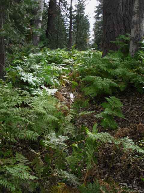 |
Trail through the ferns in the aptly named Fern Zone. The difference between the two images above represents the range of fern growth we can experience here. Sometimes it is very dense and clogged through the fern zone along the trail route. Other times less. Independent of the specific density of the ferns, the way ferns grow tends to obscure the trail if short or tall, thick or thin. The upper image of profound growth and fertility was taken during the Fall of 2009, the lower image during the Fall of 2013. That year the ferns had to be pushed through to get through. There was no trail through. The difference is the lower moisture that we've been averaging over the last fifteen years as Winters become much shorter and Springtimes drier. |
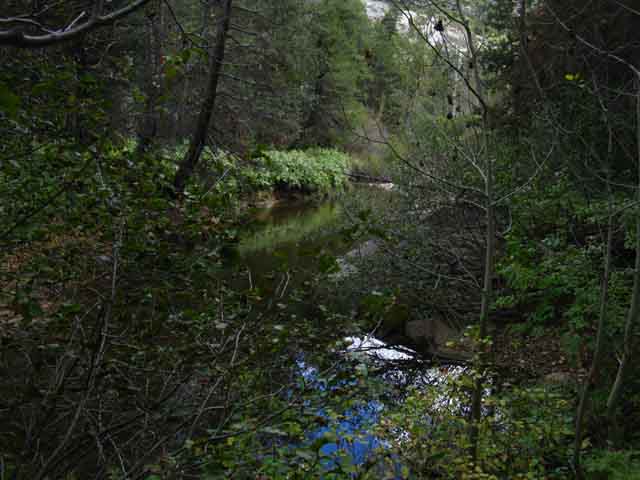
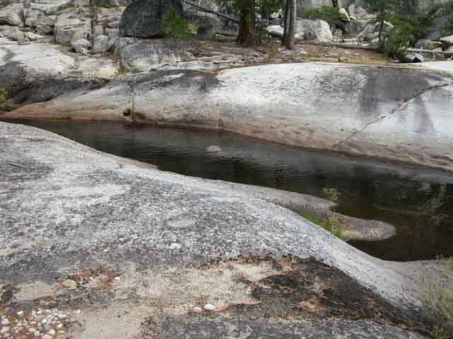
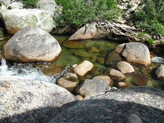
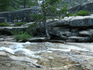
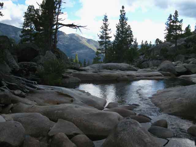
Pooling, Tranquil Summit City Creek
 |
||
Down to Summit City Creek.
|
The Past is Green
 |
The Fern Zone has been taking it on the chin in the drying climate. The bits of Temperate Rainforest that were once nurtured by the unique shape of the terrain squeezing out additional moisture and providing extra shade are turning yellower and yellower as they shrink. |
A Sadly Dry Aspect to a Normally Moist Spot
 |
Approaching a rock zone wedged between fern and forest zones. |
Sweet Little Zone of Smooth Carved Granite
 |
||
v
|
Tranquility has Landed
IT is Here
 |
Granite pool along brief stretch of open granite above Upper Ford of Summit City Creek. |
Back into the Bush
 |
Chipped trail leads us back into fern and forest. |
 |
||
Fern zone above final section of Rock Terrain down to the Upper Ford of Summit City Creek.
Telephone Gulch to Upper Ford Forum |
 |
v |
Out of the Forest and onto the Rock. I welcome the change...
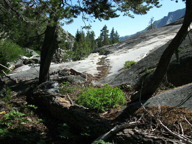 |
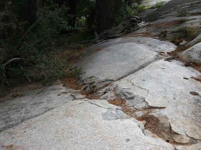
A short granite section opens South of Telephone Gulch. Trail crews long ago chipped a path to guide us across the granite, which now holds more forest debris than backpackers. The solid footing of this hard surface is a welcome change from the constant threat of a sprained ankle while crossing through deep forest floor debris. Note the debris build-up along the trail broken into the granite. |
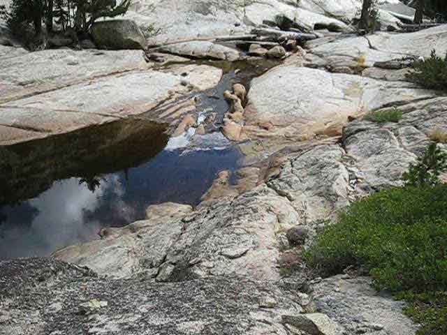 |
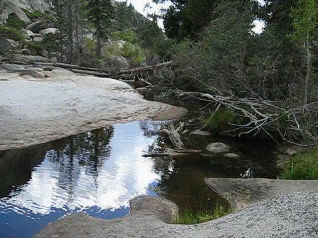
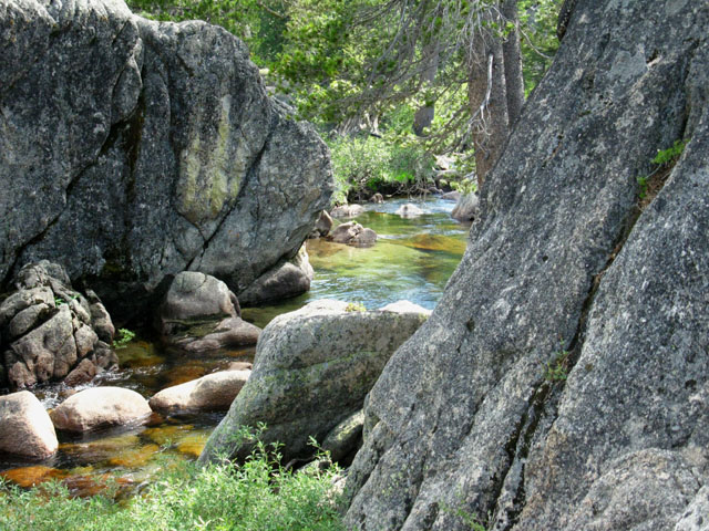
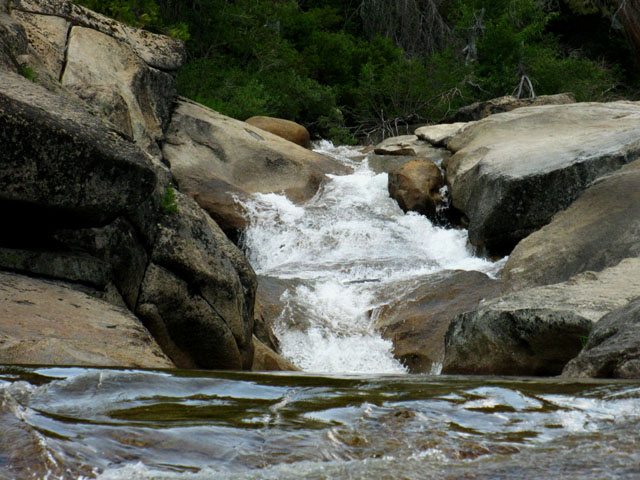
Fine trail takes us a few hundred yards downstream past this fine pool with great rock rising on both sides. Below we see the rock formation rising on the far side of this pool. A few hundred yards downriver we will climb up a great granite formation to cross over into the gulch. |
 |
The distinctive face of the granite formation towering above the pool. |
 |
||
Sand collects along granite section of Summit City Creek.
|
 |
This is a sweetly shaped piece of stone. |
 |
A trail well notched into the granite brings us past beautiful pools and fine rock faces rising above the far bank of Summit City Creek. The image above imparts the feeling of a narrowing terrain, which is happening. We are wedging ourselves further down a narrowing canyon right here. |
 |
 |
A pretty obvious route brings us down this narrow section of granite terrain wedged between the creek and steep formations rising on both sides. |
|
 |
||
All this fine trail across rock brings us down to a dead end. We will see no obvious way forward, with a great granite rise climbing to our Right. We will scurry up it, naturally.
|
 |
Scurrying up this granite berm and turning around to look back the way we came down the canyon reveals a better view of the granite formations behind us rising above the pooling section of Summit City Creek than we had while standing under it after we first emerged out of forest into this grand granite area. Turning back around to continue South down the canyon we see a moderately deep sandy gulch separating us from the complex granite terrain continuing South towards the Upper Ford of Summit City Creek beyond. We're getting closer to the Upper Ford. But first we have to get across the sandy gulch. |
 |
||
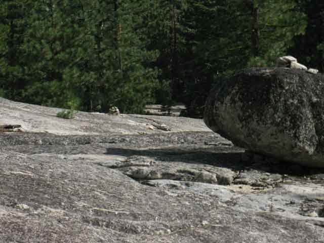
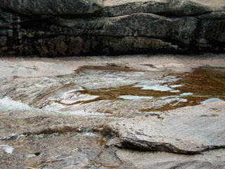
Sandy gulch and complex grantie terrain beyond. This place takes some good observing and analysis to pick our way through. Looking carefully at the granite making up the far side of the sandy gulch we can see black stripes staining a portion of the rock. This section with stripped stains is sitting almost at the center of the image above. Right next to the black-stripe stained rock we can also see a granite boulder sitting in the sandy gulch. That's where I got through last time, after I worked my way down there...
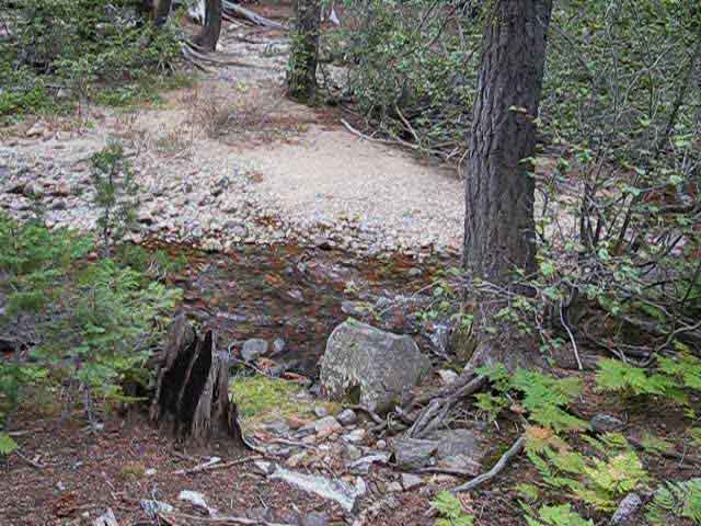
I believe this is where folks might want to begin looking for the ford. Not Yet! Post up your experiences: |
Sandy Gulch Art
 |
Lovely. This is my kind of rock garden. |
In the Sandy Gulch
 |
||
Looking South down the gulch.
|
 |
A very fine midget junniper tree growing out of solid rock on the North wall of the sandy gulch. I distinguish between a shrub and tree by the character of the trunk. Look at that massive sucker! |
 |
Looking North up Summit City Canyon across the sandy gulch. Note the location of the of the dwarf juniper in the second picture above growing out of granite on the North side of the sandy gulch. |
Looking back, North, at the twisting canyon of Summit City Creek we have been descending
 |
||
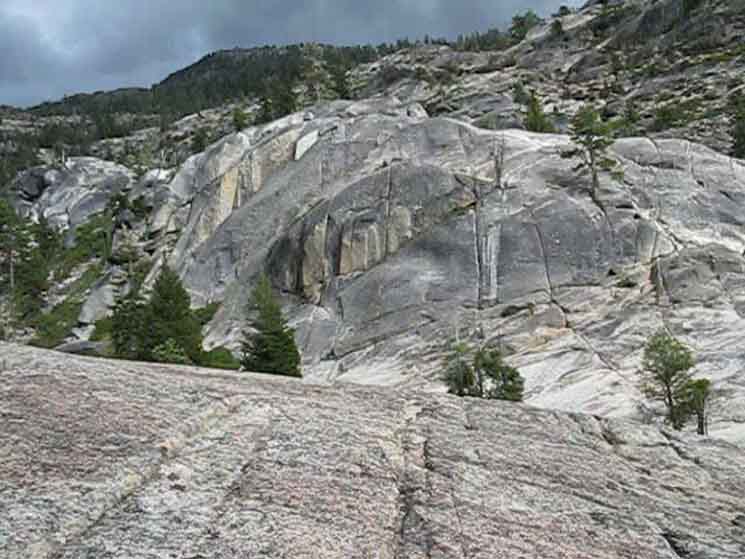
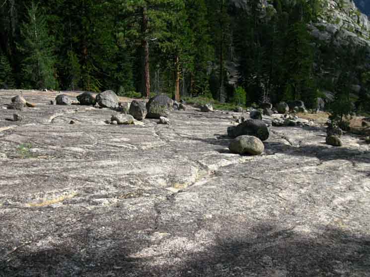
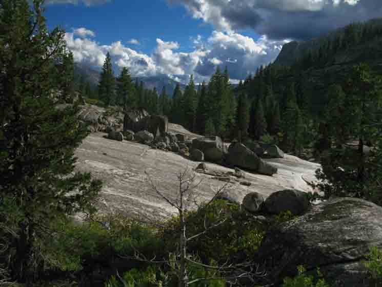
Long view North at Summit City Canyon looking past the Sandy Gulch. Note that this view is the same perspective as the second image above, but from further South. We are in the great granite section of Summit City Creek North of the Upper Ford. We are looking North, up Summit City Creek. Fourth of July Peak is peeking over the descending ridgeline in the far distance, below the cloud in the distant Right-Center of this image. It is a real relief from the dense forest. The granite beauties up the canyon are bending to the Northeast, towards Summit City Creek's trail junction to Fourth of July Lake, where we entered this awesome canyon. You must rely on your good observation and route finding skills backpacking through this whole section, but there has been a solid line ducks (Sept. 2013) guiding the way across this open granite section. And the ducks are not too bad. Good ducking subtly marks the route. This area is a bit over-ducked as of my last passage, but not by much. The biggest ducks survive the Winter snows, but the rest are swept away, to be replaced by each Summer's hikers. You don't need ducks through this granite section, in fact too many ducks take away from the experience. These wide open sections require backpackers to scan the totality of the terrain to weigh route options. Too many ducks can diminish the experience. I'd say that nowadays the real problem is that there is not enough snow falling to knock over the ducks. This will lead to a build-up of duckage.
|
 |
Looking off to our Left we can see a couple of nice soft soil flats with tree cover that make good campsites as we approach the Upper Ford. |
 |
A subtle duck (top middle-Right of image) pulls us to the Right to find our way through the granite terrain. |
 |
Too many ducks. |
 |
||
The last three images above were taken at each duck location looking South at the next. Note the white rock in the duck above is the same white rock in the second image above, but closer... Again, too many ducks. I did not kick down the extras this time through. Let's not overdo it. There's an exposed campsite on the rock up here, off to our Right up ahead that we'll see and pass in a moment.
|
Campsite on the North side of the Upper Summit City Creek Ford
 |
A nice improved campsite sits on the North Side of the upper Summit City Creek ford, at the edge of the last clump of forest above the Upper Ford. |
A momentary break to dry out the feet and relax the body
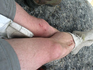
| A nice improved campsite sits on the North Side of the upper Summit City Creek ford, at the edge of the forest. | Airing out the feet and taking a break before crossing the upper ford of Summit City Creek. Some leg damage passing through the dense brush sections of the unmaintained trail. | |||||
 |
 |
|||||
Nice camp during 2009. I did not check it out in 2013. |
Long pants might be a good option through here. I measured the obstacles vs. the heat, and determined heat was more of a threat than the obstacles. So the pant legs stayed in the pack. |
Video
Upper Ford to the Campsite Overlooking the End of Summit City Canyon
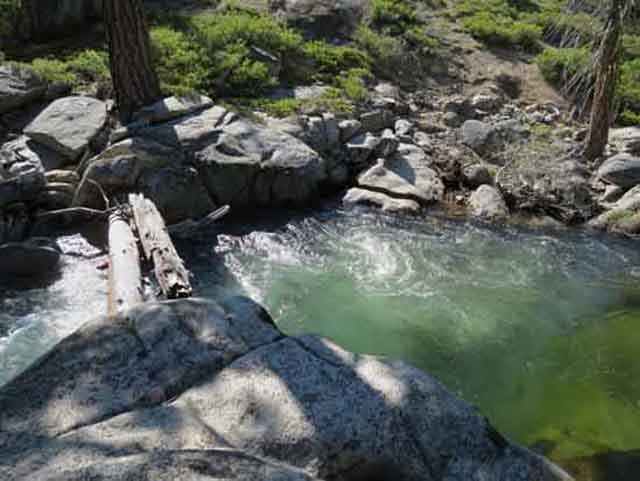
Upper Ford to the Campsite Overlooking the End of Summit City Canyon Distance Terrain Trail degrades into a route we must find and follow. We are rewarded by finding ducks and remnants of old trail bed worn into the terrain telling us we are on-course as we burst through thick manzanita and find our way through mazes of trees across fingers of dense forest. I find that threading our way through boulder gardens and sliding through ancient slots worn into the granite terrain long before the ancient civilizations of man rose to be relaxing, exciting, and exhausting all at once. If we are not finding regular indications of the old trail and current route we are not on it. If we are not on the route we are working a lot harder than if we are...
Mokelumne Wilderness Telephone Gulch to Upper Ford Forum |
North: Summit City Creek top of page South: Lower Summit City Creek Ford
The Upper Ford, Summit City Creek
 |
||
Location Latitude 38.59987° Longitude -120.03499°
|
The Upper Ford, Summit City Creek
 |
The Upper Ford of Summit City Creek. At the top of this image we can see where our route runs to the Right, to the South above the rock formation where the fording duck is situated. |
| The Great Duck on the South side of the Upper Ford of Summit City Creek. | ||||
| The Upper Ford of Summit City Creek. | 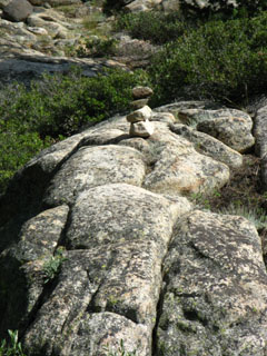 |
|||
 |
||||
I am heading left, to work my way down to the fording boulders, after checking out the fording situation to the Right of these nice fording boulders. But before fording, I've got to get down to them. |
||||
OBSERVE! |
This duck tells you you've arrived at the fording point. Note the drainage gully behind and to the left of the duck. That is the wrong way. You head right after crossing the ford. Keep your eyes open and you will see indications, if not ducks, marking the trail route turning right out of the lower part of the gully. |
 |
||
We can only access the ford by climbing down to the Creek to our Right. Once we get down there I generally cross on the far Right side of the image, then push through the bush to cross the grass berm to the Left. Then we move a few steps up the gully looking to our Right. We'll see a duck or a bit of trail bed to point ourselves towards as we climb up around the rock formation the fording duck is located. Hiker Input and Experiences
Post up your experience with finding and using the Upper Summit City Creek Ford. Mokelumne Wilderness |
Summit City Creek's Upper FordFording is one of the two most dangerous threats to High Sierra Nevada Spring and early Summer backpackers, along with lightening. Always approach a ford with great caution, as you likewise should always evaluate weather developments before crossing open terrain. Both fording and lightening are seasonally dangerous, and very dangerous when in season. Backpacking itself is dangerous! Use great caution at all times, and especially at fords and across open terrain. The peak of Fording Danger is during the height of the Spring Thaw. The peak of the Lightening Season correlates with Summertime heat waves pushing massive cells of superheated moisture out of the San Joaquin Valley up the Western flank of the Sierras. As these cells rise up the Western flank, they condense and concentrate into powerful electric storms. Even outside of their peak periods, fording and lightening are objective dangers that must always be treated with respect. Fording and Lightening dangers can even correlate. I believe it was during my 2002 Tahoe to Whitney hike that saw powerful afternoon thunder storms carrying intense Lightening, and thunder with torrential downpours. These afternoon storms flooded the creeks, making afternoon fording dangerous during mid-Summer! These Summer Storms flooded Tuolumne Meadows, knocking out the water and sewage plants. TM looked like a disaster zone when I hiked in. Big granite boulders had been pushed around, and deposited on Highway 120 across Tuolumne Meadows. I was lucky enough to observe these powerful Summer storms as I was crossing Benson and Matterhorn Canyons on my way South towards Tuolumne. These storms were powered by a super-hot heat wave in The Valley. If you observe the weather carefully in the Sierras, a well-traveled Californian can extrapolate what the general weather conditions are in the Valley and on the coast. I was privileged to observe bits of these thunder and lightening storms from above, as thunderheads traveled up the canyons that divide the five ridges North of Tuolumne Meadows. It was really beautiful, though many backpackers were not real happy about the storm's intensity, the long daily duration of the storms, or the 12 or 13 consecutive days of downpours. Too frk'n bad. I lectured them about how lucky they were to experience this special showing of Nature's Power. It was awesome! *** Independent of the season, you must observe conditions carefully, fully consider your situation, (solo?, experience level? food and gear?), and make good decisions. If you reach an obstacle you cannot safely deal with, turn around, or wait until conditions change to suite your level of skills. This is especially important with fording and lightening, both of which change with the season and during each day, with the changing conditions in the atmosphere. High runoff through fording spots is lowest during early morning, when the runoff is slowed by low overnight temperatures. Summer Lightening storms start with Valley heat crossing the Sierras in the early afternoon, generally around 2 pm, and end no later than sunset, when the Sun powering the afternoon heat and moisture pumping out of the Valley sets. Comments-Additional Information-Insights & Questions... A bit more information, and a place for your comments, questions, and experience. |
View downstream from the fording point
 |
||
Serene pools lay at the base of the boulders just downstream from our ford. Summit City Creek cuts through an inaccessible section South of here, forcing us to ford the creek to climb around this inaccessible section of the creek. After fording the Creek we have a 1.3 mile hike over a couple of bluffs descending off the canyon walls, before our route again touches Summit City Creek.
|
Downstream High Water Ford
 |
Peter reported this alternative fording point to the rock-hopping upper ford of Summit City Creek in June of 2014. Here's how Peter locates this ford: "What a place! I didn't do the fords, but found a *great* log ford further down from the "Upper Ford", maybe a 1/4 mile? " Check out Peter's nifty account of hiking the Tahoe to Yosemite Trail during late May to early June, which is traditionally done under classic Spring snow conditions: Peter's Peter also provided Tahoe to Whitney with an excellent account of his hike on the |
 |
||
Upper Summit City Creek fording logs. Image courtsey of Peter Sporleder.
|
Back to the Upper Ford location as marked on the Map...
View North back across the Upper Ford
 |
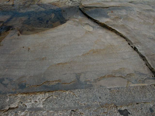
Looking back at the massive granite we just walked over hiking South to the Upper Ford as located on the map. This place is so cool. Note the rust color and smooth rock unblemished by fungal spotting marking the high-water line up and down the North bank of Summit City Creek. The graduation of the rust color defines the time the water spends at each level. It gets darker the closer to the riverbed we go. |
 |
After fording Summit City Creek and looking right for the trail, you will climb a rocky route to the top of a bluff where you can get a view of the terrain to the North that you just crossed. In this picture, looking North, Summit City Creek is passing through a narrow section of the canyon from Right to Left into a narrow cleft in the rock. The narrow gorge Summit City Creek cuts through has forced our route to ford to both ford and climb higher up over shoulders descending off the mountain's flank. If we were hiking the Pacific Crest Trail route between Highway 88 and Highway 4 we would be mostly be hiking across exposed volcanic terrain. Not so for the longest parts of the Tahoe to Yosemite route, which are dominated by fine granite and deep forests. |
Veer Right after fording Summit City Creek
 |
||
vWe can pick up ducks to guide us through the maze of low manzanita to find our way to the top of the first rise South of the Upper Ford.
|
 |
Sweet channel through rock, forest and brush. |
 |
The top of the first rise South of the Upper Ford. We're cutting between the tall and short granite. |
 |
||
v
|
 |
Up to the primitive campsite, the first to the South of the Upper Ford.
From this position the current route through the terrain and the trail as marked on the map vary considerably... |
After crossing the ford it appears that the route South continues straight up a small drainage. It does not. Look to your right for a path that climbs up, to roughly parallel the Creek South. Climbing up to the top of this rise you will find a small flat with a small fire circle. |
 |
Fire spot at primitive campsite at the top of the rise just South of the upper ford. The maps show a spring here, but I have not found it. |
Down the South Side of the First Rise South of the Upper Ford
 |
Bench-style custom duck south flank of first rise south of Upper Ford.
Note we are moving down and to our Right, the West. On the map we should be climbing East around the high meadow off to our Left from the top of the last rise. Instead, we moved West, to our Right... |
Cool Duck
 |
v |
Second Rise South of the Upper Ford
 |
v |
Heading up to the top of the second bluff, Southern View
 |
||
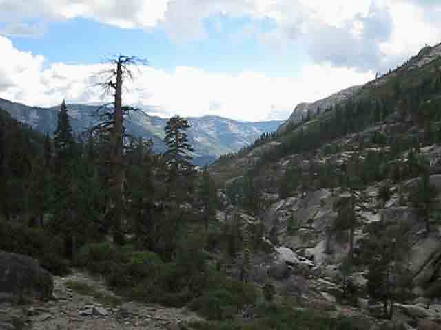
Coming off the first bluff, or small rise, South of the Upper Ford reveals another rise to our South, the second "hill" or "rise." Note the trail running up the rise on the upper Left side of the picture. Summit City Creek is off to our Right, in the deepest and most inaccessible portion of this particular part of the canyon. But just wait until you can't see the North Mokelumne! It is buried in deep granite gorges where it and Summit City Creek intersect. The trail section between the lower ford and the Munson Meadow junction has one very nasty twisted gorge section that the North Mokelumne River passes through, that we can get access to, if you know where to look. Continue on down the trail with me, and we'll try to find it. My point is that many sections of the trail route circle around places where rivers are continuing to work on deepening the gorges ancient glaciers had carved through sheer granite.
|
North: Summit City Creek top of page South: Lower Summit City Creek Ford
At the top of the second bluff
a
long view to the Northwest
of our route
down Summit City Creek
opens up
 |
The View North from the top of the second bluff, the high point South of the Upper Summit City Creek Ford. This view is looking back up the Summit City Canyon we have just followed down to our current position. We are looking up at the massive cut Horse Canyon slashes into the Summit City Creek's canyon. Highway 88 is on the other side of the far mountains, and the trail through Horse Canyon connects the Summit City Creek to Highway 88 at the Oyster Creek Trailhead just West of Caples Lake on Highway 88. Head up to the Horse Canyon trail junction for more information on that route. The peaks in the far distance are Covered Wagon Peak, on the Left, with Melissa Coray Peak rising to 9763 feet at Right. these peaks make up Horse Canyon's Northern wall, and the trail leading to Silver Lake on Highway 88. The picture below imparts a broader context. |
The view North of the twists in the canyon we just hiked through. The peaks in the far distance bound the Western side of Fourth of July Lake, where we entered this canyon
 |
||
The big peaks visible in the distant North bound the North side of Horse Canyon, and are at the backside of the Kirkwood Ski Resort. Fourth of July Lake is situated below, and just to the Right of Melissa Coray Peak, the furthest and highest peak in this picture. That's where we entered this canyon. Horse Canyon contains a trail that links Summit City Creek with Highway 88 just North of Silver Lake. Take a look at a view of this whole canyon complex from near the top of Mount Reba, to our South, which offers a bird's eye view of this magnificent terrain. Historical Information about Melissa Coray Peak.
|
 |
v |
Coming off the Bluffs South of the Upper Ford of Summit City Creek. The bluffs we cross on the South Side of Summit City Creek's upper ford are exposed. On the South of the second bluff we enter some manzanita, which offers resistance rather than cover. Our loss of elevation will soon bring us into the Manzanita Zone. The Manzanita Zone is exposed and hot. It's like this: The Manzanita Zone is composed of a Very Hot Southern exposed mountainside zone with long sections covered by dense mazes of thick manzanita. These conditions necessitate "plunges" through the grasping thickets of manzanita. I hope the material of your ultra light pack can deal with this. This is really a blast, if you are into this kind of thing. This type of terrain begins in earnest after we drop off the South side of the upcoming Granite Flat... In the meantime, Light forest cover begins as we drop down nearer to the place Summit City Creek emerges from its little inaccessible run, to cross this stunningly beautiful granite flat we are approaching. |
3rd rise South of Upper Ford
 |
||
v
|
 |
v |
 |
v |
 |
North Mokelumne River Canyon and Mount Reba in the distance. |
 |
Coming around the West side of the third rise we get clear views of the end of Summit City Canyon draining into the vast valley of the North Mokelumne River. Mount Reba is the low rounded peak on the distant-Right horizon. |
 |
v |
 |
Nice. We are finding subtle trail and a few well placed ducks leading us around sweet granite boulders, swaths of manzanita, and dense thickets of forest. |
Over the Fourth Rise South of the Upper Ford
 |
||
Emerging from dense forest into a section of sparce shrubbery and trees we must turn to the Southeat to cross over the fourth very low rise South of the Upper Ford. Unlike the previous three rises South of the Upper Ford which passed around their West sides, we cut to the Southeast away from Summit City Creek over the fourth low rise South of the Upper Ford.
|
Looking Back to the North
 |
Looking back to the North up Summit City Creek at where we just emerged from a very faint section of forest and manzanita. |
Terrain on the Southeast side of the Fourth Rise
 |
v |
Duckage
 |
 |
Ducks lead us over the rise and through forest to a fantastic granite slab.
A massive duck informs us that we are on the correct route. Fragile ducks do not survive the Winter snows. They get knocked down. This bad boy is a survivor. |
|
 |
||
Note the large stable duck in the middle of top edge of the granite slab. We follow the slab down mountain to our Right in the image above.
|
 |
v |
 |
Erratics, random boulders dropped by receding Glacier decorate our great granite slab. At the end of the slab we submerge ourselves into a sea of manzanita, growing denser as we lose elevation. Position Latitude 38.589145° Longitude -120.038153° |
 |
At the bottom of the granite slab we plunge into thick manzanita. Duck on boulder guides us through Tahoe to Yosemite Trail manzanita. |
 |
||
Looking back, to the North through manzanita at the fantastic granite feature we've just passed to the South of. The granite slab is off to the Right (East) of this feature. Remember where we cut to the Southeast to deflect around the low fourth rise below the Upper Ford? The structure above is the fourth rise viewed from the South. Now we will turn around to continue hiking South...
|
Another Look North
 |
After working our way a bit further South we again turn around to view the South facing side of the fourth rise below the Upper Ford of Summit City Creek. What a beautiful rock. |
South
 |
Hiking South the well-placed but unreliable ducks guide us through a maze of manzanita and faint trail to dense forest. |
 |
v |
Into Dense Forest
 |
||
Very faint trail along Summit City Creek. Note the duck in the foreground and the duck in the distance. No trail is no problem when ducks link the route.
|
Faint Trail through Dense Forest
 |
Faint trail through dense forest towards end of Summit City Canyon. |
The Second Great Granite Slab South of the Lower Ford
 |
Out of deep forest and faint trails onto another amazing sheet of almost jointless granite. Our route exits the forest onto another vast sheet of granite. |
Lookin Right, to our Southwest
 |
To our Right we can see Summit City Creek running onto a lower and flatter area of this amazing sheet of granite. |
Camping-Exploring-or Pushing South? We have a choice here: Forward into and through the manzanita towards the end of Summit City Canyon, or Right to explore an interesting section Summit City Creek. This choice is going to be controlled by the hiking plan we constructed for this section of trail. The problem I confront on the trail and while constructing hiking plans is the conflict between wandering about and exploring the terrain along the trail versus the demands for high daily mileage required by long distance backpacking. I deal with this conflict between "deep" vs "long" engagement on the trail by always bringing an extra day's food for each section of the trail. I also figure that I'm going to hike every trail at least five times over my life. The extra day's food and many hikes through a section of trail allows me to explore and learn more each time through. The multiple trips allow me to camp at different sites each time through. The extra food assures I've got the time to explore a new area each time through. Each time through a particular section of trail I try to camp at different spots and expend my extra food exploring an unknown area in this section. |
 |
We have two options on the South end of this granite slab. We can work our way West, to our Right, over to Summit City Creek if we want to camp and explore where the creek crosses this amazing granite slab and find a nice spot to camp. Or we can plunge into the dense manzanita hiking South to the fine campsite overlooking the end of Summit City Canyon. |
Notes After the Southbound backpacker crosses over the fourth rise South of the Upper Ford the route is all flat or down-mountain to the lower ford of Summit City Creek. As we begin descending we can take in both long and near views of the terrain. Hiking onto the second granite slab section below the Upper Ford, pictured above, we can see Summit City Creek emerging from a narrow gorge section off to our Right. Summit City Creek has become accessible again. (This is also where the Northbound backpacker will reacquire the Summit City Creek, to their Left, after climbing up the manazanita-covered mountainside hiking North from the Lower Ford. Northbound hikers first encounter the campsite overlooking the end of the canyon, then the granite slab pictured above when emerging from the manzanita picutured below.) Southbound hikers can begin watching for creek access to our right at the base of the granite slab for exploring, water, and camping opportunities. Ahead we hikers continuing South confront a dense thicket of manzanita.
The Manzanita Maze Though we are following a "trail," we'll see that the manzanita presents us with many choices of paths heading in roughly the same direction. Many times I've emerged from the manzanita onto a high point where I scan the terrain ahead for my next goal, looking for the next duck on a distant highpoint, or ascertaining my route by determining what looks like the best route through the terrain along what I project will be the line of the route. Then we re submerge ourselves into the dense manzanita to dead-recoken our way to our next duck or high point. Once submerged in the manzanita I always pick the easiest path that keeps closest to what I perceive is the best route through the terrain. During 2009 there were few ducks through here and during 2013 there were lots of ducks. It also appeared that the manzanita had been trimmed a small bit during 2013, though there are lots of sections where we are pushing ourselves through a seam in the interwoven sharp grasping branches this dense vegetation weaves between plants. The folks who did trail work during 2013 focused on ducking the route through this manzanita rather than cutting a route through. A wise use of limited resources. Yet ducks can be ephemeral, disappearing much more quickly than they appear. Many Options Getting through the manzanita sections with a minimum of trouble brings up an important tactic of cross country travel. Make sure you take note of the upcoming terrain at every high point where we can get long views. This means we should line up our map and compass with the surrounding terrain features near and far along our route through the end of Summit City Canyon to the lower ford. These points of observation give us reference points to both determine and guide our subsequent selection of paths along what we will have determined is the best route to our next destination point from our last high point of observation. When we can't see our overall position in the terrain while submerged in the manzanita we'll will have to make our route decisions from what we remember of the terrain elements from our last high-point observations, our observations of the surrounding ridgline landmarks, and the last compass bearing we took. These high points make up a series of positions where we pull out our map, align it to compass and terrain, ascertain how we got to our position on the map and how we are going to reach our next desired position in the terrain. Then we take note of the compass point of our next destination. This allow us to determine where the trail route should be relative to our current position, and note our offsets. Remember, the trail is unmaintained through this segment of the Tahoe to Yosemite Trail. This means there may be long lengths of damaged trail that we will take an "offset" route around, and long segments of cross-country backpacking without any indications of trail at all. Not only are GPS stupid, they will make you stupid too. The position of the best route through the terrain is located by our observations. A GPS will not replace personal navigation skills. Period. Be Safe Our comfort and safety depends on our commons sense, skills, and fitness, not on technology. Technology has already degraded our skills and fitness. We're here to take these vital elements of our identity back. Through these types of non-trailed sections we try to observe and follow the remaining bit of the route through the terrain while keeping a sharp eye on the upcoming terrain to determine the most-likely location of the old trail route and best route through. We are trying to keep a general geographic frame of reference on the terrain so we stay on route when the trail "bits" we are following disappear. But even more importantly, we are excavating ancient physical observation and navigation skills hard-wired into humans. If we are successfully following the best route through the terrain we will run across faint signs of the unmaintained trail route on a regular basis (as of July 2009, and more true in 2013 than '09). OFF Route? I've laid out a placeholder page for the upcoming Navigation page. I've posted a few informative links to sources of astronomical information. Astronomical information for navigation purposes because the universe is our ultimate clock and compass. We are the second hands of nature's clock and the needles of nature's compass. Time and space are not measured by looking down at instruments in human hands, but by humans reflecting the ancient movements of Earth and Sky. * * * End of Summit City Canyon to Lower Ford This place represents a natural museum of the quiet beauty remaining after timeless uplifting and Earthquaking pushed granite out of the Earth, only to cut it deeply with ice, and finally flood it with lava. This place is both a gallery of nature and an interlude, a quiet backpacker's break spot in the timeless processes of construction and destruction that rule the natural world. On the South side of this special granite flat there is the fine improved campsite overlooking the end of Summit City Canyon. We can get down along Summit City Creek to the campsite via the granite flat or by hiking along the trail route through the manzanita. Well, I've hiked down the granite flat section along Summit City Creek to where I could see the campsite overlooking the end of Summit City Canyon, but the terrain along Summit Creek gets really rough, making it easier to get to the campsite along the trail route through the manzanita I did not use the formal campsite overlooking the end of Summit City Canyon the last time I was through here (2009 no, 2013 yes). Instead, I found a very nice patch of soft sand deposited at the high-water mark of the Spring runoff wedged in a little hollow where Summit City Creek runs across the granite flat. Nice and soft... |
Below The series of images below explore the unique area where Summit City Creek flows across this massive granite flat under delightful forest that has cracked its rock cap to push its way to daylight, giving us shade. This location is off to the Right of the route of the Tahoe to Yosemite Trail when we cross the second granite flat South of the Upper Ford of Summit City Creek. Hikers continuing South along the Tahoe to Yosemite Trail will continue South across the second granite flat to enter the manzanita on the South side of the flat, rather than turning Right down to screw around exploring Summit City Creek. |
1.32 miles South of the upper ford on Summit City Creek, we can easily drop down to our Right from our route, to where Summit City Creek emerges from its gorge to cut through a beautiful granite flat.
I think I'll camp here because it is such a breathtakingly beautiful place
| Summit City Creek emerges from it's tight canyon section and becomes accessible to the trail route...for a minute. | ||
 |
||
|
I never camped here before. This is a serene place to observe the quiet power of Nature
| Summit City Creek runs across a huge section of nearly flat granite after it emerges from its inaccessible section South of the Upper Ford. | The upper section of this granite slab is polished as smooth as a baby's ass by ancient glacial action. | |||||
 |
 |
|||||
| This granite flat is surrounded with, and punctuated by, a delightful Pine forest. (Lodgepole, Jeffery, and I believe that Western Whites kick it here too.) | The polish has been worn off the lower section by thousands of seasons of weathering and Spring runoffs. The upper section is silky smooth. | |||||
| Two rough boulders on the flat along the creek still hold small sections of their previous glacial polish. | Close up of polish remnant on near boulder. | |||||
 |
 |
|||||
These granite blocks demonstrate different aspects of nature's power. They were created by plate tectonics. They were polished, broken, and transported by moving ice. Deposited in their current location by ancient global weather cycles, they are now being carved by weather and runoff. They've seen a lot of action, so far. |
||||||
| top of page | ||||||
| I suspect that the shape of this boulder deflects the water flow around this corner during the height of the Spring runoff. This deflection has preserved a small bit of ancient glacial polish. Sweet. | ||||||
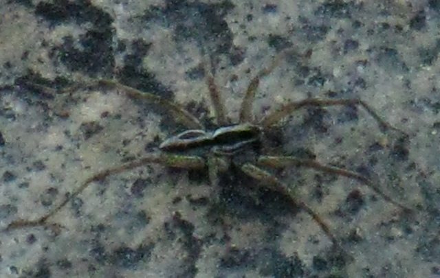
| A seven-legged spider. Note how its body resembles a black fleck of granite, and the legs are light colored... | ||
 |
||
It is not uncommon for Spiders in the Sierras to be missing legs. |
|
The whole trail between the Carson Gap and Lake Alpine is short, adding up to only 25 miles. But these are deceptively difficult miles. 9.52 of these miles are across an un-maintained trail route. This may considerably slow your progress. Or it may not. This will be determined by your actual level of fitness and skills. If you miscalculate by giving yourself too much credit, you will suffer. Remember: Better Safe than Sorry! In any case, backpacking is dangerous, and unmaintained trails involve an even higher degree of danger of getting lost or injured than maintained trails. If you are injured or lost in un maintained sections you have little prospect of support. This is why the manager of the Lake Alpine Lodge, Kim, insists that backpacker re supplies sent to The Lodge have the backpacker's expected date of arrival, along with the phone number of the person you designated to be knowledgeable of your itinerary. This may well save your ass if you get lost or injured in this difficult section. I call that insurance. Isn't Kim Sweet?
Mel and Kim at the Lake Alpine Lodge store keeping it real. * * * If this granite flat is not a planned campsite on your hike through this section, you should note its location as a good place to take a break. It is also a good place to shoot for if your hiking plans do not work out as you thought they would. I highly recommend that you bring an extra day's food with you through this section. Remember: Shit Happens! If you lose the trail route for awhile and wander around until you find it, you may end up spending an extra night in this section. In any case this nice flat makes an excellent spot to camp, or kickback, for a shaded water and food break. |

| Heavy Spring runoff pushed sand into this hollow at the perimeter of the granite flat. This made an excellent soft place for me to bed down. | Center of Camp: My Chair. | |||||
 |
 |
|||||
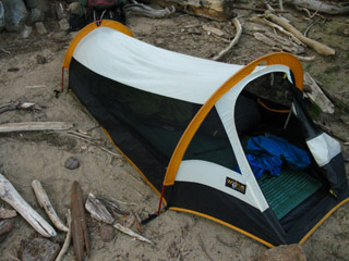
| Very Heavy mosquitoes (July 16) necessitated using the tent. I don't make fires, but note the abundance of dried out driftwood. Like the sand, the driftwood was deposited by the fury of the high water at the peak of the runoff. | Note how this boulder is my chair. The stove is sitting on my seat, and the pot is sitting on the chairback. It was quite comfortable. Especially as I sat there and observed the terrain, with the comforts of my stove, my food, and water arrayed within easy reach... This picture shows how I stowed everything so I could go explore the area. |
The Center of the Slab: Juniper constrained by Solid Rock
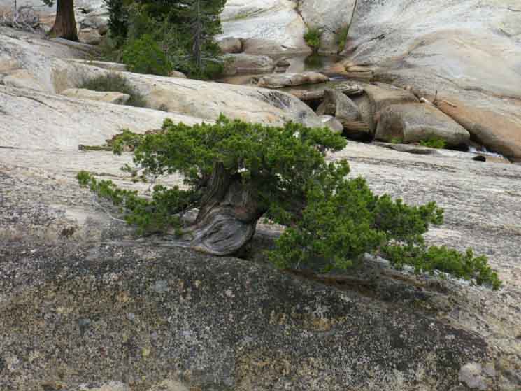
| I love this tree. It is growing out of a crack in solid granite that is not more than one inch wide. | This Juniper is attacking the granite from within, attempting to lever a slab that will not move for thousands of years. | |||||
 |
 |
|||||
| All around the perimeter of this granite section trees are breaking through the rock, and pushing rock out of their way. | This guy's predecessors laid down their lives to provide the soil for this present growth, as it will in turn provide more soil for its successors, in this crack. | |||||
| Gnarly dying trunk of the amazing tree. | Looking Downstream, South, from our flat spot where trees grow out of cracks.. | |||||
 |
 |
|||||
| Though this trunk wants to be round, it is growing in the shape that its narrow base can support. It is growing in the shape of a razor back ridge. | There is a nice campsite in the stand of trees on the Left side of the creek. |
| The trunk of this Juniper rises like a shark fin out of a thin crack in solid rock. A bonsai High Sierra Juniper, on a Sierra Scale. | ||
 |
||
Generations of trees will work this crack, as their brethren work in cracks along the creek. I figure that the combined forces of the trees working in harmony with the creek will undercut and lever out big chunks of this massive granite slab. This place will look a lot different In a few thousand years. The Sierras have experienced radical changes in the temperatures, weather patterns, and timing of the seasons over the last few decades. If this pattern continues, these changing conditions will control exactly how this terrain design process plays out. I was thinking about these observations when considering how the Winter snowpack and the trajectory of the Spring Thaw have the potential to completely change the way a ford is laid out from one year to the next at the Spiller Creek Ford in the North Yosemite Backcountry. |
The Perimeter of the Slab: Trees Breaking and Moving Rock along the Creek
| Across the creek from this flat spot a Lodgepole is growing out from under a set of granite slabs. | Close up of the Lodgepole at left. Note how the trunk has pushed up the massive slabs on its right. | |||||
 |
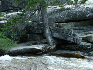 |
|||||
| This tree has grown against all odds. | On the left, the tree's roots are growing at a right angle out from under the other side of the slab it splits. | |||||
| These two different species have worked together to wedge out a massive slab between them. | Interspecies cooperation: Lodgepole hefts the Left of the plate, while a maturing Jeffery Pine takes on the Right side. | |||||
 |
 |
|||||
The trees are opening ground by slowly levering massive granite plates into the creek.
|
These trees are finishing a process started by their ancestors who first inhabited thin granite cracks, and began slowly levering them, like the Juniper growing in the one inch crack, above. |
This crack is being actively levered towards the creek, though the dead tree may present a deceptively defeated appearance. The dead tree's organic matter is rotting into the bottom of the crack it lived in, providing a wedge at the bottom of the split, and more soil for the improving health of the next generation of trees, which will continue to successfully lever this creek side granite slab. |
||
 |
||
Note how wide this crack is, compared to the one-inch crack the Juniper is working, above. Within the next couple of hundred years trees capable of finishing the job of levering this slab, as seen in the pictures above, will be hefting this slab over, and eventually topple it into the creek. There is going to be a nice granite platform along this creek side pool, sometime in the future....sweet. Trees work as "brethren," feeding and supporting each other over both time and space.
|
Below Below we continue South into the manzanita on the South side of the second granite flat South of the Upper Ford. |
Passing the Granite Flat we plunge back into Manzanita for the short hike to the Campsite at the end of Summit City Canyon
 |
The prominent rock in the middle distance marks the end of Summit City Canyon. It's Left flank runs down to the North Fork of the Mokelumne River. |
A brief hike South of the second granite flat through fairly dense manzanita brings us to what I call the camp at the end of Summit City Canyon. It's not really at the very end of the canyon, but its location gives us grand views South-Southeast out of the end of Summit City Canyon at the massive valley of the North Fork of the Mokelumne River. |
A short distance past the granite flat a fine improved campsite sits perched above Summit City Creek.
| The End of Summit City Canyon CAMPSITE |
||
Note how the surface debris is undisturbed. The surface cover is crisp, having been pressed by the Winter snows, soaked during the melt, and sun baked as Summer approached. The small hand full of coals in the fire ring are old, left by a lone traveler in 2008, and long ago lost their fresh luster. All of this indicated to me that the last inhabitation of this campsite was during the Summer of 2008. This picture was shot in July of 2009. Signs of the heavy hand of Winter snow had not been disturbed. |
||
 |
||
See the location of this camp as viewed from the granite flat. Latitude 38.580626° Longitude -120.038911°
|
Water
 |
Looking past the fire ring in the second image above, and a bit to our Right reveals a trail down to this fine pool, where we water up for our break or our stay at the Campsite at the End of Summit City Canyon. |
2013: Eric Reports
 |
Picture looking South across the campsite at the end of Summit City Canyon into the massive canyon of the North fork of the Mokelumne River beyond. Note the great rounded granite slab emerging beyond the bench. This shot was taken by Eric during one of his 2013 TYT trips. |
Time Spot One
 |
I call this unique rock "Time Spot One." "X marks the Time Spot" Every time I want to know what time it is at night I yell "Time Spot," and run over to this rock to use the white spot near its exact center to guide me to where the two unique raised ridges cross in the center of the rock: That grand X is Time Spot One, the reference point from where I measure time at night in this fine campsite. This may sound crazy, and maybe it is, but I believe in deep engagement with the Time and Space around us. Life is too short not to. I don't carry any timepieces along the trail besides my compass. Prior to hitting the trail I take careful note of the times and compass points of sunrise and sunset in my trail journal. I also note the time the sun crosses the North-South line, and its altitude. (More Info) I keep track of time during daylight hours with this information. At night the same principals apply to the stars. The problem is the time between sunset and the appearance of the first star or planet. What I've done is note the exact time of the sunset in my journal, such as "7:10 pm." At sunset I begin estimating the time. When I see the first star appear after sunset I run over to Timespot One and measure it's distance from the horizon, add the time I estimate has elapsed since sunset (7:10 plus "X" minutes), making the current position of the star represent that time. Now I have an idiot clock on Timespot One: Me standing on a rock! Now I can measure the spinning of the Earth at night by the movement of that star relative to my reference point on the horizon, and can now keep better track of my upcoming bedtime. For a series of star-to-horizon measurements to be accurate they must be taken from the same viewing position, which is "Time Spot One" here at the campsite at the end of Summit City Canyon. Every camp has a Time Spot One, but only this camp at the end of Summit City Canyon has a nice rounded round rock boulder with a set of strange low granite ridges making the outline of an "X" centered in the center of the rock, further highlighted by a bright white patch of lichen in the center of the rock where the ridges cross. I instantly knew this rock was Time Spot One the first time I saw it. For more on measuring time on the trail see the |
Eric's 2013 Update
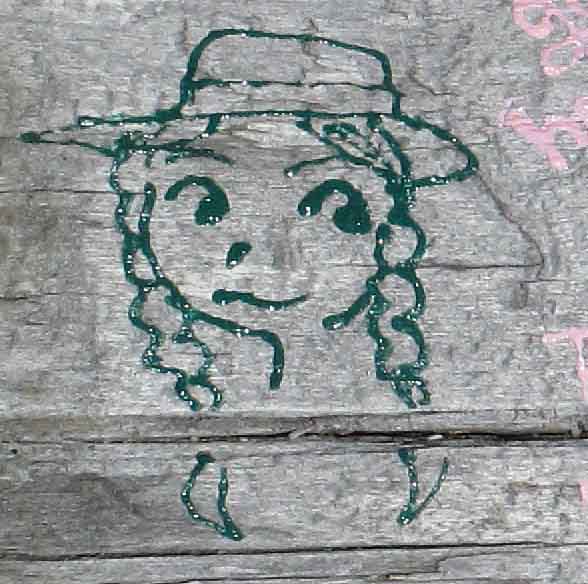 |
Finger Polish Lady self-portrait: Backpacking Fool of the Year. Only giant Fools faces are scrawled in Natural Places. This shot was taken by Eric, 2013. |
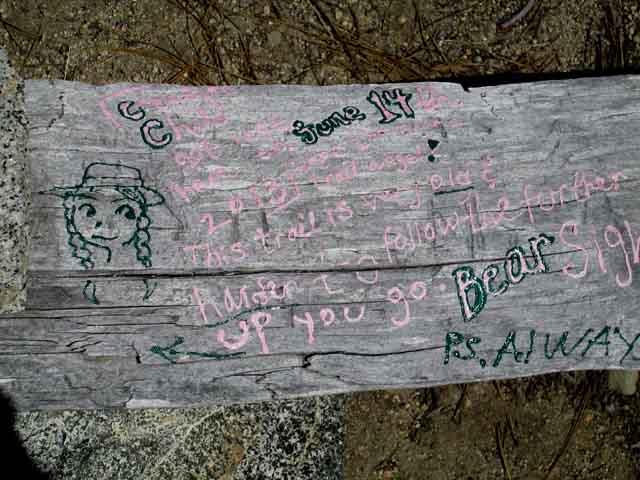 |
Wow. Somebody is full of them self. This shot was taken by Eric, 2013. |
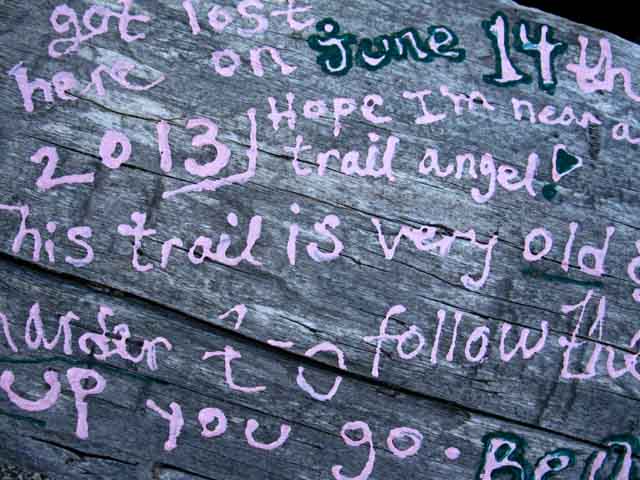 |
"Got lost here on June 14 2013" "I hope I'm near a trail angel." Highly unlikely. I'd bet dollars to dimes that she had to get herself out of what she got herself into. I've taken some guff from various hikers over the last couple of years. One German woman told me, "It's a lot harder than you said." Heck, her and her new husband did the TYT as part of their honeymoon. That's amazing. I meet lots of cool Germs in the High Sierra every year, but these are the first I know who did the Tahoe to Yosemite Trail. Kudos and Congrats. Well, I repeatedly say on this guide that backpacking here is dangerous, that you can get lost, injured, and die here. I have written these words of wisdom repeatedly along this section of the trail guide. Warnings don't get much more serious than that. You've been warned. On the other hand, another delightful lady told me, "It's not as hard as you said it was." Sigh. Well, I've written extensively about the recent repairs and work dedicated backpackers have put into this section of the Tahoe to Yosemite route, but after she hiked the trail... Sorry!. What you've got here in my warnings and reports are the bookends, the extremes of the conditions you may experience hiking through here in the years beyond this 2013 update of the trail guide: It may be trail-less and very poorly ducked, if ducked at all. On the other hand the observable portions of trail bed may be linked by ducks and cut timber to the next observable section of trail bed. Or not. The conditions you experience will be somewhere between these two extremes. You should be ready for both and either state of repair. I strongly encourage backpackers considering this route, and backpackers who have hiked this route to share their experiences, impressions, and especially updates from recent trips about the condition of the route here: Your best bet for success is to be an experienced backpacker with some degree of cross-country experience, or very ready to begin developing cross-country skills. You should be in very good, if not great physical condition. You should have a compass and map and know how to line them up with each other and the surrounding terrain, and an extra day's supply of food. Your shortfalls from the above standards determines the degree of difficulty you will experience. If you lose the route and cannont find or stay on route you will suffer greatly. This is more unlikely in 2013 than during previous years, but there are still many hard parts along this route. Somebody should know when and where you entered this wilderness area and where and when you plan on returning to "civilization." They should call the Amador Ranger District of the El Dorado National Forest if you do not reappear and check in at a predetermined time. |
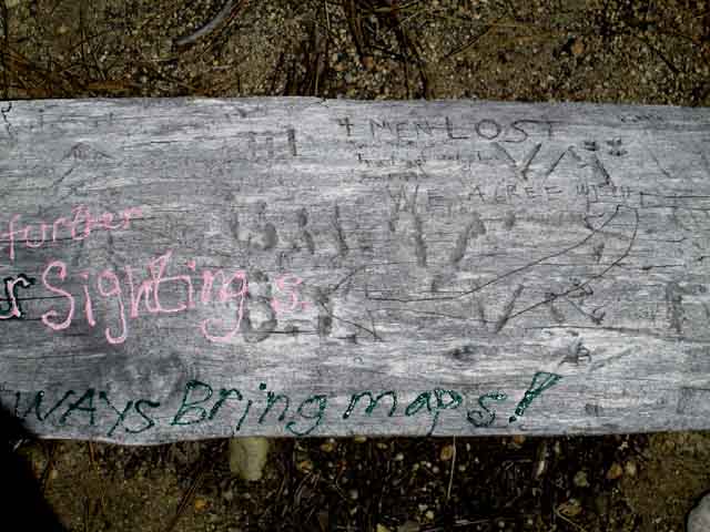 |
We can read the history of vandals' defacements of the campsite at the end of Summit City Canyon. Note the old carving on the upper middle-Right of the bench: "4 MEN LOST" This was carved into the bench some time ago, judging by the wear. I like the way they emphasized "LOST," though I wish folks would not carve anything but logical blazes. "Always Bring maps." Ha, I always say that. But I don't always do what I say. After hiking through here a few times I stopped taking maps for this section. For many years. I know the cuts and canyons along the surrounding canyon rim. I know the locations of the various terrains and obstacles. So I figured it would be much more fun to find my way through without maps. Then I decided to write this guide, and kicked myself for not bringing maps. I returned to the practice of carrying maps everywhere, even through old familiar favorites like this one, to line up map and compass for certainty in naming identifications for old familiar friends, the surrounding peaks and terrain. Knowing something and properly Naming it on a detailed trail guide are two very different things. In any case, don't carve or paint anything in the wilderness. Except your own forehead. If you really get a hankering to deface something, deface your own frkn face. Leave the face of nature alone. Unless you paint on canvass. Then have at it, by all means. Comments-Additional Information-Insights & Questions... This shot was taken by Eric, 2013. |
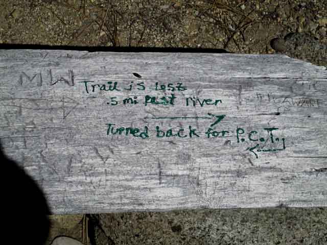 |
||
Eric recorded Finger Polish Lady's rude defacement of our Wilderness. "Trail is Lost .5 mi Past river" The trail is not "lost," it does not exist. What exists is a route. Excellent observation and analysis skills are vital to navigate the route through here when the ducks are knocked down and manzanita growth has closed the narrow seams of our route between the bushes. I assuming that Fingerpolish Lady is referring to where reasonable route ends where we enter the Enchanted Forest. Yeah, from that positions it's time for some delightful and serious route-finding. Honestly, it's harder than you would think to get lost in there. But the terrain is so very dense that it appears much worse than it is. It's not that big of a space. I generally sweep both the downhill and flat sections of the Enchanted Forest from East to West and back again as I cross this area, to check out how things are looking. Sometimes I walk around it's whole perimeter, which takes less than two hours. This is a very informative and delightful walk, will locate all the hidden terrain features and hidden natural delights, and calm down your stress levels at being "lost" in a section of trackless forest. As I tell folks about being Lost, "I'm just exploring some unknown territory." Haha, I always thought that was a good approach to unknown terrain. If that is where she turned back, that's kind of too bad. She had effectively crossed the hardest parts of this unmaintained segment of trail. Reasonable faint trail connects the South end of the Enchanted Forest to Camp Irene. So Close and yet So Far! But you can drown in an inch of water. Many backpackers find great joy in navigating this route across the wide range of conditions it presents. This route is like an unopened Christmas present that you know has good things inside, even if you don't know exactly what's inside. You don't know what you are going to get until you open it. And, have caution. You may have opened up a can of "Whoop Ass," and it is your ass that's on the line... haha... I laugh because I'm serious... This shot was taken by Eric, 2013.
Next Observed Defacement by Finger Polish Lady Lower Ford of Summit City Creek Last Observed Defacement by Finger Polish Lady
|
Finished Product, September 2013
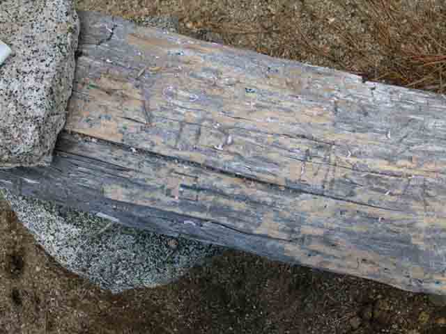 |
| Bench scraped clean, late September 2013. |
Packing Up
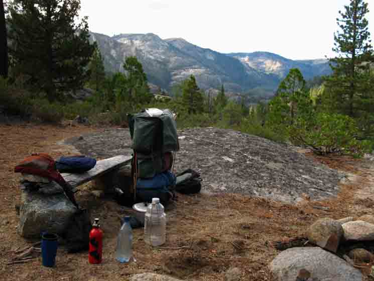 |
||
Last bits of gear being loaded up before heading South.
|
Ready to Roll
 |
| v |
The Next Steps
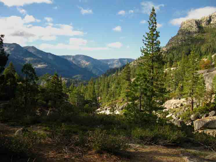 |
Looking out the South end of Summit City Canyon at Mount Reba above the valley of the N Mokelumne River. Mokelumne Wilderness |
North: Summit City Creek top of page South: Lower Summit City Creek Ford
The Tahoe to Yosemite Trail |
South of Telephone Gulch
|
Backpacking Trail Guide North |
 |
Backpacking Trail Guide South |
Backpacker ForumsHave a great Sierra Nevada route or trip to relate?Post it on
|
North: Summit City Creek top of page South: Lower Summit City Creek Ford
Trailhead
Contact
Alex Wierbinski

Backpacking Lake Tahoe to Mount Whitney
Your guide to the High Sierra Crest, including the Tahoe to Yosemite, Pacific Crest, and John Muir Trails
