
The Trails
Guide
Maps
Miles/Ele
Permits
Resupply
Forum
Current Weather Conditions
Weather Notes
Northern High Sierras
Central High Sierras
Southern High Sierras
Gear
Gear List
Gettin Started
Layering
Discussion
Testing yourself and your gear
Gear Reviews
Backpacking
Round Top Lake to Summit City Creek
via
Fourth of July Lake
Hiking the Tahoe to Yosemite Trail out of the Carson Pass Management Area
Languages
Languages
Trail Arts
The art of walking
Physical Preperation
Trail Skills
The trail
Off the trail
Scrambling
Maps
Navigation
Camp skills
Food
Resupply
Food
Other
Photo Catagories
Trail Stories
Trail Culture
News and Science
Links
Groups
Books
Terms and Conditions of Use
| Trail Guide INDEX Carson Gap to Lake Alpine |
TYT North Round Top Lake |
TYT South Summit City Creek |
7.5 Topo Map Carson Pass Region |
30 min Hiking Map Echo Summit to Lake Alpine |
SOUTH 7.5 Hiking Map Round Top to Mount Reba |
Carson Gap |
Map Index Carson Gap to Lake Alpine |
EL Dorado National Forest PERMITS |
Tahoe to Whitney on YouTube |
The Trail South
to
Fourth of July Lake
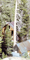
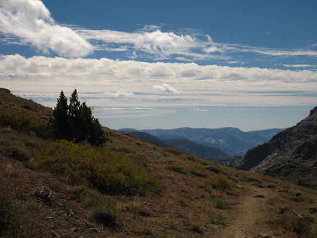
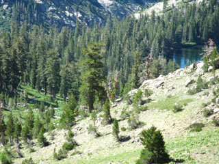
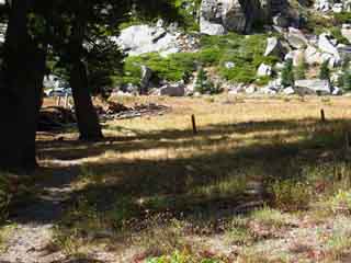
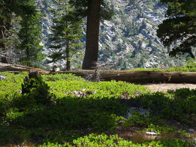
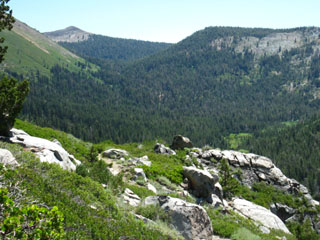
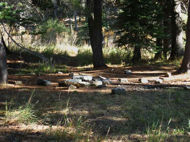
Continuing South on the Tahoe to Yosemite Trail to Fourth of July Lake from the Round Top Lake trail JunctionFrom the perspective pictured above we are looking West past the trail junction at Round Top Lake, which is obscured by the trees to the Left, having hiked up there via one of two route options that both pass by Winnemucca Lake. The Lost Cabin Mine Trail up from the Woods Lake Campground runs out of frame on the Right of the image above. Continuing straight West through the Round Top Lake junction is Southbound on the Tahoe to Yosemite Trail, though we are actually hiking West by the compass at this particular location. Backpacker's InformationLocal Mileage Totals
POST UP! All backpackers can post text comments about the following section of trail through the comments links on all the trail guide pages. Registered Members can post up stand alone post about the trail with text, images, maps and videos in the Trails Forum that supplements this section of the Trail Guide. Check out the Tahoe to Whitney .org Backpacking Trails and Topics forums |
||||||||||||||||||||||||||||||||||||||||
| Hiking South on the Tahoe to Yosemite Trail | ||
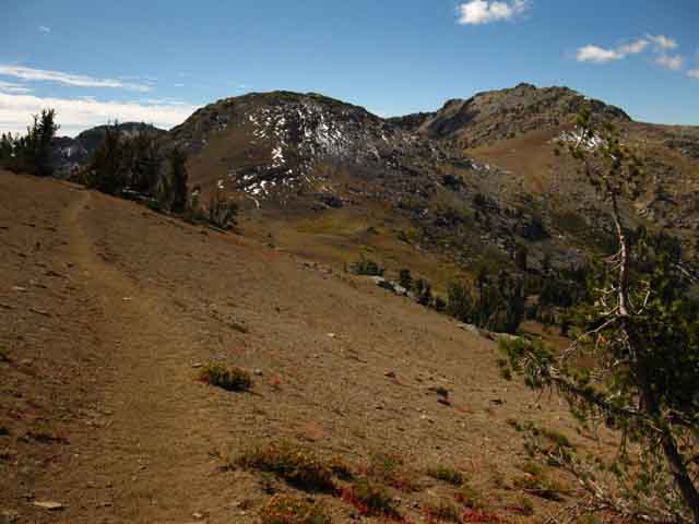
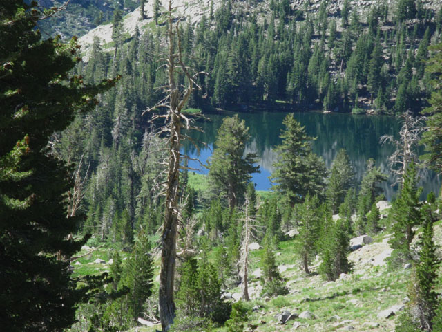
Looking South down the trail to Fourth of July Lake at the Round Top Lake trail junction.
We are approaching the junction from the East, via Winnemucca Lake. Round Top Lake sits to our Left, Woods Lake down the mountain to our Right. |
 |
The trail from Woods Lake approaches Round Top from the North, our Right. Carson Pass Region Map We continue straight, West by the compass, through this Round Top Lake trail junction to continue Southbound on the Tahoe Yosemite Trail toward Fourth of July Lake. |
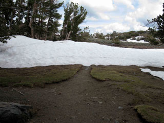
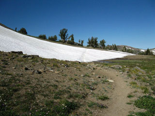
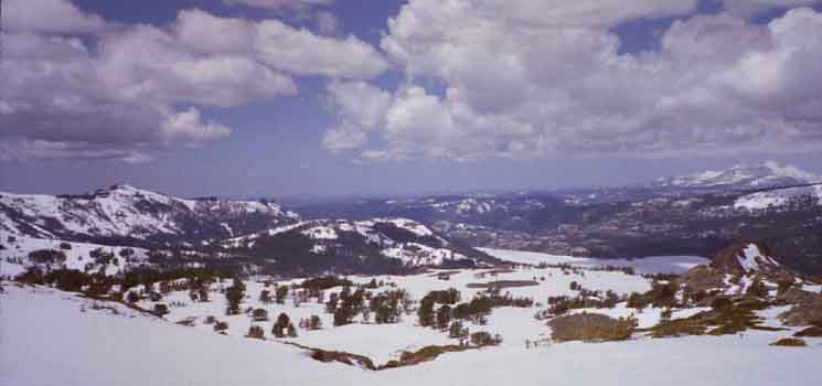
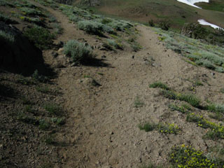
| Spring snow remnants decorating the trail. This indicates there will be a big snow apron around the North flank of Mount Reba... | ||
Round Top Lake trail junctionElevation: 9360
|
Video
Round Top Lake to Fourth of July Lake
Hiking South on the Tahoe to Yosemite Trail route from the trail junction at Round Top Lake around its West flank and down to Fourth of July Lake nestled into its little shelf in the valley above Summit City Creek.
Video Playlist |
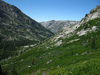
Past the Round Top Lake trail junction the Tahoe to Yosemite Trail bends around Southwest flank of Round Top and The Sisters
| Continuing South around the flank of The Sisters. | ||||
| West past the Round Top Lake Trail junction. | 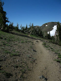 |
|||
 |
||||
| Retreating Snow berm on Northwest side of Round Top and The Sisters, July 16. A berm like this, but very steep, can be blocking the North side of Mount Reba during Winter and Spring. | ||||
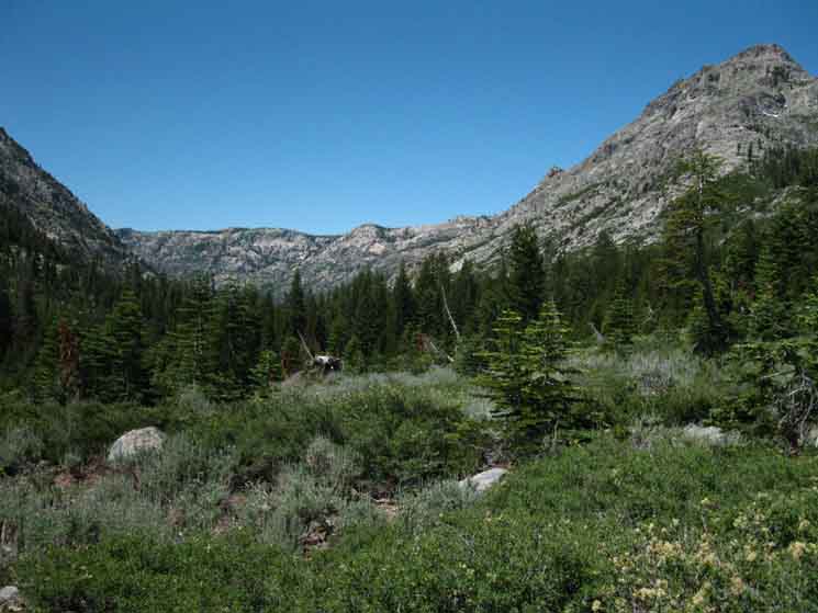
| As the trail begins to bend around the Southwest flank of The Sisters, Fourth of July Peak comes into view. | ||||
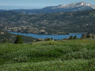
Rounding the SW Shoulder of Round Top, Caples Lake to the Northwest
| Looking Northwest from the Northwestern flank of Round Top and The Sisters. | As we bend around the SW flank of the Sisters, more of the Northern Terrain comes into view. | |||||
 |
 |
|||||
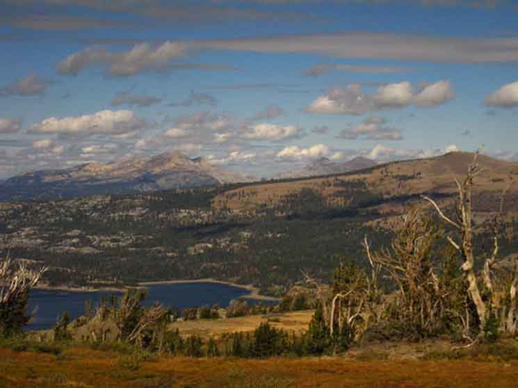
Pyramid Peak, Crystal Range in Desolation Wilderness decorates the background. The ridgeline running East, to our Right in the image above, up to Little Round Top is pictured in the middle distance between Caples Lake and Pyramid Peak. |
On this clear day it looks like we can see Dicks Pass on the ridge Arms extending to the East of Pyramid Peak towards Mount Tallac, not pictured. |
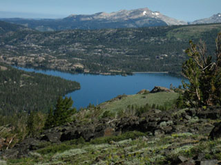
View to the Northwest
|
||
Looking Northwest at our last views into the Crystal Range in Desolation Wilderness along the West Shore of Lake Tahoe before we descend to Fourth of July Lake and into Summit City Canyon. Mount Price and Pyramid Peak are in the far distant middle-Left (West) of the image while I figure we are seeing Jacks and Dicks Peaks in the distant center-Right of the image. Little Round Top rises in the middle-distant Right of the image blocking our view of Mount Tallac in the distant North-Northwest behind it. Caples Lake floats in the foreground. Pyramid Peak is 15 miles from our position as the bird flies, and about 25 as the backpacker hikes North on the TYT route. Our position is hiking South through the gap between Round Top and the Sisters to the East and Fourth of July Peak rising on the West side of the gap leading us down to Fourth of July Lake. We just turned around to get one last view of the beauties we hiked through North of here before we plunge down into Summit City Canyon's magnificant vault of granite. Big Maps Local Map and Miles
Winter of 2002 GOOGLE EARTH VIEW OF WEST-SOUTHWEST LAKE TAHOE BASIN |
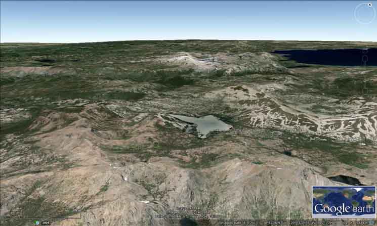 |
Wow. Google is the Devil's Godson, but their Earth offers some revealing views of the grand outlines of the terrain. I set up a view looking Northwest from above our current trail position hiking South into the gap between Fourth of July Peak and the Round Top and Sisters Massif. Our current position is on the North side of the gap above Fourth of July Lake. We can make out Fourth of July Lake in the lowest-Center of the image. Note our Carson Gap exit from the Lake Tahoe Basin looking like a long, low "V" on the far middle-Right of the image. That point marks the Southern corner of the Lake Tahoe Basin. Below the Carson Gap we can see Winnemucca Lake in the lower-Right corner of the image above the Google Box, and Woods Lake nestled in at the base of the Round Top-Sisters Massif above and to the Left of Winnemucca Lake. On the bottom-Center of image we can see Fourth of July Lake, as I mentioned above. In the center of the image directly above Fourth of July Lake we see Caples Lake, and above Caples Lake Pyramid Peak highlights the Crystal Range in Desolation Wilderness along the West Shore of Lake Tahoe. To the Right, or Northeast of Caples Lake we can see the ridge arms rising up to the crest of Little Round Top. The Western ridge arm rising to Little Round Top is featured in the photo above this google Earth view. Little Round Top is the high point along the ridge arm to the Left of the Carson Gap in the google Earth image above, while Red Lake Peak rises to the Right, or East of the Carson Gap. The maps linked to above and below help us sort all this complex terrain out. The google Earth image above lays out the highpoints of our Tahoe to Yosemite Trail route South from Meeks Bay to Fourth of July Lake. I can trace the Tahoe to Yosemite Trail route all the way from Middle Velma Lake on this google Earth image and make out the faint smudge of Phipps Peak too... Check out the Desolation Wilderness Hiking Map for more info about points North... Click the black-dotted trail route for more detailed maps of that area and the red dots for trail guide reports on the Desolation Wilderness Map. |
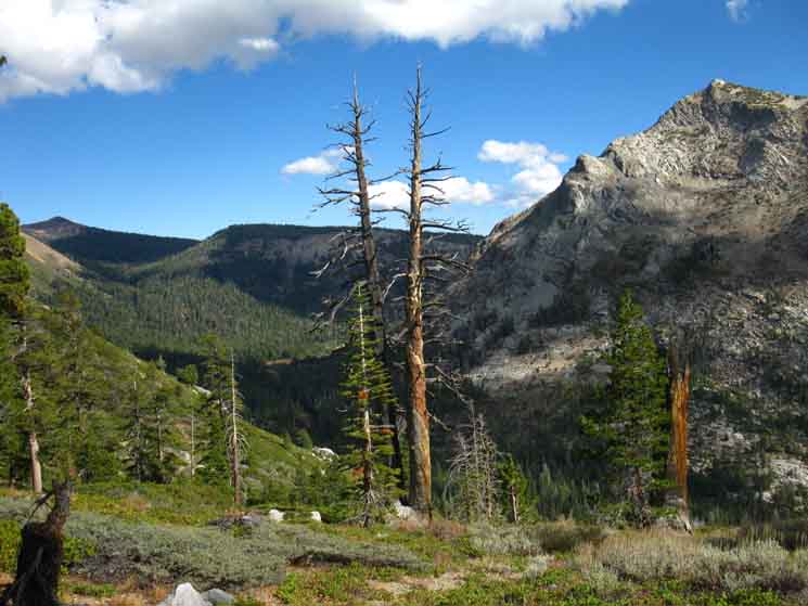
Hiking around the West Flank of Round Top and the Sisters
 |
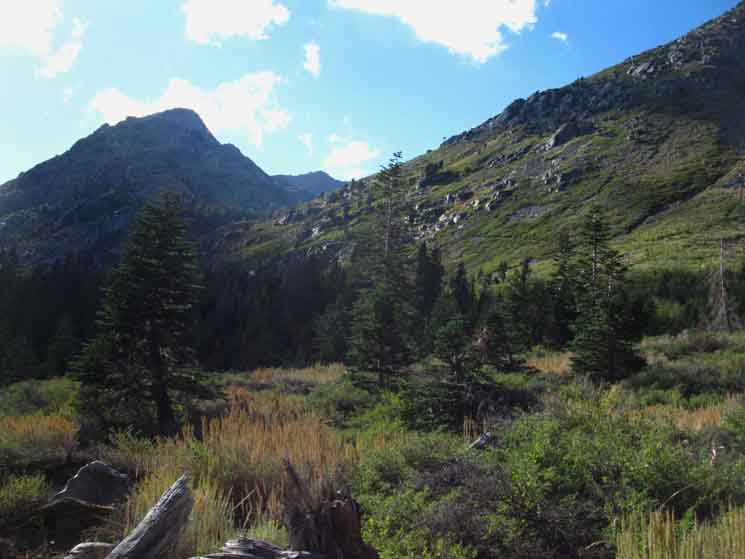
Fourth of July Peak 9020 across the gap to our Southwest as we hike around the West flank of Round Top and the Sisters. |
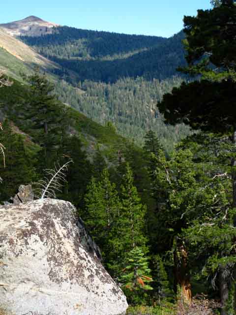
Through the Gap to Summit City Creek Drainage
 |
||
|
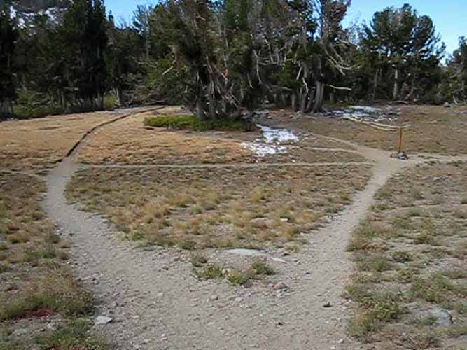
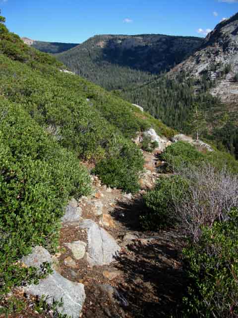
Summit City Creek to the Southwest, with the Southeast Edge of Fourth of July Lake visible poking out of its cleft in the mountainside
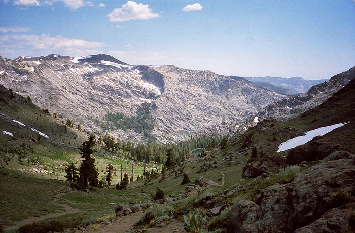
Above: note the old trail center Left, new trail tracking Right. Our trail will turn Left swinging over to Northeast side of this canyon. About 20 years ago this trail went straight down to Fourth of July Lake, but erosion issues prompted rerouting.
The great granite mass before us bounds the Southeast bank of Summit Creek, which runs from Left to Right along its base. Check out Devils Corral, an outcropping of this massive chunk of granite located upstream near the headwaters of Summit City Creek below Forestdale Divide.
The Carson Pass Region map depicts the trail up Summit City Creek to Devils Corral, while this topo map will show you how to hook up with the Pacific Crest Trail at Forestdale Divide or hike to Upper Blue Lake on the way South to Ebbetts Pass...Or you can craft a nice short loop by hiking a big backpacking loop around the Round Top Massif.
Me, I'm heading South, downstream along Summit City Creek on the Tahoe to Yosemite Trail.
We are now departing volcanic terrain and entering granite terrain to Mount Reba
| Unmarked Trail Junction on Northwest flank of The Sisters. This is not a through trail. | Fourth of July Lake | |||||
 |
 |
|||||
Veer to your right. The trail to the left dead ends at a nice view. |
Wedged between folds within a cleft in the mountains. |
Fourth of July Lake
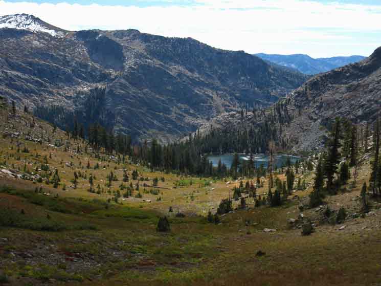
| Just above Fourth of July Lake. The trail down to Summit City Creek passes by the left side of Fourth of July Lake where an expansive flat wraps around the Southeast shore. Summit City Creek runs through the canyon below, visible in the upper left corner of the image. | ||
 |
||
There is an apron of trees on the Southeast, left, side of the lake where the trail down to Summit City Creek connects with Fourth of July Lake. There are a few campsites there, a few along the North side of the Lake, below us, and three campsites to our right, along the backside of the lake. The following three pictures are all shot from the Southeast side of the lake.
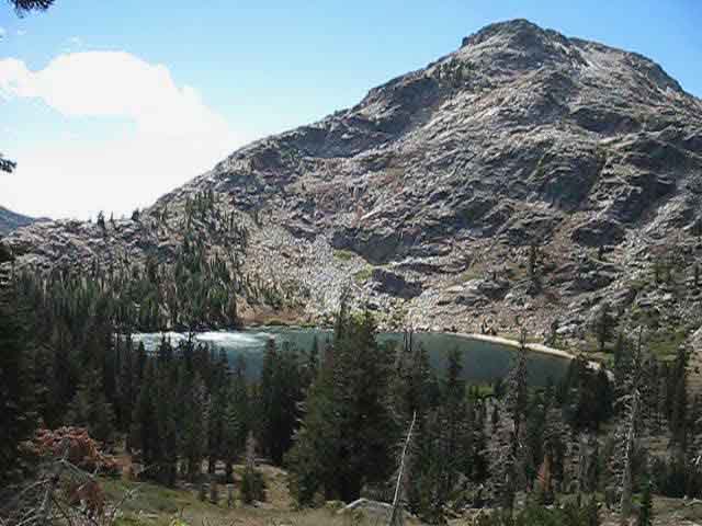
Peak 9607 & Fourth of July Lake |
Hiking Kids in the High SierraIn 2009 I heard a strange wailing sound echoing around the cut in the mountain while hiking down it to Fourth of July Lake from Round Top. I laughed, recognizing the sound as the very unhappy utterances of a young girl who was expressing her complete unhappiness with her backpack, the climb up to Round Top, and her parents. A backpacking family came into view. They were mom and dad with a 15-ish son trailing behind them, and further back was a girl about 12 year old. The girl was stopping often to wail, and the family was stopping often to encourage their wailing child onward. The girl was 12 or 13, not fat and and not out of shape, not carrying a heavy pack, and not at all willing to backpack one step without making everyone perfectly aware of just how completely unhappy she was. Encountering the sheepish, apologizing parents as they hiked up, I told them I was happy they were getting the kids out. They laughed, relieved that my trip was not disturbed by their daughter. They could take her wailing, but were really concerned about other hiker's peace, and were real happy, almost thankful, that I was not complaining about their daughter's wailing. It turned out that they were lifetime backpackers who were bringing their daughter on her first backpacking trip. It was a rough go for everyone. When I encountered the girl I knew she was completely capable of the physical work, and that her problem was completely centered in her attitude. This can be a real problem. You can fix the body, but the head is tricky. Kids who are out of shape can be brought into good health, but a kid (or an adult) who decides that they hate backpacking is a completely different ball of wax. These parents had previously exposed their kids to nature and car camping, and were bringing their kids through a gentle transition to backpacking. They had done everything possible to make an easy transition to the rigors of the trail, but sometimes the best laid plans go awry. The son caught up, and started complaining about his sister, as he was embarrassed by her display. I told him he looked good, and chill out on sis, as she was having a hard time and it did not reflect on him. The girl approached resentfully, partially out of embarrassment and partly out of anger that I observed her display. I spoke to the girl telling her, "hey, hang in there, it will get better..." and that the top of the climb was not too far away. She was refraining from crying, whining, or wailing in front of company, but her unhappiness was palatable. Her bright-red tear streaked face was sad in a funny way, but I refrained from laughing. Hey, I'm a nice guy. he he. Instead, I told her that there were things on the trail that made me want to wail like she was wailing, and asked her if she had blisters, sore shoulders, butt rash, or some other hurting parts. She shook her head "no," and I told her that all the pains would eventually pass, at least when they arrived at their car stashed at Carson Pass! That got a snorting almost-laugh out of her, which did make me laugh. I told them to all to hang in there, and told her I'd look forward to seeing her leading the way up next Summer, and we departed in different directions, everyone feeling a bit better, I hope. Have a family or kids hiking Story? Backpacking Topic Forum: Trail Kids, Hiking the High Sierra |
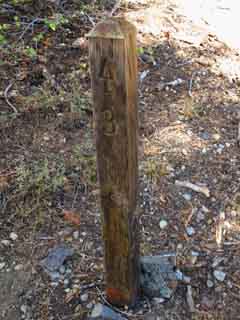
Fourth of July Lake
 |
||
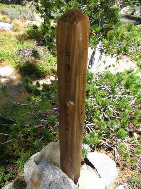
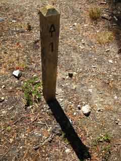
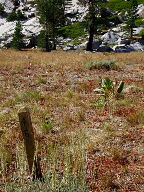
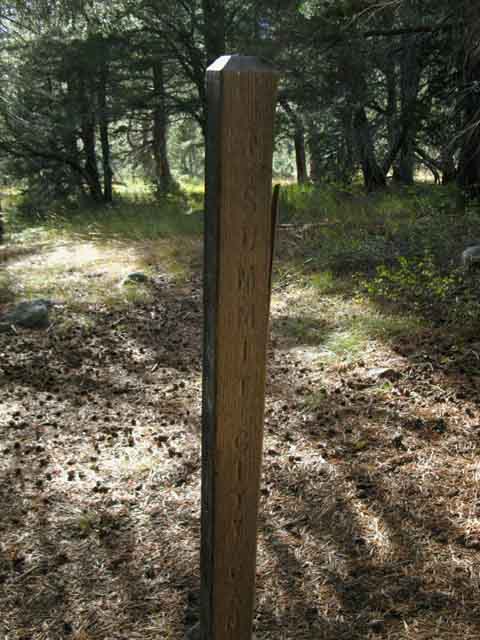
Old trail junction post at Fourth of July Lake.
|
Fourth of July Lake Layout The Tahoe to Yosemite Trail passes by the rather large flat forested apron wrapping around the Southeast shore of Fourth of July Lake at a rather well weathered trail junction post. The post reflects the character of age, or maybe the deepening sense of timelessness happening as we hike closer to Summit City Creek. Things feel real old here, even the recent stuff left here by recent Western visitors... Fourth of July Lake has six designated campsites. 2 of the 6 campsites are around this expansive forested flat on the lake's Southwestern apron where the TYT comes by. Fourth of July Lake is a great place to take a break and have a meal or snack as well as a strategic camping place. It's strategic because it puts us in a good position to begin the hike across the difficult 9.52 mile section of trail between Summit City Creek to Camp Irene early in the morning. The other nearby option for camping on the Southbound Tahoe to Yosemite Trail is the fine campsite above the trail junction in Summit City Creek Canyon below Fourth of July Lake. That site puts us even closer to the beginning of the un maintained route, yet the terrain and beauty of Fourth of July Lake trump convenience. Hiking the short walk from the Fourth of July Lake trail junction over to the lake we note the first campsite marker off to our Left. Following the faint trail to campsite one we are surprised to find an unimproved site just off the East side of the center of the flat apron around the East shore of the lake. No good rocks to sit on, no real good flats. But this is not a problem.
The forested flat apron between site number one and the lake is chock full of great boulders and rocks to sit on as well as forest and rock protection from wind and sun. Lots of protected views of the lake and its surrounding mountains and the view into Summit City Creek's magnificent canyon. Though site one is the most primitive site it has access to the best views and terrain features of all the sites. On the North side of this forested flat apron around the East shore of Fourth of July Lake we see what appears to be campsite 2 and a trail moving West along the North Shore of the lake. This is the trail to the remaining 4 campsites.
The last three of the six designated campsites, numbers 4, 5, and 6 are located where the trail down the North shore of the lake bends Southwest around the Northwestern corner of the lake. Two of these sites, numbers 4 & 5 are located off to our Right in stands of trees while site 6 is off to our Left a little further around past the West end of the lake. These last three sites are on the far side of the lake from where our trail here connected to the forested apron around the East shore of the lake. Designated Campsites and Long Distance Backpackers An important fact for through hikers who may not have reserved a specific spot at Fourth of July Lake when they pulled their permit from the Lake Tahoe Basin Management Unit or begun hiking trips from distant forests and parks: The apron along the Southeast shore of Fourth of July Lake can easily hold a lot of backpackers. If you are camping at Fourth of July Lake without a specific assigned site you will find ample space on the Southeast forested apron to throw down your gear and camp even if all six designated sites are filled up. Understand that if you drew a permit from a distant National Forest or Park all the National Forests that you subsequently hike through must honor your permit. If you designated "Fourth of July Lake" on your permit you can legally camp at Fourth of July Lake. Though the Carson Pass Management Area (which administers this small zone for the Amador Ranger District of the El Dorado National Forest) only issues a limited numbers of permits to backpackers beginning in the CPMA they must honor the permits of all through hikers. Through hiker permits must be honored. The CPMA must accommodate through and long distance backpackers who began trips from distant National Forests and Parks. Thus I offer through hikers this information about how you can find a nice spot on the Southeastern apron of Fourth of July Lake (and Round Top Lake too..) even if all the designated sites are full up. In any case the assigned campsites at Fourth of July Lake only fill up during busy Summer holiday weekends, if then. It is much more likely that the designated sites at Round Top and Winnemucca Lakes will be filled than the sites at Fourth of July Lake due to Round Top and Winnemucca Lakes' closer proximity to Highway 88 trailheads. The further away you go, the quieter it gets. Campsites 1 and 2 are adjacent to the forested apron around the East shore of Fourth of July Lake. Campsites 3 through 6 are sprinkled down the North shore of Fourth of July Lake with campsite 6 located off the far Northwest end of the lake, opposite the forested apron wrapping around the Southeast end of Fourth of July Lake. For backpackers drawing a permit from the CPMA or Amador Ranger District I'd say the best campsites are numbers 2, 4, and 6. Sites 1, 3, and 5 are primitive while sites 2, 4, and 6 are improved as of 9/2013. By improved I mean seating, good sleeping flats, and a fire ring. Site 1, though itself primitive, is located at the back-center of the forested apron, meaning it has access to excellent seating and cover. Deciding Factors for Local and Long Distance Backpackers If you are deciding between stopping at Fourth of July or Round Top Lake when you hike across the CPMA these facts may help you decide which lake to camp at. My main deciding factor is timing and variety. I plan my trip to avoid crossing the CMPA during weekends, if possible. Weekends are just too busy. Through I prefer the views and altitude at Round Top Lake I find Fourth of July Lake is much less busy and quieter during Summer Weekends. Fourth of July Lake is a couple of miles further away from the Highway 88 trailheads making it much quieter than Round Top Lake. Round Top Lake's proximity to Highway 88 trailheads, and Carson Pass's proximity to the growing and vast populations of Tahoe and Reno have made the Carson Pass Management Area a popular destination for weekend hikers and backpackers. This assures Round Top is busy during the Summer, even during weekdays. The extra distance out to Fourth of July Lake translates into that much more quiet. NOTE: As of my last visit through (Sept 2013) it appears that the elevation for wood fires has been lowered from 9000 to 8000 feet, now making fires off-limits at Fourth of July Lake. I never make fires, except in emergencies or social situations, so it's no problem for me. |
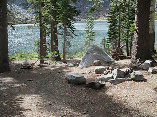
Stopping for a Break at Fourth of July Lake
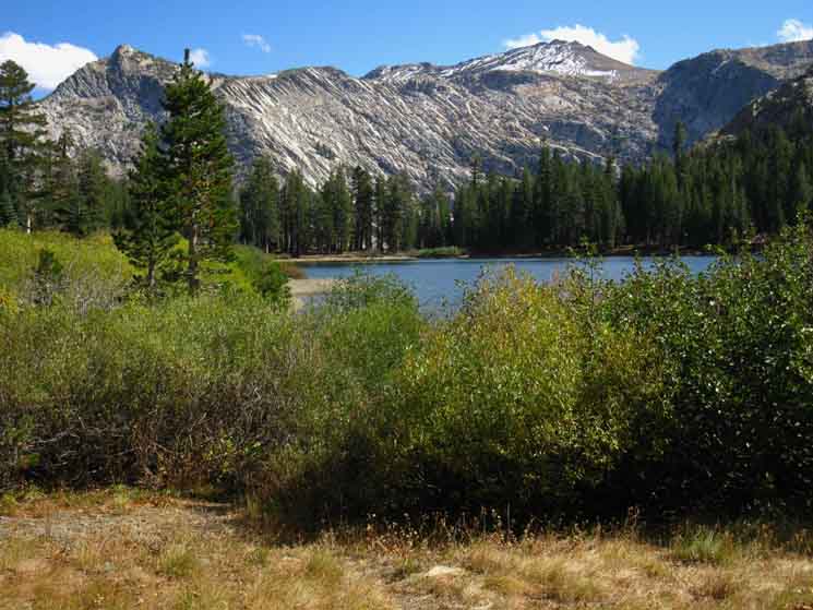
| Looking Northwest across Fourth of July Lake at the entrance to Corrie Locan. | Taking a break at Fourth of July Lake at the SE apron of boulders and trees, near where the trail continues down to Summit City Creek. | |||||
 |
 |
|||||
| This is a good place to explore. But I am headed much further South. | A nice and shady spot, with a boulder that fits. Ahhhhh. | |||||
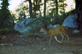
| Deer running around Fourth of July Lake. | Miles and Elevations | |||||
 |
Fourth of July Lake Elevation: 8164 feet Six designated campsites from the East Apron wrapping around the Northeast shore of the Lake. Mileage South Camp Irene is 10.75 tough miles South. Lake Alpine on Highway 4 is 19.11 miles South. Mileage North Round Top Lake is 2.3 miles North. Carson Gap via the Lost Cabin Mine through Woods Lake: 5.79 miles North.
|
|||||
I was enjoying twilight deepening into darkness when some things kept running back and forth in the bushes around the lake. A couple of deer were running around, like they were playing tag. I got up to check them out, and see what they were up to. I took a bunch of pictures as they darted around, but it was almost dark. The above was the only image that kind of came out, but I had to "pump it up," which I don't like to do. |
||||||
| Deer Forum |
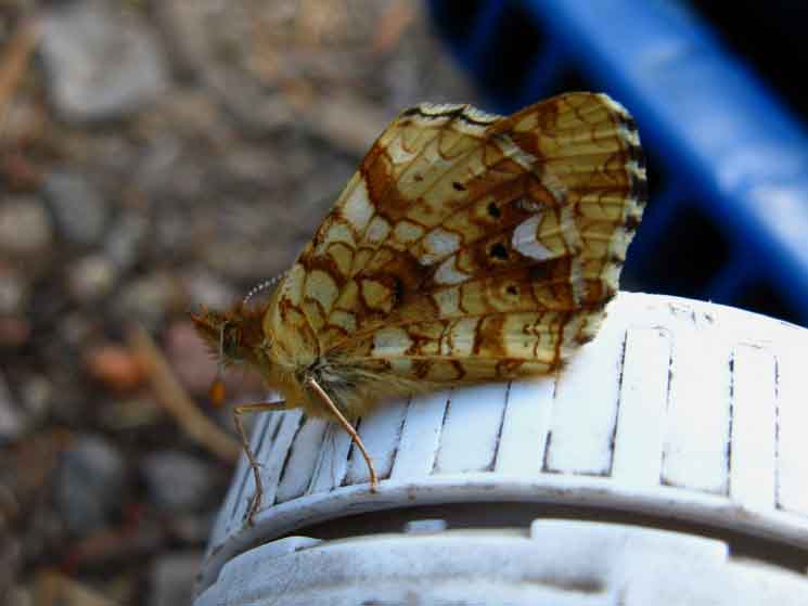 |
Relaxing during lunch with a beautiful local resident of Fourth of July Lake. High Sierra Living Things Forum |
Stopping to Camp at Fourth of July Lake
| Fourth of July Lake is a good backpacking destination on its own merits. It is generally very quiet and has less campers and hikers than Fourth of July Lake. It is also a good stopping point while hiking local loops around the Carson Pass Management Area starting out of Carson Pass, Forestdale Divide, or Blue Lakes. |
Campsite 1
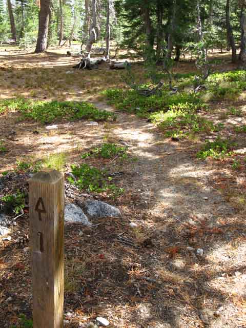 |
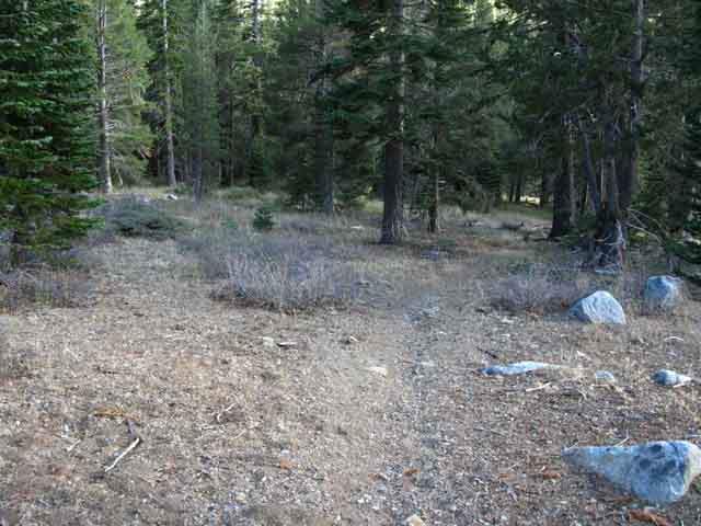
The trail leading to campsite one. The forested flat around the East shore of Fourth of July Lake is off to our Right, and the lake itself just beyond the flat. This faint trail parallels the forested flat to about the middle of the flat, where campsite one is located just off the East side of the forested flat. |
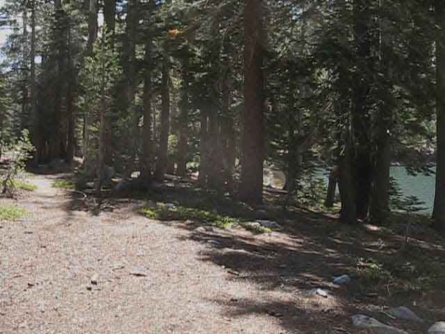
Forested Flat Apron around East Shore of Fourth of July Lake
 |
||
Once we reach the Fourth of July Lake trail junction we can see the Lake off to our Right, to the West. Hiking towards the lake we also see the first post for the designated campsites. Continuing to the Lake we find an expansive flat apron shaded by mature forest along the East shore of Fourth of July Lake as shown above. The first campsite is a simple flat to the East of the center of the shaded apron around the East Shore.
|
Fire Ring on the Apron
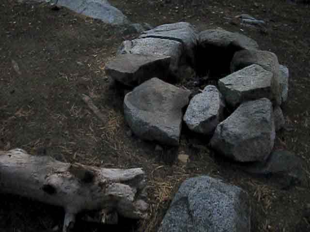 |
At the center of the flat apron around the East shore of the lake we find a big fire ring. Though campsite #1 is itself primitive, it abuts the East apron of the lake about fifty feet from where you have this big fire ring and numerous fine rocks to sit on, great shade and wind blocks, and fantastic views. And it is quiet and serene here most times. The fire ring is superfluous. Fires are now banned in the CPMA as they are above the recent 8000 foot fire elevation limit. Fire We're surprised that the flat apron itself still has a big fancy fire ring. The fire rings in the improved campsites I describe below are relics of the 9000 foot fire limit era. It appears that the top elevation for fires was recently reduced to 8000 from 9000 feet in the CPMA. Not that this affects me. I never make fires, with the two exceptions of emergencies and social occasions. The 8000 foot fire limit essentially makes the CPMA off limits for campfires. These fire rings are a remnant of those earlier times, as fires are now prohibited, for good reason, in the Carson Pass Management Area. Once a wilderness area reaches a certain level of human activity all campfires must be banned or we humans will strip the terrain of dead wood for our fires. The CPMA long ago reached that point. Though I was ticked off when the CPMA designated campsites and banned fires I was not mad at the CPMA, but at the society which had so brutally overstepped its natural, social, and spiritual limits making restriction necessary. Banning the activities without stopping the process making so many activities destructive is nonsense. Worsening conditions demand greater action, which appears to be forthcoming. National Forests and Parks are likely to, and are justified banning all wood fires. Wildfire risk and depleted resource conditions indicate greater actions are necessary. If you are a through hiker permitted to camp at Fourth of July Lake you would camp somewhere on this apron if the six designated campsites are full. |
Campsite 2
On the Northeast corner of Fourth of July Lake
 |
On the Northeast corner of the flat apron on the East shore of the lake we find what appears to be campsite #2, though not marked as such, though this developed sits between the marked first and third sites. We are looking across the campsite's fire ring with nice boulder seating and good sleeping flats at a fantastic view of the lake and mountains. |
View Southwest down into the Forested Apron off the East Shore of Fourth of July Lake from Campsite 2
 |
View of Fourth of July Lake along its East shore from campsite 2. |
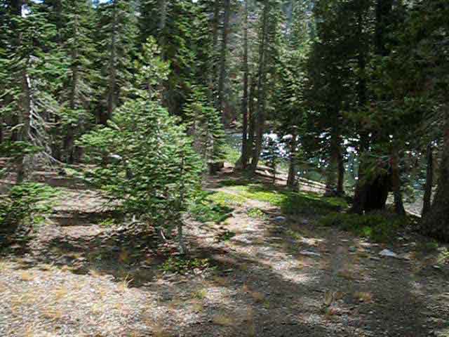
Along the North Shore of Fourth of July Lake
 |
Down to campsites three through six. The trail breaks up into different routes through the underbrush. |
Campsites Three Four and Five
| Campsite three is located along the North shore. | Campsites Four and Five are located off the Northwest corner of the Lake. | |||
 |
 |
|||
| Campsite four is well appointed with fire ring and benches, but five is a flat spot between two trees. | ||||
| v | top of page |
Campsite Six
 |
Located under the rock face off the West shore under a couple of trees. |
View East across Fourth of July Lake
 |
||
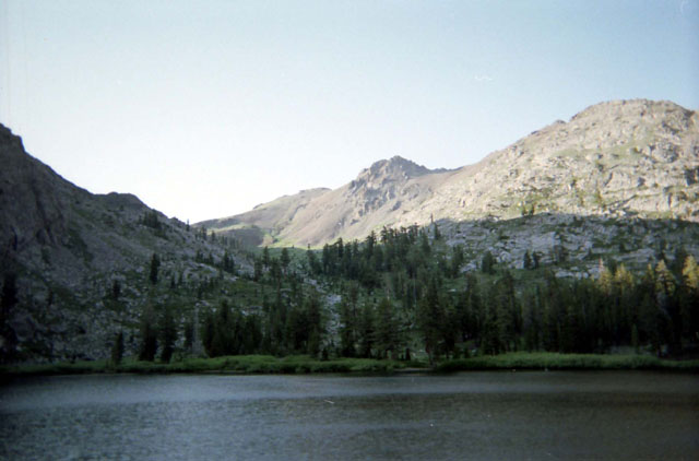
Across the lake we are looking into the forested flat on the East side of the lake. Beyond that the canyon drops off down to Summit City Creek. Rising on the far side of Summit City Canyon Deadwood Peak dominates the scene in the far center-Right distance with its Northern buttress, Peak 9626, running North down to us on the Left of the image. The characteristic glacial-carved gouge in its flank looks much different from this position than from higher up the mountain. Closer to us campsite six is behind us off to the Right a bit, about sixty yards back, backed up against the rock bowl Fourth of July Lake sits within. Campsite 5 is about fifty yards off to the Left of our current position.
|
Continuing South on the Tahoe to Yosemite Trail
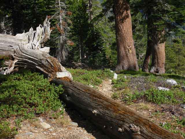
Making our way back to the Fourth of July Lake trail junction to resume our hike South on the Tahoe to Yosemite Trail we find a good indication of the nature of the upcoming trail: Looking East we see a downed tree with a duck stacked up on it. |
 |
 |
The rocks piled up on the Left side of the fallen tree marks the Southbound route of the Tahoe to Yosemite Trail from Fourth of July Lake. Video |
South into the remote feeling terrain on the South flank of the Round Top and The Sisters Massif. I can count the people I've encountered between Summit City and Camp Irene during the last 20 years on one hand. The trail deteriorates a bit as we hike South from the Summit City trail junction down to Horse Canyon. Then it gets worse below Horse Canyon. South of the Upper Ford the manzanita can be quite challenging on our way down to the lower ford, where we begin my favorite part of this section: The hike into and through the "Enchanted Forest." Big old growth forest and white sand beaches fronting steep cliffs where the North Mokelumne River slips between sheer cliffs flowing down to Camp Irene. We have to find the way out of the Enchanted Forest to take the long way around the steep cliffs and massive granite through which the river slips on its short route from the Enchanted Forest to Camp Irene.
No big deal. It's beautiful too. Duration: 20:40
Video Playlist |
 |
The Tahoe to Yosemite Trail South from Fourth of July Lake. |
The Trail into Summit City Creek The upper section of the trail into Summit City Creek from Fourth of July Lake is a rock gully, the lower section a rather long but stable traverse. |
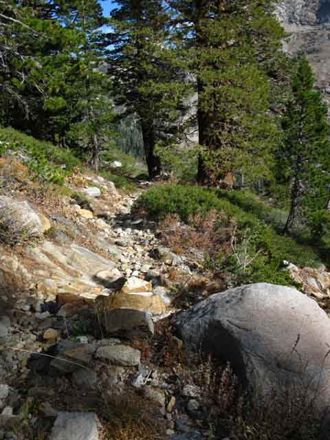 |
The upper section of the trail below Fourth of July Lake is more like a dry stream bed than a trail. |
Across the Canyon
 |
Deadwood Peak viewed to the Southeast across Summit City Canyon while departing Fourth of July Lake. |
Down and Out of the Carson Pass Management Area
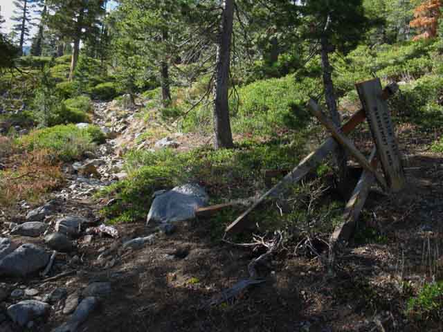 |
Carson Pass Management Area Boundary below Fourth of July Lake. |
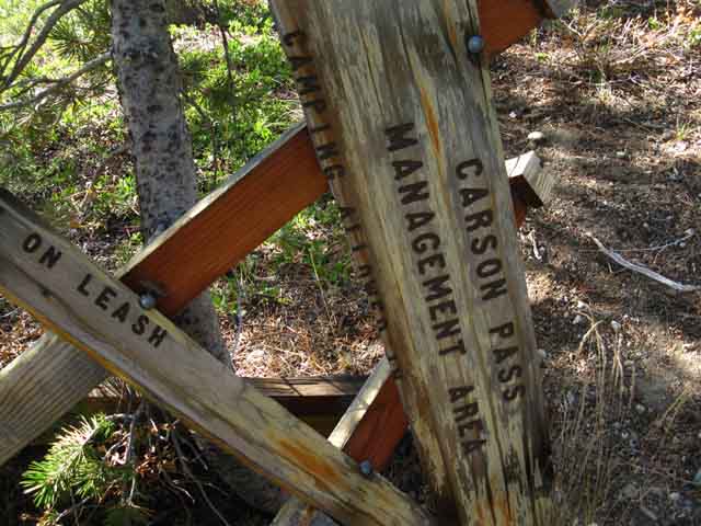 |
Detail of CPMA boundary marker below Fourth of July Lake. |
Coming around the corner our views of the Headwaters of Summit City Creek Opens Up
 |
| Below the rocky gully portion of trail the trail turns up canyon and flattens out into reasonable trail bed for the long straight traverse down to the bottom of the canyon. |
Terrain opens up as Trail moves East up Summit City Creek
 |
||
We can see the Tahoe to Yosemite Trail traversing down towards Summit City Creek headwaters on the lower Left of the image. Ahead the trail makes a ninety degree turn South off of our current Eastbound traverse. I traced out a curving route for the trail down into Summit City Canyon on the video; That is not quite the case. The trail actually makes a 90 degree bend to the South at the end of this long traverse East, and runs straight down to the Summit City Canyon trail junction.
|
Looking East
up to
Forestdale Divide
and
West down Summit City Creek
from below
Fourth of July Lake
| View East from the trail below Fourth of July Lake. Following the trail in Summit City Canyon East brings us upstream on Summit City Creek towards Devils Corral, Forestdale Divide, and Blue Lakes. | View Southwest down Summit City Canyon from the trail below Fourth of July Lake. | |||||
 |
 |
|||||
The barren peak in the background Left is Peak 9374, which composes the Eastern Side of the Forestdale Divide. View of Devils Corral from Forestdale Divide. The PCT route for Ebbetts Pass crosses the open space visible on the flank of Peak 9374. We will not see the PCT route again until we join up with it far to our South at the top of Jack Main Canyon in Yosemite for the majority of the remaining hike down to Tuolumne. |
The Tahoe to Yosemite Trail route follows Summit City Canyon down to where Summit City Creek joins the North Fork of the Mokelumne River.
|
Views East Up Summit City Creek
 |
||
In this image we are looking up to the headwaters of Summit City Creek from the trail below Fourth of July Lake. We can see the open terrain on the floor of the top of the canyon where upper Summit City Creek bends Right, to the Southeast, into Devils Corral. The great rocky peak in the near Right of the image is Peak 9626. Peak 9626 is the Northern arm of the higher Deadwood Peak, the two of which make up the great rock face wrapping around Devils Corral. Straight up the end of the valley we can see the flat ridge in the middle distant middle of the image and the pointy mountain on the distant Left of the image, designated as Peak 9374. The Pacific Crest Trail crosses the barren patch on Peak 9374, which composes the high point above the East side of Forestdale Divide. The trail climbing East out of Summit City Creek splits into a "Y" shape. The Left arm of the "Y" tracks Northeast to Forestdale Divide while the Right Arm of the "Y" tracks Southeast to Upper Blue Lake. The trail to Blue Lakes splits again, and again the second Left hikes up to Forestdale Divide, but by a shorter route than the first split of the trail leading to Forestdale Divide. Check out the maps below for details. The mileage figures for both routes are listed below at the Summit City Canyon trail junction.
Mokelumne Wilderness The image below gives us a better idea of the nature of the climb out of Summit City Creek to Forestdale Divide or Blue Lakes. This climb is the hardest degree of an intermediate difficulty hike.
I rate this climb as a difficult intermediate climb, an Intermediate-1 trail. |
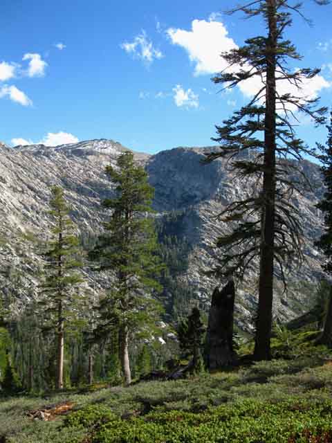
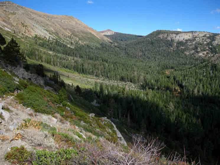
View Southwest Down Summit City Creek
 |
We get a feel for the course of our upcoming route South along the Tahoe to Yosemite Trail snaking our way down Summit City Creek's steep and deep canyon. |
Arriving at the bottom of the Canyon
 |
Taking a last look down Summit City Canyon before we plunge under forest cover and begin hiking down the canyon. The important thing about this image is Peak 9607 towering above our trail down from Fourth of July Lake in the upper Right corner of the image. This peak will act as a landmark offering reference for our position as we hike down Summit City Creek. As we hike South we will first use Peak 9706, then the vast cut in the mountain making Horse Canyon, and finally the narrow outline of Telephone Gulch to track our position as we hike down Summit City Creek. This will help us preserve a frame of reference if we lose the trail every now and then. |
The Trail from Summit City Creek up to Fourth of July lake
 |
||
A look back at the Tahoe to Yosemite Trail Northbound up to Fourth of July Lake. We can make out the faint line of the Tahoe to Yosemite Trail across the green of the manzanita along the Southwestern base of Round Top and the Sisters. Fourth of July Lake is wedged on a shelf up on that mountains below Peak 9706, which is the dark mass of rock on the middle Left of the image, contrasting with the brightness of the base of the Round Top and the Sisters massif nearer to us.
|
Last Steps to Summit City Creek Trail Junction
 |
Our last steps to the Summit City Canyon trail junction. Turning Right here begins our hike through this first unmaintained section of the Tahoe to Yosemite Trail. The second unmaintained section of the Tahoe to Yosemite Trail is to our South following the Upper reach of the Clarks Fork of the Stanislaus River over Saint Marys Pass to Highway 108. |
Summit City Creek Canyon Trail Junction
 |
||
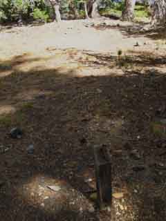
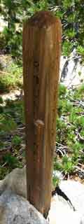
The new Summit City Creek Canyon trail junction. Well, new in the sense this old post was pulled out and reinstalled to replace the last trail junction post that was here, which was destroyed by a bear. This one is not deeply or strongly set into the ground, so the local bears will have no trouble knocking it down, but will have little luck shattering it as they did to the last one. Living Things Forum Map and Miles Information
|
Nearby Campsite
 |
A few steps upstream we find this nice improved campsite with easy access to water, excellent flats for tent or pad, and good seating around a fire ring. |
North: Round Top Lake South: Summit City Creek
Fourth of July Lake |
Fourth of July Lake marks the Southern Extent of the Carson Pass Management Area. Departing Fourth of July Lake Southbound also marks the end of the high density backpacker and hiker traffic that characterizes the CPMA. Things are going to get a whole lot quieter South of Fourth of July Lake on the Tahoe to Yosemite Trail route. The hushed quiet that characterizes Fourth of July Lake will deepen considerably when we drop into the forests along Summit City Creek. Fourth of July Lake is quiet because the amphitheater bowl that it sits within imparts a "hushed" atmosphere. That atmosphere is complimented by the relationship of the lake to the trail. The body of the lake and its campsites are offset and somewhat distant from the trail, and therefore from any noise of hiker traffic on the trail. Fourth of July Lake is also the furthest feature in the CPMA from the trailhead, so it tends to attract fewer backpackers and day hikers. Summit City Creek is quiet because of its dense forests are contained within steep canyon walls, as well as its lack of backpackers and hikers. The sounds in Summit City are wind and water, broken by the occasional crash of a falling snag or rock. Or a grunting backpacker. If you camp at Round Top Lake during a busy Summer weekend, you will constantly have day hikers and backpackers walking into, or past your camp. Hey, no big deal. Nice to meet you. The quiet at Fourth of July Lake highlights, even amplifies the sound of the creek running down into Fourth of July Lake from Corrie Lochan. The sound of the rushing creek dances in the air. If you are heading South on the Tahoe to Yosemite Trail, Fourth of July Lake has the last established camping sites at high altitude alongside an alpine lake before we descend into Summit City Canyon and lose a whole lot of altitude hiking down this unmaintained trail section. But don't worry too much about campsites. There is a good campsite just above the Summit City Canyon trail junction, there are good campsites about a mile South of the Summit City Canyon junction(2013 update: Boy Scout Camp is destroyed, buried under an ocean of fallen snags), at Horse Canyon, and at Telephone Gulch. Though we may find shortages of trail to the South of the Summit City Canyon trail junction we will find no shortages of water or fine campsites along our hike down the unmaintained trail to Camp Irene. 7.5 Topo Hiking Map: Carson Pass Region Map 7.5 Topo Hiking Map: Summit City Creek to Bee Gulch 30 minute Topo Index Map: Mokelumne Wilderness Click along the trail routes on this large map for links to maps and trail guide pages. This map is an experimental index of the underlying maps and trail guide pages. 30 min Tahoe to Yosemite Topo Hiking Map: Echo Summit to Lake Alpine 7.5 Topo Hiking Map: South on the Tahoe to Yosemite Trail Note: Click the Red Dots on the Maps! South: Summit City Creek |
Backpacking Trail Guide North |
 |
Backpacking Trail Guide South |
Backpacker ForumsHave a great Sierra Nevada route or trip to relate?Post it on: TahoetoWhitney.OrgPost up your comments and questions on the Fourth of July Lake Forum Page.Register to post your own stand-alone pages about your trips and the trails around Fourth of July Lake on the Carson Gap to Lake Alpine Forum.Section Forum: Backpacking Carson Gap to Lake Alpine on the Tahoe to Yosemite TrailLocation Forum: Hiking Fourth of July Lake |
North: Round Top Lake South: Summit City Creek
Home Page
Contact Alex Wierbinski

Backpacking Lake Tahoe to Mount Whitney
Your guide to the High Sierra Crest, including the Tahoe to Yosemite, Pacific Crest, and John Muir Trails
