

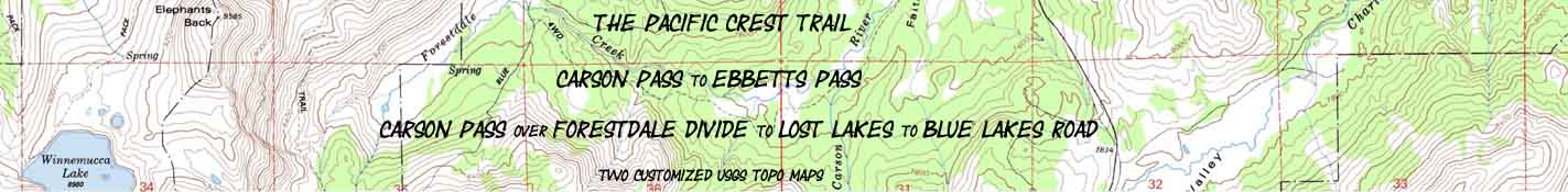

Carson Pass
to
Lost Lakes and Blue Lakes Road
in the
Mokelumne Wilderness
The Pacific Crest Trail between Carson Pass to Ebbetts Pass
Two
7.5 minute USGS Backpacking Topo Maps, Mokelumne Wilderness, Toiyabe National Forest

| Pacific Crest Trail Maps and Mileages South PCT |
Trail Guide | Tahoe to Whitney Indexes |
More Miles and Elevations SOUTH PCT |
Permits & Resources |
Weather, Map Data | ||||||||||||||||||||
PCT |
South |
NORTH |
South |
West |
PCT Miles and Elevations Carson Pass to Ebbetts Pass |
TYT-PCT |
Index |
Section Carson Pass to Ebbetts Pass |
Page Carson Pass to Forestdale Divide |
All Miles Tahoe to Whitney |
Section Maps Lake Tahoe to Highway 4 |
All Maps Tahoe to Whitney |
PCT-TYT NORTH Meiss Country Echo Summit to Carson Pass |
PCT South Carson Pass to Ebbetts Pass |
PCT South Ebbetts Pass to Sonora Pass |
PCT South Sonora Pass to Tuolumne Meadows |
Resupply | ||||||||
| PCT South |
click colored dots on the map below for related trail guide pages | All Trail Information | Echo Summit to Tuolumne Meadows Miles | Logistics | Predictions and Projections | ||||||||||||||||||||
PCT MILES
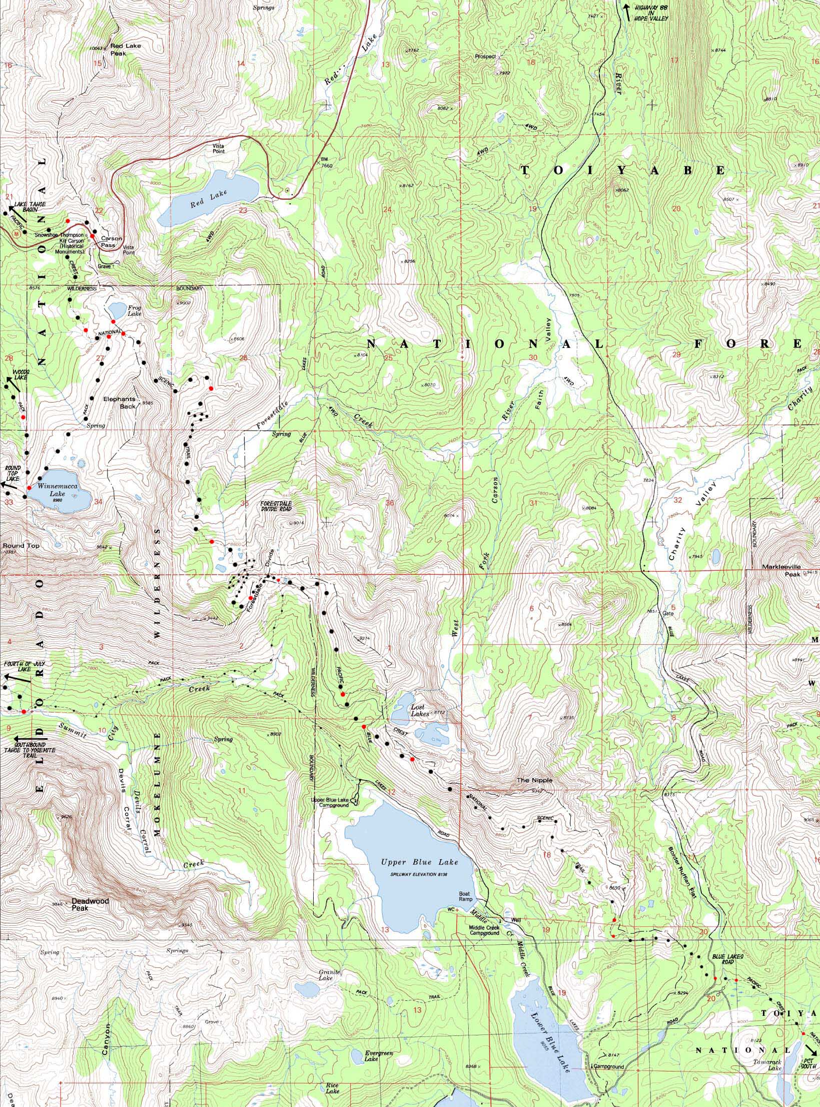
7.01 miles from Carson Pass to Lost Lakes via Forestdale Divide
3.64 miles from Lost Lakes to Blue Lakes Road
.84 of a mile North to Tamarack Lake
11.49 miles of Map
| TYT-PCT North map Meiss Country Roadless Area |
TYT West Map Carson Pass Region |
click red dots | TYT South map Summit City Creek to Mount Reba |
PCT South Map Blue Lakes to U. Sunset Lake |
PCT South BIG map Mokelumne Wilderness Topo Map |
|
| TYT-PCT North map Meiss Country Roadless Area |
TYT West Map Carson Pass Region |
click red dots | TYT South map Summit City Creek to Mount Reba |
PCT South Map Blue Lakes to U. Sunset Lake |
PCT South BIG map Mokelumne Wilderness Topo Map |
Mapology |
||||
MAP NOTE What's important for our general reference purpose is that each side of a square is 1000 meters, or a Kilometer. From my point of view that is 1093.6 yards or .62 of a mile. Diagonal: 1414.22 meters, if my trig is correct. That converts the diagonal distance into 4,639.8 feet or .88 of a mile.
|
Trail and Terrain The trail route was "straightened-up" as indicated on the map above to pass to the West of Lost Lakes. The dirt road was also rerouted, and now runs to the West of the new trail route. The Forestdale Road now intersects with a dirt road to Lost Lakes, rather than passing close. South of the Lost Lakes dirt road the trail now traverses the Western flank of the Northern Spur descending from The Nipple. Both of these modifications are incorporated into the map above and discussed on the trail guide. |
West: Carson Pass Region South on the PCT: Blue Lakes to U. Sunset Lake
Pacific Crest Trail MAP MAP 30 Min Section MAP See the
miles and elevations |
Notes Local Loops and Backpacking A Little Longer... Next Steps down the Trail |
|||||
Carson Pass Region Road Map
Highway 88
Location |
Main Features Backpackers hiking on the long trails South from the Carson Pass have the option of taking either the Pacific Crest or Tahoe to Yosemite trail down their very very different routes to where they rejoin in Yosemite National Park at the top of Jack Main Canyon. Final Difference Backpackers heading North into Carson Pass on either the Tahoe to Yosemite or Pacific Crest Trail will find both trails merging back together again a bit North of Carson Pass, at the Carson Gap. At Meiss Meadow the Tahoe Rim Trail joins in, and these three trails share the same trail bed for the length of the Meiss Roadless Area and most of the Desolation Wilderness, only parting company a bit North of Middle Velma Lake in Desolation Wilderness, where the Tahoe to Yosemite Trail turns for an 11.5 mile hike East to its Meeks Bay Trailhead. At the North end of the Tahoe Basin Pacific Crest Trail hikers will continue North past Meeks Bay towards the Canadian Border. Tahoe Rim backpackers will bend East around the North shore of Lake Tahoe. |
Mapping Information |
|
Mileages and Elevations
Backpacking Permitting AuthoritiesEl Dorado National Forest National Forest Contacts via TW National Forest web page Wilderness Area Ranger Districts
Toiyabe National Forest National Forest Contacts via TW National Forest web page Wilderness Area Ranger District
|
USGS topo map Information Map Names Pacific Valley Compass Offset
scale Contours
Back to
North to North to Physical locationSouth of Carson Pass, North of Paved Road to Blue Lakes. |
North on the PCT: Carson Pass Region South on the PCT: Blue Lakes to U. Sunset Lake
| Elevations | More Information | ||
Carson Pass Forestdale Divide Dirt road to Lost Lakes High Point of The Nipple Blue Lakes Road |
Trail Guide, Section Trail Guide page Trail Guide Location |
||
Map CreditThanks USGS! |
U.S. Geological Survey, Department of the Interior Move the Map to the Sierras. Select size of Maps you wish to locate. Click "Mark Point" on map to see the USGS map grid of the selected map scale. USGS Topographic |