
The Trails
Guide
Maps
Miles/Ele
Permits
Resupply
Forum
Current Weather Conditions
Weather Notes
Northern High Sierras
Central High Sierras
Southern High Sierras
Gear
Gear List
Gettin Started
Layering
Discussion
Testing yourself and your gear
Gear Reviews
Backpacking
Forestdale Divide
to
Blue Lakes Road
Hiking the Pacific Crest Trail between Carson Pass and Ebbetts Pass in the Toiyabe National Forest
Languages
Languages
Trail Arts
The art of walking
Physical Preperation
Trail Skills
The trail
Off the trail
Scrambling
Maps
Navigation
Camp skills
Food
Resupply
Food
Other
Photo Catagories
Trail Stories
Trail Culture
News and Science
Links
Groups
Books
Terms and Conditions of Use
| Trail Guide Index Carson Pass to Ebbetts Pass |
North PCT The Forestdale Divide |
South PCT Blue Lakes Road to Mokelumne Wilderness |
Topo Map Carson Pass over Forestdale to Lost Lakes |
7.5 min Map North Carson Pass Region Map |
30 min Map Carson Pass to Ebbetts Pass |
Carson Pass |
Map Index Carson Pass to Ebbetts Pass |
National Forest Humboldt Toiyabe NF |
Tahoe to Whitney on You Tube |
Forestdale Divide
to
Blue Lakes Road
on the
Pacific Crest Trail
The Basic Information This segment of trail from Forestdale Divide to Blue Lakes Road is mostly descending under forest cover. South of the road to Lost Lakes we again cross exposed terrain, and will remain under the Sun until about a mile and a half North of Blue Lakes Road. Backpacker Information South North
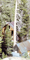
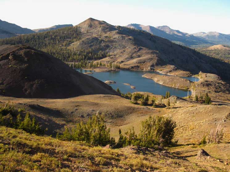
Southbound off the Southeast Flank of Forestdale DivideWe drop elevation rapidly on a Southeastward line off of Forestdale Divide, crossing Forestdale Divide Road a short way down Forestdale Divide's Southwest facing Flank. (We can actually see our PCT route crossing the end of the open space across Peak 9374's Western flank below the South side of Forestdale Divide from the Tahoe to Yosemite Trail.) We will cross an open space before entering the dense forest we see wrapping around the crest of Peak 9374. As we descend we briefly catch a quick glimpse of Lost Lakes through a gap in the forest cover laying below the North and West flanks of The Nipple and its subordinate ridgeline, which bends West-Northwest to separate the basin containing the Lost Lakes from the Blue Lakes. Below we can make out a bit of the blue surface of the Southeastern Lost Lake through the treetops in the middle of the image below. The Nipple is the mountain rising behind the visible Lost Lake and to the Left of the mountain with the shadow covering its back. The flank covered in shadow is also part of The Nipple's Massif, so I would call these mountains The Nipples. Looks like two to me... Lost Lakes and The Nipple(s) Trail and Road to Lost Lakes Note that the trail has been redirected to pass much further to the West of Lost Lakes while the North loop of the dirt roadbed, which bent the Southbound Forestdale Divide Road to Lost Lakes, has been removed. The road to Lost Lakes now consists of one dirt track down to the lakes from the Forestdale Divide Road. Both the road and trail now actually pass a half-mile to the West of Lost Lakes as of September 2009, rather than looping over to, and back from the Lost Lakes, as depicted on the maps. The loop in the trail and the North segment of the dirt road out to Lost Lakes has been removed and the Forestdale Divide Road rerouted, as depicted on the modified Tahoe to Whitney 7.5 and 30 minute maps of this area as detailed on the map below. The Forestdale Divide Road now stays to the West of the trail, and the trail stays to the West of the Lost Lakes, at least down to the point where the road and trail intersect at what was the Southern loop out to Lost Lakes, but which is now the sole road out to Lost Lakes. The loop of road and trail out to Lost Lakes was changed into a T-junction. None of these changes are a problem, except that the trail gets a bit faint where it's new path crosses the Forestdale Creek Road's old North route. Illegal use by four-wheelers following the old faint track through here to Lost Lakes have obscured the Southbound PCT a bit, though good PCT markers keep the Northbound hiker on track. We continue down a total of 200 feet of elevation loss from Forestdale Divide to the junction between Forestdale Road and the spur road breaking off to Lost Lakes. Looking down the dirt road we can see the NW Lost Lake. Crossing the dirt road begins our climb up and over the Southwest facing flank of The Nipple massif's Southwestern ridge arm towering over the Blue Lakes as well as the Lost Lakes. Dropping off the South flank of The Nipple finally brings us down to the Blue Lakes Road, and the end of this trail guide page. Hikers also have the option of following the Forestdale Divide Road down to Blue Lakes from the location of its intersection with the road out to Lost Lakes. At Upper Blue Lake we find the trail into the headwaters of Summit City Creek tracking West from the West shore of Upper Blue Lake. |
|||||||||||||||||||||||
| Atmospherics | Road to Lost Lakes | ||||||||||||||||||||||
|
|||||||||||||||||||||||
Watch the trail carefully Southbound
|
Video
Lost Lakes over the Nipple
| Coming South off the Forestdale Divide puts us under dense forest, finally giving us relief from the five miles of exposed terrain we've crossed hiking South from Carson Pass. We're to the East of the Forestdale Divide Road, but we come upon remnants of the old road bed leading out to Lost Lakes, which had been abandoned when the loop out to Lost Lakes was removed in favor of a much more restrictive T-junction off the Forestdale Divide Road. Well, more restrictive for four-wheelers, but more protective of the terrain and the experiences of backpackers and horse folks... We'll notice the trail growing fainter under multiple tire tracks as we approach the old Northern segment of the loop out to Lost Lakes, until the crisscrossing of tracks left by illegal four-wheelers makes following the trail South a bit challenging. Not so much for Northbound hikers on the Pacific Crest Trail route through here, as ample PCT emblems keep you on-route. Duration: 6:40
|
Clarification Jeeze. I was just reviewing the video above and the text here on April 15, 2013 and I have to further clarify the trail situation between where we cross Forestdale Road to when we reach the road to Lost Lakes. After we follow the trail across to the Southeast side of the current Forestdale Divide Road, and hike down into the forest we will come to the East-West track of the old Forestdale Divide Road, before it was rerouted, and made off-limits to four-wheelers. But some of the renegade kids still follow the old route, and generally drive all over the mountain around here, to the extent the terrain admits trucks. This activity has obscured our trail South where it crosses the old road. In the video above that is the first location where I mention that the PCT route gets sketchy. This position is to the North of where the PCT route currently crosses the dirt road heading East to Lost Lakes. That is the second place the Southbound PCT gets sketchy. As I show in the video above, the view of the trail where the Southbound PCT hiker crosses the road out to Lost Lakes is not very well marked. Going in the Northbound direction here the PCT is very well marked. |
| Backpacker's MAP Old and New Routes to Lost Lakes |
|
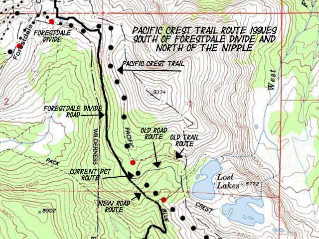
The current Pacific Crest Trail route between Forestdale Divide and the road to Lost Lakes (2014). Differences between situation on the ground and the above map 1> The trail follows the dots, not the "old trail route" out to Lost Lakes. 2> The "old road route" has been removed out to Lost Lakes. The road segment from the South junction with the Forestdale Divide Road to Lost Lakes is now the only legal way in and out to Lost Lakes for a vehicle. As on all TahoetoWhitney Maps, Click the Red Dots for detailed Trail Information. Please post up your updates, conditions reports, and your impressions of this segment of trail! Here Carson Pass to Blue Lakes |
This Guide is set up so that you can add your perspective & experiences backpacker's forum to broaden this trail guide's view of the Blue and Lost Lakes and their backpacking opportunities. The whole guide is linked to forum pages designed to collect hiker input, updates, corrections, experiences, comments, and questions. Check the Forum linked to every trail guide page for more information or to add your bits of wisdom and experience. My perspective alone is insufficient to describe the terrain or the experience. Thus your perspective adds another dimension to the experience and increases the value of this guide for us all. Questions and comments always welcome. General Backpacking Specific Backpacking Trails & Topics This Location |
Close-up
of
The Nipple
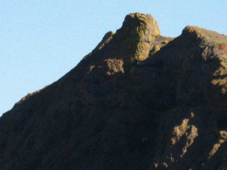
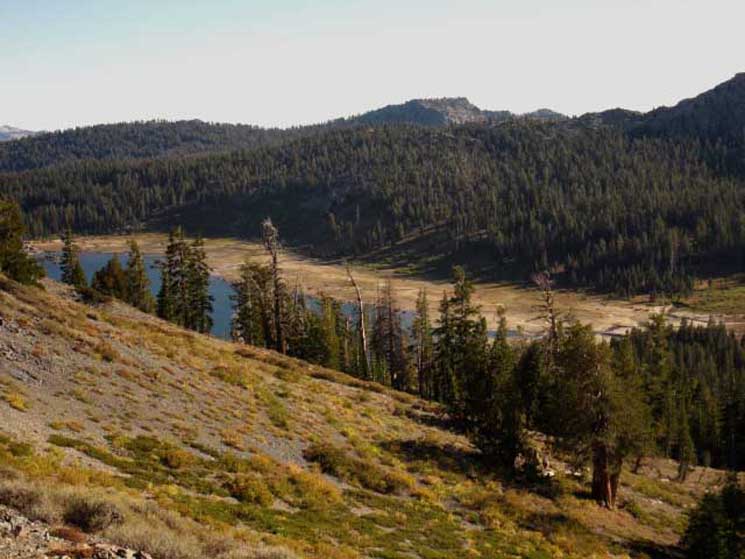
Well, I've always kind-of agreed with the map, and called this "The Nipple." But, this is not "The Nipple." I'd call it, "one of the nipples." This unique point of view below, looking at the top of the crestline of the Western arm of the massif of The Nipple depicts the dominant feature of this section of our hike, and from under which our finest views of the terrain to the Southwest will come into view, as we hike across its Southwestern facing flank, which is the Sunlit flank dropping down out of our frame of view to the Southwest. That would be the Right side of the image below. That's where the Southbound PCT tracks under this nipple. |
|
 |
|
Above we have the view Southeast from the Northwest, at an opportune moment when the tree cover broke while hiking down from Forestdale Divide to the road breaking off East to Lost Lakes. These rare views tell us something very important. We've got to keep our eyes open for breaks in the forest cover we are hiking under to get spectacular views of The Nipple massif wrapping around the Lost Lakes. We were made to do this, so in my mind it is only a matter of how we return to the source. Remember: The Backpacking Formula of Reality: That is who you are, in one respect. The other respects take care of themselves, if you find your balance. Deep, shallow, long, short, weak, strong, high, low, it's how you take it that demonstrates what you know. |
Dirt Road Spur
off of
Forestdale Divide Road
to
Lost Lakes
Yet another Wilderness Boundary! Boundary Number 3 Before beginning our climb South up along the Western flank of The Nipple, we once again cross the convoluted boundary of the Mokelumne Wilderness, this time in the Toiyabe National Forest, this time where the current dirt road to the Lost Lakes crosses the Pacific Crest Trail route. As described above, the Northern segment of the old dirt road looping out to Lost Lakes has been removed, well, obscured really, and the new trail and road beds routed about a half-mile to the West of Lost Lakes. Rather than hiking to and past Lost Lakes, as depicted on the USGS maps, the Pacific Crest Trail and Forestdale Divide Road pass about a half mile Southwest of the lakes, and the Forestdale Divide Road was moved to the West of the new trail route. The rerouting of the road and trail diminishes, but does not end auto access to the Lost Lakes. That's a mixed blessing. Number two, we will clearly see the wear-and-tear on the terrain brought about by mechanical access. Huge zones of flattened terrain. Hey, I don't have too many problems with four-wheelers, when everyone act correctly. The point for all responsible horesmen, backpackers, day hikers, and four-wheelers should be access to, and protection of, this stunningly beautiful terrain, not its destruction. I have no problems with access, as long as it does not destroy what it accesses. Coming South off the Forestdale Divide we saw the random four-wheeler tracks East and Wet our Southbound line through the forest where four-wheel drivers have openly defied the wilderness boundaries, and as we travel across the Mokelumne Wilderness South of here we will encounter the great fire rings in the center of great circles of flattened terrain, trampled flat by dozens of four-wheelers carrying hundreds of partiers/campers. Wow... I'm a proponent of multiple-public uses of the forests, including four-wheelers and snow-mobilers, as long as each user-group cleans up their mess, especially the trash and mess created by random four-wheel trucker-group parties, I am an opponent of private use of public lands. I support various levels of public use, from auto to foot, as long as the means of access do not damage or destroy what they are accessing. Car Camping around Carson Pass Looking Southeast for the continuing track of the Pacific Crest Trail on the other side of this faint dirt road East down to Lost Lakes, I finally located a partially obscured PCT marker in a tree that indicated the way South. Now we climb South across the Southwestern Flank of The Nipple: The Nipple The Nipple Trail elevation 8.0 miles from Carson Pass to the high point of the trail across The Nipple. |
North and South
from the
Road to Lost Lakes
NORTH This terrain is regularly crossed by all of the above b |
||
 |
||
Yeah, Sure... Though four-wheelers are supposed to stay on the dirt roads, they often follow the old dirt road across prohibited terrain...
Paper Maps Online has the National Forest Mokelumne Wilderness Map online that best depicts this complex wilderness boundary. |
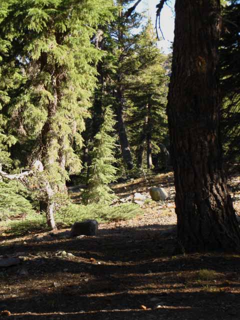
Looking Across the East West Road out to Lost Lakes
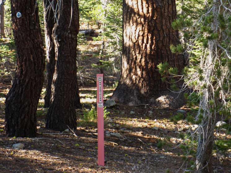
| SOUTH Looking South at the fairly obscure continuation of the PCT across the dirt road to Lost Lakes. |
 |
| Note the wound on the trunk of the tree on the right. |
| Close up: The wound in the tree is the PCT marker I was looking for! |
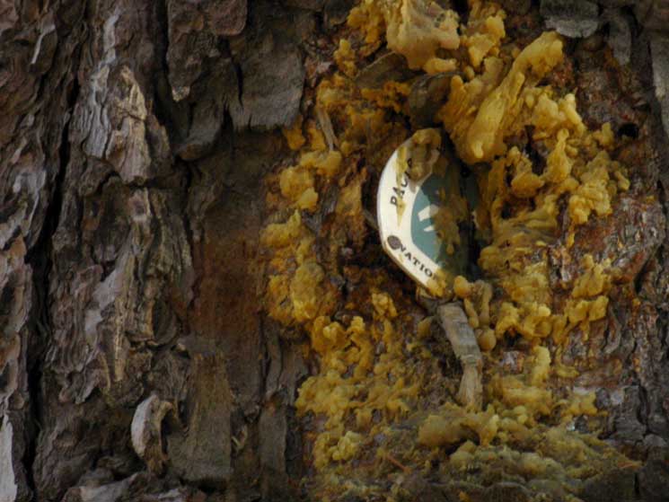 |
I really hope the sap is not an indication that the PCT marker exposed the tree to a pathogen or parasite, and is merely the tree's response to an irritation. It looks like a heavy-duty rejection to me... Have you observed this? Tell Us: |
The Nipple
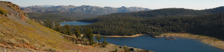
As we climb higher up the flank of The Nipple our view of the Upper and Lower Blue Lakes, sitting below us to the Southwest, expands nicely. The high point of the trail across the flank of The Nipple is a mile South of the Lost Lakes road junction, at 8920 feet in elevation. Reaching the highest point on the trail across The Nipple brings you up 280 feet of elevation in less than a mile. You will have no cover until you pass off the Southern side of The Nipple. The Nipple The Nipple: 9342 feet. Trail high point elevation: 8920 8.0 miles from Carson Pass
|
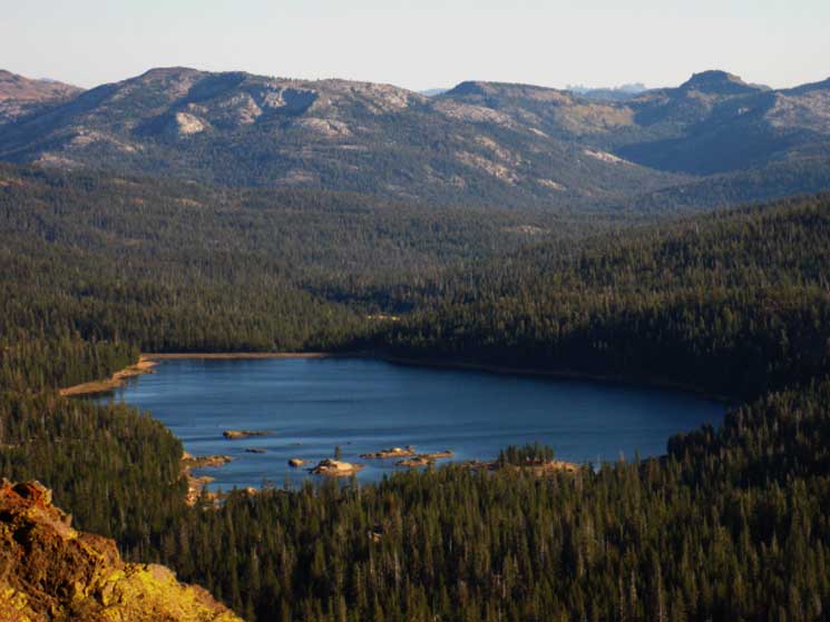
Upper Blue Lake
| View of a very low Upper Blue Lake (Fall) comes into view as I ascend the flank of The Nipple | ||
 |
||
Climbing South out of the dense forest onto the exposed flank of The Nipple begins to open up expansive views of the Blue Lakes laying at base of The Nipple's Southwestern flank.
|
View Southwest
of
The Blue Lakes
| Climbing higher up, Lower Blue Lake also comes into view. |
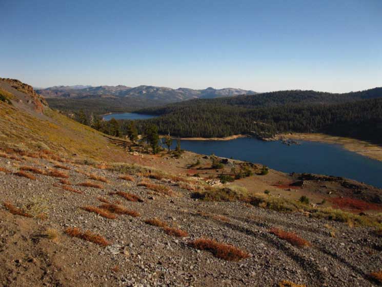 |
Upper and Lower Blue Lakes. |
Stunning View Northeast
Looking Northeast from The Nipple reveals Charity Valley
Hiking to the South up the Southwest flank of The Nipple we notice we're hiking up to a subordinate peak followed by a gap in the crestline, before our path across the Southwestern flank cuts off our view to the North. For a brief moment we get a view to the Northeast as we pass by this gap, of Markleeville Peak, the barren peak rising out of sight on the far-Right of the image, framing our view of the Eastern escarpment of the Sierra, the Carson Valley beyond, and the Pine Nut range wrapping around the East edge of Carson Valley. This gap in the mountain's crestline allows us great views to the Northeast while hiking the few feet of the trail across its width. |
||
 |
||
The Mouth of Charity Valley Lines Up the Carson Valley and the Pine Nut Range beyond. Grover Hot Springs is located further down Charity Valley, and to the Southeast, the Right. A bit further beyond Grover Hot Springs lays Markleeville on Highway 89. In the far distance we are looking straight out into and across the South end of the Carson Valley, at the Pine Nut Range bounding its Eastern edge.
|
Lower Blue Lake
looking
Southwest
off of the
Flank of The Nipple
 |
Watching the wind play across the surface of Lower Blue Lake. Lichen glowing in the brightening Sun of twilight. |
Unnamed Lake
come into
View
as we descend the
Southern Flank of The Nipple
| This lake sits just East of the trail. | ||
 |
||
Nestled in the Southern Shoulders of The Nipple.
|
Great long views
to the
East-Southeast
open as we descend the
South Flank of The Nipple
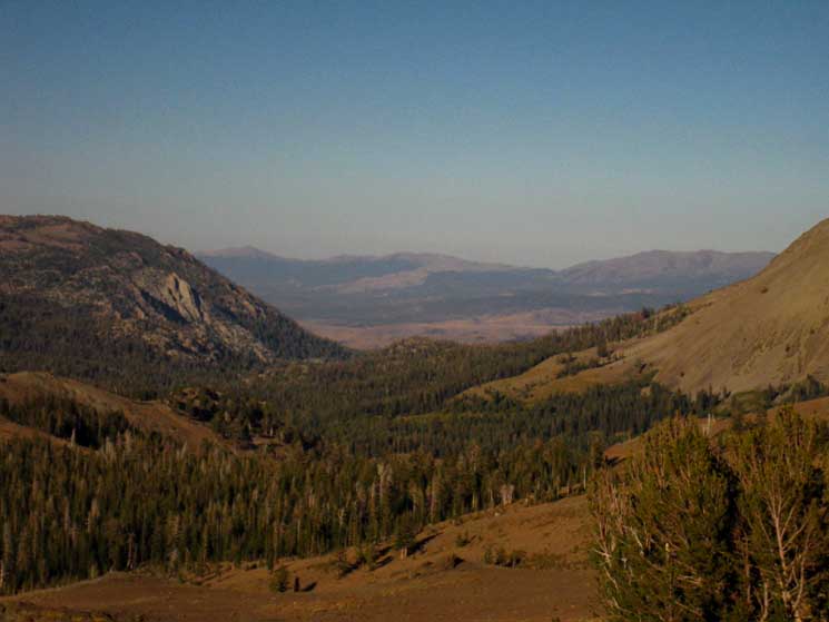
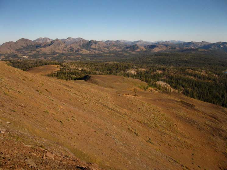
Hiking off the South flank of The Nipple looking across a 7 mile long 8000 foot elevation "flat," at the High Sierra Crestline mountains surrounding Ebbetts Pass.
Let's Figure Out
our
Next Seven Miles
As Seen in the Images Above & Below
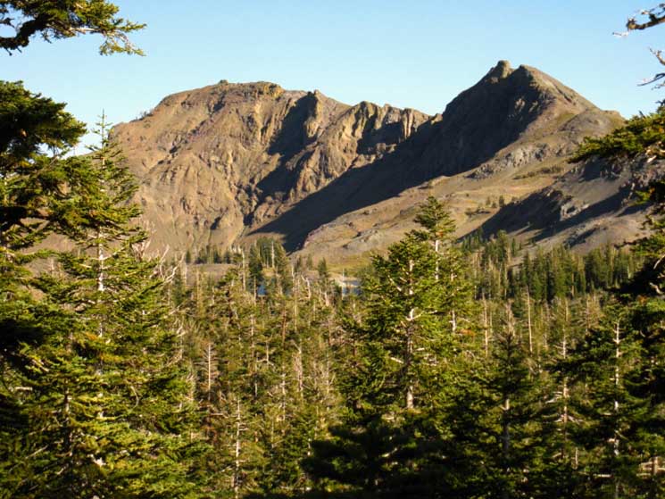
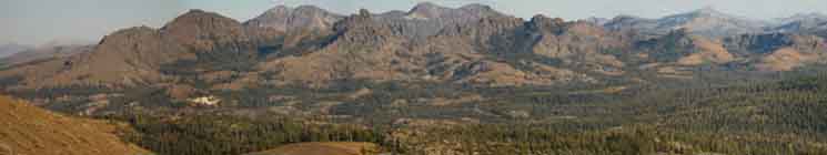
Images Hiking off of the Southern Flank of The Nipple reveals the next seven miles of terrain we will hike across between our present position on The Nipple to the base of where we begin to climb Raymond Peak on our way South to Ebbetts Pass. Above we see the Sierra Crest Mountains surrounding Ebbetts Pass and guarding the entrance into the Carson-Iceberg Wilderness to the South of our position on the South flank of The Nipple. This is our first, and most impressive view of the upcoming range we will cross. The tallest peak on the far Left is Raymond Peak. The campsite of which I speak sits in forest at the base of its ridgeline running to the Northwest, on the far Left end of the massif. That's our view Southeast. Behind and to the Right of Raymond Peak we see Silver Peak in the further distant Southeast. To the Right of Silver Peak, also in the furthest distance, is the double-crest of Highland Peak. Silver and Highland Peaks are connected by a low ridgeline, and both are located on the South side of Ebbetts Pass and Highway 4 in the Carson Iceberg Wilderness. Raymond and Reynolds Peaks are located on the North side of Highway 4 in the Mokelumne Wilderness.
Closer to our position than all these peaks is the great volcanic cylinder rising to the Right of Raymond Peak between Silver and Highland Peaks. The "cylinder" rises prominently above the low ridge in the background dividing Silver Peak from Highland Peak. The pictures below have better resolution, but the picture above lays out the whole range. Nonetheless, though this "cylinder" appears to rise between Silver and Highland Peaks we can see that it is even closer to us than Raymond Peak. Reynolds Peak is the high point of the ridgeline running Southeast from that volcanic cylinder. If we draw an imaginary line from our current position to that volcanic cylinder we will find Wet Meadow Reservoir splitting that line at the base of the volcanic cylinder peak, and the series of lakes, being Tamarack, Lilly Pad, and Upper Sunset Lakes all located on or slightly to the Right side of that line between us and The Cylinder. That would be on the Southwest side of the line. The PCT bends Northeast from Wet Meadow Reservoir to the Left of this imaginary line to access its onto the Northeast facing flank of Raymond Peak. That would be its far flank, not visible in the images above and below, in both of which we can see the full extent of its Southwestern flank. The map for this segment of trail lays out the terrain we are looking across between The Nipple and Raymond Peak: Blue Lakes Road to Raymond Peak The images above and below explain that once we reach the top of The Nipple we have an all-downhill or fairly-flat/rolling terrain crossing under forest for the next 7.1 miles, at an elevation of between 7600 to 8000 feet. This relaxing section of shaded trail ends shortly past the campsite situated at the base of the Northwestern corner of Raymond Peak, where we again begin climbing. View |
||
 |
||
Once we get off the exposed flank of The Nipple we will be hiking under nicely forested rolling terrain with good sun protection until we begin climbing up onto Raymond Peak to hike across its Northeastern facing flank. This flat shaded length of trail ahead ends where we begin climbing Raymond Peak past the improved campsite located aside a tasty all-season spring-fed creek. The creek begins its flow from a spring just below the summit of Raymond Peak. Hiking South from that campsite on the edge of the forest at the base of the Northwest flank of Raymond Peak we hike out of the protecting forest to be exposed without cover until we approach Upper Kinney Lake, a total of about 9.4 miles. Exposure My point breaking this down is to point out that this section of trail between Carson Pass and Ebbetts Pass is highly exposed, which will affect us physically, especially if we neglect to properly plan and account for our water and/or Sun protection needs. If anything can affect us physically, it will affect our perception. |
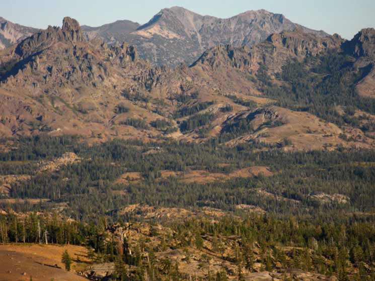
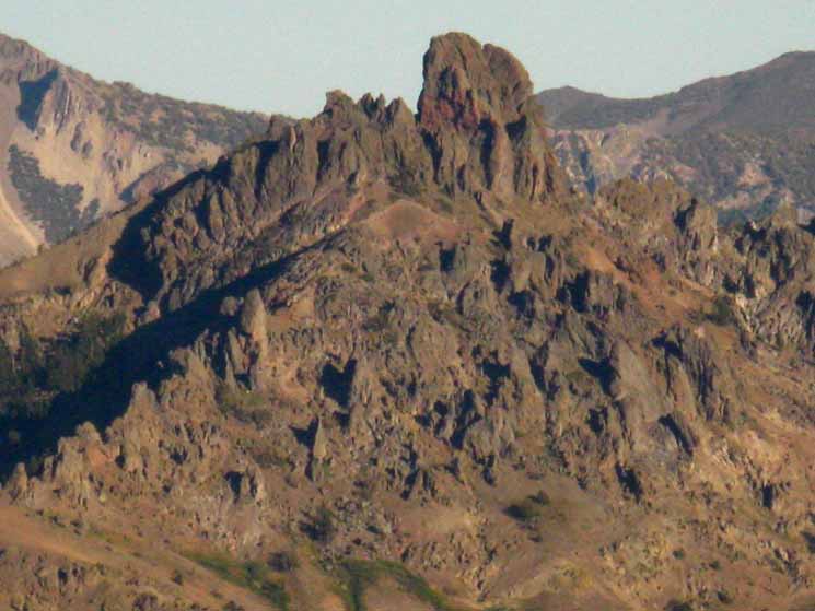
The Cylinder, Highland Peak
and
Reynolds Peak
A close look at the distant Highland Peak and its nearby mountains reveal their rugged volcanic composition. In the closer Left of the frame we have the volcanic cylinder. I marked that sucker on the hiking map. To its Left out of sight (Northeast) is Raymond Peak, and Reynolds Peak is the high point just down the Sierra Crestline behind and to the Right (Southeast) from "The Cylinder." It is through here we can see just how wildly the path of the Mokelumne Wilderness Boundary swings around, taking on an almost tattered look, as it swings to and fro under the command of ancient economic and political interests. Looking through the gap to the Right of the cylinder we can see the double-crests of Highland Peak in the distance. |
||
 |
||
Erosion cuts amazing shapes into the hard volcanic rock.
|
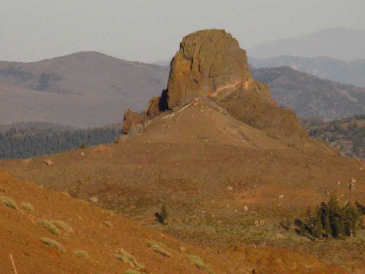
"The Cylinder"
| The variety of shapes, textures, colors, and shadings of the volcanic terrain is remarkable. | ||
 |
||
The harshness of the terrain adds serious character to its stark beauty. I have marked this feature as "The Cylinder-Cone" on the "Near Terrain" map below. Behind it we can see the ridgline connecting Silver Peak rising to the Left from Highland Peak rising to the Right.
We're going to pass under The Cylinder on our way onto the Northeast flank of Raymond Peak. |
Jeff Davis Peak
Bending around the contours of the PCT coming South off of The Nipple Jeff Davis Peak reveals itself to our Northeast as we approach the Southern end of The Nipple. The hard volcanic rock is slowly sinking into a grave of its own eroded soil. |
|||
 |
|||
Jeff Davis Peak. Note that the soil is composed of eroded or broken down volcanic material. All of the soil. For miles and miles in every direction. Except for the small zones, or islands of granite sticking up through this vast ocean of vulcanism.
|
Last Steps South
to
Blue Lakes Road
After dropping off the Southern Flank of The Nipple, we find ourselves tracking South and finally entering some thick forest cooled by good tree cover. Since climbing onto the exposed flank of the Nipple we have been lashed by sun and wind. A bit of shaded travel is nice. Little islands of granite rock appear here and there, a nice counterpoint to the volcanic terrain we have hiked through since departing Carson Pass. You cannot miss the Blue Lakes Road. It is paved. We cross it. I guess it's paved so PGE can service their facilities at the Blue Lakes. Blue Lakes Paved Road Elevation 10.65 miles South of Carson Pass 16.13 miles North of Ebbetts Pass |
Granite and Forest
Entering the forest dropping down to the base of the South side of The Nipple marks one of the rare times we see bits of the rare granite terrain between Carson and Ebbetts Passes. This upcoming five mile long stretch of trail from here, just a bit North of Blue Lakes Road all the way down to the Campsite under the Northwest edge of Raymond Peak has bits of granite terrain mixed into the volcanic along this nice length of shady forest trail. |
 |
The vast majority of the terrain the Pacific Crest Trail crosses between the Southern Tahoe Basin and Jack Main Canyon is volcanic, or describes an interface between volcanic and granite terrains. No, it is mostly volcanic... Above we see a rare outcropping of granite in this predominantly volcanic terrain. |
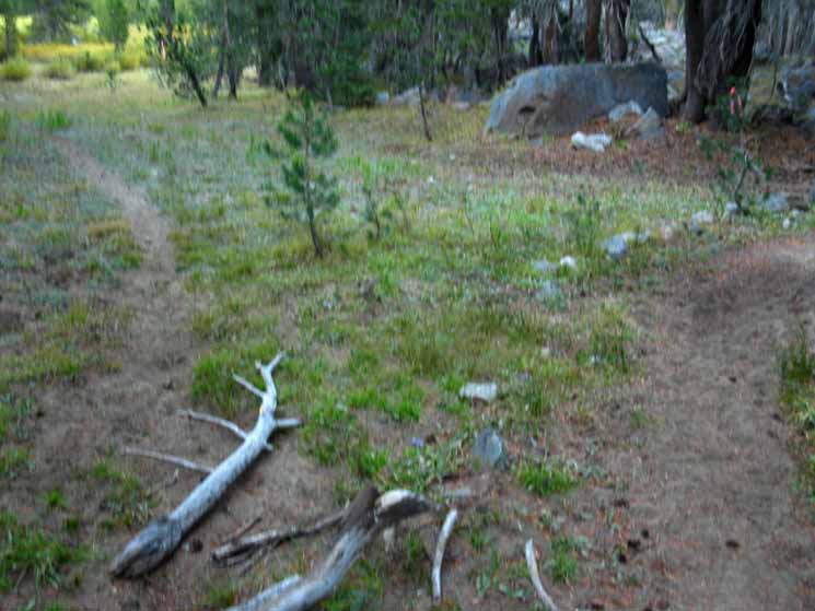
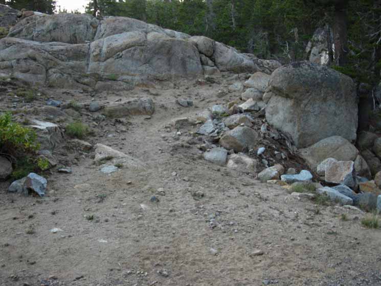
Local Trail
| One of the many heavily used unmarked trail junctions between Blue Lakes and Wet Meadows Reservoir. | |||
 |
|||
The convoluted Mokelumne Wilderness Boundaries across the Toiyabe-administered Mokelumne Wilderness give easy access for vehicles to this location. That's why there are so many heavily used unmarked trail junctions through this area. Paper Maps Online has a Mokelumne Wilderness Map showing this complex wilderness boundary. Note the depth of the PCT trailbed, the branches warning long-distance backpackers back onto the main PCT, and even a bit of construction tape tied to a little lodgepole pine.
|
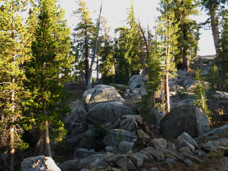
Granite Terrain!!
| Looking back to the North at the Pacific Crest Trail winding its way through a bit of fine granite terrain towards The Nipple. |
 |
This section of the trail is not marked on the topo map, so I put it in. |
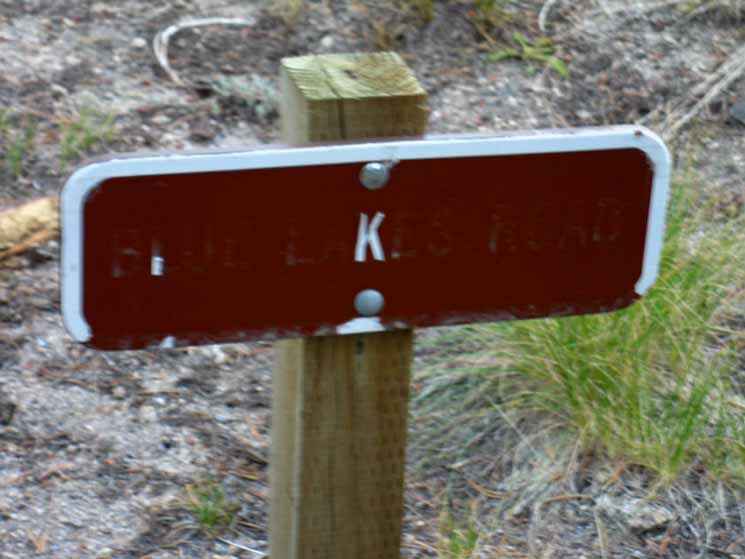
Blue Lakes Road
| The sign denoting the Blue Lakes Road. | |||
 |
|||
"K" marks the spot!
|
Blue Lakes Road Elevation 10.65 miles from Carson Pass 16.13 miles to Ebbetts Pass The Blue Lakes Road intersects with Highway 88 2.5 miles West of the junction between Highway 88 and Highway 89, otherwise known as Picketts Junction. Check out this google roadmap to see where Blue Lake Road and Highway 88 meet. |
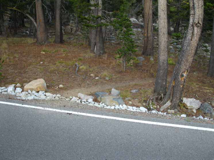
Blue Lakes Road
| Looking South across the Blue Lakes Road | |||
 |
|||
at the Pacific Crest Trail.
|
North: Forestdale Divide South: Blue Lakes Road to Mokelumne Wilderness
Forestdale Divide |
The predominant characteristic of this section of the trail is Dry. Dry and exposed from Carson Pass down to where we cross the exposed Forestdale Divide. A bit South of Forestdale Divide we enter a short bit of moderately thin forest cover down to where the spur road off the Forestdale Creek Road turns East towards the Lost Lakes. Forestdale Creek Road continues down to the North side of Upper Blue Lake. This spur of road to Lost Lakes also obscures the the trail for the Southbound hiker. For the Northbound hiker on the PCT, a nice reflective marker points the way North on the Pacific Crest Trail route. Before reaching the dirt road to Lost Lakes the Southbound hiker will cross the old dirt road's bed hiking South of Forestdale Divide, where we should take extra care. After crossing the main Forestdale Creek Road at the top of the Forestdale Divide, the Southbound hiker will encounter the old road loop to Lost Lakes, which appears to still be used by ambitious four-wheelers. The Northbound trail is clear to see, but the Southbound trail requires a bit of scouting to pick up on the other side of the faint old dirt road. This is because the PCT is better marked out for North than Southbound hikers. A short distance further South we encounter the currently used spur off of the Forestdale Divide Road down to the Lost Lakes. Here the tire tracks from auto traffic combined with a partially obscured trail marker on the Southern side of the road again give the Southbound hiker pause. And again, for the Northbound hiker this location is well marked. In this case by a home made PCT marker that someone put up, which well marks where the Northbound route continues across the Lost Lakes road spur. The video on this page address all of these ambiguous points on the Southbound trail. After finding the Southbound trail on the South side of the spur road to Lost Lakes, we again emerge from forest cover to climb across the Southwestern flank of The Nipple. As we traverse up the Western Flank of the Nipple, we encounter a sweet spot for views, composed of where the trail crosses a low spot in the ascending crestline allowing views in almost all directions. Great views to the West reveal the backside, the Southwestern flank of the Round Top/Sisters Massif. This range makes up the Northern flank of the Summit City Creek's great granite canyon. The Tahoe to Yosemite Trail route drops into Summit City Canyon crossing over from the North Side of the Round Top massif. The impressive mass of granite that makes up the South bank of Summit City Creek, and the Devils Corral, are also visible from this sweet spot. Looking Northeast, we can see Markleeville Peak in the distance through this gap in the flank of The Nipple, and further beyond the Carson Valley sitting in a haze beyond the base of the Eastern Flank of the Carson Range. To the Southwest we now get an amazing perspective overlooking the Western Sierra beyond the stunning blue beauty of Upper and Lower Blue Lakes. Continuing South up the Northern flank of The Nipple brings us past our cool view spot, and our views to the North and East are again restricted until we drop off the South flank of The Nipple. From the South Flank of The Nipple the terrain to Ebbetts Pass, as well as long views of the Sierra Crest tracking South, become visible. And, the first thing I generally measure with my eye is the distance to the tree line on the North side of Blue Lakes Road where we can find cover from our exposure to searing Sun and whipping winds on our exposed position traversing The Nipple. From the high point of the trail on The Nipple we are now less than 2 miles from Blue Lakes Road. We will enter forest cover before we reach the Blue Lakes Road. A short distance to the South of Blue Lakes Road we will encounter a series of Lakes which offer water, good campsites, and nice places to spend the night. And, I am ready to kick back. I generally hit Tamarack Lake after a roughly 16 mile hike from Showers Lake or Round Lake, depending on if I am coming out of the Tahoe Basin through the Echo Summit or South Upper Truckee traiheads. I was especially tired during my last trip through this section in late September of 2009, when I was carrying a heavy 11 day food supply to sustain me across the 181 miles from Meeks Bay to Tuolumne Meadows without resupplying. I was more than ready to make camp at Tamarack Lake! The forum pages for this section of trail are set up and broken down so backpackers can correct, update, comment, or question the guide information. 7.5 Hiking Topo Map 30 min Hiking Topo Map Note: |
Backpacking Trail Guide North |
 |
Backpacking Trail Guide South |
Backpacker ForumsHave a great Sierra Nevada route or trip to relate?Post it on
|
North: Forestdale Divide South: Blue Lakes Road to Mokelumne Wilderness
Trailhead
Contact
Alex Wierbinski

Backpacking Lake Tahoe to Mount Whitney
Your guide to the High Sierra Crest, including the Tahoe to Yosemite, Pacific Crest, and John Muir Trails
