

High Sierra
Backpacking
Trail Guide
Forums
Sierra
Weather
WeatherNotes Northern
Sierra Weather
Gear
Backpacking
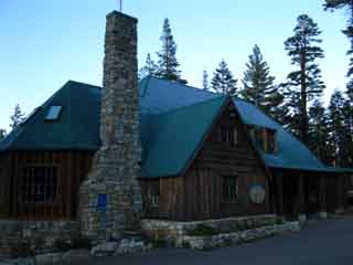
Echo Chalet
to
Echo Summit Trail Head
Hiking The Tahoe to Yosemite and Pacific Crest Trail around Lake Tahoe
Languages
Trail Skills
Mountain
Safety
Food
Planning
Trail Arts
More
Information
Social
Trail |
North |
South Echo Summit |
Trail Miles & Elevations |
Trail Miles & Elevations INDEX |
Lake Tahoe Basin PERMITS |
Local Weather All Sierra Weather |
All Wilderness PERMITS |
all pages |
Echo Lake Chalet to the Echo Summit Trail head
Resupply information
Echo Lake Chalet
Arriving at Echo Lake Chalet after May 30 and before Labor Day (1st Monday in September) we can pick up the resupply we sent ourselves via the US Post Office located at Echo Chalet. Check out the Echo Lake Resupply page for more information about resupplying. If we are not resupplying at the Echo Lake Chalet, we're certainly going to chow down and collect up some massive calories with a nice fresh deli sandwich, their famous milkshakes, and some juice. Yes, I am going to do it all. Well, I would if they were open... Note that this two mile length of trail between Lower Echo Lake and Echo Summit is only hiked by through hikers on the PCT, TYT, TRT, and Tahoe to Whitney Hikers. Lower Echo Lake to Echo Summit The reason is that local hikers will start their Northbound hikes into Desolation Wilderness out of the Lower Echo Lake Trailhead, while Southbound hikers into the Meiss Country Roadless Area will start South through the Echo Summit Trailhead. Only long distance hikers hike the segment of trail connecting Lower Echo Lake to Echo Summit. Or maybe dayhikers and locals. Comments Questions Add Your Experience & Information Meeks Bay to Echo Summit Forum |
 |
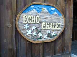 |
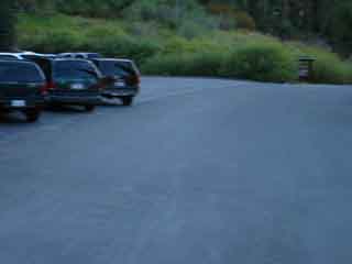
| Echo Chalet, pictures above linked to their website. | |
 |
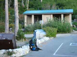 |
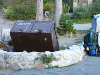
| Vital backpacker resources: Trash and Bathroom. Road to upper parking lot to the Right of the bathroom, trail to the Left. |
|
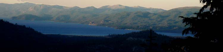
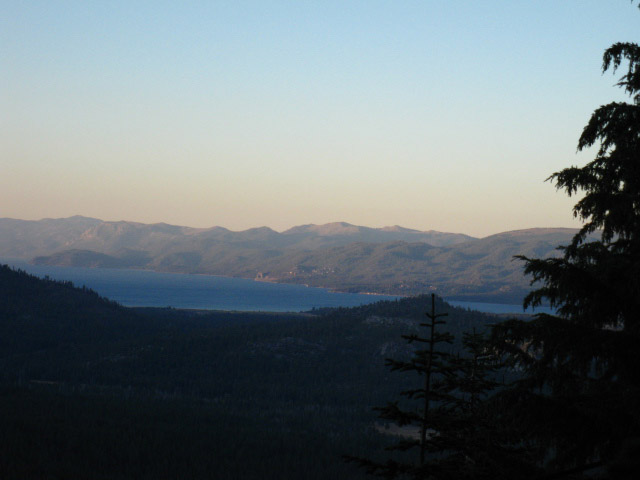
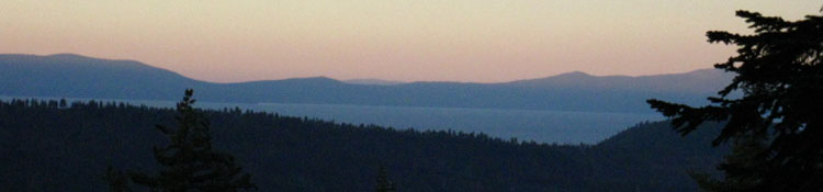
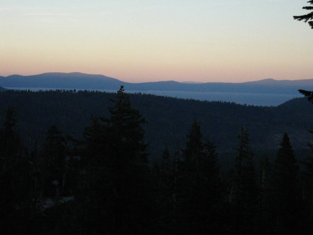
Sun Setting over Lake Tahoe
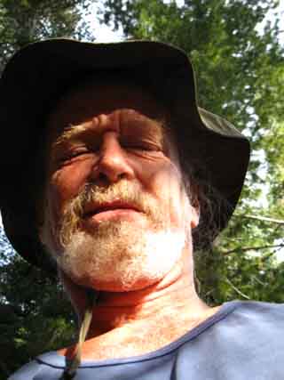
As I was not resupplying at Echo Lake Chalet, good thing, because it was closed, I continued my hike towards Echo Summit after a brief break at Lower Echo Lake. It has good resources, even though Echo Chalet was closed. I emptied a couple of pounds of my garbage into the bear-proof can, and marveled at the bathrooms, though I did not need to use them. The pack was lighter, even if I was not... The trail off to the left behind the bathroom, when looking South at the bathroom, as in the picture above-Right, runs up to the North side of upper parking lot, which we will cross to the South side to find the trailhead sign and trail for our route continuing South along our combined Tahoe to Yosemite-Pacific Crest-Tahoe Rim Trail route. Otherwise we would have to follow the road the long way around and up to the upper parking lot. I would have liked a snack at the Echo Chalet, but it had already closed for the season when I came through in September. But the quiet of the area was a fair sacrifice for snacks. The trailhead and Echo Chalet were really strange in September. It was very quiet at the Lower Echo Lake Trailhead. The last few times I've been through here were during mid-Summer. Not quiet. This entrance to Desolation Wilderness is not quiet during Summer, and downright frantic during Summertime weekends and holidays. Desolation swarms with backpackers, local residents and their boats full of friends, kids, and dogs that fill up the terrain up through the upper parking lot as well as around Echo Chalet right up to, and past the trailhead into the Southern end of Desolation Wilderness. Desolation Wilderness is referred to as the busiest Wilderness in the country. It's understandable. It is very pretty, and it sits above the now-large population of South Lake Tahoe, and within easy reach of the Sacramento, Reno, and Bay Area metropolitan areas. Anyway, we're off to climb the low ridge to the South dividing us from Echo Summit and our entrance into the Meiss Country Roadless Area. |
South Lake Tahoe Glowing during Sunset
 |
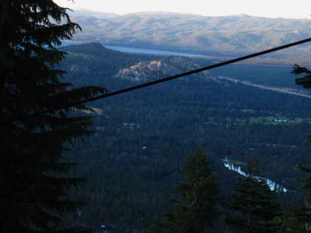
Beautiful vistas open up through breaks in the dense forest cover hiking up to the upper parking lot after passing South out of Desolation Wilderness through the Echo Lake trailhead. When sky and terrain begins glowing in twilight hues I start running down the trail. |
| Echo Lake Trailhead |
Though the Desolation Wilderness ended on the North side of Upper Echo Lake, the Lake Tahoe Basin Administrative Unit continues through Echo Lakes and Echo Summit encompassing the Meiss Roadless Area all the way South to where we will exit the Lake Tahoe Basin through the Carson Gap At the Echo Lake Trail Head we can pick up our pre-sent resupply we sent to ourselves at the Echo Lake Chalet, stop for lunch at the Chalet and then continue South. We also have to option of catching a ride down to the Tahoe Basin and check out the South Lake Tahoe Regional Resources. I mean hitch-hiking. There is no shuttle service between Echo Lake and South Lake Tahoe. Arriving at the Lower Echo Lake trail head marks the end of the first leg of our backpacking trip to Tuolumne Meadows is Yosemite along the Tahoe to Yosemite Trail. Or it can be broken into loops and trailhead to trailhead trips out of the West Shore trailheads described on the guide pages to the North. A nice little Backpacking Trip
Backpacking 28.71 miles Meeks Bay to Echo Summit Next Segment of Trail 2 miles This two mile segment is between Desolation Wilderness and the Meiss Country Roadless Area, thus we will hike near houses, retreats, and across a road and Highway 50, then along Highway 50 to Echo Summit.
Elevation
+123 Feet
Note that Echo Lake is higher than Echo Summit. The high point between Lower Echo Lake and Echo Summit is 7600 feet climbing over the end of the ridge dividing Echo Lake from Echo Summit.
Lower Echo Lake to Echo Summit Mileage Meeks Bay to Echo Summit
Echo Summit to Carson Pass
|
South Lake Tahoe
 |
| Not Wilderness: Power line down to Lower Echo Lake indicates we are not in the Wilderness. |
Upper Parking Lot, Echo Lake Trailhead
 |
 |
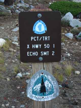
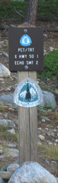
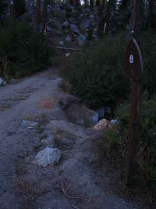
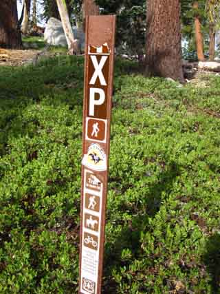
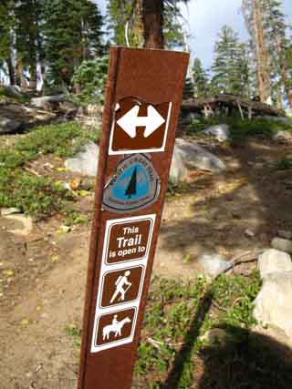
| Sign to upper parking lot trail head. | The upper parking lot serves backpackers going into Desolation. Southbound backpackers generally depart from the Echo Summit trailhead. |
 |
Lake Tahoe to Mount Whitney: your guide to the High Sierra Crest Trails |
| The Southbound trailhead on the South side of the upper parking lot. | top of page |
North: Echo Lake trail head South: Echo Lake to Echo Summit
Echo Lake Trailhead: Continuing South to Echo Summit |
Arriving late at the Echo Lake trailhead I stopped for a brief break before continuing South. I had done 14.18 miles from Fontanillis Lake to the Echo Lake trailhead, and the sun was already setting. This did not fit with my plans. I was supposed to be passing Echo Summit right now, looking to Frog Lake and a nice campsite. I knew this would happen much earlier in the day, every time I scrambled off trail to take pictures and films. Late in the afternoon, when I stopped and hung out with Eric, John and Will my fate was sealed. I knew that I would not get past Echo Summit this day. This is the dilemma of the long distance backpacker. Food restrictions require high mileage days. I could have called it a day at Lake Aloha, and spent a relaxing afternoon enjoying the view. But my food/mileage ratio required that I continue, and I knew then that I would be hiking in the dark. On the other hand, I am going to stop and talk to everyone who comes by. I am going stop and take in the stunning views, and take pictures and videos of the view. I really hate it when backpackers run right past the things they backpacked long distances to see. If you took the time to get there, take the time to enjoy it. My problem was too much to enjoy, and too few hours in the day to enjoy it all. As Echo Lake Chalet operates from Memorial Day to Labor Day, I was not able to have a sandwich and beer to supplement my food supply. I saddled up HOPP (my nickname for my pack, the Harness of Pain and Pleasure...haha), found the trail to the Upper Parking Lot behind and to the Left of the bathroom, and scurried on up there to find the Southbound Pacific Crest Trail trailhead.
Resupply information
Trail Map
|
Hiking between Lower Echo Lake & Echo Summit in the Dark
Because this two mile section of trail between Lower Echo Lake and Echo Summit sits between major trailheads to its North and South it is not hiked by most short-distance backpackers. Local backpackers and hikers begin their trips North and South out of Echo Lake and Echo Summit, respectively, so this short section is mostly hiked by Summer residents, local kids, and the visitors-tourists visiting Echo Lake and its facilities. |
Over the end of the ridge and past the Houses Southbound towards Highway 50
North: Upper Echo Lake South: Echo Summit
| Echo Lake Trailhead |
Desolation Wilderness ended on the North side of Upper Echo Lake, but the Lake Tahoe Basin Administrative Unit continues all the way to the Carson Gap, where we exit the Lake Tahoe Basin. The Meiss Roadless Area, AKA Meiss Country, begins South of Echo Summit and runs all the way to the Carson Gap.
Backpacking
|
Crossing Highway 50 at twilight
Hiking Southbound to Highway 50 we find the creek out of Echo Lakes crossing under Highway 50 in a culvert to our Right, just beyond which sits the unique wreck of Little Norway. No longer a vacation resort, Little Norway now looks like an interesting rental property for a wide variety of interesting local characters. The Southbound trail turns East along the South shoulder of Highway 50 for a short distance, maybe 30 yards, until we come to a dirt road well posted as the Southbound Pacific Crest Trail. |
 |
 |
| Above: The HUGE Pacific Crest Trail sign on North side of Hwy 50. The Northbound trail route crosses Highway 50 to the West of Echo Summit. This huge marker is to calm the Pacific Crest Trailers down.. | Above: View crossing Highway 50 backpacking South. Cross over, then turn Left and walk a short distance East to the dirt road on your Right. |
 |
 |
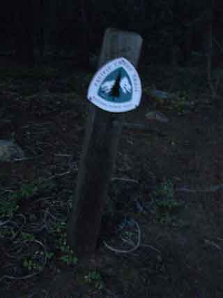
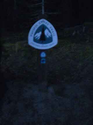
Pacific Crest Trail marker at the dirt road on the South side of Highway 50, just East of where we crossed Highway 50. |
100 feet down this dirt road we will see another Pacific Crest Trail maker that directs us to make a left turn, East, where the dirt road turns right. From there the TYT-PCT-TRT trail parallels Highway 50 East up to Echo Summit. |
To Highway 50 |
|
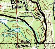
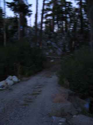
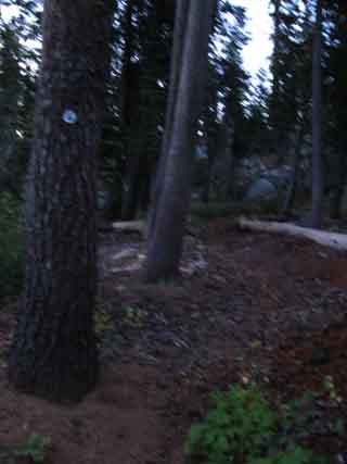
Lower Echo Lake trailhead South to the Echo Summit Trailhead It is two miles South to the Echo Summit trail head from the trailhead at the Echo Lake upper parking lot. As the sun was already down, I had 45 minutes of diminishing twilight to locate the two basic elements of a backpacking camp: Water, and enough flat space to sleep on. Pushing on around the end of the ridge overlooking Lake Tahoe between Echo Lake and Echo Summit, I crossed Echo Lake Road at the Upper Parking Lot and shortly came to an unmapped creek running West hard down the mountain before dropping down to Johnson Pass Road. This is the drainage from Echo Lake, which constitutes a major source of the headwater of the American River. Strangely, the creek does not appear on the 1992 7.5 USGS Topographic of Echo Lake, but it is shown on the 1976 30 minute Placerville map, circled in white below. On the other hand, the Placerville map does not show the Pacific Crest Trail's present route through this section. I understand. Trail routes, as well as rivers, are made to run in different courses over the years.
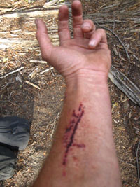
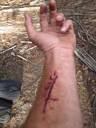
It appears to me that this drainage naturally out of Echo Lake would naturally run into the Lake Tahoe Basin. And with no dam to block and redirect this flow, there would be no or a much lower set of Echo Lakes... I looked about for a flat spot to camp near the ford, and finding none, I decided to continue South across the creek. There is a rather large downed tree crossing the creek to the left of the flooded low-water fording point. It has been dead long enough to have lost its bark. The problem was the trunk was too high off the ground to climb up onto from the side, and the root mat on the back side was a climb-able, but a difficult climb. Especially as heavily loaded as I was. I climbed up the vertical root mat at the bottom of the toppled tree, but the dilemma when I reached the top was, how the hell do I step over the lip from the root mat onto the trunk? Standing up on the top of the root mat put me a good 15 feet off the ground, and stepping over from the back, from the root mat side, onto the very slick taper of the trunk was a little sketchy. Especially as my pack weighed just a bit above 70 lbs. Root ends were sticking up, protruding out from the root mass I had climbed up, so I grabbed one root in my left hand, one in my right, and tentatively put my left leg over onto the trunk side. All good, so far. Then, just as I got my right leg onto the trunk from the the root mat side, the left root that I was using to hold myself steady snapped. As I had not completed my transition from the vertical root ball to the tapering trunk I toppled clumsily over onto the tapering trunk, and started sliding head-first down the smooth surface towards the trunk. I instantly foresaw that I would bounce off the trunk and plunge into the madly rushing ice-cold frkn creek. Nonetheless, I was sprawled face-down in a precipitous position with only my strained grip on a dead root holding me onto this fallen tree. It took a little struggling to completely stabilize myself enough to get my legs under me, and work myself into a standing position. And jeeze, I had already hiked 14 hard miles and was dead beat tired. As soon as I stabilized myself I scurried across the creek atop the downed tree. Once on the other side I inspected my left arm, which had been gouged by the part of the left root which did not break off. When the root broke my fully laden weight dropped onto the unbroken lower part of the root, gouging my arm. I decided it looked ok, though it was bleeding a lot. It had not gouged though all the layers of skin, so I was good to go without trail stitches. No problem. Bleeding cleans the wound. I would let it bleed clean. As it was almost dark, and I had still to find a campsite soon I figured I'd continued South to find a campsite, then clean it up and bandage it when I did find a campsite and could use the flashlight to properly inspect and treat the wound.
View of my scratch the next morning. After scanning the South side of the ford for a suitable camping site and finding none, I continued to press on towards Highway 50, hoping that a site near this runoff from Echo Lake would appear, so I could tap it for water. None did, so I continued South and shortly crossed Johnson Pass Road. In a few minutes I arrived at and crossed over Highway 50 in the dark. I was already planning on pushing as far into darkness as I could, but now this injury had moved finding a spot to camp to my number one goal. Trail Map: Echo Lake North Trail Map: Echo Lake to Echo SummitTrail Miles and Elevations
Next page |
North: Upper Echo Lake South: Echo Summit
Last Steps of Day 3
Tahoe to Yosemite Trail
Hiking across Highway 50
and
Camping
After a long day hiking South through the Desolation Wilderness from Fontanillis Lake, I began to run out of daylight between the South end of Desolation Wilderness and the North side of the Meiss Country Roadless Area. I decided to push on as far as I could before complete darkness ended my hiking day. Then I took a minor injury. Twilight ended a short ways South of where the combined Pacific Crest, Tahoe to Yosemite, and Tahoe Rim trails cross Highway 50. Don't let this happen to you. I'm an idiot. I could have staged up at Tamarack Lake North of Upper Echo Lake. I wanted to squeeze out as many miles as possible, and I knew I could get water, if with difficulty, where the outflow from Echo Lakes drained into the American River. So I pushed ahead. It turned out that the American had dried out way up here, the beginning of the flow had retreated down-mountain. This "retreat" of the tops of rivers and drainages down the mountain always happens during late-Summer into Fall and Winter, earlier during dry years and later during wet, up and down the High Sierra Crest Trails. I was lucky the water managers had opened up the Echo Lakes. Transition from Desolation to Meiss Roadless Area
Maps
Miles and Elevations
|
The Tahoe to Yosemite, Pacific Crest, and Tahoe Rim trails
on the
South side of Highway 50
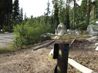
| After we cross Highway 50 southbound we walk about 30 yards East towards Echo Summit along Highway 50 to this sign. | ||
|
||
| This sign marks the dirt road pictured below. |
Final Loading 16 days unresupplied to Tuolumne Meadows.
|
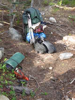
At the tiny emergency "throw-down" backpacking camp about 100 feet up the trail East of the dirt road. It is a camp because I camped there. Note the two large food bags in front of my pack. The Garcia bear-proof canister is already inside the pack, above the sleeping bag. The two huge food bags will be firmly secured to the outside of the pack. No bounce. The external food bags are securely attached to the frame and slung low on the pack to keep the center of gravity low and controllable. Trail Skills
|
Information
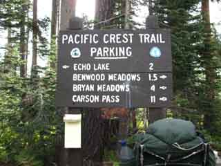
| Echo Lake Trailhead to Echo Summit |
Desolation Wilderness ended on the North side of Upper Echo Lake, but the Lake Tahoe Basin Administrative Unit continues to the Carson Gap, the very point where we step South out of the Lake Tahoe Basin. The Meiss Roadless Area, AKA Meiss Country, begins South of Echo Summit and runs all the way up to the Carson Gap. Echo Lake to Echo SummitElevation
Highway 50 crossing
Echo Summit trailhead
Highway 50 Crossing
|
Camp Notes
|
Morning 4, Highway 50 just North of Echo Summit
 |
|
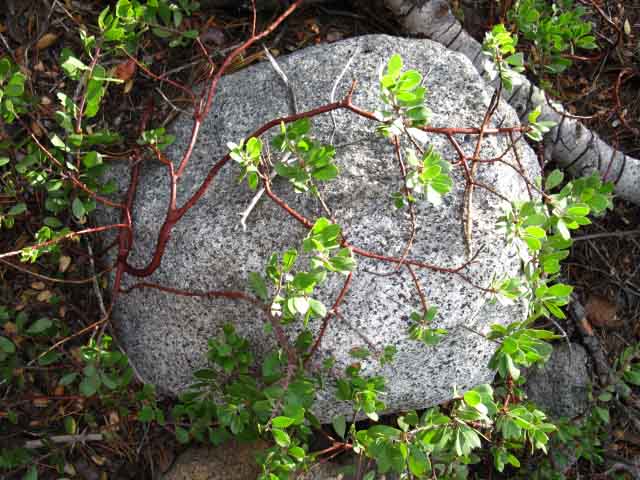
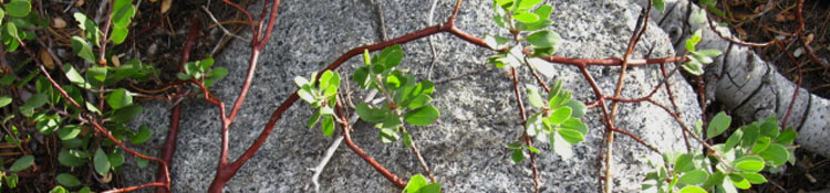
| Natural decor: Rock trussed up by shrub at my little backpacking camp. | |
 |
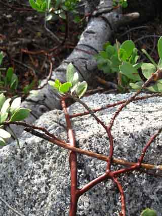 |
| Happy Camper. Not the best camping spot, but sweet nonetheless. Looking forward to the day! | Rock and plant detail. |
Emergency Camp by Highway 50 |
It was a brief hike South down to Highway 50 after my almost disastrous ford. On my immediate right (West) at the Pacific Crest Trail junction with Highway 50 is Little Norway. Between Little Norway and the Pacific Crest Trail on the North side of Highway 50 sits the raging torrent of the very same creek that I had almost fallen into minutes before. The creek runs into a rock lined culvert that passes under Highway 50 into the South Fork of the American River. Its flow is determined by the operation of the flood gate at the Lower Echo Lake dam. It was a raging torrent the evening I passed by. It was now completely dark, but on the positive side I now knew where I was going to get water. Now I just had to figure out where I could throw down my pad and sleeping bag. I crossed to the South side of Highway 50 and proceeded East along the shoulder for the brief walk to the Southbound Pacific Crest Trail marker posted at the junction of a dirt road and Highway 50. About 100 feet down this road our Pacific Crest/Tahoe to Yosemite Trail route turns Left off of the dirt road to parallel Highway 50 Eastbound up to the Echo Summit trailhead. About 100 feet up the trail I noted a small flat shelf in the forest floor debris to my immediate left off the trail. It was also equipped with a nice little granite boulder that I could use as a backrest. Perfect. This would be where I would spend night 3. Because it was so late in the season, the American River, here a little creek running along the South side of Highway 50 down from its headwaters at Echo Summit, was not flowing. I hung my two big bags of food on the trees at the trail junction with the dirt road, pulled the Garcia bear canister out of the pack, and set off for the big creek from Echo Lakes next to Little Norway to fill my water jug so I could make dinner and filter some fresh water. I sure would have liked to camp at a better site. But sometimes this is how things work out when you are pressing hard on the trail, and you have to make due. I knew this would happen as I constantly stopped to meet other backpackers along the trail throughout the day, took detours to chase interesting bugs, and stopped to take pictures for this trail guide. No big deal. Tomorrow morning we will have a very short hike up to the Echo Summit trail head. Trail Map: Echo Lake South Trail Map: Echo Lake to Echo SummitTrail Miles and Elevations
|
North: Upper Echo Lake South: Echo Summit
Highway 50 to Echo Summit
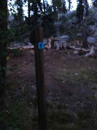
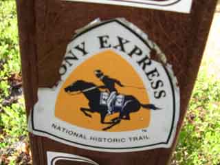
After crossing Highway 50 a brief hike South towards Echo Summit along the highway brings us to an interesting trail junction: The Pony Express Trail. More Information about the Pony Express Trail. The Pony Express Trail comes up Hawley Grade's sheer steep route from the trailhead along the South Upper Truckee Road in Meyers on the floor of the Tahoe Basin far below Echo Summit. Highway 50 is also part of the Lincoln Highway Scenic National Byway. Well, it's part of the Lincoln Highway, if not a part of the Scenic Byway. Check out the map below and note the proximity of the bottom of the Hawley Grade Trail with the trailhead into the Meiss Country Roadless Area from the end of the paved part of the South Upper Truckee Road. Hiking between these two trailheads can be a link in a delightful circular backpacking trip from Echo Summit back to Echo Summit via Showers Lake, Round Lake, and then hiking up the Hawley Grade to Echo Summit. As we depart Meiss Country Roadless Area we will note Red Lake Peak rising to our East. That is likely where Fremont and Kit Carson first viewed Lake Tahoe in 1844.
Transition from Desolation to Meiss Roadless Area
Miles and Elevations
The total distance to Echo Summit from our point crossing Highway 50 near Little Norway is .65 of a mile. |
 |
 |
| Above: Snow markers in trees approaching Echo Summit. | Above: What's this? A Pony Express Trail marker. |
 |
 |
Above: Close up, Pony Express Trail marker. |
Above: Pony Express Trail in background heading West towards Strawberry. |
Trail Information
| Highway 50 to Echo Summit |
Desolation Wilderness ended on the North side of Upper Echo Lake, but the Lake Tahoe Basin Administrative Unit continues to the Carson Gap. The Meiss Roadless Area, AKA Meiss Country, begins South of Echo Summit. These are the last steps we will take along this 30.71 mile hike we've done from the Meeks Bay Trailhead to the Echo Summit Trailhead. Our next section of trail is the brief hike across 10 mile hike from Echo Summit to the Carson Gap across the Meiss Country Roadless Area. From the Carson Gap to a mile past Carson Pass Tahoe to Yosemite hikers will encounter three junctions branching off to the Southwest and the Tahoe to Yosemite Trail's 25 rough miles to Lake Alpine. Southbound hikers will reamain on this main trail, the Pacific Crest Trail, for the 27.88 mile hike down to Ebbetts Pass. Echo Lake to Echo SummitElevations Lake Level Top of rise between Echo Lake and Echo Summit Highway 50 crossing Echo Summit trailhead Lower Echo Lake to Echo Summit Mileage 29.71 miles South from the Meeks Bay Trailhead. 1 mile South of the Echo Lake Trailhead. 1 mile South to Echo Summit Trailhead. 13 miles South to Carson Pass.
Meeks Bay to Echo Summit |
Camp Notes:
|
The trail on the South side of Highway 50 from our crossing point at Little Norway parallels the Highway to Echo Summit. Lots of car noise. The South Fork of the American River flows to our West, between our position on the trail and Highway 50. The South American River dries out late in the Summer season. |
Arriving at the Echo Summit Trail Head
 |
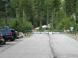 |
| Above: Last steps to the Echo Summit trailhead | Above: Echo Summit trailhead. Pacific Crest Trail is to the Right of the locked gate to Adventure Mountain |
 |
|
Above: Sign at Echo Summit trailhead |
|
North: Upper Echo Lake South: Echo Summit
Highway 50 to Echo Summit |
||
After crossing Highway 50 and heading South towards Echo Summit, we will encounter the Pony Express Trail junction. The Pony Express Trail heads West down to the town of Strawberry on Highway 50 from the junction pictured above. Heading East, the Pony Express trail follows our trail to Echo Summit, then continues East to descend into the Tahoe Basin via the Hawley Trail into Christmas Valley, Meyers. The Hawley trail intersects with the South Upper Truckee Road a half mile to/from our third Lake Tahoe trailhead option, the Round Lake trailhead at the end of South Upper Truckee Road's year-round maintained road. This would make an excellent loop: Echo Summit down Hawley Trail to Round Lake. From Round Lake to Showers Lake, and out to Echo Summit.
Above: Trailhead on South Upper Truckee Road, Meyers Trailhead, just South of the bottom of Hawley Trail from Echo Summit. Check the Echo Summit to Carson Pass Map for location details.
Information
Trail Miles and Elevations
Next page South
|
Backpacking Trail Guide
North
|
 |
Backpacking Trail Guide
South
|
Backpacker ForumsHave a great Sierra Nevada backpacking route or trip to relate? Post it on
Lower Echo Lake Add your backpacking experiences, comments, or pictures about heading from Desolation to Meiss: Section
|
North: Upper Echo Lake South: Echo Summit
Trailhead
Contact
Alex Wierbinski

Backpacking Lake Tahoe to Mount Whitney
Your guide to the High Sierra Crest, including the Tahoe to Yosemite, Pacific Crest, and John Muir Trails
