

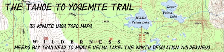

Meeks Bay to Middle Velma Lake
Topo Hiking Map
Tahoe to Yosemite Trailhead
to the
Junction with the Pacific Crest and Tahoe Rim Trails
Two 30 minute USGS Backpacking Topo Hiking Maps of the Desolation Wilderness
Desolation Wilderness Backpacking Information
| Topo Maps INDEX Meeks Bay to Echo Summit |
7.5 min topo map Meeks Bay Trailhead |
SOUTH 30 min TOPO MAP Phipps Pass to Echo Summit |
SOUTH 7.5 map Phipps Pass to Susie Lake |
Full Desolation Wilderness Topo Map |
Trail Guide |
all maps |
Miles and Elevations |
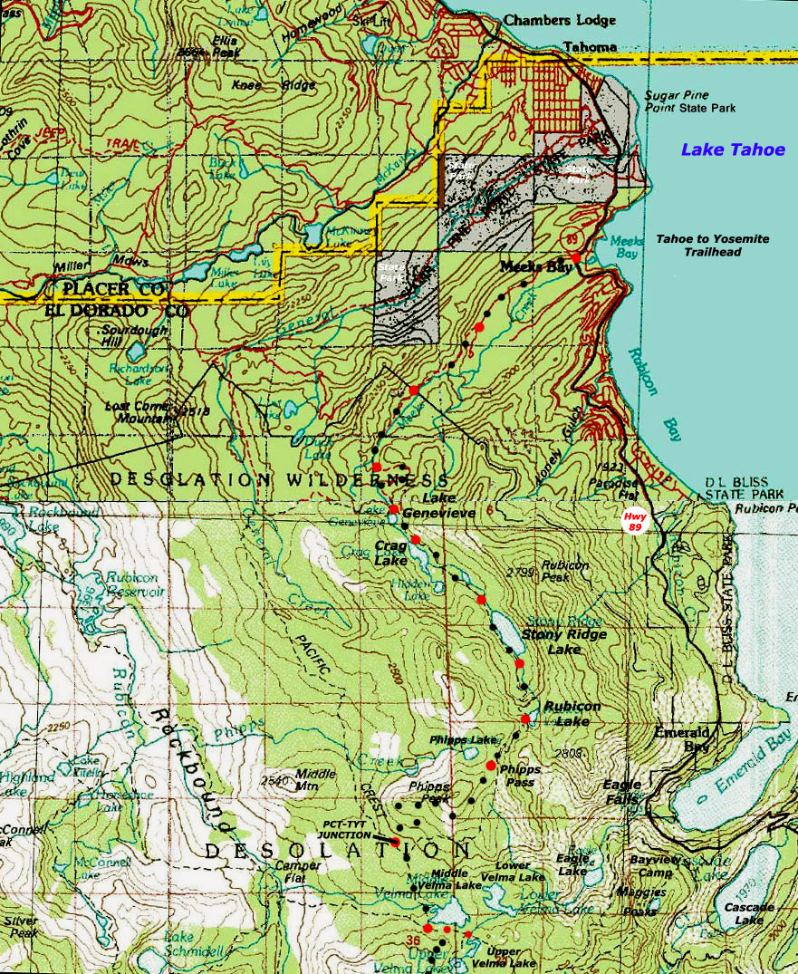
North Desolation Wilderness Backpacking Map
Backpacking
12.69 miles
from
Meeks Bay to Middle Velma Lake
Two USGS 30 minute topo hiking maps
| Click BLACK DOTS & MAP for Detailed Maps |
Click RED DOTS for Trail Guide Information |
| North Desolation 7.5 MAP Meeks Bay to Dicks Pass |
Mileage and Elevations | 30 TOPO MAP SOUTH Phipps Pass to Echo Summit |
Central Desolation 7.5 map Phipps Pass to Lake Aloha |
|
| North Desolation 7.5 MAP Meeks Bay to Dicks Pass |
Mileage and Elevations | 30 TOPO MAP SOUTH Phipps Pass to Echo Summit |
Central Desolation 7.5 map Phipps Pass to Lake Aloha |
Above
NORTH DESOLATION WILDERNESS
30 minute Backpacking Topo Map
Meeks Bay to Middle Velma Lake
Tahoe to Yosemite Trail
Meeks Bay trail head, |
||||
Main Feature These maps give our long hikes local context. In the North Desolation Wilderness we can see a possible hiking Loop out of and back to Meeks Bay via the General Creek Cross-Country route from the North side of Genevieve Lake. This is a faint non-maintained trail to the Pacific Crest Trail North of where our TYT joins the PCT and TRT. Hikers can loop back to Meeks Bay via Phipps Pass. The map above shows the General Creek Trail as a maintained route. It is not, but it is well traveled. We have medium-length destinations both to our North and South. Hiking South from the TYT junction with the PCT we can hike East from Upper Velma Lake to exit the Desolation Wilderness through the Camper Flat or Eagle Falls trailheads at Emerald Bay. As we hike South through Desolation Wilderness we are going to encounter a series of trail junctions leading to trailheads along the Western shore of Lake Tahoe and its bays and associated lakes. North of Meeks Bay a series of trailheads along Highway 89 offer access to the PCT route as it makes its way North from Desolation Wilderness up to Highway 80 passing East and West on the Northern Edge of the Tahoe Basin. Out of Meeks Bay 4.39 miles South of Meeks Bay Lake Genevieve is the first in a series of pretty lakes in a gently rising valley leading to the climb to Phipps Pass out of the South end of the valley. Beautiful Rock formations emerging out of forest as we climb higher frame the fine views decorating our last steps South to Phipps Pass. Lake Tahoe, Emerald Bay, and Cascade Lake all combine to provide a stunning backdrop to our views around the Southwestern corner of the Tahoe Basin highlighting our views of the amazing granite formations around Phipps Pass. Nature, in it's infinite Wisdom, gives us The Finger as we pass. Ha, I love Nature, though its fickle finger sometimes tries to rub us out, when brutally and beautifully informing us about ourselves. From Phipps Pass we begin to get great views Southeast of our next destination, Middle Velma Lake, backdropped by Maggies Peak. Dropping off the South flank of Phipps Pass quickly brings us to our junction with the Pacific Crest and Tahoe Rim Trails laying .85 of a mile North of Middle Velma Lake.
MAP NOTE What's important for our general reference purpose is that each side of a square is 1000 meters, or a Kilometer. From my point of view that is 1093 yards or .62 of a mile. Diagonal: 1414.22 meters, if my trig is correct. That converts into 4,639.8 feet or .88 of a mile.
|
Locate the Meeks Bay Trailhead
| Forest Road 14N42 begins the Tahoe to Yosemite Trail. |
| Meeks Bay on the West shore of Lake Tahoe along Highway 89. |
Backpacking Map Notes |
|
11.5 miles South of our Meeks Bay Trailhead the Lake Tahoe to Yosemite joins with the Tahoe Rim and the Pacific Crest trail just North of Middle Velma Lake. More maps covering the About Map Notes I have noted both of these route modifications on the map above. High Detail 7.5 Topo Map |
|
Mapping Information |
|
MileagesMeeks Bay to Middle Velma Lake: 12.69 miles Details Meeks Bay Trailhead to Lake Genevieve Lake Genevieve to the far South end of Stony Ridge Lake The South end of Stony Ridge Lake to the Pacific Crest Trail junction The Pacific Crest Trail junction to the Middle Velma Lake trail junction to camper flat, & Rockbound Valley
Total Trail Miles depicted on the map above:
Middle Velma to Echo Summit Middle Velma to Aloha Lake Aloha Lake to Echo Lake trail head
Meeks Bay trail head
Meeks Bay trail head |
USGS Topo Hiking Map InformationUpper Map Lower Map Compass Offset scale Contours
Backpacking Permitting Information Lake Tahoe Basin Management Unit LTBMU Fed's Site
National Forest LTBMU Desolation Wilderness Desolation Wilderness
Meeks Bay
Physical location Between Highway 89 at Meeks Bay and Highway 50 crossing Echo Summit. Physical location
|
North: Meeks Bay trail head 30 min MAP South: Middle Velma Lake to Aloha Lake
| Elevations | More Information | ||
Meeks Bay Lake Genevieve Phipps Pass Middle Velma Lake |
Trail Guide, Section Trail Guide, Segment Google Map |
||
Map Credit |
U.S. Geological Survey, Department of the Interior: The Get this topo from the:USGS Topographic |
Trail guide
Meeks Bay Trailhead