

High Sierra
Backpacking
Trail Guide
Forums
Sierra
Weather
WeatherNotes Northern
Sierra Weather
Gear
Backpacking
Lake Aloha
Hiking The Tahoe to Yosemite Trail & The Pacific Crest Trail through Desolation Wilderness
Languages
Trail Skills
Mountain
Safety
Food
Planning
Trail Arts
More
Information
Social
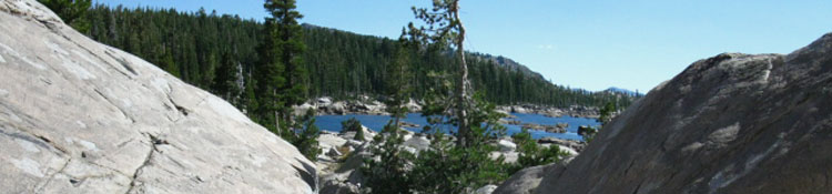
Lake AlohaHiking the short length of trail South & up from Heather Lake a commanding view of Lake Aloha from its Northern shore abruptly opens before us as we approach the Rubicon Trail Junction to Mosquito Pass. It's a very nice transition.
Meeks Bay to Echo Summit
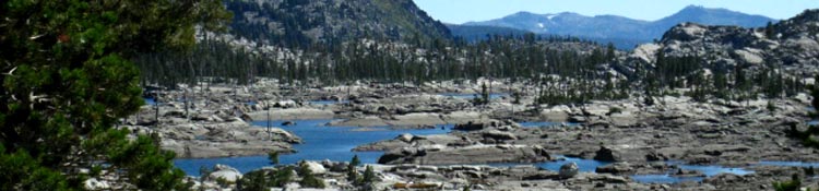
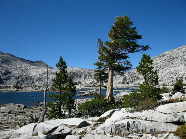
North Shore of Lake Aloha We're 7.55 miles North of the Trailhead on the South end of Desolation Wilderness at Lower Echo Lake.
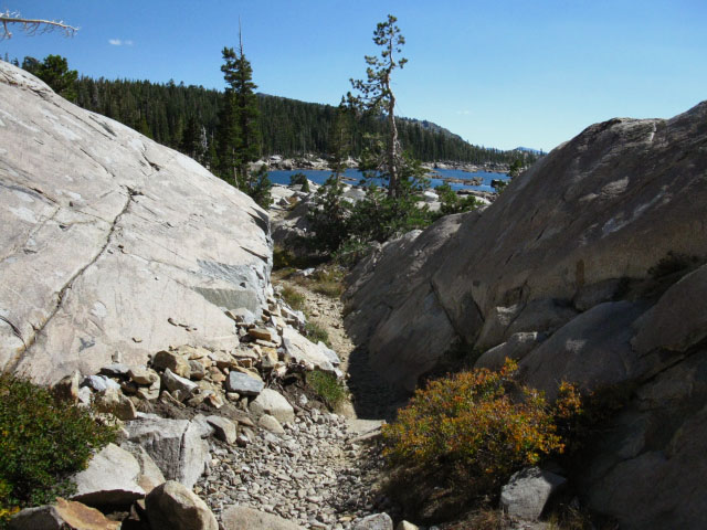
A stunning view of expansive granite surrounding the pure blue waters of Lake Aloha, all under vast expanse of granite running up to the hard spire of Pyramid Peak, comes into view as we hike around the last boulder. It is a sudden transition from hiking up a narrow chute to standing at the head of Desolation Valley's massive expanse of granite running South between Pyramid Peak and Cracked Crag. This view, and a trail junction running a trail leading West to the Mosquito Pass entrance into the South end of Rockbound Valley meet up here with the Southbound route on the Tahoe to Yosemite Trail, on the far North Shore of Lake Aloha. Note: This trail guide is traveling North to South through the Desolation Wilderness along the Pacific Crest Trail, the Tahoe to Yosemite Trail, and the Tahoe Rim Trail.
We need to hear about your questions, comments and Experiences here!
|
Rubicon Trail & Mosquito Pass
Trail Junction
on the
North Shore of Lake Aloha
 |
 |
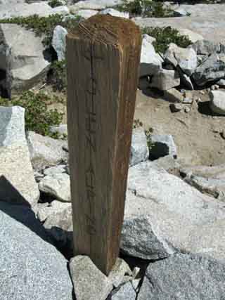
| To Glen Alpine Northbound PCT, Desolation Wilderness |
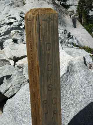
To Dicks Pass Northbound PCT, Desolation Wilderness |
Video
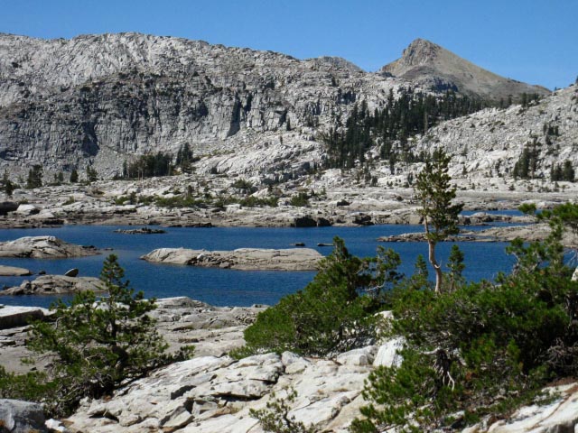
The Pacific Crest Trail across the North and Central sections of Lake Aloha
The great crystal blue expanse of Aloha Lake, one of the Desolation Wilderness great beauties. |
North: Heather to Susie Lakes South: Trail Junctions S of Aloha
Lets do The Numbers
| Aloha Lake, Desolation Wilderness |
Desolation WildernessAloha Lake Trail JunctionBackpacking South
|
Views North and South,
at the
half-way point
passing by
Lake Aloha
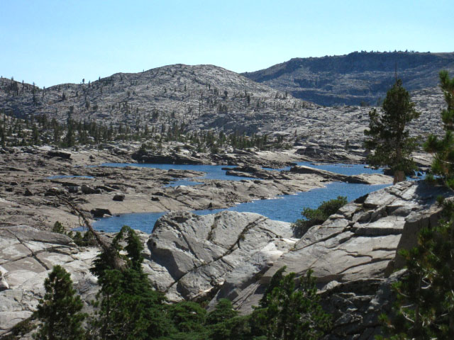
Time for Sunglasses This section of the Tahoe to Yosemite trail hiking along the East shore of Lake Aloha is flanked to our West by the crystal blue remnants of Lake Aloha, now retreating during Fall into many crystal-blue pools. It looks like the original crystal blue Sierra lake has been shattered into a thousand blue shards. Check out the differences between these two USGS maps. The 30 minute map shows Lake Aloha during Fall, the 15 minute map shows Lake Aloha as it appears during Fall. The shining glare off of Pyramid Peak's great granite slab is intense. The receded Fall water level on Lake Aloha has shrunk it down into lakelets, and each lakelet is sparkling as a powerful lens of reflected sunlight. The intensity of sunlight and beauty will push tears out of our eyes along this segment of the trail. Sunglasses, sunscreen, and our hat pay their freight for their weight in these conditions. They all come in real handy here. Caught within this cocoon of reflections off rock and water, all based on and reinforced by the Sun itself, gave me the impression that I was cooking myself up in a solar furnace. Let's look at the Pictures! |
Lake Aloha in Pictures
Jacks Peak and the Trail North to Heather Lake
 |
View North at Jacks Peak rising above Lake Aloha, above the channel through the terrain to Heather Lake, while backpacking South along Eastern side of Lake Aloha, Desolation Wilderness. |
 |
||
Mosquito Pass, North Side Lake Aloha, Desolation Wilderness. That's the way over into the South end of Rockbound Valley. The route from the trail junction on the North Shore of Lake Aloha to the Camper Flat trail junction in Rockbound Valley is 6.12 miles. Camper Flat is 1.43 miles West of the Tahoe to Yosemite Trail junction near Middle Velma Lake. The Middle Velma Lake trail junction is 8.74 miles North along the Tahoe to Yosemite/Pacific Crest Trail route. This means that the Rockbound Valley Loop from Mosquito Pass back to Mosquito Pass is 16.29 miles before you figure out how many miles it you are going to hike in and out to the loop... We can see that the trail over Mosquito Pass into Rockbound Valley, then North up to the Velma Lakes Trail at Camper Flat opens up interesting backpacking loop possibilities around the North-Central Desolation Wilderness.
|
View Southwest across Lake Aloha
 |
South Side Lake Aloha, Desolation Wilderness. The Southbound trail enters the strip of forest at the Right base of the granite dome beyond the far end of Lake Aloha. |
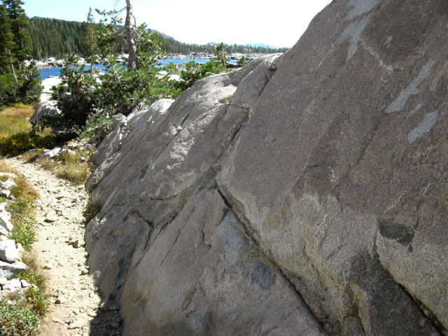
Fine Trail and Terrain around Lake Aloha
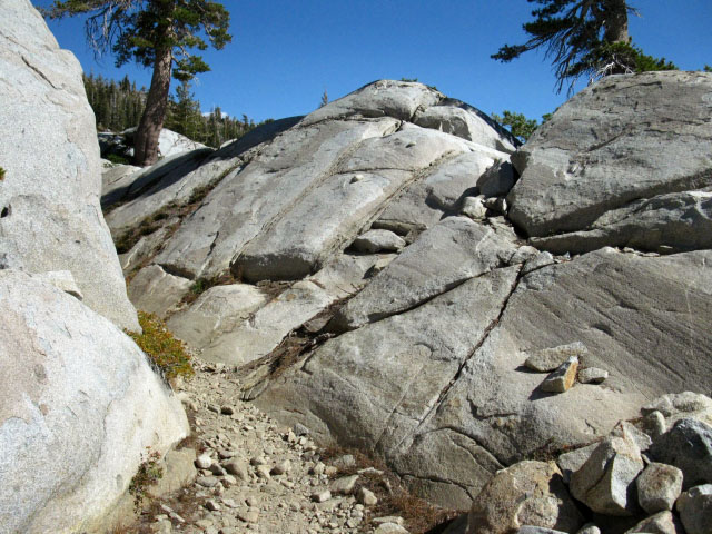 |
Trail Feature, winding our way around cool granite protrusions along Lake Aloha, Desolation Wilderness. |
View South out Drainage to Twin Bridges
 |
Pyramid Creek falls down the West flank of the Sierra down to Twin Bridges along Highway 50. In the picture above we are looking that way. When you drive across the Bridge at Twin Bridges, look North up the mountain flank to see Pyramid Creek flowing down the mountain from Lake Aloha in Desolation Wilderness. This is where it came from. In the far distance we are seeing the peaks around Kirkwood on Highway 88. I think that's Thunder Mountain on the Right and Thimble Peak on the Left in the far far distant South. Note how the USGS maps depict Lake Aloha both full with Spring Thaw and withdrawn into a multitude of pools. Which is correct depends on what time of year you observe Lake Aloha. |
North: Heather to Susie Lakes South: Trail Junctions S of Aloha
Backpacking Lake AlohaDeparting Desolation Wilderness |
The Tahoe to Yosemite Trail follows the Eastern shoreline of Lake Aloha for almost two miles before turning down into the forest line. After sustained miles on a hard surface, entering the forest with its softer trail bed and shade is refreshing. Consider the impact of hard granite surfaces on knees, feet, and so on. Consider it when picking boots. Consider it when planning daily miles. Consider it when packing the first aid kit.
Topo Hiking Map: Phipps Pass to Susie Lake Topo Hiking Map: Lake Aloha
Next page |
Video
Backpacking past Central and Southern Lake Aloha
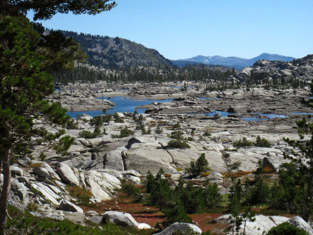
South Lake AlohaOnce we reach the North side of Lake Aloha we get clear views down our Southbound route through the wide open expanse of Desolation Valley for the next couple of miles. We'll be hiking between the Northeast shore of Lake Aloha and the Southwest flank of Cracked Craig.
Meeks Bay to Echo Summit
The open granite terrain and the shattered spattering of Lake Aloha's Fall configuration of lake-lets scattered over the terrain are visible down to the point where the our Southbound trail climbs a low rise to enter the forest, visible in the far distance, for our drop down to Upper Echo Lake. This segment of trail finishes our hike South along Lake Aloha through Desolation Valley.
|
Winding through the maze of great granite slabs, boulders, and rocks along the Southern Lake Aloha shore. |
North: Heather to Susie Lakes South: Trail Junctions S of Aloha
The Numbers
| South Shore of Aloha Lake in Desolation Wilderness |
Desolation WildernessSouthern Shore of Lake AlohaLake of the Woods trail junctionElevation Mileage 22.58 miles South from the Meeks Bay Trailhead. 6.13 miles to the Echo Lake Trailhead. note: Mileage sign at Echo Lake trailhead states: Aloha Lake 5 miles. This is incorrect according to my measurements and experience. Meeks Bay to Echo Summit |
South Shore of Lake Aloha
 |
The trail winds through a beautiful granite landscape on the East side of Lake Aloha. The peak in the distance is one of the mountains on the South side of the Echo Lakes. Either Ralston Peak or Talking Mountain. |
The Central and Southern Shores of Lake Aloha
| The trail winds through, around, and by some beautiful, strange, and intriguing granite formations as we pass South along the East shore of Lake Aloha. |
 |
Tahoe to Yosemite Trail along great granite formation, Lake Aloha, Desolation Wilderness. |
Cracked Craig
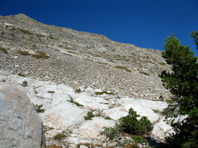 |
| Shattered surface of Cracked Crag. |
Continuing SouthAs we proceed South through Desolation Valley we can see the granite terrain reach far to the Southwest, further than we can actually see. Beyond our vision Pyramid Creek and the granite terrain create some fine falls where they run together all the way down to Twin Bridges on Highway 50. But our trail does not go so far. Our trail keeps a Southeast line to enter the forest when we first encounter the forest fringe, bending gently Southeast and downward towards the Echo Lakes. |
North: Heather to Susie Lakes South: Trail Junctions S of Aloha
South Side of Lake Aloha |
||
At the South end of Lake Aloha an expansive view to the Southwest opens up, flanked to the North by Pyramid Peak and its massive granite slab. The first trail junction on the South Side of Lake Aloha, the trail to Lake of the Woods, breaks off to our right. The Echo Lake trail head is 6.13 miles straight past this junction. From here the elevation drop puts us into forest, which means shade and softer trail surfaces,, which will accompany us all the way to Echo Lake trailhead on the trail along the North shores of the Echo Lakes. Passing Echo Lakes the forests deepen approaching and into the Meiss Roadless Area through the Echo Summit trailhead.
Meeks Bay to Echo Summit Forum
Maps
30 min Map
South Trail Guide |
Backpacking Trail Guide
North
|
 |
Backpacking Trail Guide
South
|
Backpacker Forum
|
| High Sierra Trails | High Sierra Topics |
Add your experiences, comments, or pictures about Lake Aloha, or this whole section of trail below.
Section
Meeks Bay to Echo Summit
Segment
Lake Aloha
North: Heather to Susie Lakes South: Trail Junctions S of Aloha
Trailhead
Contact
Alex Wierbinski

Backpacking Lake Tahoe to Mount Whitney
Your guide to the High Sierra Crest, including the Tahoe to Yosemite, Pacific Crest, and John Muir Trails
