The Trails
Guide
Maps
Miles/Ele
Permits
Resupply
Forum
Current Weather Conditions
Weather Notes
Northern High Sierras
Central High Sierras
Southern High Sierras
Gear
Gear List
Gettin Started
Layering
Discussion
Testing yourself and your gear
Gear Reviews
Backpacking
Round Lake
Meiss Country Roadless Area
Languages
Languages
Trail Arts
The art of walking
Physical Preperation
Trail Skills
The trail
Off the trail
Scrambling
Maps
Navigation
Camp skills
Food
Resupply
Food
Other
Photo Catagories
Trail Stories
Trail Culture
News and Science
Links
Groups
Books
Terms and Conditions of Use
| Trail Guide INDEX |
NORTH Meiss Country Roadless to Round Lake |
Topo Map South Upper Truckee to Carson Pass |
Maps INDEX | MILES and ELEVATIONS |
Miles and Elevations INDEX |
Tahoe to Whitney on YouTube |
Round Lake
Four-Season Beauty and Campsites
Two Views South
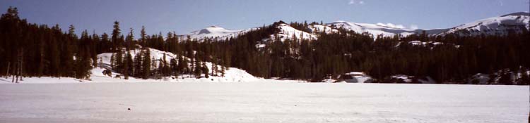
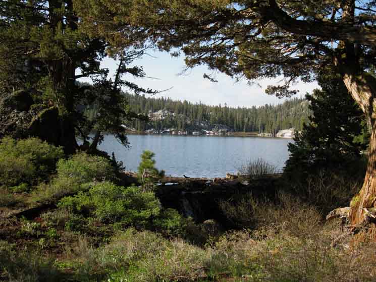
Same Angle, Different Seasons
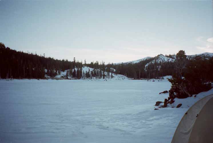
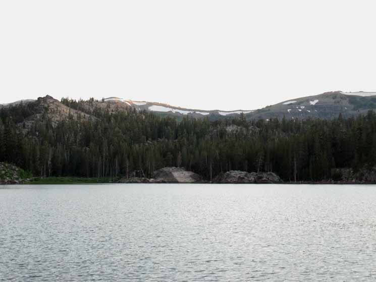
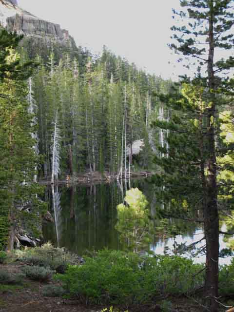
View South across Round Lake. We're in the Northwest corner of Round Lake. |
||||
 |
||||
The perfect forest frame for a beautiful Summer day kicking it by Round Lake, July 16 2009. We can see some of the water from the Spring Thaw still flowing over the check dam.
Information Map, Miles, and Elevations
and Comments
Round Lake is a pretty place to relax and soak in tranquil views after soaking in sweat on the stiff trail up from the South Upper Truckee Trailhead. |
Winter View South
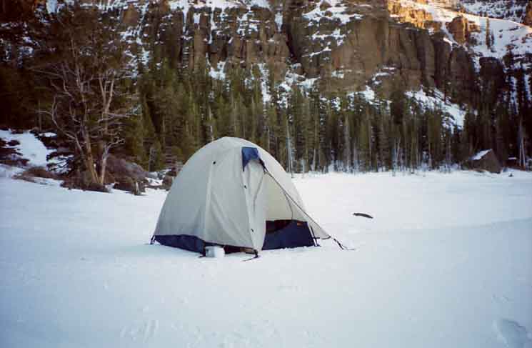
| The Same View, but we are camping on the flat apron of the shrunken and frozen Round lake, rather than on the irregular surface along the shore-side terrain. |
 |
Once the shrunken lake of Fall freezes over snowfall again fills the lake up to its Summertime high water mark. This deposits a nice flat snow surface along the edge of the lake for our campsite. Spring and Fall Backpackers Al Story Our route South from Round Lake towards Meiss Meadow (or Showers Lake) climbs out to the left of the snow covered rock along the shore of Round Lake towards Meiss Meadow, located two miles to the South of Round Lake. 2001. Can you see the section of open snow off the Left flank and a bit behind that large snow-covered lakeside rock? If so, we are looking at a rough, very brushy meadow that the Summertime trail route up to Meiss Meadow circles around, above its high side. During Winter we snow shoe straight up the center of that meadow when the snow covers its dense brush, on our way up to Meiss Meadow. |
Trails and Miles
Information
South Upper Truckee Road TrailheadArriving at Round Lake can be the final destination of our local backpacking trip, the first steps of a longer hiking trip into the Meiss Country Roadless Area, or the beginning of a much longer hiking adventure down to Yosemite on our way to the Whitney Portal. Meiss Country Roadless Area Elevation Mileage miles and elevations Local Options
|
| 15 min Hiking Map Meiss Country Roadless Area |
30 min Hiking Map Echo Summit to Round Top Lake |
miles and elevations
Meyers to Carson Pass
Backpacking Meiss Country Roadless Area
We've got some real nice short backpacking trips for beginning and intermediate backpackers in the Meiss Country Roadless Area. These short backpacking trips contain all of the elements that make High Sierra Backpacking challenging, but within a fairly small space, and in reasonably limited doses.
I'd call the Meiss Country "accessible."
Moderately high elevation, some steep trails and terrain, and the enduring beauty of mixed granite and volcanic terrain shrouded in dense forests with a few beautiful "Sierra-Blue" lakes scattered about, all within a few miles of the South Upper Truckee and Big Meadow Trailheads, make Meiss Country Roadless Area one of the best ways to easily access the High Sierra Backpacking Experience.
Thus the Meiss Country, and specifically Round Lake, is a good place for experienced backpackers who've been off the trail for too long, or don't have too much time, to get their backpacking "fix," as well as a great place for beginning backpackers to get a reasonable introduction to the pleasures and pains of High Sierra Backpacking.
This is a great place to bring kids up to the "next level" of their backpacking development, once they've mastered basic skills and fitness. The Sierra beauty we seek to expose them to comes wrapped in steeper trails, thinner air, and dense forests giving this hike a degree of difficulty not found at lower elevations.
This place can "fix" up beginning and expert backpackers with what each needs. A stiff short shot of backpacking for the expert, or a not-too-stressful introduction into the rigors and rewards of High Sierra Backpacking for the beginner.
Take it as you need it.
Winter Aspects of Round Lake
| Winter Camp at Round Lake. | |||
 |
|||
Old School Half-Dome Tent. 5.5 lbs. The Meiss Country Roadless Area for Winter Travelers The routes into Meiss Country Roadless Area through the Big Meadow and Carson Pass Trailheads offer fairly easy access to snow conditions for beginning snow backpackers. Anyone beginning snow travel into the High Sierra has got to get a few things in order. First, one should be a well-experienced fit Summertime High Sierra backpacker who is totally familiar with the area during Summer that they plan on entering during Winter conditions. Second, prudence indicates that our first trips should be during Spring or Late Spring, after the threat of powerful Winter storms has diminished, and before the dangerous stages of the Spring Thaw begins. As we build Winter skills and experience we will push our trips earlier into Spring, and beginning adding in Fall trips. The first steps towards the goal of developing Mid-Winter skills is collecting up the gear and skills to hike earlier during Spring and later into Fall conditions each year, until you eventually gain the skills and experience and collect the gear necessary for year round backpacking. Forum Snow Videos
|
A different Winter Camp at Round Lake. View South across West shore of Round Lake. The furthest ridgeline is the Tahoe Rim rising above the North end of Meiss Meadow. |
||
 |
||
Same Old School Half-Dome Tent, November 2011. Tent Use and Selection The reason I prefer a bigger tent for rain is it is much easier to take off and store wet gear while entering the tent. I can remove the jacket and pants entering the atrium, shake them out, then store them on my string rack strung across the upper part of the tent, like a spider web. This set up allows me to keep the wet stuff out of my way, and out of the working/relaxing floor space of the tent. During Winter snow storms I just need to shake off all the snow before sliding into the coffin-like shape of the Walrus Microswift. Since my gear is not wet, I do not need to suspend it from the ceiling of the tent. Thus the low profile of the Microswift is not the problem during snow as it is during rain. Heck, I might end up wearing all my clothes in the sleeping bag inside the Microswift during Winter, anyway. Try getting into and out of the Microswift, or any other low-profile lightweight tent when wet. It is a nightmare. Then try to figure out what to do with your wet coat and pants once inside such a cramped tent. Wet gear in a tight tent ends up getting everything else wet. This brings out a key point for four-season High Sierra Backpackers: We must figure and bring the gear that makes life as easy as possible for the conditions we are operating under. If our gear is constantly frustrating us we are wasting a huge amount of energy unnecessarily. The real factors that control my basic decision of which tent to bring during Fall-Winter-Spring backpacking trips revolves around how long I am going to be spending in the tent, and under what weather conditions I will be confined. For snow and the possibility of blizzards blowing in feet of snow rapidly, the Walrus Microswift is my number one choice. I can easily and quickly bury it by using my MSR snowshoes as a shovel to cut out a nice six-foot long by three foot wide by two feet deep trench within which I set up and then bury the Microswift. If we're doing some late Spring or early Fall backpacking during a succession of rainstorms blowing in off the Pacific Ocean, we're going to bring the big old REI Half-Dome. Sitting up within the Half Dome and being able to cook in the atrium during the many hours we are going to be in the tent is total luxury/joy. Other factors affect my gear selection. If I only have one tent, I bring what I've got, and develop technics and practices to make it work. Sometimes we've got what we need, other times we run what we've got!
Weather |
Round Lake to Meiss Meadow
Winter to Spring
March 19-20, 2010
| Snow Camping at Round Lake | |||
|
We're snow shoeing into the North end of Meiss Meadow via Meiss Lake. This map lays out the terrain described: Hiking Map South This is what I call the "Western" Winter Route up to Meiss Meadow from Round Lake. At the head of the meadow area behind the big rock on the Southeast shore of Round Lake we turn Southwest through a gap at the top of the first, lower meadow, into a second upper meadow. There's a narrow neck of terrain with a route through it at the top of the meadow above Round Lake. In the Southwest corner of the meadow there is a passage between the top of the rock formation pinching towards a corner of the dense forest to the Southeast. We pass through that gap into a higher, smaller meadow stretching to the South. Looking Southwest diagonally across this upper meadow we will find a route tracking Southwest to the North shore of Meiss Lake. That's what I call the "West" route from Round Lake to Meiss Lake and Meiss Meadow. From here at the Southeast corner of the upper meadow above Round Lake we can also pursue an "Eastern" route to Meiss Meadow. Turning East by Southeast from the upper meadow we work our way into the upper meadow of the next set of two meadows. The next two meadows each lay at the northern base of the two low rises we have to climb on our way to Meiss Meadow. All of these routes are great Wintertime routes, but not good Summertime cross-country routes due to the dense undergrowth. This undergrowth is buried by the snows of Winter, making the terrain delightfully passable. Hiking Map South Once we get around the Eastern edge of the upper low ridge and into the far Eastern edge of Meiss Meadow we are positioned almost directly in line, but offset a bit to the East of, the center of the South Upper Truckee ravine that brings us up to the Carson Gap and out of the Lake Tahoe Basin. We have three distinct and really fun route finding challenges between Round Lake and Meiss Meadow during Winter conditions. As we saw in the video above, the Western route from Round Lake to Meiss Meadow via Meiss Lake is the local's favorite. I've been the first one who opened up the route from South Upper Truckee Trailhead to Round Lake a few times, after last storm of Spring puts its final coat of snow onto the terrain. Beginning snow backpackers who are a little shaky on route-finding skills will have pretty good routes to follow once these snow routes are firmly etched into the terrain by people like me and the local snow travelers during mid-to-late Spring. I don't care if you "expect the unexpected," as long as you are ready for what can happen. The Middle and Eastern routes from Round Lake to Meiss Meadow are "do it yourselfers," in that I've never seen locals open those up as "routes." That's because they are self-selected routes that vary with conditions. I have seen the tracks of lone skiers and snow-shoers on Eastern and Middle routes, and though my route selection choices may overlap with other hikers they differ significantly. The Western route is pretty much the easiest way between Round Lake and Meiss Meadow, though not the funniest! Forum Snow Videos
|
Spring
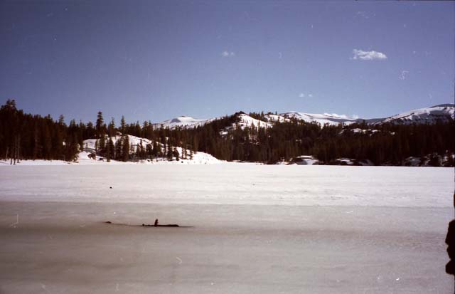
Soft-Frozen Round Lake
| Springtime-Soft Round Lake during May 2002. | ||
 |
||
The granite feature on the South side of the lake is shrouded in snow. Note that conditions vary considerable during Spring from year to year. Recently, we can take note of the Winter of 2010-2011, which developed into heavy Spring snows. Trails cleared very late in the year, and snow pockets remained to be covered by the snows of late 2011. These conditions can be expected to repeat during the Spring of 2015 if the El Nino conditions developing during the late Spring of 2014 consolidate. Contrast this with the "non" Winter of 2013-2014, where little snow fell during Winter, and enough fell in Spring to record the lowest snowpack readings on record during the Spring of 2014. Though the overall trend of the seasonal transitions is moving towards shorter drier Winters divided by what seems to me to be Endless Summers, the natural variability of the Sierra Nevada Seasonal Cycle still makes each year unique. Every aspect of the Sierra is affected by the character of the High Sierra Seasonal Cycle. The timing, intensity, and duration of the Spring Thaw sets the table for the rest of the Summer's evolution. The evolution of High Sierra Weather towards drier conditions and longer Summers is having the effect of "slowing down time" across the Sierra Range. The decline of the snowpack and its subsequent dampening of the Spring Thaw's forces of erosion and life are receding hand in hand. The weakening of the snowpack and thaw has not just slowed the physical aspect of erosion, but it has weakened the living force of nature. This living force of nature is the fundamental force that has gradually been converting both granite and volcanic terrain into meadows and forests. The reduced watering of the trees has slowed their inextricable march into granite terrain. Forests are amazing things. They integrate their individual and group motivations to work together as what I call, "The Brethren." The diminishment of Winter has slowed, even turned this whole process around. Time is moving backward in the Sierra Nevada, towards a future reflecting a less fertile time of the Sierra Nevada's past. A time before the trees had penetrated far into its rocky armor. Without water the present penetration of forest into rock will be repulsed. These changes are happening so rapidly we will only see their full extent when great areas of forest terrain are no longer able to provide the moisture and temps necessary to support their current populations of moister fir and pine species, and subsequently burns down. These vast zones of Ponderosa and Fir forest will burn and never return, for they will quickly be replaced by pinion pines. This "drying out" mechanism is in mid process right now, and growing rapidly to broadly reveal the grim future we face during the ultra dry Spring and rainless Winter of 2014. See the remnants of the classic ancient Sierra Nevada webs and engines of life now, before they are gone. The dryness is marching up the mountains as it spreads across the calendar, and both are being ignored by those who created these changes, as these changes indicate that the fundamental engines and webs of life that support everything are diminishing. We are the lobotomizers of man and nature. We'll rectify this problem, if we really are as smart as we think we are. |
South Upper Truckee to Round Lake
Spring Snow Backpacking
June 5, 2010
| Hiking to the North side of Meiss Lake from Round Lake | ||
Partial Playlist
|
The Liquid Form of Round Lake
Delightful
North: Meiss Country Roadless to Round Lake South: Hiking South Past Round Lake
July at Round Lake
2009
| Round Lake full in Summer. View South from the North shore of the lake. Note the granite rocks and formations on the far side of Round Lake, all sitting wrapped under in the surrounding arm of the volcanic ridge making up the Southwestern end of the Tahoe Rim. | ||
 |
||
Fresh clean water, too many mosquitoes, and the beautiful blush of abundant Spring Flowers adding color to everything. Background crestline of the Tahoe Rim sits above the North end of Meiss Meadow, nestled in at the base of the Southern end of the Tahoe Basin. See that volcanic rock face in the distant Right of the image? Here's views of that volcanic face from Meiss Lake and while hiking South to Meiss Meadow from Showers Lake. We know that the North (-by the trail direction-West by the compass) end of Meiss Meadow runs along the foot of the Tahoe Rim below that volcanic face.
|
Sweet Sunset
| Summer View to the South across Round Lake. We will exit the Tahoe Basin across the low point in the far distant ridge line. | ||
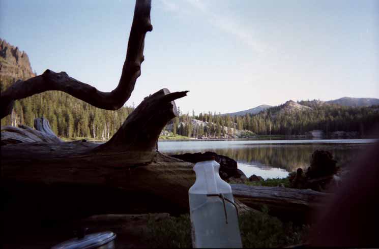 |
||
Water and Aluminum cooking pot in foreground, Landmark cliff in background Left. The low point in the far ridge line is the Southwestern extent of Tahoe Basin, and we can see the ridge line dropping down to just a few feet West of the Carson Gap, which is the low point along that ridgeline where we will exit the Tahoe Basin tomorrow. The Map below on the Left shows good detail of the upcoming trail to Meiss Meadow and out of the Tahoe Basin through the Carson Gap. The Map at Right gives us a good overall context on our upcoming trail options once we hike South out of Meiss Country Roadless area and the Lake Tahoe Basin.
Don't forget that the red dots on all the maps are linked to that position's trail guide entry, while the black dots on the larger 30 minute maps are linked to the underlying detailed maps. The labels on the maps pointing to the maps North and South are also linked to those maps. |
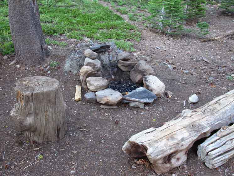
High Sierra Check Dams
The Round Lake Check Dam
Round Lake, like almost every large and small lake in the Sierras, is the product of a check dam. Most of the check dams were put up by early sheep herders, then reinforced and expanded by ranchers as they displaced the herders. Round Lake has one of the more substantial check dams. |
 |
I am an advocate of maintaining the historic check dams that created our favorite High Sierra Lakes. The traditional use of these legacy check dam lakes has passed from their original builders, the early ranchers and herders in the High Sierras, to today's backpackers, horsemen, and hunters. I believe that ending the check dams as the Sierras are warming up and drying out is a bad idea. Other High Sierra Check Dams we've seen in the Lake Tahoe Basin: Forum |
Behind Round Lake's North Shore Campsites
Gully-Stream leading down to South Upper Truckee-Big Meadow Trail
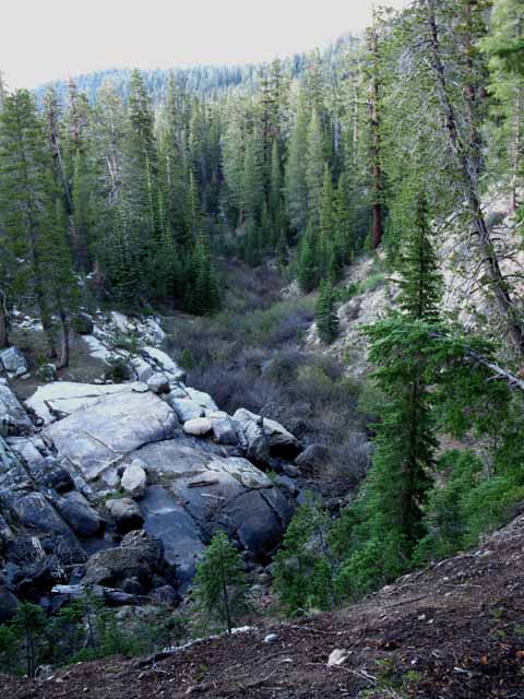 |
View This is the gully/stream we saw to our Right while hiking up from the South Upper Truckee Trailhead, shortly after passing the Big Meadow trail junction. To the Right of our position on the top of this ridge are the campsites nestled into the folds of this ridge along the North Shore of Round Lake. Note the brush down in that gully that I was speaking of as we hiked past on the trail. Getting through that crap is a real nightmare. Once it fills with snow this gully offers an easier way up to Round Lake, if there is no avalanche danger coming off the high point from which this picture was shot. Check out the map below. It depicts this gully below the North flank of the ridge along the North shore of Round Lake. Hiking Map South |
This Guide Is set up so that you can add your perspective & experiences here to broaden the trail guide's view of this area. That's the High Sierra Backpacker's Trails and Topics Forums. Check the Forum that's linked to from every trail guide page for more information, or to add yours about that location. Questions and comments always welcome. The more perspectives and experiences we have the better we cover the place and how people experience it. Good questions and comments help us all understand the terrain. General & Current Information Backpacking Topics This Location's Forum |
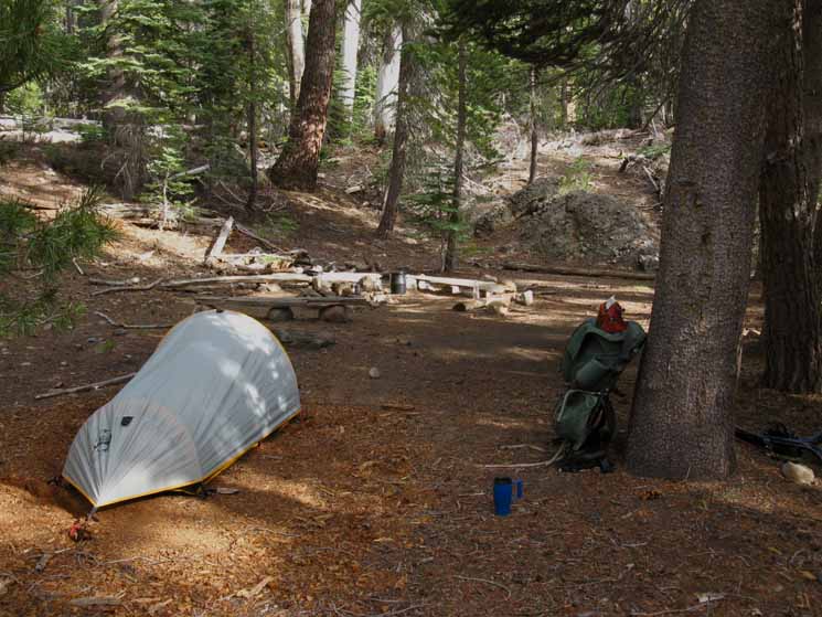
Round Lake Summer Campsites
| A large site sits in a little bowl next to the trail along the Northeast shore of Round Lake. |
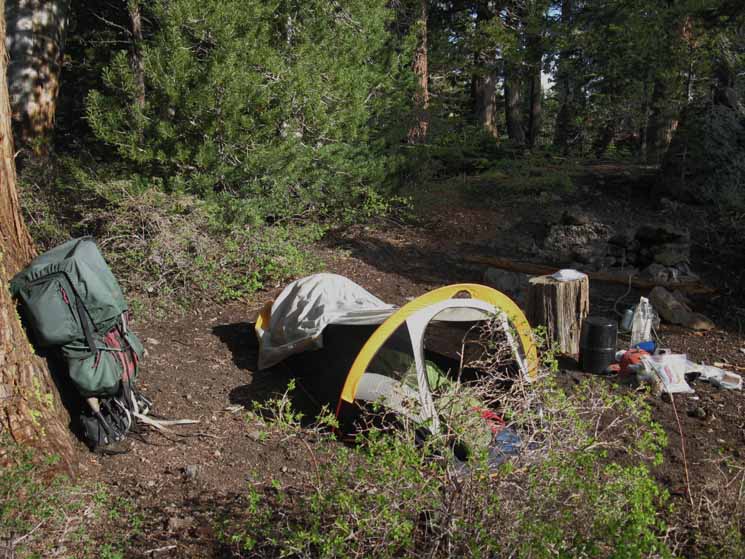 |
The tent was set up for rain squalls, and left up for mosquito protection. 2.2 lb Walrus Micro-Swift. Cascade Designs bought Walrus, and no longer manufacturers the Micro Swift. I purchased it on sale for less than ninety bucks over ten years ago (2014), and counting. |
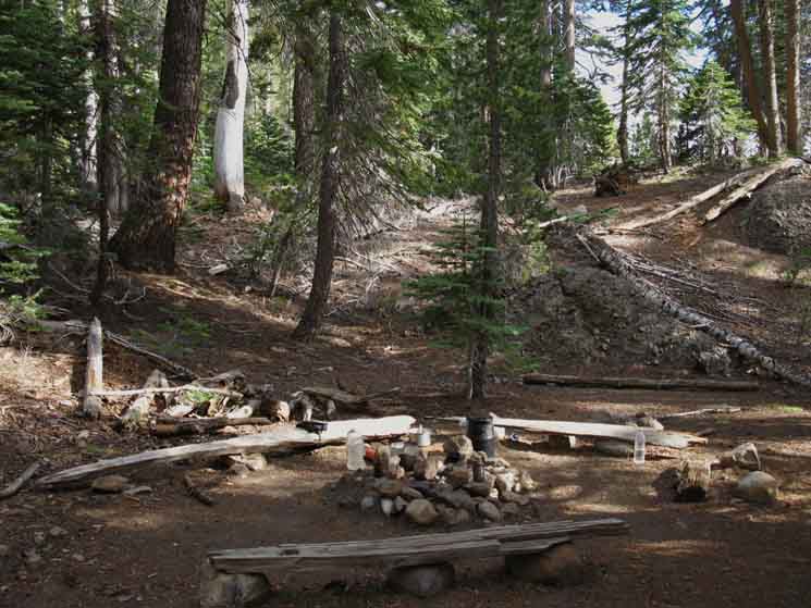
Camping at Round Lake
| Round Lake basics: |
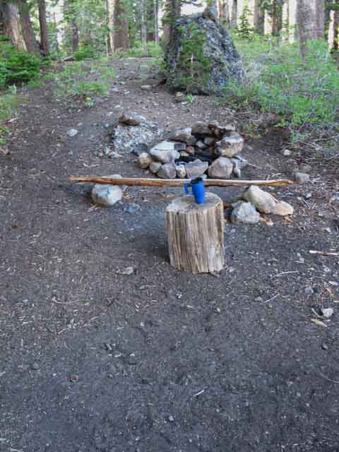 |
Seat, Table, Hot Chocolate, and two different kinds of rock. I don't make fires, so the fire ring remains unused. Note the big composite boulder beyond the fire ring, amid the granite. |
Round Lake Campsite
| This is the same site as pictured above. |
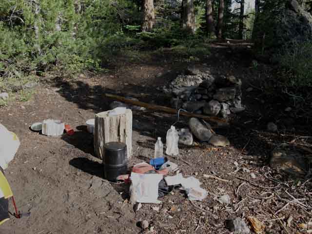 |
| Campsite laid out for water and cooking comfort. |
Round Lake CampsitesComing in from the North to Round Lake, either up from the South Upper Truckee Road trailhead, or laterally, from the Big Meadow Trailhead brings us to the Northeast corner of Round Lake. From the Northeast corner of Round Lake we notice the trail cutting off to our right, directly West above the North shore of Round Lake. To the West along this trail down the North shore to the check dam there are a series of campsites to the Right of this trail spanning the spectrum of sophistication from simple flats to fully developed sites with fire rings, benches, and flattened areas for sleeping/tents. If we continue South past this trail down the North shore of Round Lake we will see the series of campsites along its East Shore off to our left. |
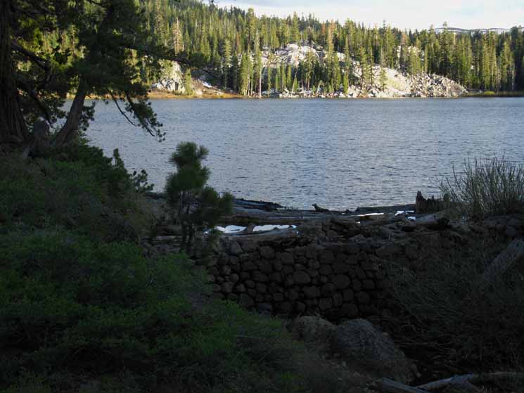
North Shore Round Lake Campsites
| This is one of three distinct campsites at the end of the trail down the North shore of Round Lake. |
 |
At the end of the trail along the North Shore of Round Lake we come to a bluff overlooking the little gorge spanned by the impressive Round Lake Check Dam. This drainage makes a "wishbone" split a few dozen yards below the Check Dam. Above, we saw that one arm of the gorge drains to the Northeast, wrapping around the base of the North flank of the ridge along the North shore of Round Lake, heading Northeast towards the Big Meadow Junction to reveal itself as the top of the tributary we followed all the way up to the Big Meadow trail junction from the South Upper Truckee Trailhead. The other branch of the gorge, the main branch, runs down to the Northwest as one of the headwaters streams feeding the South Upper Truckee River, but from much higher up the valley than the branch splitting off Northeast from the South Upper Truckee River trailhead that we followed up to the Big Meadow trail junction. Hiking Map South |
North: Meiss Country Roadless to Round Lake South: Hiking South Past Round Lake
Round Lake Spring Visitor
Badass little Doe
This stout little girl cruised up on a grazing run with a determined intensity that caught my attention. This little girl seemed both highly directed and motivated. She was on a mission. |
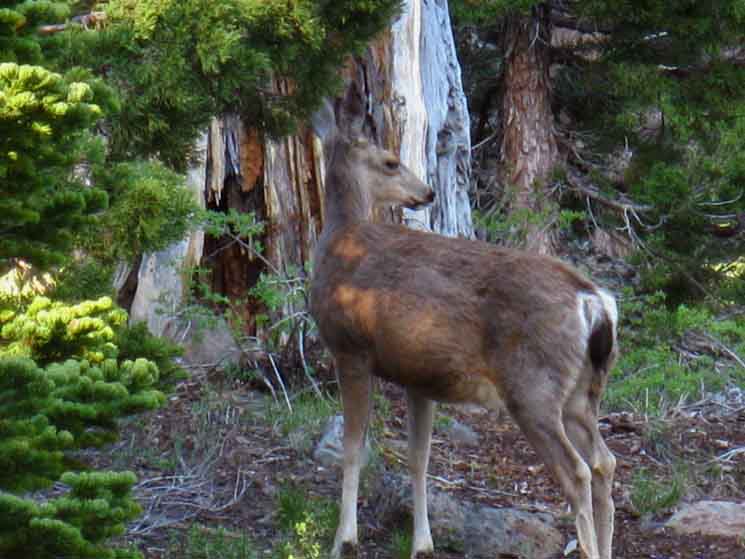 |
She was "high stepping," meaning she was taking exaggerated steps, and appeared to be a bit "bothered," as in indignant, rather than scared by my presence. She was imparting that I was in her space, not her in mine. Ah, a rowdy chick... That got me up from my reclined position, to get some shots. Deer are a trip, if you can get near the deer. This little girl was a bit wary when I rose up, but I figured her determined character would keep her near, and I've got ways. I sweet talked her and she settled down to eat, though always keeping an ear, if not an eye on me, and continued to stamp out her rowdy character as she did her Round Lake grazing run. |
| I didn't spook or crowd her, I made friendly noises, so she tolerated my intrusion into her meal cruise. |
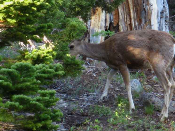 |
Stubborn little Doe Grazing with one eye on Alex. "Yeah, I'm watching you..." |
Various Round Lake Campsites
Detail of Round Lake Campsite Above
| This is the first site we see hiking South into Round Lake. |
 |
This is the site we can see if we keep our eyes open and look to our Right, the West, as we hike our final steps Southbound down to Round Lake from the South Upper Truckee or Big Meadow Trailheads. Off to the Right out of the frame of the image above is a fallen tree between low rises in the terrain. Just beyond that is the trail South down to Round Lake. Staying here we will be able to see hikers approaching or departing the North shore of Round Lake. They can see us camping here, but only if they know where to look when they are hiking past. This is also the first campsite along the short trail we see running North, to our Right, if we turn West when we arrive at Round Lake to walk down its North shore. |
Campsites at Round Lake Round Lake has a series of campsites along its Northern and Eastern shores. I prefer the campsites along the Northern shore. Campsites are peppered along the ridge rising above the North shore trail to the check dam. You will see that a large campsite sits in a soft depression if you explore the first trail off to your Right (North), off the trail down to the check dam on the Northwest corner of Round Lake. Turning off the main route to hike West along the lakeside trail down the North shore of Round Lake reveals a series of campsites to our right between where the terrain rises above the lake to where the steep drop towards Lake Tahoe begins. These are private little sites nestled into the folded terrain along the North shore of Round Lake. At the end of the trail along the North shore of Round Lake we come to the check dam that maintains the lake, and a series of open campsites above the check dam. These are highly improved sites with nice views of the Round Lake Pinnacle and the surrounding granite and forest terrain. Staying on the main trail hiking South along the East side of Round Lake reveals a series of sites along the East side of Round Lake. I've stayed in these East side sites a couple of times, but I always look with caution at the big field of huge composite boulders littering the forest floor slope below the shedding Round Lake Pinnacle and the East shore of Round Lake. |
View Southeast from the North shore of Round Lake. This is the Northeast corner of Round Lake. |
||
 |
||
The trail between the South Upper Truckee Trailhead to Meiss Meadow runs North and South along that far shore, the East shore of the lake. South towards Meiss Meadow is to the right. Out of sight to our Left is the Northeastern corner of Round Lake where our trail South up from the South Upper Truckee arrives at the lake. To our Right along the North shore of Round Lake we are standing on is its check dam, and behind us campsites are nestled into folds in this low ridge along the North shore of Round Lake. Hiking Map South |
Round Lake Late Fall before the Freeze
It's already freezing. Waiting for the snow! Late November. Cold late Fall afternoon. Looking Northwest across the North Shore of a very depleted Round Lake. |
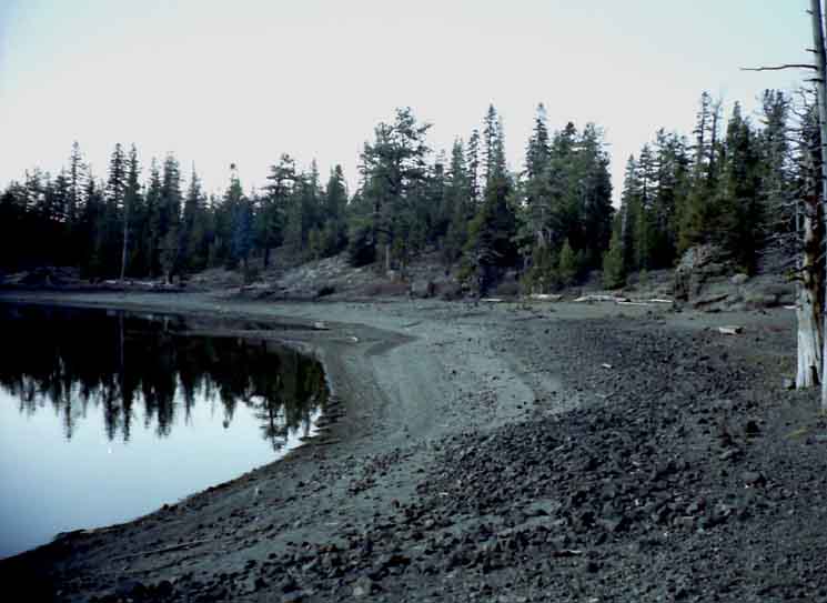 |
The water was pine-pollen covered, and stale to taste. Melted snow would be a welcome change. Round Lake has essentially become a stagnant pond as it's input stream decline to near zero, and it's low level long ago choked off its drainage creek. |
And it was Freezing!
Late Fall at Round Lake I did not feel warranted bringing my very heavy North Face Mountain Jacket, yet, which I only use for Winter conditions. I did not then have my mid-weight North Face Fall/Spring Jacket, which would have been perfect. So I'm stretching the use limit of my Marmot Precept Ultralight Summer Coat beyond its range into cold Fall conditions. So I added layers to my layering plan to make up for the shell deficit. I look like the pillsbury dough-boy with all my layers on. |
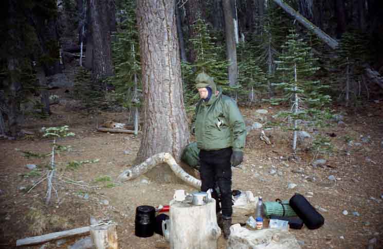 |
I'm still bringing a bear can as well. That will be dropped once the snows fall and deepen. Lot's of bears are responding to the shorter Winters by not hibernating. One change in fundamental conditions leads to many other changes. November 8, 2001. |
North: Meiss Country Roadless to Round Lake South: Hiking South Past Round Lake
Round Lake |
Easy access to Round Lake Round Lake is just too easy to get to for such a quiet, pretty little place. The trail down from Big Meadow (well, down most of the way...) makes this fine little lake too accessible. But there's no-one here, most of the time... Well, it's mostly down from Big Meadow, until we reach the Big Meadow trail junction with the Round Lake trail coming up from the South Upper Truckee trailhead. The Big Meadow/South Upper Truckee trail junction is .58 of a mile North of Round Lake. Big Meadow trailhead is 3.26 miles total distance from Round Lake. The South Upper Truckee Trailhead is 2.81 miles on the old trail route from the Big Meadow trail junction, and likely around 3.5 miles from the trailhead up the new route to the Big Meadow trail junction. This puts the new trail distance from the South Upper Truckee Trailhead to Round lake at around 4 miles. If the much more difficult trail up from the South Upper Truckee Road trail head was the only way in to Round Lake, it would be even quieter than it is now. But the Big Meadow Trailhead offers much easier access to Round Lake than the South Upper Truckee Trailhead. The majority of the times I have been to Round Lake there is no one else camping there. I have been alone. When not alone, there are one or two parties at most. Most people camp at the campsites above the East shore of Round Lake, under the Pinnacle, and leave the best sites on the Northwest corner of the shore of Round Lake for me. But, I come to Round Lake during both less traveled and well-traveled seasons. Heck, I've come through here regularly during all seasons for a long time. As soon as the snows melt legions of mosquitoes rise out of the saturated ground, dominating the environment around Round Lake until they begin to recede in late July, depending on the year, and they all but disappear by mid August. Again, this timing depends on the character of each year. The timing of Each season's thaw, bloom, and the trajectory of the mosquito populations is always dependent on the character and transition of Winter into Spring. In 1997 the Sierras had a catastrophic Spring thaw. In 2010 we had massive Spring snowstorms. The former stripped the mountains of snow very early in Spring, the latter clogged the mountain passes until well into July. Each year is different. The Winter snows packed the High Sierra trails until late August during the Summer of 2011. Late snows and wet Springs provide moisture that supports heavy mosquito populations later into the Summer season. Dry Springs and early thaws limit mosquito populations, and draw them down earlier in the Summer. Though beautiful, Round Lake's true rulers, the mosquitoes, will extract their quart of blood in exchange for your stay at Round Lake early in the season, unless you have taken the steps necessary to protect yourself from the mosquitoes' wrath. If you are prepared for the mosquitoes, potential rain, the occasional heat wave, and the indisputable hard but brief work it takes to get up here from the South Upper Truckee Trailhead, each of these aspects of the environment will become another dimension adding to the beauty and experience of backpacking to Round Lake. Hiking Information 7.5 min 30 min Next page South |
Backpacking Trail Guide North Meiss Country Roadless |
 |
Backpacking Trail Guide South |
Backpacker ForumsHave a great Sierra Nevada route or trip to relate?Post 'em on
On the Forum you can browse trail locations and add your experiences, comments, questions (& pictures and videos if you Register...) about hiking South out of the Echo Summit Trail Head. General comments about the South Upper Truckee to Carson Gap section of the High Sierra trails, or this particular location: Section
|
North: Meiss Country Roadless to Round Lake South: Hiking South Past Round Lake
Trailhead
Contact
Alex Wierbinski

Backpacking Lake Tahoe to Mount Whitney
Your guide to the High Sierra Crest, including the Tahoe to Yosemite, Pacific Crest, and John Muir Trails
