
The Trails
Guide
Maps
Miles/Ele
Permits
Resupply
Forum
Current Weather Conditions
Weather Notes
Northern High Sierras
Central High Sierras
Southern High Sierras
Gear
Gear List
Gettin Started
Layering
Discussion
Testing yourself and your gear
Gear Reviews
Backpacking
Raymond Lake Junction
to
Ebbetts Pass
Hiking The Pacific Crest Trail between Carson Pass and Ebbetts Pass
Languages
Languages
Trail Arts
The art of walking
Physical Preperation
Trail Skills
The trail
Off the trail
Scrambling
Maps
Navigation
Camp skills
Food
Resupply
Food
Other
Photo Catagories
Trail Stories
Trail Culture
News and Science
Links
Groups
Books
Terms and Conditions of Use
| Trail Guide Index Carson Pass to Ebbetts Pass |
North PCT Wet Meadow Reservoir |
South PCT Ebbetts Pass |
7.5 Map Upper Sunset Lake to Ebbetts Pass |
7.5 Map North Blue Lakes to Upper Sunset Lake |
30 min Topo Map Carson Pass to Ebbetts Pass |
Carson Pass |
ALL SEGMENT MAPS |
National forest Humboldt Toiyabe NF |
Resupply Lake Alpine |
Tahoe to Whitney on You Tube |
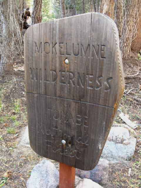
Raymond Lake Trail Junction
in the
Mokelumne Wilderness
| On this page | ||||||||||||||||||
Lay of the Land South off Raymond Peak
South to Reynolds Peak
Video: South side of Raymond to Ebbetts Pass
Gallery of strange lava shapes
|
Weather and Road
All All High Sierra Weather Resources Comprehensive High Sierra Fire and Smoke Information |
South of Reynolds Peak
Trail options South of Ebbetts Pass |
||||||||||||||||
| > Forum < | ||||||||||||||||||
POST UP! All backpackers can post text comments about the following section of trail through the comments links on all the trail guide pages. Registered Members can post up stand alone post about the trail with text, images, maps and videos in the Trails Forum that supplements this section of the Trail Guide. Check out the Tahoe to Whitney .org Backpacking Trails and Topics forums |
||||||||||||||||||
Raymond Lake junction
on the
Pacific Crest Trail
Elevation 17 miles South of Carson Pass 9.78 miles North of Ebbetts Pass .97 of a mile to Raymond Lake.
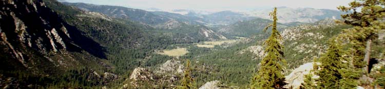
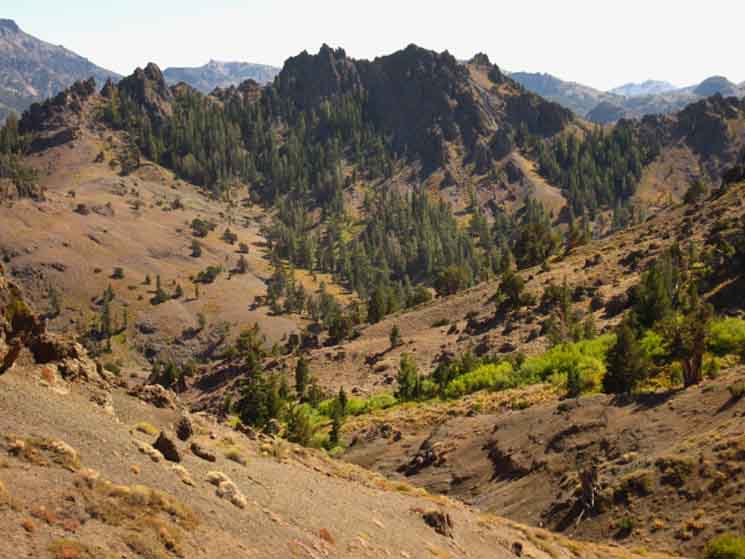
South from the Raymond Lake junction on the Pacific Crest TrailLay of the Land "Roller coaster" characterizes the nature of our next 5 miles South on the Pacific Crest Trail from the Raymond Lake trail junction to Eagle Creek. We will be crossing two drainages hiking South off of Raymond Peak meaning we hike over two ridge arms descending off of Raymond Peak's Northeastern facing flank. Check out the trail around Raymond Peak on the map. Ups and Downs After a 200 foot climb South out of Pennsylvania Creek's upper ravine we cross the next ridge to overlook Eagle Creek, and the terrain radically changes. Volcanic Rock Sculpture Garden Raymond Peak is a great degrading mass of broken down volcanic soil while Reynolds projects great spires of hard volcanic material into the air from the exceptional sharpness of its razor back hard rock crestline. Even better, hiking down and looping around the head of Eagle Creek under Reynolds Peak brings us into and through an amazing museum-like menagerie, a natural rock garden full of eerily eroded other-worldly sculpted volcanic forms. I've got to hike through here on a fully moonlit night. As we traverse down the ridge dropping down to Eagle Creek we notice amazing shapes cut into the hard volcanic rock along the upper section of the ridge we crossed from Pennsylvania Creek. Amazing forms. We can't help but compare these hard rock spires with the very different character of Raymond Peak's heavily eroded reddish volcanic soils we just crossed. Mostly Good Hiking The trail passing through the hard rock around Reynolds Peak is much more stable. As we continue to the South end of Reynolds Peak's extent its fine hard volcanic sculptures give way to a field of interesting composite boulders, and finally we climb the last low ridge descending off Reynolds Peak's Southeastern flank to overlook, then drop into a dense forest punctuated by Lower Kinney Lake along with refreshing little islands of granite formations we see poking through the forest cover. The granite indicates we are departing this vast ocean of volcanic terrain we have been crossing, with a few short exceptions, since departing the Lake Tahoe Basin. On our way down into the forest South of Reynolds Peak we looks about the terrain around Raymond and Reynolds Peaks to get our last look at these impressive remnants of ancient volcanoes. Many of these volcanic projections appear to be volcanic "plugs," the remnants of ancient central shafts of lava exposed after their surrounding volcanic cones eroded away long ago. These features have very distinctive shapes. South of Reynolds Peak we again enter forest cover but we first get looks at Upper and Lower Kinney Lakes nestled in the dense dark green forests ahead. The last few miles of the Pacific Crest Trail South of Reynolds Peak passes around, rather than across steep sections and undulations in the terrain, so we will easily and quickly pass by the Kinney Lakes and around Ebbetts Peak to arrive at Highway 4 through Ebbetts Pass. Planning the Resupply These are good places to camp if we plan on hitching down to Lake Alpine to pick up our Resupply the next day. If we are continuing South our next reasonable campsite will be 4 miles South of Ebbetts Pass at Noble Lake. Noble Lake did not look so good in September of 2009, at the end of the Summer backpacking season.
Noble Lake's shore was extensively post-holed by cow hooves, and the water had a lot of algae, moss, and that nasty cow smell that indicates you may want to find a better water source, if possible. The Kinney Lakes trail junction is 1.36 miles North of Ebbetts Pass. |

South on the Pacific Crest Trail past the Raymond Lake trail junction
Down to Pennsylvania Creek
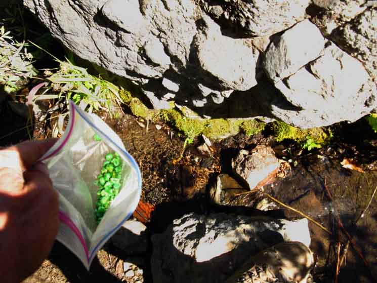
| Snack, rest, and water at Raymond Canyon. | ||
 |
||
I love those baked Green Peas! This is the second, Southern branch of Raymond Creek which seems to hold low flows very late into the season while the Northern branch dries out.
Carson Pass to Ebbetts Pass |
Looking down the mountainside to the North
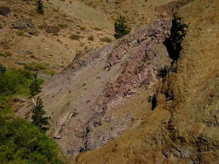 |
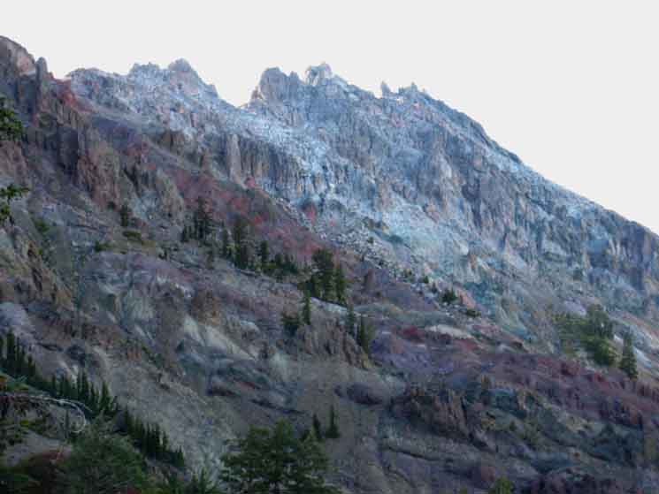
The barren terrain displays a wide range of subtle colors of exposed minerals eroded out of the mountainsides. |
Textures
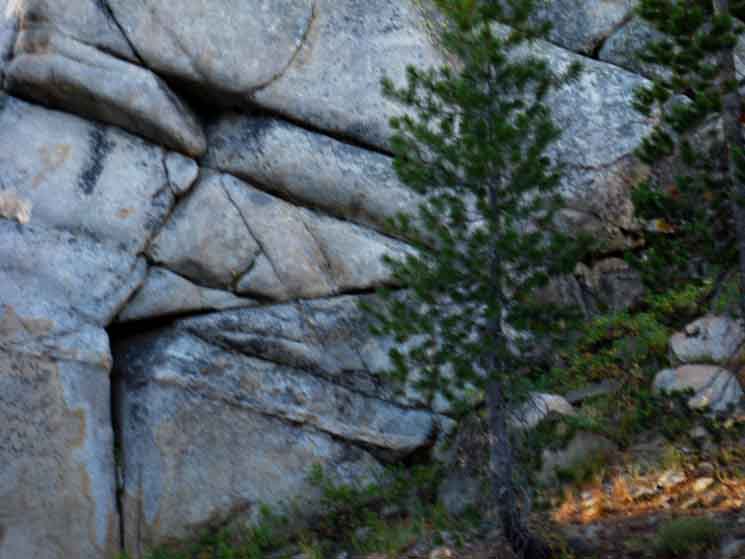
| The geological beauty of this section is not limited to the subtle colors of the exposed minerals. Nor to the craggy ridge lines and eerie shapes of sheer eroded volcanic remnants. |
 |
Textures Too The wide variety and range of textures of the eroded minerals displayed by different compositions of the volcanic terrain makes texture an extra dimension to the beauties of color and shape while hiking through this terrain. The wide range and variety of textures combined with the range of mineral colors on the jagged eroded volcanic sculptures and across the slumping eroded volcanic soils is very pleasing. The Textures, Colors, and Forms along this section of the Pacific Crest Trail are striking. It is a stark environment who's beauties are striking. |
Mountain Crest
between
Raymond and Reynolds Peaks
 |
||
Pennsylvania Canyon beyond Pennsylvania Creek. Looking up the canyon holding Pennsylvania Creek reveals the crestline of this massif linking Raymond Peak off to our Northwest (Right) with Reynolds Peak off to our Southwest (Left). Well, this ridgeline actually connects Reynolds Peak with "The Cylinder," from where the ridgeline jogs East to Raymond Peak.
|
Bit of Green
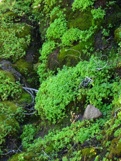 |
Mosses and ground cover brighten Pennsylvania Creek |
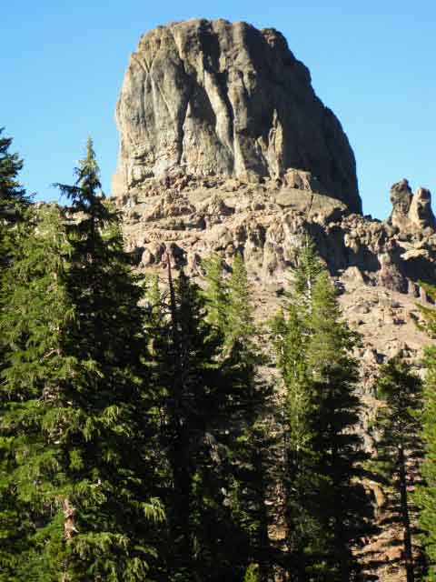
Raymond Peak
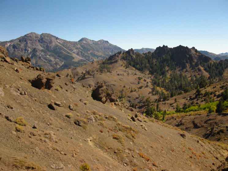
Water The PCT across Raymond Peak traverses its exposed treeless eroding volcanic flank. Narrow fingers of thinning forest follow the drainages up mountain. We've got little cover up here. A few areas of thin tree cover, rapidly crossed South of the Raymond Lake trail our Northeast facing terrain nourishes these thin fingers of forest cover in narrow drainage canyons. The trees mostly reach their limits below where the PCT crosses Raymond Canyon Creek's two upper branches. This North-Northeast facing terrain is badly situated to catch what little moisture remains in the air carried across the Sierras from the Pacific Ocean by the prevailing NW winds. Not much rain makes it up here. This rare moisture, along with springs at the tops of these gullies sustains the thin forest fingers climbing up the gullies on these North facing ridge-sides. Thus we can see thin strips of forest running up Raymond Canyon and Pennsylvania Creek, but not quite making it up to our position on the trail. I've found good cold water in both, if flowing at restrained levels, and a very little bit of nearby shade to enjoy it under during late Summers of dry seasons. The Northern branch of Raymond Canyon Creek seems to dry out before the Southern branch. Getting water out of either of these when they are barely flowing may require the "stick" method of water purification. Or we continue South to check out the higher levels of water in Pennsylvania and Eagle Creeks... Low Water Filtering I find a stick that bridges the pool or section of flowing water I wish to draw from that does not disturb or cloud the water. I drape my intake hose over the stick and slowly lower it into the tiny pool or flow, hopeful that I will not screw it up. Once I've got the intake situated I pump carefully so any movement of the intake hose with each stroke of the pump does not damage or cloud up the little pool or the low flow I am drawing from. Terrain Look up Pennsylvania Creek and we note of the massive hard volcanic formations along the crest line that feeds Pennsylvania Creek's headwaters. When we cross the subsequent ridge South to pass into Eagle Creek's drainage, we will be standing at the entrance of a fine gallery of hard lava formations, carved by the combined forces of erosion into a wide range of spires and other interesting and delightful shapes. This is really cool terrain. Note on the topo map how Raymond and Reynolds Peaks are part of the same massif, though each expresses different very characteristics. |
East-Northeast View
| The view to the Northeast hiking South down to Eagle Creek. | ||
 |
||
We can see the flank of Highland Peak rising out of the upper Left corner of the image.
Carson Pass to Ebbetts Pass |
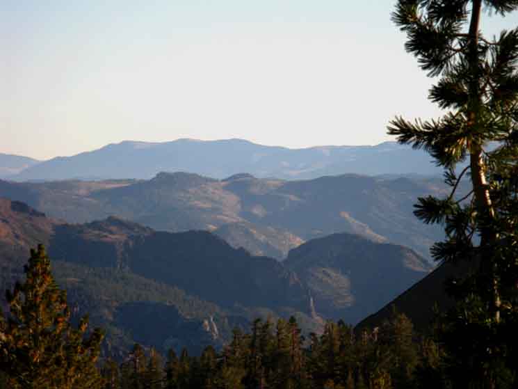
Silver and Highland Peaks
 |
||
Silver Peak from the gap in the ridge between Pennsylvania and Eagle Creeks. We can see Highland Peak peeking out down the crestline from Silver Peak.
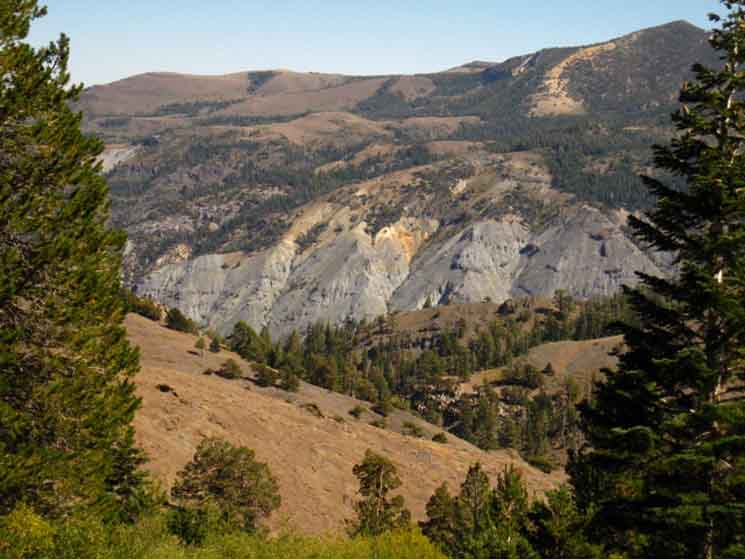
The 30 minute map below shows Silver and Highland Peaks above Noble Canyon and where Highway 4 runs East of Ebbetts Pass down across the bottom of Noble Canyon. Carson Pass to Ebbetts Pass |
Raymond PeakDetails South of the Raymond Lake Trail Junction 1.86 miles from the Raymond Lake junction South to Raymond Canyon. 3.68 miles from the Raymond Lake junction South to Pennsylvania Creek. |
View Northeast Battleship gray volcanic deposit erodes out of the mountainside to our Northeast. |
||
 |
||
Highway 4 sits at the base of the eroded gray mountain feature, Silver Peak rises out of the Right edge of the image, which would be South by the compass. Eastbound Highway 4 runs North down the mountain from Ebbetts Pass along the base of this feature, which is almost exactly where Noble Canyon and Highway Four intersect. Just a bit further down the mountain Highway 4 bends East by the compass, but Highway 4 runs North by the compass while driving Eastbound over Ebbetts Pass. The map below shows Highway 4's route over Ebbetts Pass and down to the bottom of Noble Canyon at the base of Silver Peak. Carson Pass to Ebbetts Pass
|
Detail
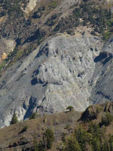 |
| Battleship Gray Volcanic Minerals above where Noble Canyon and Highway 4 intersect East of Ebbetts Pass. |
Juniper
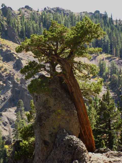 |
Massive volcanic boulder and an equally massive Juniper. |
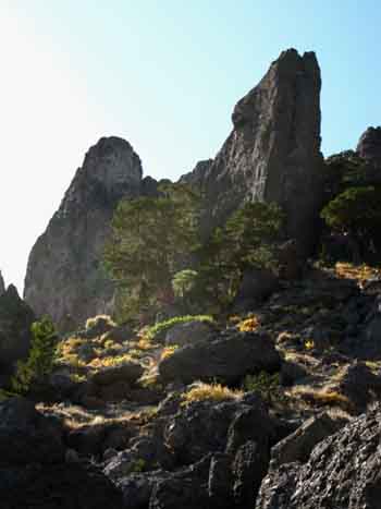
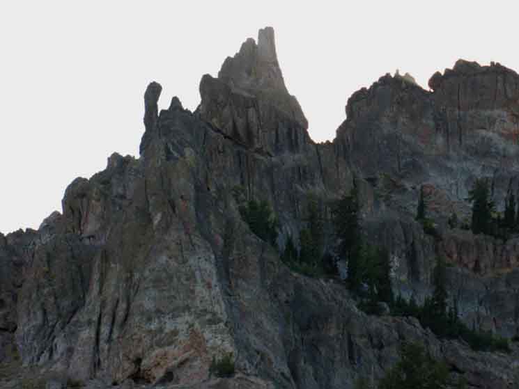
Reynolds Peak Crestline
 |
||
Amazing features begin appearing along the crest line when we hike South over the ridge dividing Pennsylvania Creek from Eagle Creek and Reynolds Peak from Raymond Peak.
|
Ground Art
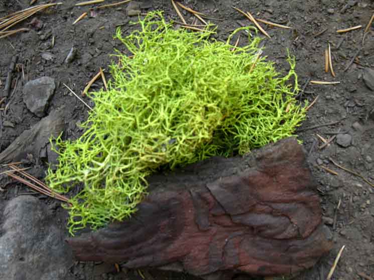 |
On the ground moss and bark combine for a pleasant partnership, though short-lived. |
top of page Silver Peak
| Nearby Mountains along the Sierra Crest line |
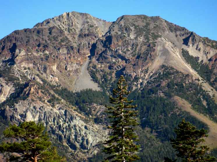 |
West Flank of Silver Peak, sitting to the NE of Ebbetts Pass. We're looking almost due East. Noble Canyon lays at the base of the ridgeline of Silver and Highland Peaks running North and South by the compass. Noble Canyon runs North by the compass off the top of the Sierra Crestline just a couple of miles East of Ebbetts Pass, running down the East flank of the Sierra parallel to the route of Highway 4. This may sound a bit confusing. The deal is that Highway 4 runs North and South across Ebbetts Pass before it bends East below Noble Canyon towards Monitor Pass and Markleeville. Sometimes our Southbound trail bends East and West as it picks its way through complex terrain. So too with the routes of the trans-Sierra highways, which also have to turn considerably off the direction of their travel to get around difficult sections of the terrain. That's why Highway 4 is running North and South across Ebbetts Pass. Carson Pass to Ebbetts Pass |
Crestline
approaching
Reynolds Peak
 |
 |
|
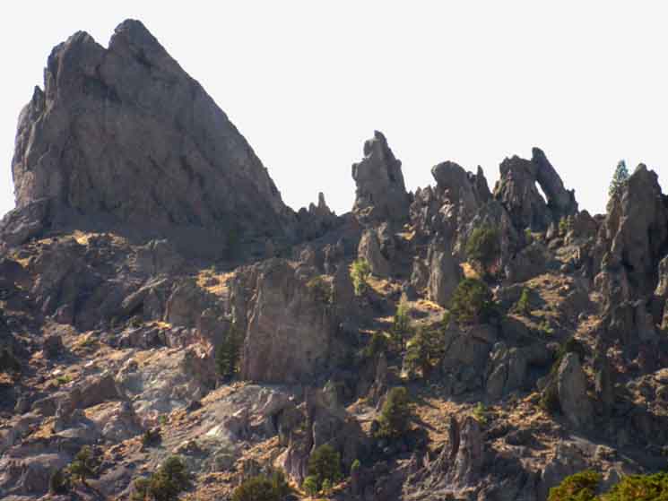
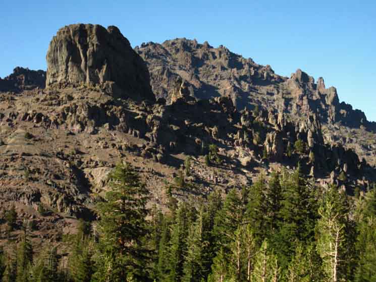
| Approaching Reynolds Peak we can see that the unique formations carved along its crestline are much more complex than the rounded mass of mostly broken down eroded volcanic soils composing Raymond Peak. | ||
Composite Boulder Garden
 |
||
Strange volcanic boulder garden hiking down to Eagle Creek under Reynolds Peak.
|
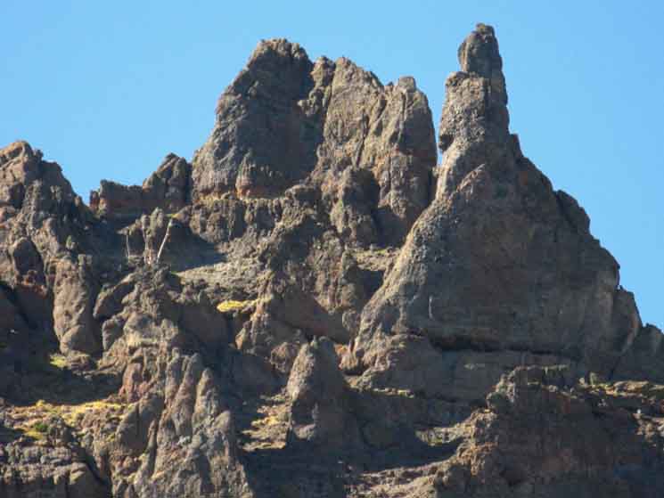
Jutting Volcanic Crestline
 |
| The Sierra Crestline here is very cool. |
Video
South Side of Raymond Peak to Ebbetts Pass
|
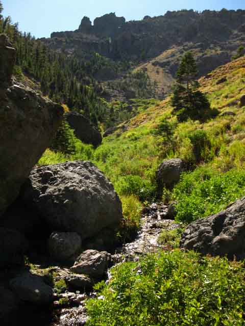
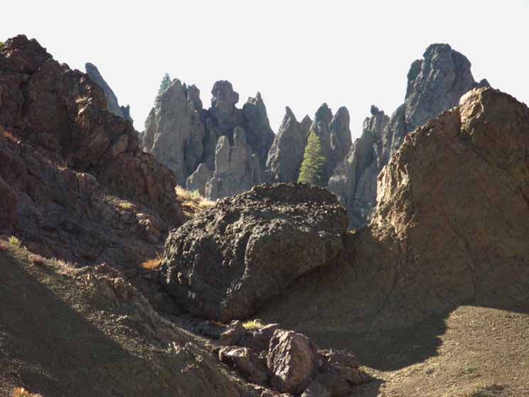
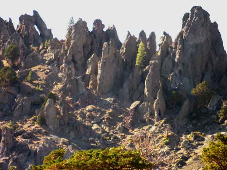
Amazing erosion carves exotic shapes which rise out of the volcanic debrisPassing South of Pennsylvania Creek demands a 200 foot climb that crosses through a saddle in the sheer crestline of the ridge coming off of Raymond and Reynolds Peaks that divides the Pennsylvania and Eagle Creek drainages. Crossing the highpoint of this exposed ridge brings the canyon surrounding Eagle Creek into view. The southbound trail traverses Westward down the open ridgeside towards Eagle Creek's headwaters, paralleling the creek until the trail drops down to cross the creek right under the shadow of Reynolds Peak towering above. Within Eagle Creek's canyon is an amazing gallery of volcanic spires carved into a wide range of striking shapes and textures carved by wind, rain, and runoff. |
Heading up Eagle Creek towards Reynolds Peak
| Strange hard lava forms, the remnants of thousands of years of erosion off of the flanks of Reynolds Peak, extend East above Eagle Creek. |
 |
This show should continue for centuries. |
Ridge below Reynolds Peak Crestline
The top of the ridge dividing Pennsylvania from Eagle Creeks. Monolithic Volcanic Features stand alongside a garden of highly detailed eroded formations. |
||
 |
||
Note the reddish tones of the soil around the volcanic formations.
|
Gallery of Fine Volcanic Sculptures
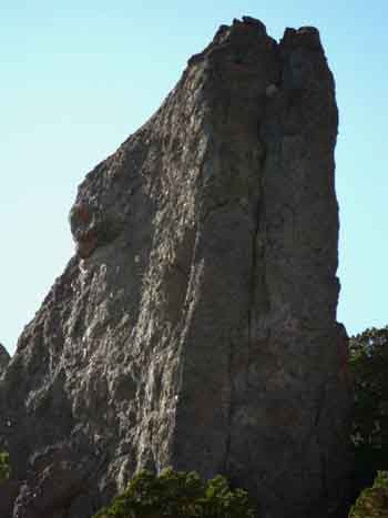
| This is the distinction between Raymond and Reynolds Peaks: Raymond Peak's steep flanks are composed of already eroded unconsolidated small grain volcanic materials. |
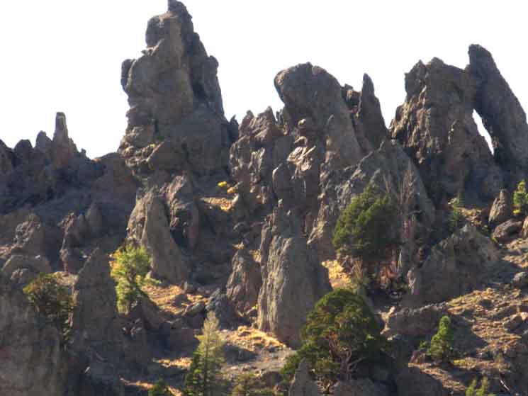 |
The jagged remnants decorating Reynolds Peak are carved out of a much harder ancient lava. Or possibly Reynolds was the product of a later eruption. |
| This is the ridge arm dividing Pennsylvania Creek from Eagle Creek heading up towards the crestline of Reynolds Peak. |
 |
The character of the terrain, and the effect of terrain on the backpacker changes radically when the trail brings us around Reynolds Peak. The three pictures above depict the fine eroded features decorating the top of the ridge running up to the crestline between Pennsylvania and Eagle Creeks. |
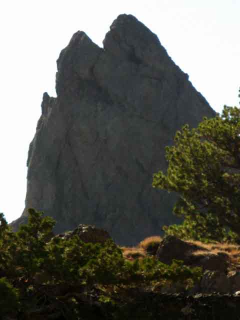
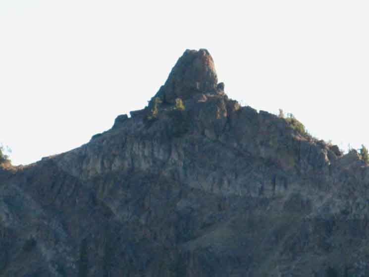
Reynolds Peak
At the head of Eagle Creek we are sitting directly below Reynolds Peak. Is this not great? Since passing South of the Wet Meadow Reservoir trail junction we have crossed Raymond Peak's mostly barren eroded volcanic mountainside, only enjoying little bits of thin forest cover running along the tops of the ridges between the drainages. Sweet. Now we will again enjoy a nice partially shaded section of thin forest hiking over the low ridge separating Eagle from Raymond Meadow Creek. We've good access to water in both creeks under the imposing line of the jagged, razor-backed hard volcanic rock called Reynolds Peak. This is an amazing place. Eagle Creek
|
Fungus
| I found this fungus growing on a downed tree while passing through the thin forest crossing the ridge to get down into Eagle Creek. |
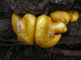 |
Again, as with the lava and related minerals that compose the terrain, I find the texture, shape, and color of this fungus has a fundamental appeal inherent in all natural expressions. Beauty is... Art is... |
Life
 |
Biological machines of Beauty. |
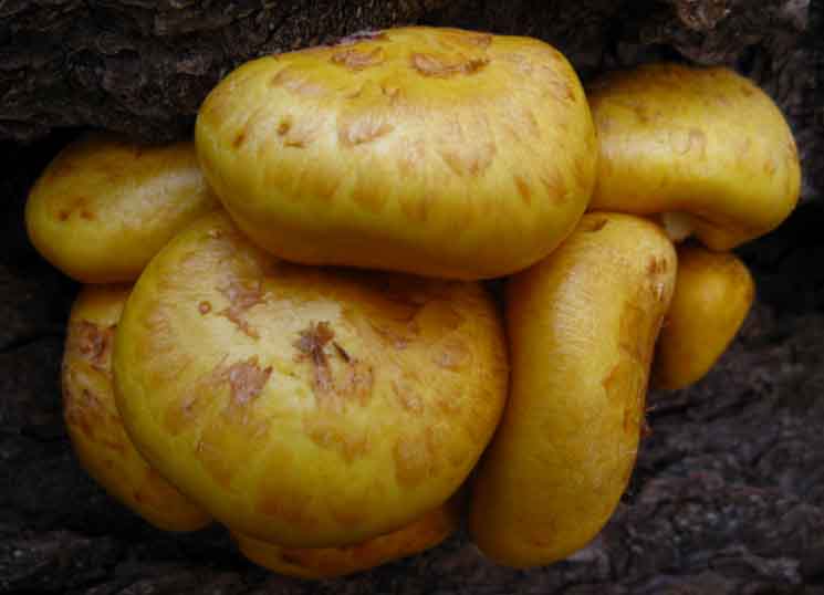
Colonies
| It appears that These fungal colonies found the proper combination of light, moisture, and nutrients to thrive. |
 |
I have no idea what they are named, even after a bit of research. If you have any idea, post it. Check out the Fungus Forum to post up entries about fungus, while you can leave comments on this Fungus entry. Living Things Forum |
Looking at the East End of Reynolds Peak's Crestline
| Heading South under Reynolds Peak | ||
 |
||
Early Morning glare of the low Sun. We're hiking South through the forest between Eagle Creek and Raymond Meadow Creek. We're looking at the end of Reynolds Peak.
|
Top of Ridge Dividing Eagle from Pennsylvania Creeks
| Looking back to the Northwest we get a different view of the plug-peak marking the top of the ridgeline between Pennsylvania and Eagle Creeks. |
 |
The View North
Let's get some perspective...
 |
||
Looking back North-Northwest by the compass at the top of the ridgeline dividing the drainage of Pennsylvania Creek on its far side from Eagle Creek along its near. That ridge runs up to Reynolds Peak's crestline ridge, which we can see on the far Left of the image. The mountain rising in the background is Raymond Peak. Raymond peak is located almost directly North of Reynolds Peak along a Western spur of a section of crestline that runs between, and connects the peaks with each other. Once we crossed the above ridge (we crossed it lower down out of the image above to the Right), we only have two more low ridges to our South to cross before we get South of Reynolds Peak to enter the dense forest around the Upper and Lower Kinney Lakes. Upper and Lower Kinney Lakes are the best places to camp near Ebbetts Pass. Here's the scenario: It's getting late in the day as we're hiking North to South across Ebbetts Pass on our backpacking trips South to Mount Whitney. Our plan is to hitch down to Lake Alpine tomorrow to pick up the free resupply package we sent to ourselves there, if we get to Ebbetts Pass too late in the day to hitch down today. So we are going to hold up and camp this evening, to set up on Highway 4 early the next morning. Eagle Creek and Raymond Meadow Creeks sit between the upcoming ridge arms to our South, then we have a short easy hike to Ebbetts Pass. Eagle Creek to Ebbetts Pass is 4.54 miles.
|
West of Reynolds Peak
|
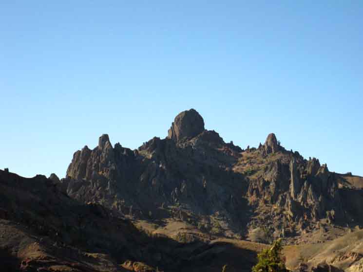 |
Citadel of the Rock Gods Fascinating plugs, appearing to be hard lava core remnants of ancient volcanoes, dot the region. We first spotted this one dropping off the South flank of The Nipple up by Blue Lakes, and named it "The Cylinder." It is marked as such on the lower-Right of the Blue Lakes Hiking Map. This very distinctive plug sits South of Raymond Peak and West of Reynolds Peak. We're taking our last fleeting glimpse of it to our Northwest across the intervening ridgeline of Reynolds Peak before we leave it behind. |
Reynolds Peak Crestline
 |
||
Looking North at the razor-back character of Reynolds Peak and its main ridgeline as we climb the low ridge to the South of Eagle Creek towards Raymond Meadow and Raymond Meadow Creek.
|
Reynolds Peak Crestline
| Passing by the Southern ridge of Reynolds Peak. |
 |
Passing South from Eagle Creek we pass over a low rise toward Raymond Meadows, passing around this distinctive feature on the South end of the Raymond Peak ridgeline. |
Sweet Volcanic Plugs
 |
On the Southern Crestline of Reynolds Peak . |
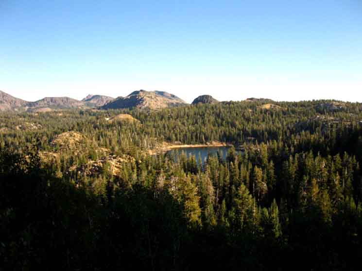
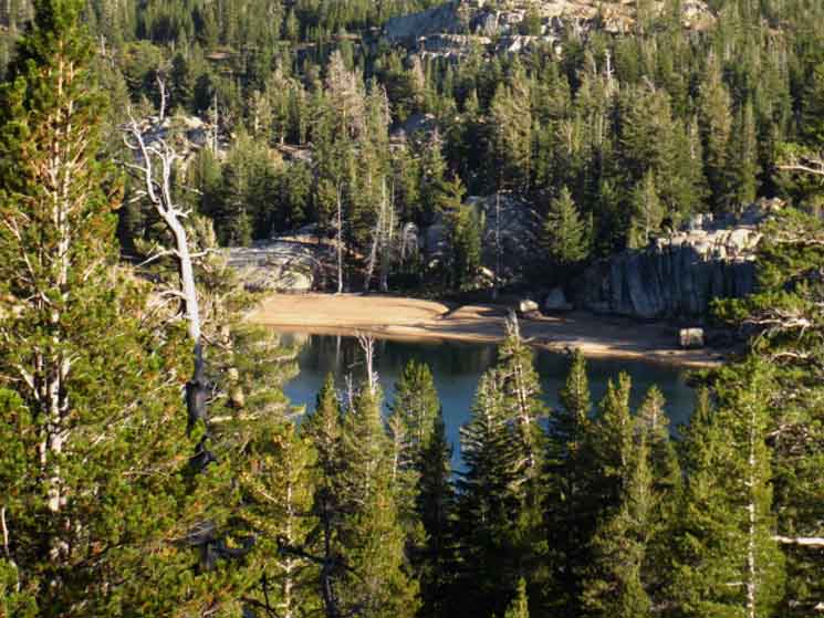
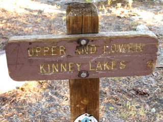
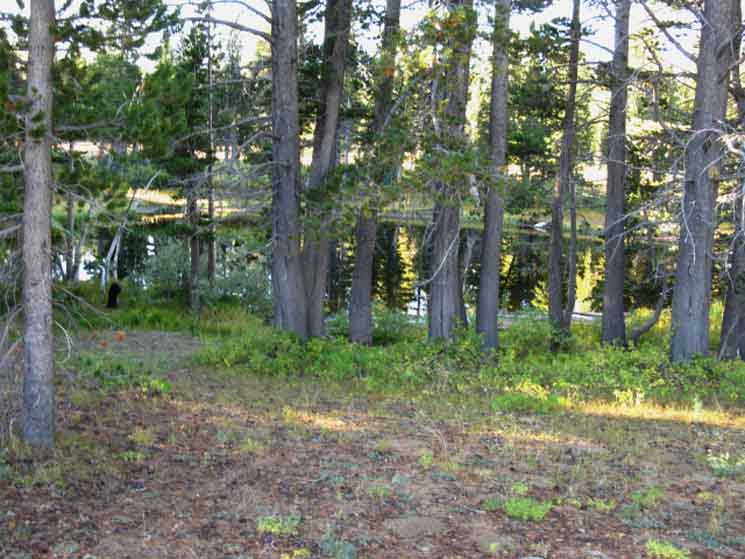
A Brief Glimpse of Lower Kinney Lake
First Look at Lower Kinney Lake. Hiking South from Eagle Creek we climb the first of the last two low ridges between us and the Kinney Lakes. At the top of the first ridge we get a look at Lower Kinney Lake in the forests ahead. We'll drop down to cross Raymond Meadow and Creek before making the low climb over the last ridgelet between us and the Kinney Lakes, and Ebbetts Pass just beyond. |
||
 |
||
Ebbetts Peak is the rounded bulb rising directly behind Lower Kinney Lake. In the distance to the Left of Ebbetts Peak is the Sierra Crestline rising up to Tyron Peak, over on the South side of Ebbetts Pass. Upper Kinney Lake sits out of the view of the image above, located off to the Right of the mound of granite rising off the Right (West) shore of Lower Kinney Lake.
Carson Pass to Ebbetts Pass |
Lower Kinney Lake
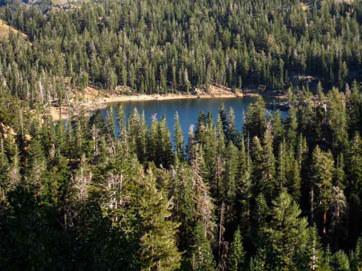 |
Those are sweet white sand beaches, perfect for laying around on. The dense forests around the Kinney Lakes show us that our great exposed crossing of the Mokelumne Wilderness along the Pacific Crest Trail is about to end in refreshing shade under dense forest cover. I feel the need for shade! We can also see that Ebbetts Peak is granite, and that the bits of terrain sticking out from the dense forest cover are granite too. Serene granite terrain under dense forests... quite a change from the exposed volcanic terrain that has characterized the vast majority of our hike South since exiting the South end of the Lake Tahoe Basin. Sweet! Our upcoming hike across the Carson Iceberg Wilderness will cross terrain much more balanced between granite and volcanic geology than our hike across the Mokelumne Wilderness, and much more balanced between exposed and shaded hiking. We underwent a dramatic change in terrain from the forests and rock around the West shore of Lake Tahoe into the mostly-barren stark beauties of the volcanic Mokelumne Wilderness. Now these stark beauties of the Mokelumne are going to change again as we cross into the Carson Iceberg Wilderness. The terrain of the Sierra is unique in every part. Sweet! |
Consolidated Volcanic Boulder Remnants
Dropping of the low ridge we descend into sweet meadow terrain below the extending arms of the volcanic ridges descending off the Northeast flank of Reynolds Peak. The green of Raymond Meadow where Raymond Meadow Creek finds its beginnings tempers, but does not alter the volcanic nature of the terrain we've experienced across Raymond and Reynolds Peaks. A very broken-down consolidated volcanic boulder. |
 |
Consolidated boulders are what breaks off ancient volcanic formations that I figure were once great lahars. These ancient volcanic flows picked up a wide variety of rocks from pebble to hefty-rock sizes, then bound them together into a variety of cement-like materials. Great volcanic cliffs rose as erosion recut the High Sierra valleys these lahars had once filled. Check out similar composite boulders located in the Tahoe Basin's Christmas Valley. |
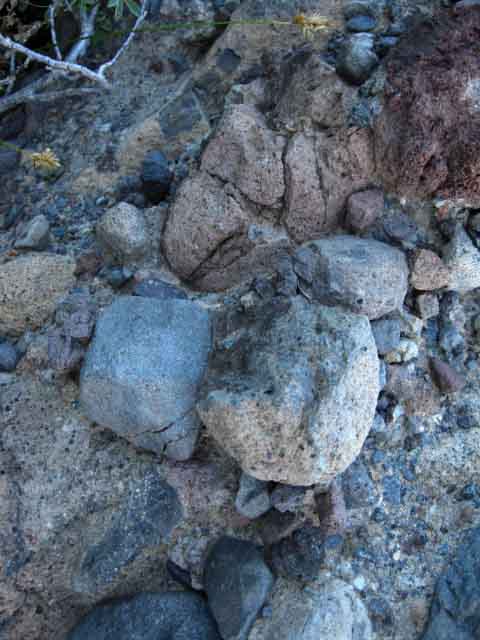
Soft Composite Boulder
On the South side of Reynolds we encounter what appears to be composite boulders composed of aggregates of many types and sizes of stones suspended in a cement like materials. Below we see a wide variety of different glacial cut and polished rocks suspended in a weak cement-like volcanic slurry. As we can see this weakness indicated by the sand and pebbles that have eroded free sitting on top of the boulder. |
 |
Great rocks are eroding out and falling off the sides of this shrinking boulder as its weak cement erodes away. This indicates to me the ancient action of massive lahars. |
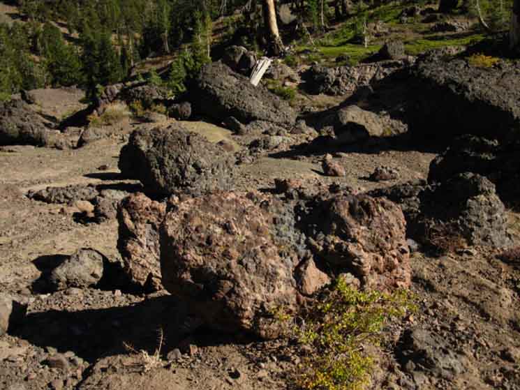
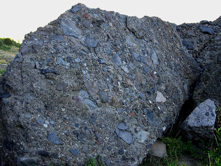
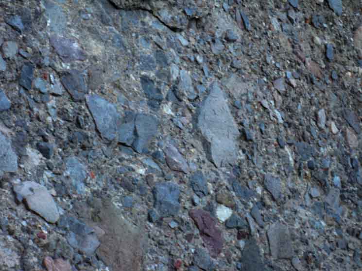
Composite BouldersOn the South side of Reynolds Peak we pass though an zone of composite boulders decorating the flattening terrain. Most of the previous terrain we've crossed over Raymond Peak has been over volcanic materials eroded into unconsolidated soil, or around the harder volcanic material making up Reynolds Peak's jagged forms. These composite boulders we encounter are composed of a uniform cement-like material that has engulfed and captured many different types of rocks and stones. All of these different rocks are now locked into the cement, and as erosion breaks boulders off the composite volcanic cliffs and terrain above and around us these strange boulders reveal clues about the distant past of this particular location and the variety of eruptions that created it. Another observation is that although these composite zones and composite boulder fields are associated with hard lava areas by proximity, these composite materials have significantly different properties than the harder volcanic rock formations around them. Each is the product of a distinct type of volcanic flow, while other types of flows produced different types of terrain features. This indicates that our surrounding terrain was built up in layers by different types and characters of eruptions, and these different layers are now breaking up in different ways at different rates, depending mostly on how their hardness holds up to erosion and resists the intrusions of brush and tree. The most important observable difference driving the ancient terrain here seems to be the difference in heat between the various volcanic flows that deposited them here. The hard volcanic material was brought to us by molten flows who's high heat brought about a much more uniform internal composition, and left hard volcanic rock behind, such as the hard rock making up Reynolds Peak and its hard volcanic sculptures. I wonder if the Romans figured out the secrets of cement from their volcanic experiences... What the Heck Happened Here? Imagine the lava and ash flows of ten or fifteen Mount Saint Helens, erupting not across the idyllic forests, lakes, and meadows that were destroyed by Mount Saint Helens, but erupting from under massive ice caps hundreds of feet thick along a hundred miles of ancient Sierra Crestline. Because of the presence of Ice Age snow and ice in proximity to major volcanic eruptions, I speculate that the first of these lahars must have measured hundreds of feet in height as they flowed down into foothill valleys dozens of miles distant from the actual eruption. Alice, our resident consulting geologist, pointed out to me that lahars would tend to flow down the already present ancient drainages cut by the glaciers, and harden to fill these drainages. These lahar-filled ancient valleys have slowly eroded out, but this time the forces of erosion would cut through the rock deposited by ancient lahars, ultimately removing most indications of their presence. Over the ten thousand years since these deposits were originally made the majority of its consolidated boulders have long been eroded away, leaving only a wide variety of polished stones as the only clue of their presence. What is apparent is that massive lava flows and giant lahars were sweeping down both flanks of the Sierras 10,000 years ago during the last period of intense volcanic activity that coincided with the end of the last ice age. Hiking South we are exiting this extensive ocean of volcanic terrain onto a small island of granite around Ebbetts Pass. |
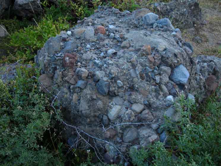
Hard Composite Boulder
Massive composite boulders holding many types of completely different unaltered stones in a weak cement-type material are liberally strewn around the Southeast side of Reynolds Peak as we hike around the upper perimeter of Raymond Meadows. The composite boulder below and its surrounding brethren are held together by a much higher quality of "weak cement" than most other composite boulders we have or will encounter hiking from Tahoe to Whitney. The "cement" holding this boulder together, and composing the binding material of its nearby terrain almost has the qualities of modern commercial quality cements. It appears to have the proper amounts of sand, small pebbles, and limestone properly heated and mixed up to form up what looks like a much harder and therefore longer-lasting cement than that typically binding composite boulders together. If you figure out the vast volume of all the lahars the flowed down the East flank of the Sierra during this period of volcanic activity, it seems likely that parts of at least one of this massive flow would mix up almost perfect cement... We see examples of excellent natural cement composite boulders along the upper and Southern edges of Raymond Meadow. |
 |
Above we also can see the first example of "aggregate" finish cement work, where a decorative surface is achieved by washing away the top layer of cement to expose the decorative rock. The builder was a volcano, the finish done by timeless erosion... As the cement is eroded away over the eons, large piles of unrelated stones are left in mysterious piles. This one will not be a pile of rocks for a long time. |
Nature's Aggregate Concrete Finish
 |
Rocks suspended in ancient lahar flow. |
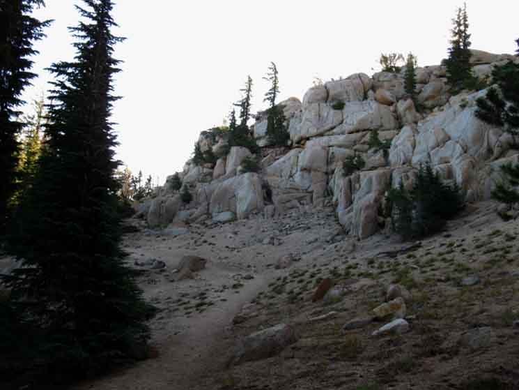
top of page South of Reynolds Peak
As we continue South of Reynolds Peak, its sharp volcanic shapes give way to a gentler series of terrains characterized by dense forest punctuated by bright meadows and refreshing little islands of white granite formations poking out of this vast ocean of volcanic terrain. |
Views of Upper Kinney Lakes from the North
| As we continue South towards Ebbetts Pass Upper Kinney Lake comes into view. | ||
 |
||
Bits of granite around Upper Kinney Lake offer nice contrast to the continuous volcanic terrain we have passed through for the last 15 miles. Look at all those islands of granite rising through the forest cover!
|
Upper Kinney Lake Beach and Cliff
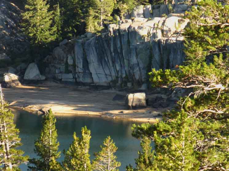 |
Ah yes, this looks like a nice place to spend the rest of the day... |
The Mokelumne Wilderness
| We again exit the Mokelumne Wilderness, this time just to the South of Raymond Meadows Creek a bit to the West of Upper Kinney Lake. | ||
 |
||
Raymond Peak to Ebbetts Pass
Map Paper Maps Online has a Mokelumne Wilderness Map showing this complex wilderness boundary. |
Upper Kinney Lake Campsite
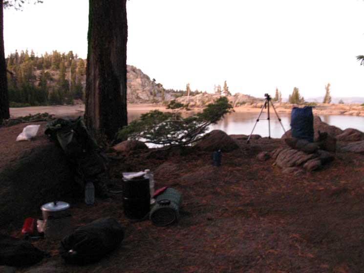 |
| The first trail Southbound hikers encounter brings us down a steep hillside to a fine little camp overlooking Upper Kinney Lake. |
Camping at Upper Kinney Lake
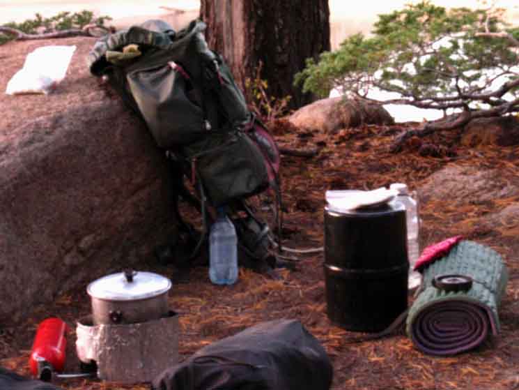 |
The low granite rock makes a perfect backrest, which I situated my stove next to. The garcia food container is my little writing desk, the bedroll is to up my tired legs up on. Water and food are laid out next to my perfect place to sit as I cook up some hot chocolate and powdered buttermilk, think about what to have for dinner, and watch this sweet day turn to evening and night. |
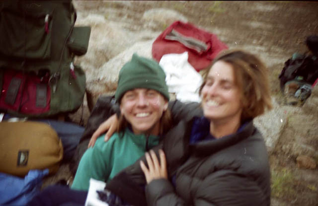
Marie and Susan
1999 Pacific Crest Trail Hikers
| ' | During 1999's Tahoe to Whitney Hike I ran into Susan and Marie on the South Side of Forester Pass. We had a real nice chat, and they continued North on their long PCT trip, and I headed South to the end of my trip and exited through the Whitney Portal two days later. | |
 |
||
Returning to "civilization" after forty days on the trail was disquieting. I needed a short trip to ease the way back into "civilization," so I figured I'd hike the PCT from Carson Pass to Ebbetts Pass, but swing through Summit City Creek because I'd never hiked up to Blue Lakes from there. Two weeks after ending the Tahoe to Whitney hike I was doing a trip from Carson Pass over Round Top to Summit City Creek, then North to Ebbetts Pass on the Pacific Crest Trail via Blue Lakes. On day five, as I approached Ebbetts Pass, I again encountered Susan and Marie as they were continuing North on their long PCT journey. I figure I had last seen them more than 300 miles South of this position. This time we met at the end of the day, and headed to Upper Kinney Lake to kick back and camp for the evening. |
Simple Solutions
| Ready to call it a night camping at Upper Kinney Lake. |
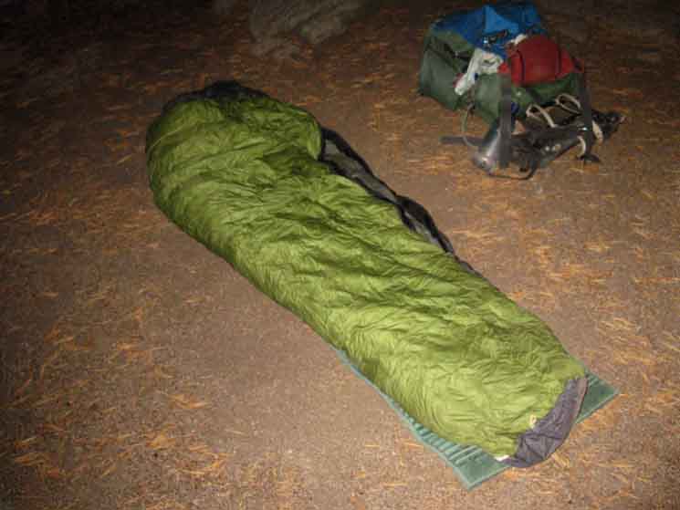 |
No mosquitoes, no weather, no tent. Note that I am using the same backpack in 1999 in the second picture above that I was using in the picture above during 2009. My last backpack change was in 1992 when baggage handlers for Aloha Air broke my frame on the way over to backpack the Na Pali Coast on Kauai. |
Kinney Lakes Trail Junction
Just North of Ebbetts Pass 25.42 miles South of Carson Pass 8.42 miles South of the Raymond Lake trail junction. 1.36 miles North of Ebbetts Pass. |
 |
||
Continuing straight through this junction will bring us to Lower Kinney Lake, Left will bring us to the South side of Upper Kinney Lake and down to Lower Kinney Lake, while turning Right brings us to Ebbetts Pass.
|
Back to the Granite Rock
 |
Granite outcroppings around Sherrold Lake. Coming over the last low ridge on the South side of Reynolds Peak gave us our first view of some granite terrain since we crossed that small outcropping of granite around Blue Lakes Road. We get into small island of granite in this sea of volcanic terrain approaching the Kinney Lakes, and camp in forest shrouded granite above Upper Kinney Lake. |
 |
Tiny pond approaching Sherrold Lake. |
View East
 |
View off the East Flank of the Sierra Nevada from North side of Ebbetts Peak. The low angle of the rising Sun off the horizon fires up the contrasts in the terrain. |
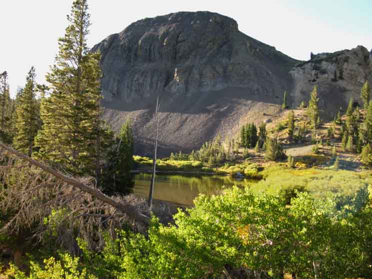
Sherrold Lake
and
Ebbetts Peak
 |
||
Sherrold Lake under Ebbetts Peak under the intensity of the rising Sun.
|
Ducks
| Wood Ducks in Sherrold Lake, September 2009. |
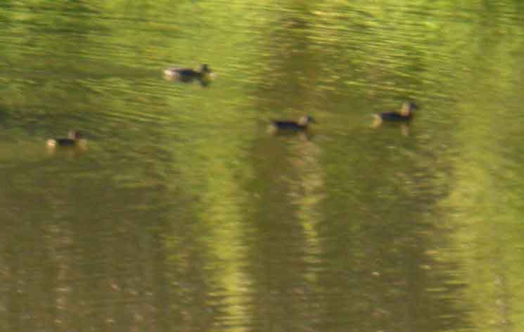 |
The ducks were unhurriedly moving away from where I was going. They were aware and responding to my presence, but unconcerned. |
Around Ebbetts Peak
 |
Last little rise around the East side of Ebbetts Peak before Ebbetts Pass. On the other side the trail runs down into forest and picks up the small creek down to Ebbetts Pass. |
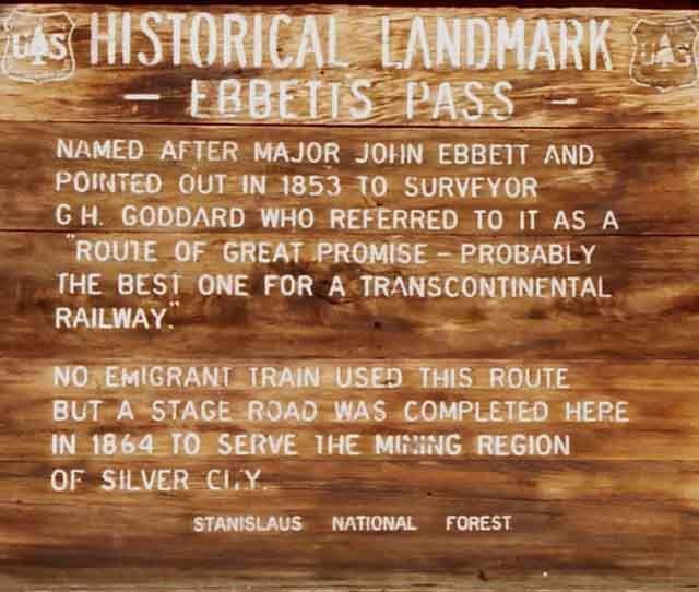
Ebbetts Pass
Exiting the Mokelumne Wilderness at Ebbetts Pass
| The Historical Landmark at Ebbetts Pass | ||
 |
||
1999 Trail Guide Trail Culture |
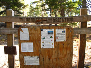
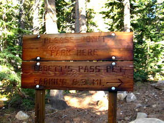
NORTH SIDE
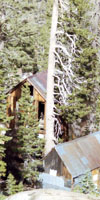
| The broken down bulletin board at Ebbetts Pass. | Sign at Ebbetts Pass asking people not to park at the Pass, but rather park in the trailhead parking lot .3 of a mile West on Highway 4. | |||||
 |
 |
|||||
| NEW ERA RULE: NO FIRES. | NO PARKING AT EBBETTS PASS |
Looking East from Ebbetts Pass
down
HIGHWAY 4
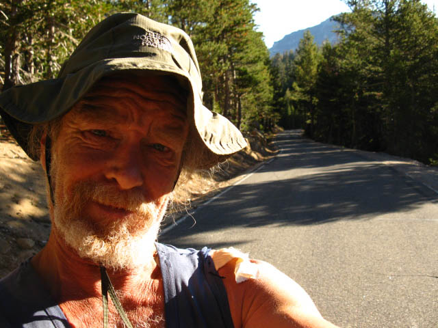
Ebbetts Pass at 7:30 am on Tuesday, September 22, 2009. 2009 was a good year. I had already finished the Tahoe to Whitney hike, went home, settled down for a couple of weeks, then packed up to hike the Tahoe to Yosemite. I had already hiked the Tahoe to Yosemite Trail route as part of the earlier Tahoe to Yosemite hike, so I decided to hike the PCT down the Eastern Sierra through the Mokelumne Wilderness this time through. 2009 was a good year. |
||
 |
||
Not much of a rush hour. In fact, only 3 cars came by during the first hour. The third car picked me up and drove me down to Bear Valley, which sits 3 miles to the West of Lake Alpine. My goal was to take a day sitting and eating in the Bear Valley Deli and Store. Mission Accomplished. But I failed to get a ride back to Ebbetts Pass before dark. But I did get a ride up to the East side of Lake Alpine from Bear Valley. Though this was only four of the twenty-five miles to Ebbetts Pass, this ride brought me to within a half-mile of my fine little customary Lake Alpine campsite. I easily caught a ride to Ebbetts Pass the next morning. Again, it took me around an hour to get a ride, and during that time only a handful of cars were heading Eastbound over Ebbetts Pass. But it was late September, and few fishermen, car campers, or backpackers were to be found on Highway 4. This is not the case during the peak Summer season, when a constant flow of traffic makes it easy for backpackers to hitch down to, and up from The Lake Alpine Lodge or Bear Valley. The Lake Alpine Lodge is where the long-distance backpacker on the Sierra Crest can UPS themselves a resupply package, eat in their restaurant, and have a drink in their bar. Bear Valley is a small community located three miles West of the Lake Alpine Lodge on Highway 4. Bear Valley has a deli, store, gas station, and a couple of sports stores where a limited selection of backpacking gear and supplies can be had. For me the most important resource at Bear Valley is the Store and Deli. The BV Store and Deli stocks a good selection of lightweight backpacker-style foods, and the deli has a wide variety of tasty hot and cold food.
Carson Pass to Ebbetts Pass |
on the
South side of Ebbetts Pass
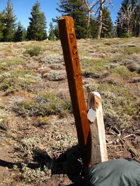
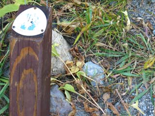
| This PCT post marks the spot where the Pacific Crest Trail continues South out of Ebbetts Pass. | ||
 |
||
|
Ebbetts Pass Backpacker INFORMATION |
Resupply
and
Backpacker Resources
on
Highway 4
The |
North: Wet Meadow Reservoir top of page South: Ebbetts Pass
Ebbetts Pass |
||
69.49 miles 38.78 miles 26.78 miles |
The Pacific Crest Trail at Highway 4 |
29.44 miles 103.24 miles |
Resupply StrategyReaching Highway 4 at Ebbetts Pass marks the Southbound backpacker's first opportunity to resupply since the Echo Lake Chalet, 40.78 miles to the North along the Pacific Crest Trail route. Your next location to resupply South of Ebbetts Pass is 29.44 miles South at Kennedy Meadows Pack Station. The Kennedy Meadows Pack Station sits 8 miles West of where the Pacific Crest Trail crosses Highway 108 at Sonora Pass. My plan always includes hitching West on Highway 4 down to Lake Alpine for at least some food, a few beers, and hanging out with the cool folk at the Lake Alpine Lodge, (and/or the Bear Valley Store and deli) if I do or do not pick up a resupply package at the Lake Alpine Lodge. I recommend planning your days off. Resupply locations are generally a good place to take a day off, relax, feed your body, and spend some time hanging out with the locals and other visitors in a beautiful location. I have a real nice campsite on the East side of Lake Alpine where I lounge around for my day off, when I'm not eating and drinking at the Lodge. Lake Alpine Lodge backpacker's resupply page Trail Options
|
||
Backpacking Trail Guide North |
 |
Backpacking Trail Guide South |
Backpacker ForumsHave you hiked these mountains before? Do you have a great Sierra Nevada route or trip to relate?Post it on
|
North: Wet Meadow Reservoir South: Ebbetts Pass
Trailhead
Contact
Alex Wierbinski

Backpacking Lake Tahoe to Mount Whitney
Your guide to the High Sierra Crest, including the Tahoe to Yosemite, Pacific Crest, and John Muir Trails
