

The Trails
Guide
Maps
Miles/Ele
Permits
Resupply
Forum
Weather Conditions
Weather Notes
Northern High Sierras
Central High Sierras
Southern High Sierras
Gear
Gear List
Gear Forum
Gettin Started
Layering
Testing yourself and your gear
Gear Reviews
Backpacking Echo Lakes
Hiking from Upper Echo Lake to the Lower Echo Lake Trailhead
Meeks Bay Trailhead to the Echo Lake Trail head, The Tahoe to Yosemite Trail
Translate
Languages
Trail Prep
The art of walking
Physical Preperation
Planning
Trail Skills
The trail
Off the trail
Scrambling
Maps
Navigation
Camp skills
Food
Resupply
Food
Other
Photo Catagories
Trail Stories
Trail Culture
News and Science
Links
Groups
Books
Terms and Conditions of Use
Nearing
the
Lower Echo Lake Trailhead
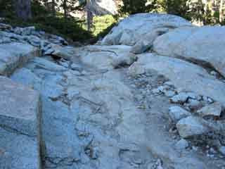
Hiking South for 2.69 miles from the trail down to the Boat Dock on the trail around the North side of the Echo Lakes on the far North side of Echo Lake brings us to the Echo Lake Trailhead. Or we can call the Echo Lake Chalet from the Boat Dock for a ride on their Boat Taxi to the Echo Lake Marina between Memorial Day to Labor Day. I'd rather walk. From solid rock to soft forest floor trail beds, we cross a variety of excellent trail surfaces between the Tamarack Lake trail junction to the Echo Lake trail head. I'm just happy to get off of constant pounding of downhill hiking on hard rock surfaces!
|
 |
 |
| Trail, Echo Lake | fine rock formations, Echo Lake |
 |
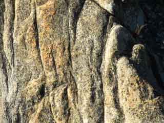 |
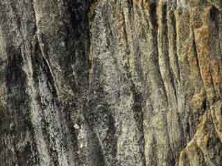
| fine rock formations, details, Echo Lake | |
| Approaching the Lower Echo Lake Trail Head |
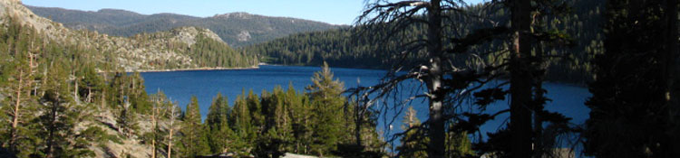
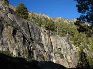
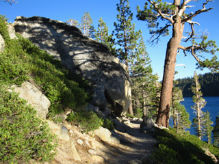
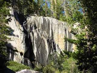
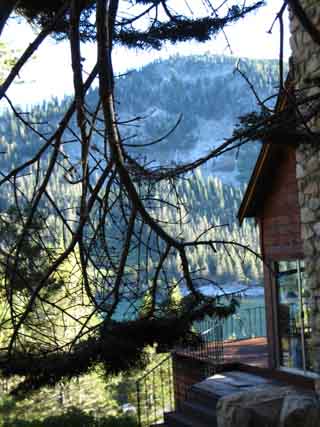
We're just one mile North of the Echo Lake trailhead. Rock Faces descend off of Flagpole Peak sit to our immediate NE, above us, with the crystal blue waters of Lower Echo Lake to our SW. It is a beautiful location, despite the vacation houses. Our fine level trail winding through rock and forest splits the distance between steep rock and deep blue water. It's reallyl pretty along this section of trail. Our generally downhill run from the North side of Lake Aloha ends at Echo Lake. South from there we have a two mile climb to the Echo Lake trail head on Highway 50. Elevation Mileage
note |
Hiking along Lower Echo Lake nearing the trail head
 |
 |
|||
| The trail South along Echo Lake. | ||||
| top of page | ||||
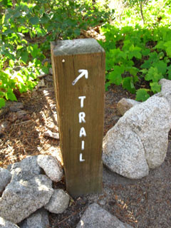
| Sign posts on the East side of Echo Lake keep you on the trail to the trailhead, rather than down to cabins. | ||||
Houses accompany the rock and lake hiking South to the Echo Lake trailhead
 |
|
| lots of fine rock lines the trail along Echo Lake. The reddening of the setting Sun highlighted the rock colors | |
 |
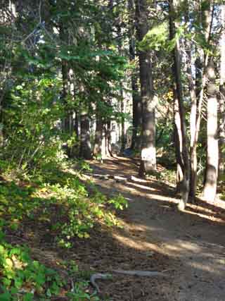 |
| Frodo lives here, Echo Lake | Nice wooded trail section along Echo Lake |
 |
|
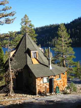
Not my patio, but my view was the same while passing by. |
|
North: Upper Echo Lake South: Echo Lake trail head
Mid-Point: Echo Lake |
I was racing against sunset as I flew South by the luxury houses lining the East shore of Echo Summit. This section of trail has been unfairly disparaged. The trail snakes along between a beautiful rock and forest ridge and and the crystalline blue waters of Echo Lake. But I am running low on energy. Since I'm not resupplying between Meeks Bay and Tuolumne Meadows, the pack is very,very heavy, which is very tiring.. The short length of Desolation Wilderness requires I pass it quickly, which is always challenging at the start of a trip. Despite my dedication to observation and enjoyment of every inch of trail I cover, I was determined to push until darkness terminated my day. In any case, I would not take the boat taxi through this section of trail, even if it was still running. Echo Chalet Boat Taxi information.
Hiking Topo Map: Echo Lake North Hiking Topo Map: Echo Lake SouthMiles and ElevationsSouth: Echo Lake 3 |
Backpacking Trail Guide North |
 |
Backpacking Trail Guide South |
Backpacker Forum: Echo Lakegeneral comments: TahoetoWhitney.OrgAdd your experiences, comments, or pictures hiking along Echo Lake.Section: Tahoe to WhitneySegment: Echo Lake |
Home Page
Contact Alex Wierbinski

Backpacking Lake Tahoe to Mount Whitney
Your guide to the High Sierra Crest, including the Tahoe to Yosemite, Pacific Crest, and John Muir Trails
