The Trails
Guide
Maps
Miles/Ele
Permits
Resupply
Forum
Current Weather Conditions
Weather Notes
Northern High Sierras
Central High Sierras
Southern High Sierras
Gear
Gear List
Gettin Started
Layering
Discussion
Testing yourself and your gear
Gear Reviews
Trail Segment
Sunrise High Sierra Camp
to
Little Yosemite Valley
Trail Section
Tuolumne Meadows to Yosemite Valley
BACKPACKING
YOSEMITE NATIONAL PARK
Section Hiking
The John Muir Trail
South
to
Happy Isle
Languages
Languages
Trail Arts
The art of walking
Physical Preperation
Trail Skills
The trail
Off the trail
Scrambling
Maps
Navigation
Camp skills
Food
Resupply
Food
Other
Photo Catagories
Trail Stories
Trail Culture
News and Science
Links
Groups
Books
Terms and Conditions of Use
| Trail Guide INDEX Tuolumne Meadows to Yosemite Valley |
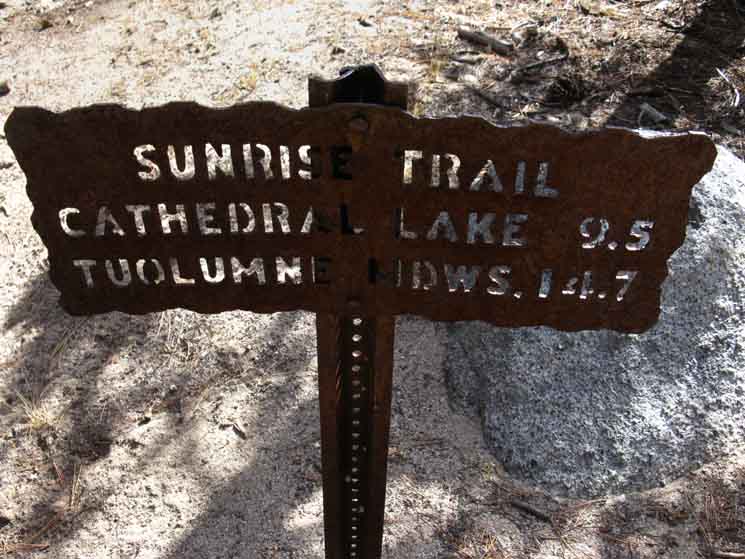
Trail Guide NORTH Cathedral Lakes to Sunrise High Sierra Camp |
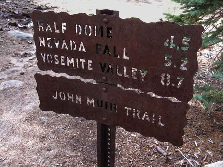
Trail Guide SOUTH Little Yosemite Valley to BIG Yosemite Valley |
Trail Guide |
7.5 Topo Map Yosemite Valley & Central Yosemite |
30 min |
MILES Tuolumne Meadows to Yosemite Valley MILES and ELEVATIONS |
TOPO MAP INDEX Central Yosemite |
Resupply South |
PERMITS National Forests & Parks Toiyabe & Stanislaus & Yosemite |
Sunrise
High Sierra Camp
to
Little Yosemite Valley
Backpacker's Camp
This Page
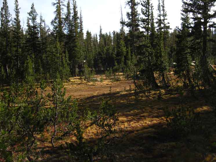
To the Merced River But we are not yet done climbing. Hiking South from the bottom of Long Meadow begins with a 360 foot climb over the next mile and a half of a gently climbing traverse along the forested East flank of the Sunrise Mountains. This segment of our hike positions us for the descent into Merced Canyon via Sunrise Creek. Our climbing traverse South from Long Meadow ends by putting us above the steep slash in the mountainside where Sunrise Creek is born, and begins its run down to the Merced River. We drop in to join it, beginning the steeper parts of our descent down to Yosemite Valley in earnest. Map and Miles
Miles & Elevations Tuolumne Meadows to Yosemite Valley
Backpacker Resources
Lakg the Tahoe to Yosemite Trail. |
||||||||||||||||||||||||||||||||||||||||
Transitions
The John Muir Trail
Descending 9520 feet 8.44 miles South of Tuolumne Meadows 13.36 miles North of Yosemite Valley
The John Muir Trail
Maps and Miles Map
Miles & Elevations Tuolumne Meadows to Yosemite Valley
|
Sunrise High Sierra Camp to Little Yosemite Valley. |
Sunrise High Sierra Camp
Trail Junction
SOUTHWEST
to
Little Yosemite Valley
 |
||||
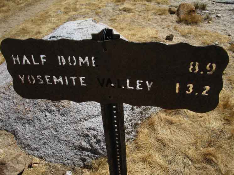
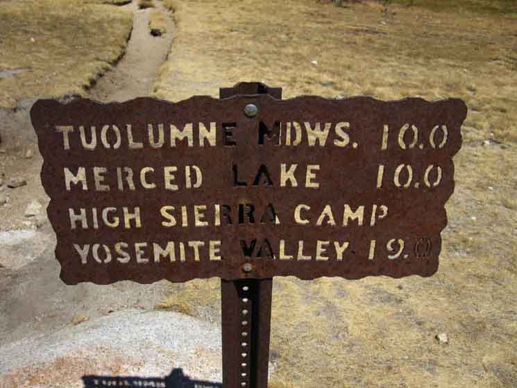
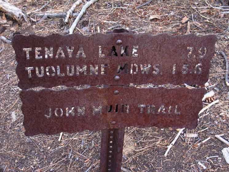
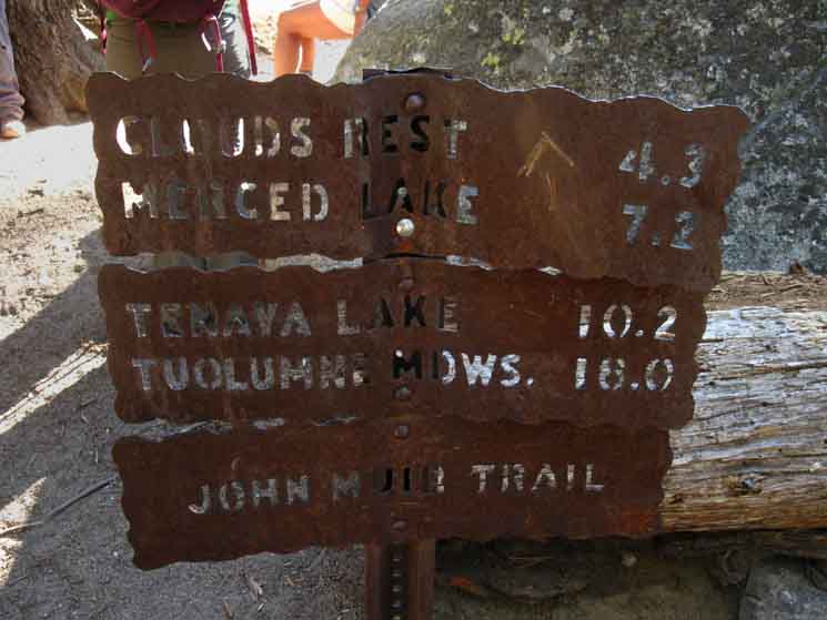
Miles post at Sunrise Southbound trail junction pointing us South by Southwest to Yosemite Valley citing 13.2 miles to The Valley.
|
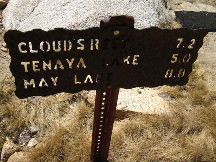
WEST
to
Clouds Rest or Tenaya Lake
 |
||
Sunrise High Sierra Camp Northwest to trail junction beyond Sunrise Lakes. Trails track Northwest to Tenaya and May Lakes or Southwest to Clouds Rest from Sunrise Lakes.
|
NORTH
to
Tuolumne Meadows
 |
||||||
This is in the conventional direction of traditional John Muir hikers. The route to Merced Lake is turning East near the top of this Long Meadow to climb a low ridge to the East to drop down into the canyon at the base of the East Flank of Sunrise Mountain where the Cathedral Fork of Echo Creek flows down into the Merced River at Echo Valley.
|
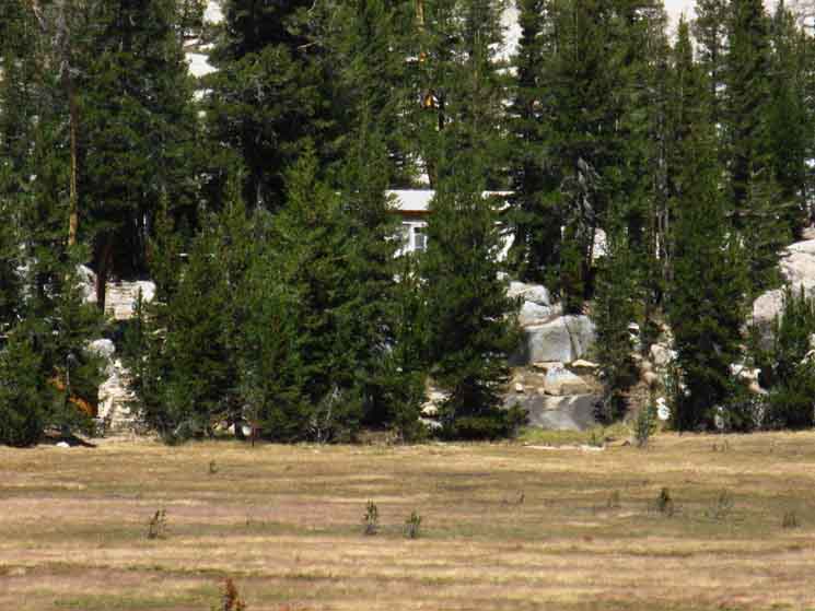
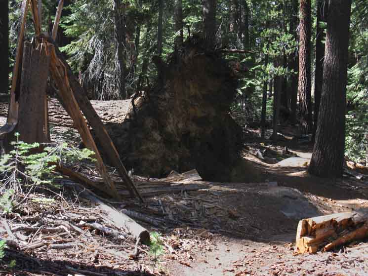
Last Look at Sunrise High Sierra Camp
 |
||
Sunrise from trail junction.
|
Long Meadow
Stock Prohibitions
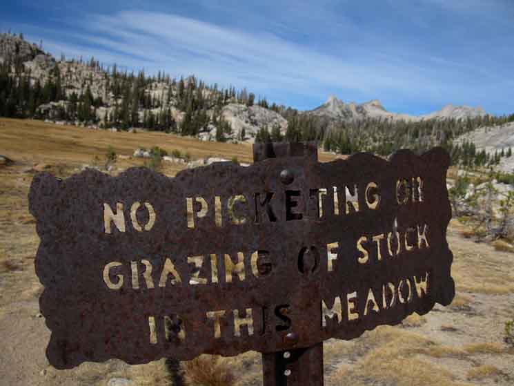 |
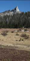
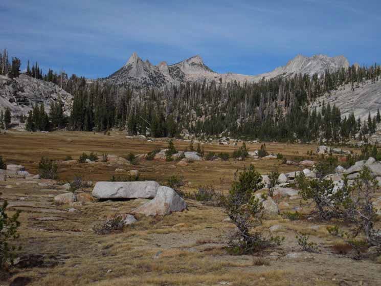
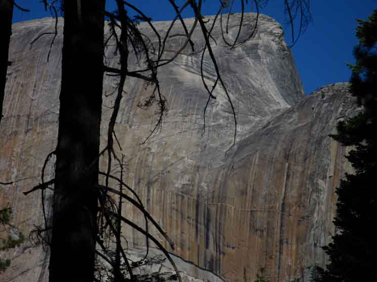
Sign about grazing prohibition in Long Meadow below Sunrise High Sierra Camp at the South edge of the meadow where the trail comes up from Yosemite Valley. We can see Colombia Finger and Matthes Crest in the distance, with the low arc of Cathedral Pass running a line between them. Well, between Tresidder Peak and Matthes Crest. Let's take a closer look. |
North
West End of the Cathedral Range
 |
||
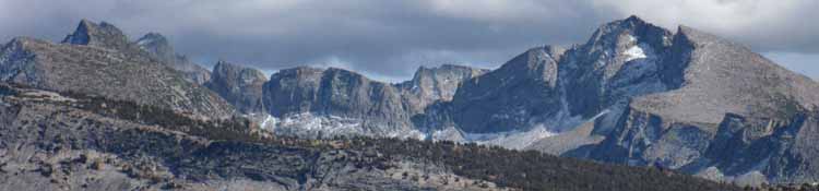
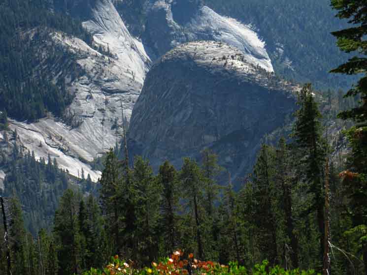
Last Look at the Cathedral Range before dropping South out of the South end of Long Meadow. Colombia Finger on far-Left of high crest, Tresidder Pak is the tallest to its Right, Matthes Crest is the line of rock along the Right side of the high crest. Cathedral Pass located between Tresidder and Matthes. We passed under the nose of Colombia's Finger to drop into the top of this Long Meadow, to follow it down to our present position at the South End of Long Meadow. We turn around to hike South into a short gentle climb before descending forest terrain.
|
Cathedral Pass Detail
Colombia Finger, Tresidder Peak, Cathedral Pass, top of Echo Peaks, and Matthes Crest.
 |
| View from the South end of Long Meadow. Features to the East and West of the Southern Flank of Cathedral Pass. |
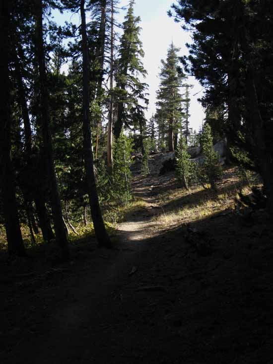
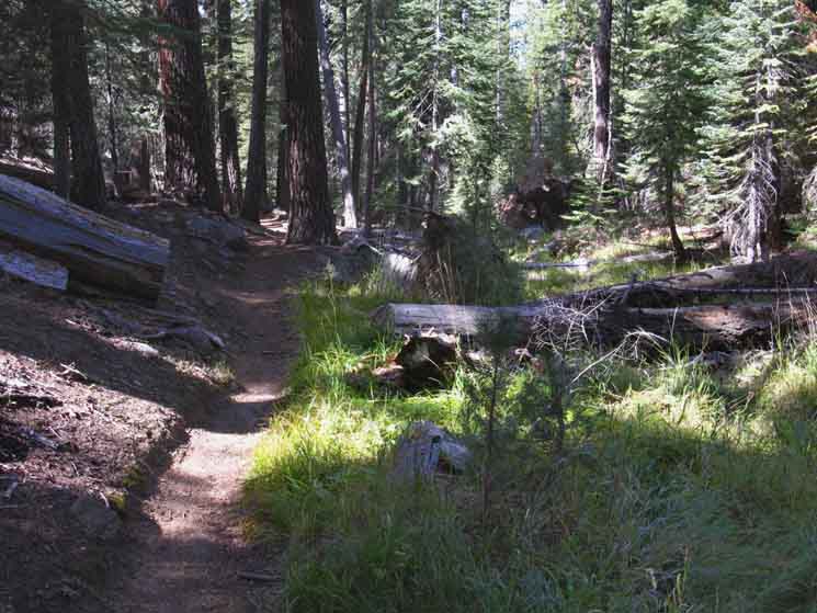
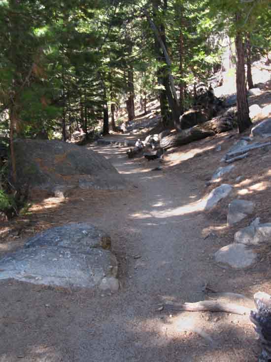
Trail South out of Long Meadow
 |
||
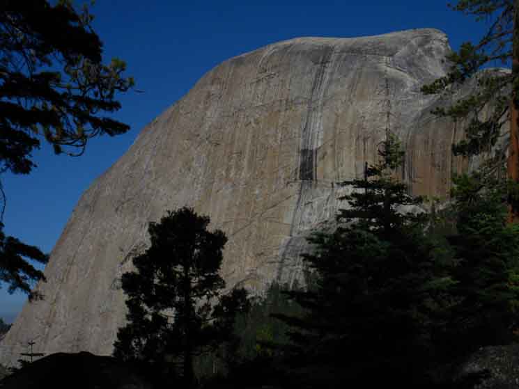
Trail South down from Sunrise High Sierra Camp perched above the bottom of Long Meadow. The granite mound above the trail passes is plainly apparent on our map.
|
JMT hiking South of Sunrise
 |
| Hiking the John Muir Trail South out of Sunrise High Sierra Camp. |
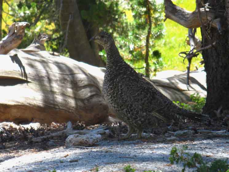
Grouse
 |
||
Grouse and I check each other out. I see them first most times, so I gently click at them, which prevents them from pulling their "escape maneuver," which is to burst into a short bit of frenzied flight. Their preferred outcome is to rely on their cammo to avoid detection in the first place. When they know they are seen grouse seem to choose either rushing their perceived attacker directly, seemingly figuring that flying at them will shock the attacker long enough to enhance grouse's chances of escape, or grouse chooses a direction of flight away from the threat, preferably into/through a thicket, to hinder pursuit. Both avenues of retreat a grouse considers at the moment of escape both include hindering pursuit. One is towards the jaws of doom, the other away. Once my observation skills matured I stopped having "heart stopping" incidents when an unseen grouse would pop out of the underbrush and fly by my face in frenzied flight. Improving our observation skills helps keep everyone from wasting energy and experiencing unnecessary stress. If we see them first and click at them properly we just observe each other for awhile. Birds are both very "flighty" and very curious. We've got to get past the former character element to explore the latter.
|
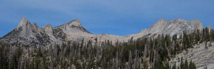
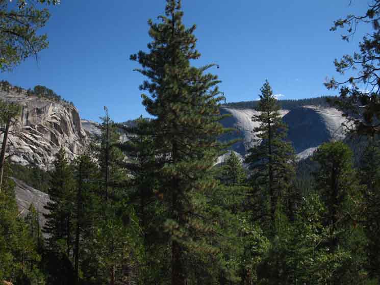
View
A bit East of North
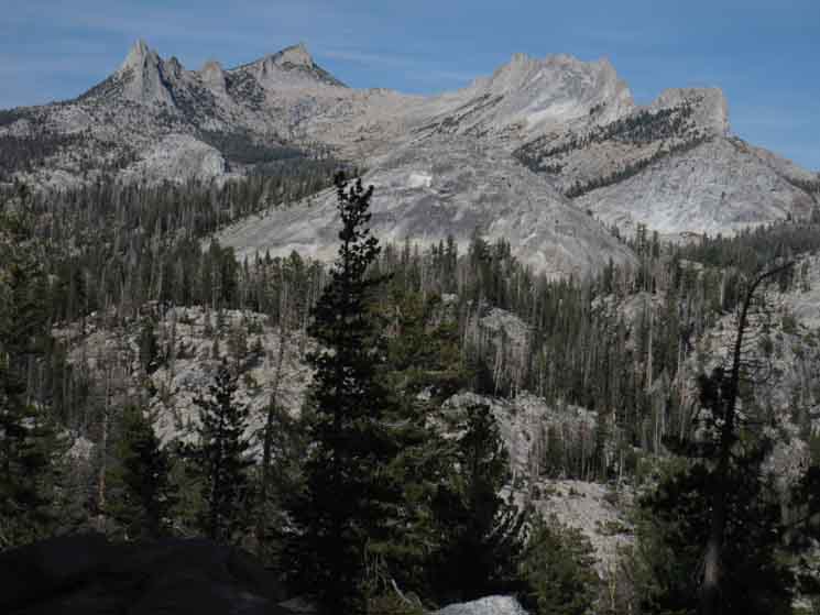 |
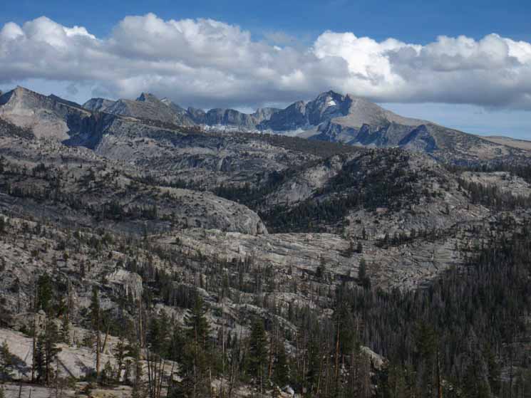
View North at West end of Cathedral Range before descending into Sunrise Creek. Colombia Finger is the projecting spire on the far Left. The highest peak behind Colombia Finger is Tresidder Peak, the low gap to its Right constitutes Cathedral Pass. To the Right of Cathedral Pass rises the Matthes Crest . |
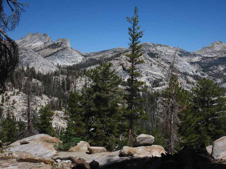
View
A bit more East of North
 |
||
Matthes Crest on the Left, Peak 11105 is the highest peak in the center, and Rafferty Peak is the highest peak on the far Right.
|
View
East-Slightly Southeast
Vogelsang Peak
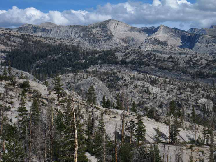 |
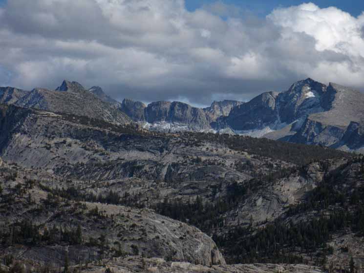
Vogelsang Peak is centered in the image. The dark low peak on the further Left is Fletcher Peak. The light-colored rounded peak towering up behind and to the Right of Fletcher Peak is Peak 11850. |
View
Southeast
Peak 10681 on the Left---Florence Peak to the Right
 |
||
Peak 10681 on the furthest Left, Mount Florence the peak on the furthest Right.
|
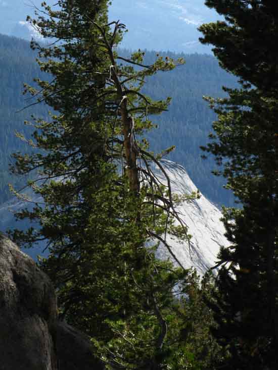
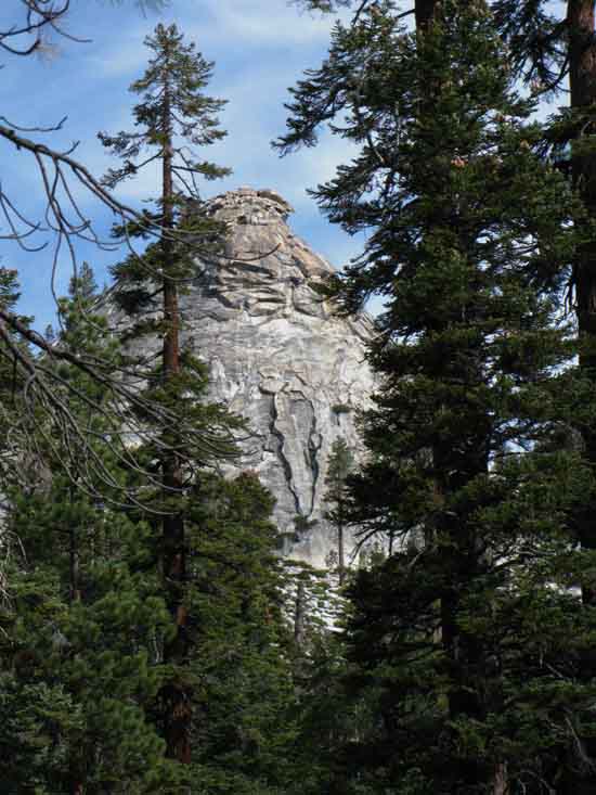
Closer Look at Mount Florence
 |
||||||
Mount Lyell in furthest distance on Left, Mount Florence on Right.
Miles & Elevations
|
Continuing our Moderate Climb
 |
||
Still Climbing hiking South of Sunrise on the John Muir Trail. I means South by compass.
|
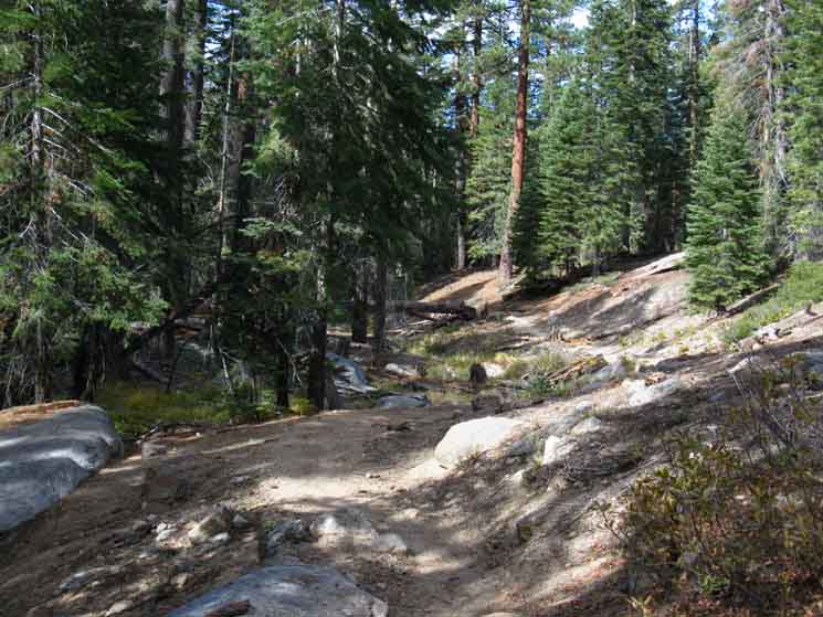
Crossing Interesting Surfaces
 |
| Nicely compressed sandy wash. Some minerals break down rapidly, then are spread by rain and compressed by snow into interesting surfaces. |
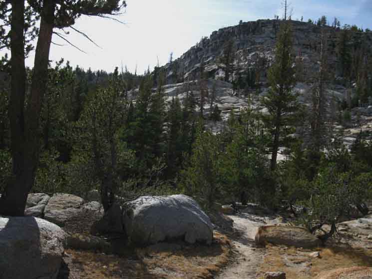
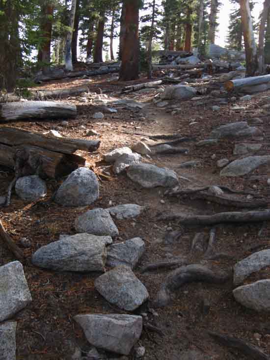
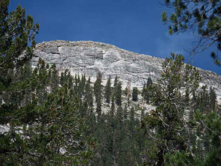
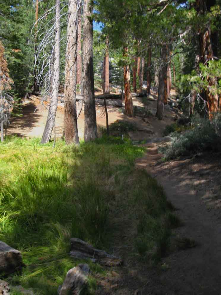
High Point Meadow
 |
||
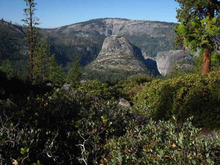
Our trail crests along the edge of this high meadow wedged in along the upper flank of Sunrise Mountain below its Southern Crest. This meadow marks our final approach to the high point of the John Muir Trail between Sunrise High Sierra Camp and Little Yosemite Valley. We make a gentle climb into the upper throat of Sunrise Creek after following the JMT around the crescent-shaped perimeter of this small meadow.
|
Last Steps to top of Sunrise Creek
 |
| Last steps to highest point of JMT above Sunrise Creek |
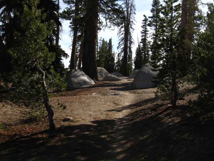 |
||
A sweet garden of beautiful boulders under perfect shading mark the beginning of descending forest at the top of the drainage of Sunrise Creek.
|
| Transitions
Descending Sunrise Creek down to the Rim of the Merced Canyon |
Turning Down
Views South
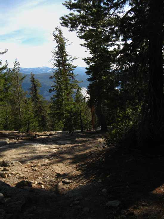 |
||||||||
Dropping into Sunrise Creek gives first views of Canyon of the Merced River.
Miles & Elevations
|
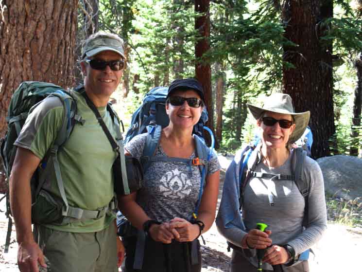
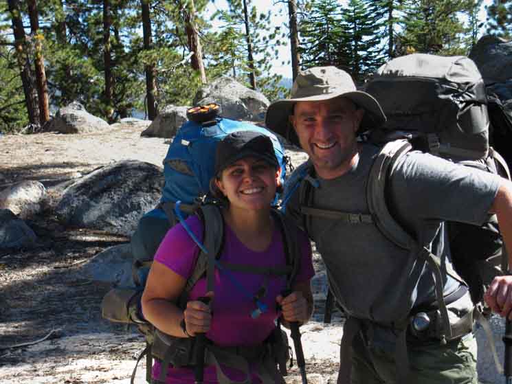
Joe, Kelly, and Mary
 |
||
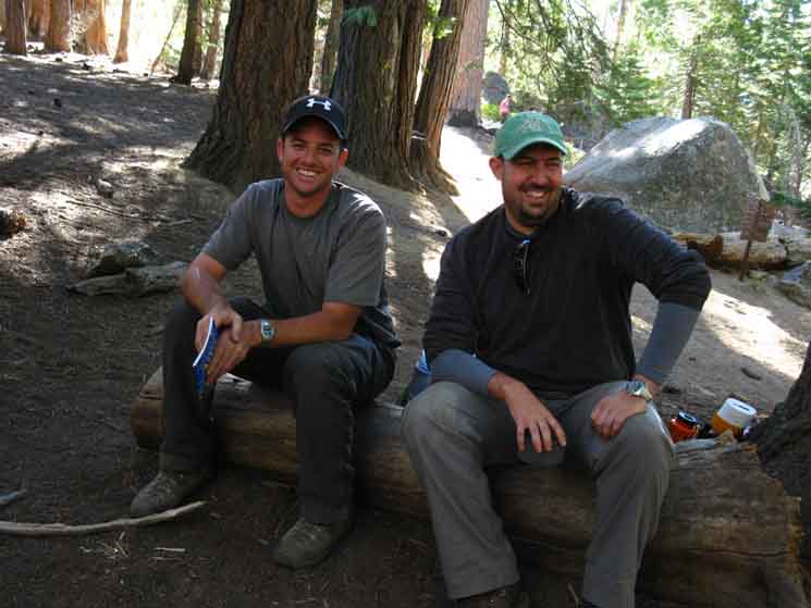
Joe Kelly and Mary near the resumption of their steep climb up Sunrise Creek above the Forsyth Trail Junction. Kelly and Mary are hiking the whole John Muir Trail while Joe is hiking to the next resupply at Tuolumne Meadows.
|
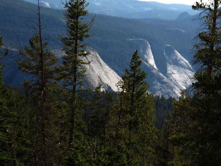
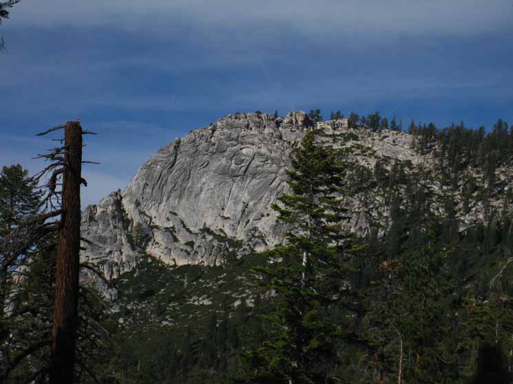
Bunnell Point
 |
| First view of grand granite of Merced Canyon. |
Bunnell Point and Cascade Cliffs
 |
||
Bunnell Point and Cascade Cliffs.
|
Mount Clark
 |
| Mount Clark marking the edge of the Clarks Range in the South Yosemite Wilderness. |
Campsites The John Muir Trail
Descending
8550 feet 11.16 miles South of Tuolumne Meadows 10.64 miles North of Yosemite Valley
to
Maps and Miles Map
Miles & Elevations Tuolumne Meadows to Yosemite Valley
|
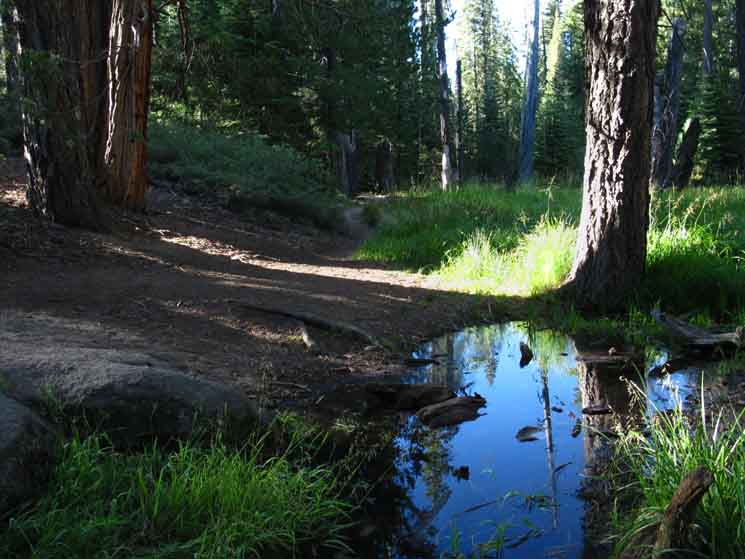
Upper Sunrise Creek Ford
 |
||
The uppermost ford of Sunrise Creek below Sunrise High Sierra Camp.
|
Expansive Campsite at the Upper Ford
 |
Sunrise Creek upper ford campsites. Woke up here one morning in 2012 with no one camping here but I. Well, that's what I thought. Then I began, and kept hearing large branches snapping, about 60 yards above the campsites, up in the the heavily forested gorge of the Upper Sunrise Creek. I quickly figured out what was making the sounds, as there are few things so big that snap big branches on and off the trees. I was listening to something snapping big branches like toothpicks. Something big and fairly articulate. I estimated, judging by the sounds of things breaking, that a large bear was prowling about. It might be breaking branches to reveal insects. I kind of wish Bear did visit, but I did not miss this Bear encounter enough to induce me to hike up the drainage to find a position where I could get an eye on the Bear up there. I did think about moving up to a potential position of observation, but decided that prudence was the best course of action. It was good enough to know Bear was up there. |
| Transitions
Descending On down and then out to the Rim of the Merced Canyon. Our steep descent along the course of Sunrise Creek flattens into a mountain highway. |
South below the Upper Sunrise Creek Ford
 |
||
Hiking South, down-mountain from the Upper Sunrise Creek Ford.
|
To the Rim of the Merced
 |
| Our trail down flattens out and moves South away from Sunrise Creek to the edge of the rim of the canyon of the Merced River. |
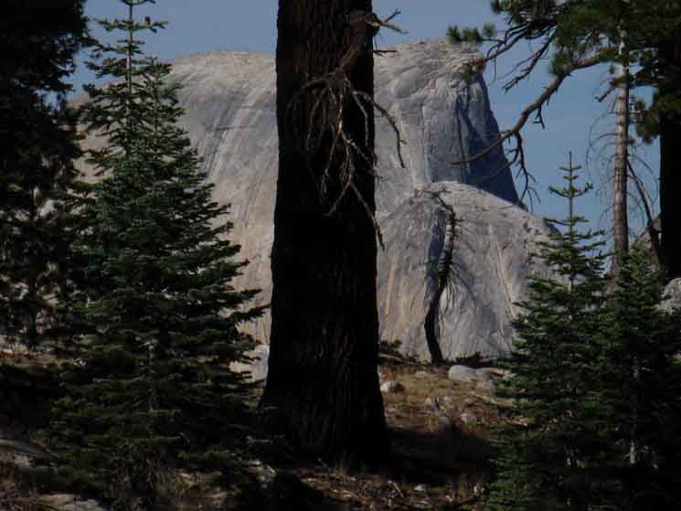
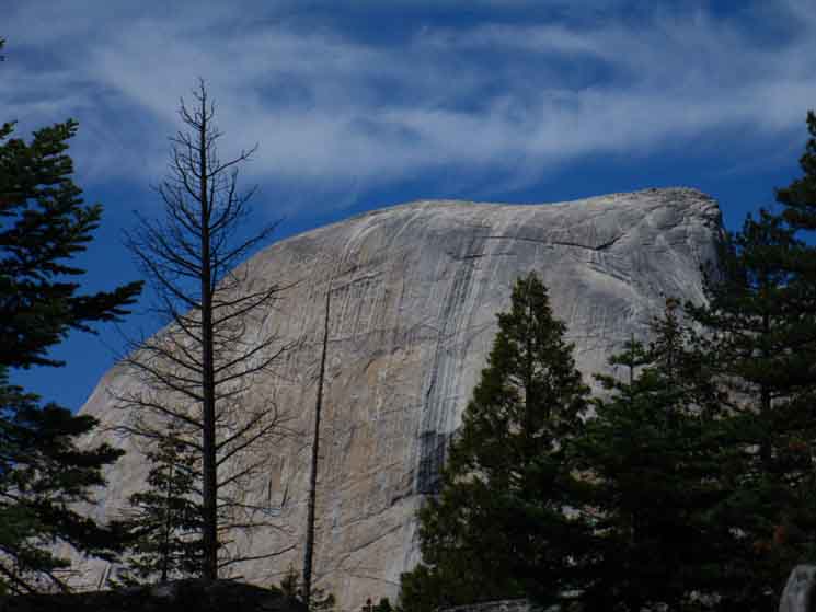
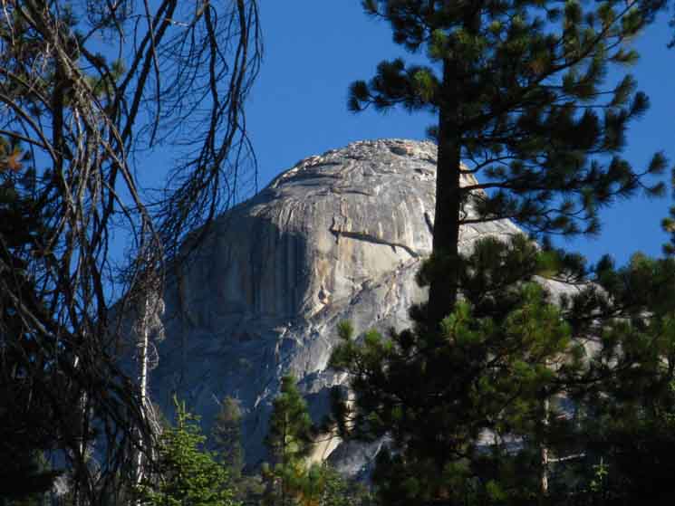
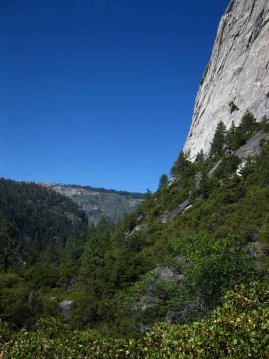
First Look at Half Dome descending the JMT
 |
||
Our first look at Half Dome happens as we descend far enough that the terrain unmasks its position down the mountain below.
|
Final Steps to the Rim of the Merced River Canyon
 |
Our down-mountain trail approaches the rim of the Merced, then bends to our West about 25 yards short of reaching the rim. Our Southbound then JMT parallels the canyon rim along a wide"shelf" of moderately-forested terrain for a couple of hundred yards, down to where the shelf is pinched-off by narrowing and steepening terrain. This "boulevard" style of terrain terminates just above where we reacquire the course of Sunrise Creek. In the image above we are continuing South off the route of the JMT where it bends to our Right at the bottom of the steep descent from the upper Sunrise Ford, veering up off the trail by a few yards to take a look at the view from the rim of the Merced Canyon. |
The Merced River Canyon
Bunnell Point in foreground, Mount Starr King in distant background
 |
||
Bunnell Point bisected by morning light and last of the evening shadow along the East Rim of the Merced River Canyon from our nice overlook.
|
Starr King beyond the Merced
 |
| A closer look at Mount Starr King in the distance beyond the stunning prominence in the foreground. This vast granite foreground protrusion pinches the course of the Merced River opposite Bunnell Point. |
Bunnell Point's Cross-River Neighbor
 |
||
Top of the mighty dome pinching the course of the Merced opposite Bunnell Point.
|
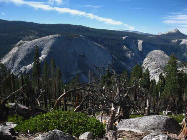
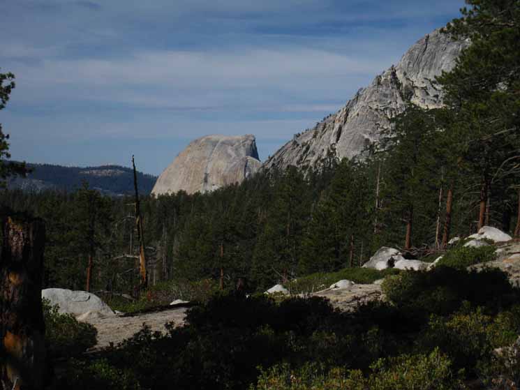
Half Dome below spur of Clouds Rest
 |
||||||
Half Dome below shoulder off Clouds Rest Massif rising to our Northwest. Half Dome towers above the Northwestern aspect of our upcoming campsite in Little Yosemite Valley, which gives us an idea that our current horizontal and vertical distances to the end our our day's trail in Little Yos Valley are almost equal.
Miles & Elevations
|
Quiet Moment
 |
||
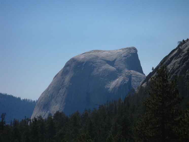
Half Dome in tentative morning light.
|
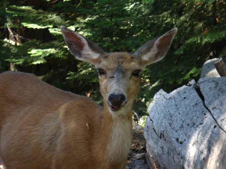
Deerstraction
Along our Wide Track
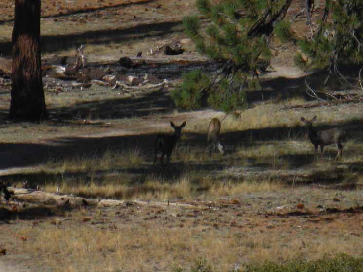 |
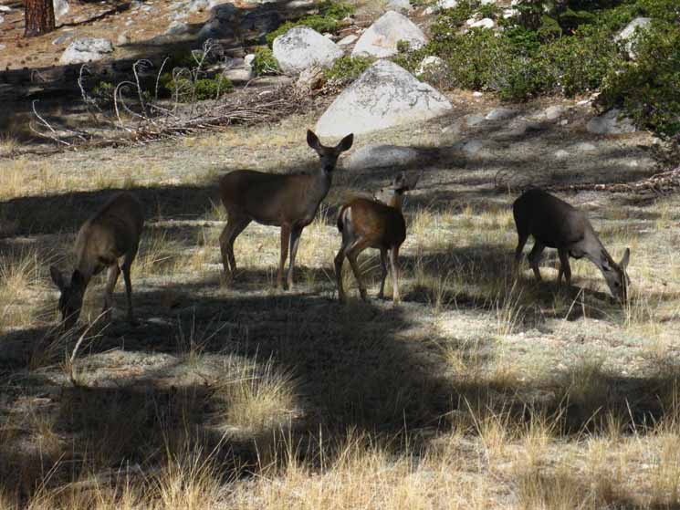
As I was watching the terrain I noticed that a couple of families of deer, a couple of Does with a bunch of Fawns were "grazing up" this wide, flat track towards my position. Two of Nature's Mobile Lawn Mowing Teams. A couple of Deer moms meeting with the kids for a quick graze. It is Yosemite, and every animal here knows that people will not mess with then, so I figured that the deer and I could easily pass each other on this wide segment of terrain without problems, once we all determined that none of us were a threat to each other's goals. So I made my position known, and made a few friendly clicks. Ears popped up, which was my cue to shoot them. Notice that mom is like, "screw it, I'm eating." |
Everything's Cool
 |
||
A fairly calm scene. Deer generally will walk away, even if they do not feel threatened. These kept their line towards me, even though it crossed mine closely. I was being especially sweet. These ladies were willing to maintain their original intention, to graze up this section of terrain, if I did not do anything stupid. That was the mom's obvious decision.
|
Passing in Review
 |
I move to the lower section while the last of the deer move to the upper. Mom encouraged the Fawns into a brief trot as we passed each other in review, but Fawns were more curious than scared. Mom had the "don't talk to strangers" attitude going, and there are no stranger strangers than humans. |
The full Spur above Half Dome
 |
||
The full spur of a ridge running off the Clouds Rest Massif rising to our Southwest.
|
Terrain Narrows, Descent Steepens
 |
The wide, gently descending "boulevard" with its expansive views is tapering down to a narrow trail-track, our descent is increasing, and we are entering a densely forested zone of quiet. The forest is noticeably thickening as we descend. Jefferies have about totally replaced the lodgepoles down here. |
Hiking Higher and Higher
 |
||
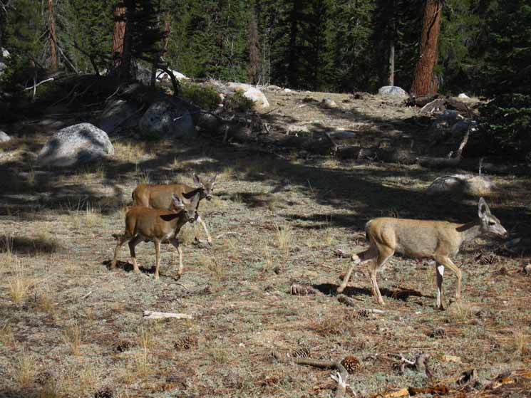
Amber and Steve hiking above the Clouds Rest junction out of Yosemite Valley. They noted the climb out of The Valley is a high degree of sustained difficulty, rating it a seven out of ten on the hardness scale. I believe they were hiking to Agnew Meadow.
|
The Spur from Below
 |
||
The sheer face of the Clouds Rest Spur as we pass under it, just above the Forsyth Trail junction. The image of the spur above, and the second image above that, are both of the same scene, only our perspective has slightly changed from approach to passing under.
|
The Forest is full of Surprises
 |
We constantly see beautiful things poking up through the forests here. A sweet spire of granite decorating the base of the spur. |
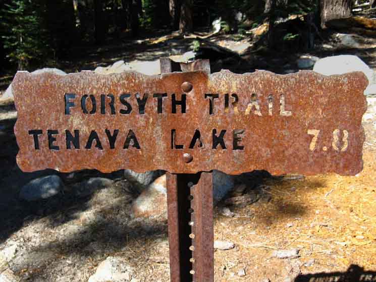
Forsyth Trail Junction
Descending
8000 feet 12.89 miles South of Tuolumne Meadows 8.91 miles North of Yosemite Valley to
Maps and Miles Map
Miles & Elevations Tuolumne Meadows to Yosemite Valley The Forsyth Trail to Tenaya Lake & Sunrise Lake. The Forsyth Trail tracks almost directly North from this junction, while we maintain our Southwestern direction along the descending John Muir Trail. |
 |
||
Forsyth Trail junction along the John Muir Trail. This trail tracks almost directly North. It offers a Northern approach to Clouds Rest, as well as access to Sunrise Lakes on the way up to Tenaya Lake.
|
John Muir Trail
to
Tuolumne Meadows
 |
| Up the mountain the way we came down. |
John Muir Trail
to
Yosemite Valley
 |
||
Continuing Down the John Muir Trail from the Forsyth Trail junction.
|
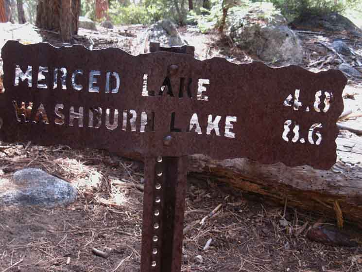
Forsyth Trail Junction I figure about 200 yards separates the Forsyth Trail junction from the Merced Lake Junction. The signs read the distance as a tenth of a mile. Descending The Merced and Washburn Lakes Trail continues East on a fairly flat route following the North Rim of the Merced River Canyon until it reaches Echo Creek. At Echo Creek the trail makes a steep, switch-backing descent into Echo Valley on the floor of the Merced River Canyon locating us just below Merced Lake. Local Backpacking Loops Extended Loop From that junction we then hike East into the uppermost segment of Echo Creek for the hike down to Echo Valley, and then up to Merced Lake, and possibly Washburn Lake, too. |
Merced-Washburn Lakes
Trail Junction
 |
||
The John Muir Trail junction to Merced and Washburn Lakes below Forsyth Trail and above Clouds Rest junction.
|
East to Merced and Washburn Lakes
 |
| Trail East up the North Rim of the Merced River Canyon towards Merced and Washburn Lakes. |
JMT
Up Mountain
 |
||
Up the John Muir Trail to Tuolumne Meadows.
|
JMT
Down Mountain
 |
| Down the John Muir Trail to Yosemite Valley. |
| Campsites & Mileage Issues Descending The lower Sunrise Ford & Campsites are a bit over halfway from the Merced Lake junction to the Clouds Rest junction. I put the distance at about 1.3 miles. Mileage Anomaly The Yosemite signs are very wrong between the Merced Lake and Clouds Rest trail junctions. To be expected. They were cut in the early 1950s. The trails have been cut and recut many times since then. WE take all old trail signs with a bit of healthy skepticism in an ever-changing world. I suspect this mileage variation is due to a major re-routing along the length of this segment of trail. Close inspection of the old route depicts it following Sunrise Creek much more closely, very different than the present route where it turns away from Sunrise Creek below the Merced Lake trail junction.
Reviewing the maps clearly shows where the trail was turned South away from Sunrise Creek onto a less-steep, much less direct route down to Clouds Rest junction. Thus this segment is 1.18 miles longer than the .9 of a mile specified on the Yosemite Trail Signs, totaling out at 2.08 miles between the Merced Lake and Clouds Rest junctions. Two Campsite Locations Bonus Sites Second Set of Sites
|
Down to Clouds Rest
 |
| Forest below Merced Lake trail junction. |
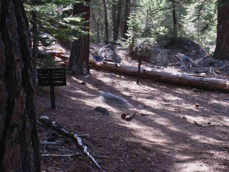
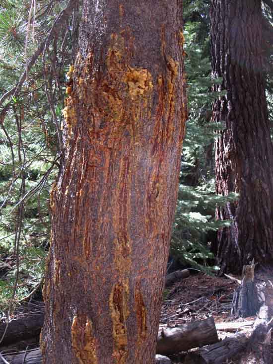
Trail Sign for Bears
 |
||
Bear slashed tree.
|
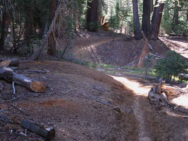
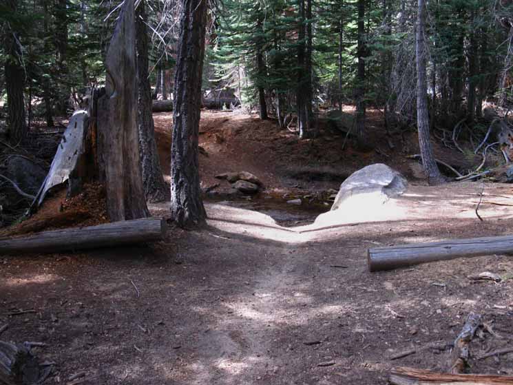
Lowest Ford of Sunrise Creek
 |
||||||
Lower Sunrise Creek ford
Miles & Elevations
|
Flat around Lower Sunrise Ford
 |
||
Expansive flats, nice forest cover, tranquil surroundings.
|
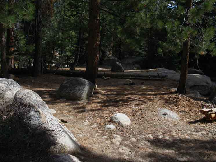
Campsites above Lower Ford
 |
| Campsites above ford. |
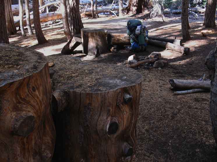
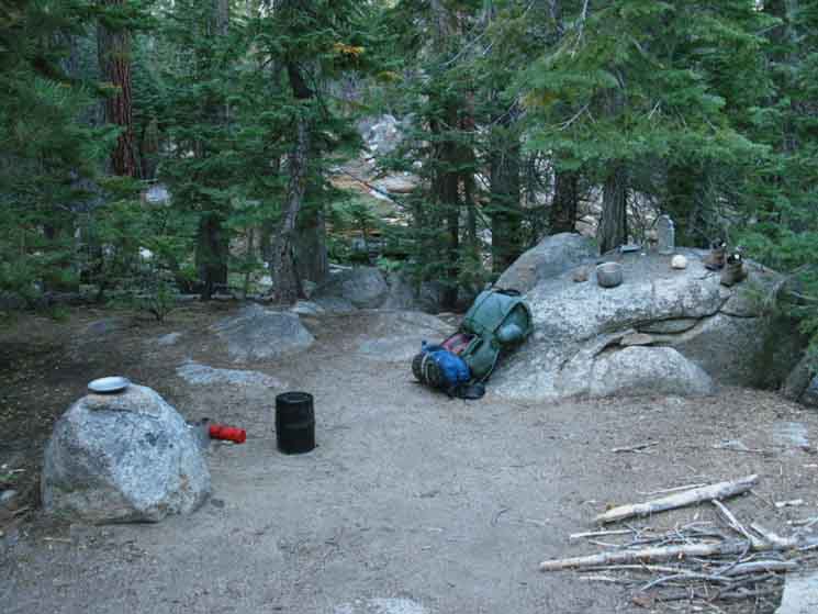
Campsite below Lower Ford
 |
||||||||
Campsite just below lower Sunrise Creek ford. Got water, got the boots off, time to get cooking. I don't make fires, so the wood here, stays here.
Miles & Elevations
|
Site Neighbors
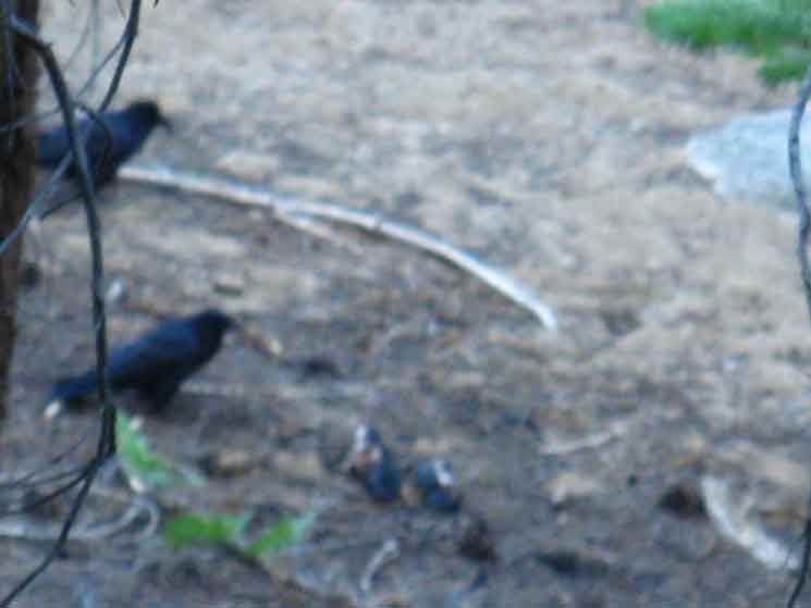 |
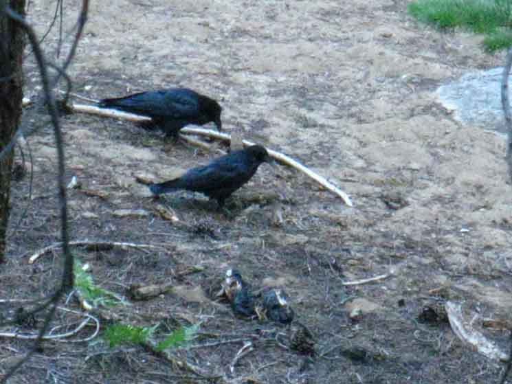
These old crows were having a time. My camp was set up on the rise above their position. They flew down onto a flat sandy shoulder of terrain with few trees below, and fair views around, for the density of the surrounding forest. There was an objective to their visit. |
One Looks Up, the Other, Down
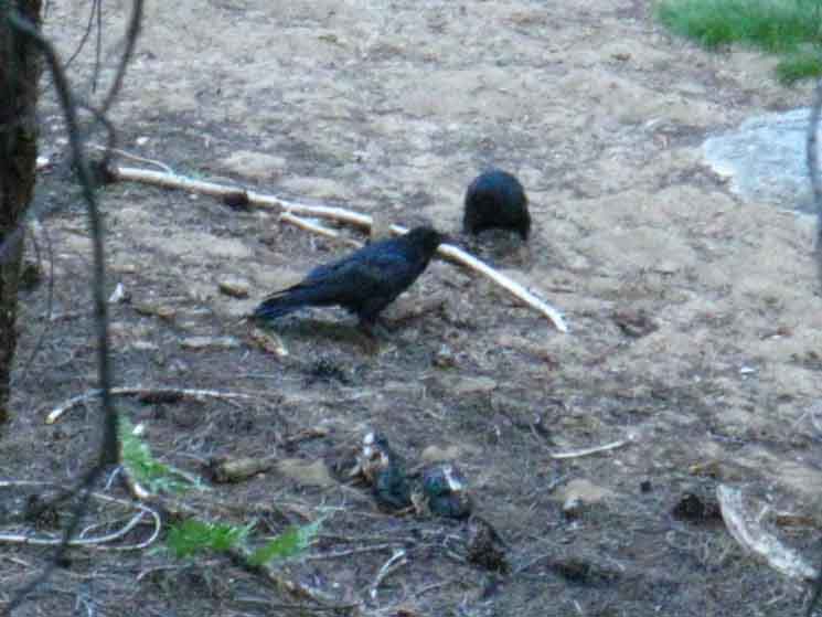 |
They showed signs of being a team, each watching and working in turn. I figure they were targeting some dense populations of insects. It seemed like they had a plan, had done it before, and being here working the bugs was a regular part of their schedule. |
The Local Scene
 |
||
The Crows seemed as intent on relaxing and enjoying the moment and interacting with each other as they were on getting bugs, maybe more. Their own presence and personalities were clearly more important to them than eating bugs, they were clearly defining their tasks within the frameworks of their observations and interactions in what appeared to be a measured way. It was Crow Time. I found it quite relaxing watching the Crows interacting and watching the forest for threats as they picked off whatever bugs had drawn them there.
|
Deer Here
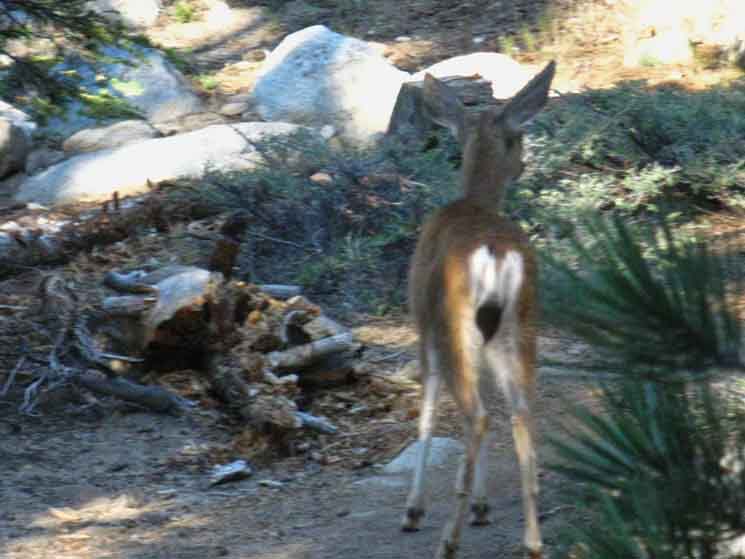 |
Lots of deer. Like Crows, Deer too was splitting attention between finding sources of nourishment and avoiding becoming nourishment. That goal, not becoming food, is why deer's ears are on a swivel. Deer depend on their auditory early warning system, their ears on a swivel, to give their race-horse legs the signal to go. Deer survival depends on clear perception and instant speed. |
Hiking South to Descending
Miles & Elevations
|
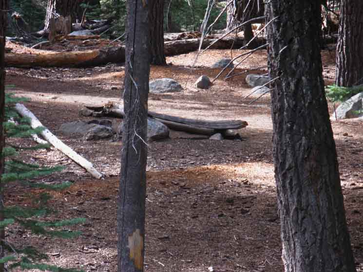
Great Root
 |
||
I figure we've got about 3/4ths of a mile of hiking South down the JMT from the lower ford campsites to the Clouds Rest trail junction. This great root surfaced when its tree fell, transforming from one type of landmark into another along our route.
|
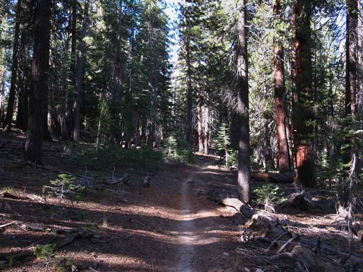
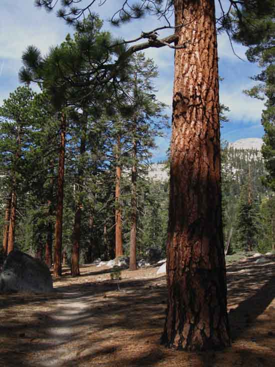
Dense Forests
 |
||||||
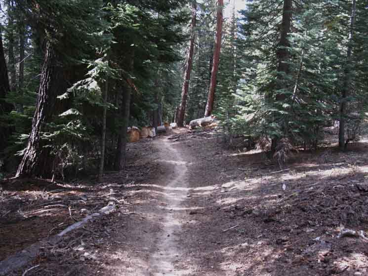
Well-grooved John Muir Trail above the Clouds Rest trail junction. We've transitioned from thin forests of whitebark and lodgepole into white pine and fir and down into jeffery pine forests. The Yosemite site speaks of zones of trees, while other references describe different depths of study, from basic tree identification to understanding each strand in the web of life in the mountains. Tree References
All Living Things
|
Trail Below the Lower Ford
 |
| Quick trail surface for a soft spot in the terrain. The period of drought has allowed lots of terrain moving and moved by ground water to consolidate. |
Wow
 |
||
First view of Half Dome. Wow. It just keeps getting bigger and growing taller as we get closer.
|
Unique Textures and Colors
 |
| Morning light reveals sweet texture and color once we get below the glare. |
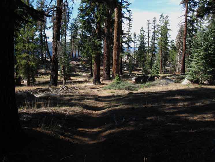
Approaching Clouds Rest Trail Junction
 |
||
Approaching the little creek feeding Sunrise Creek just above the Clouds Rest trail junction.
|
Meadow above Clouds Rest Trail Junction
 |
| An expansive meadow precedes the Clouds Rest trail junction. The trail cutting across the meadow leads to campsites and the Clouds Rest Trail junction, while staying on the trail leads us around the meadow to the Clouds Rest trail junction. |
Approaching the Clouds Rest Junction on the JMT
 |
||
Last steps to Clouds Rest trail junction.
|
Clouds Rest Trail Junction Descending
7220 feet 15.83 miles South of Tuolumne Meadows 5.79 miles North of Yosemite Valley to
Maps and Miles Map
Miles & Elevations Tuolumne Meadows to Yosemite Valley
|
JMT
UP
 |
||
Clouds Rest trail junction miles up the John Muir Trail to Tuolumne Meadows.
|
JMT
DOWN
 |
| Clouds Rest trail junction miles down the John Muir Trail to Half Dome and down to Nevada Falls |
NORTH
CLOUDS REST
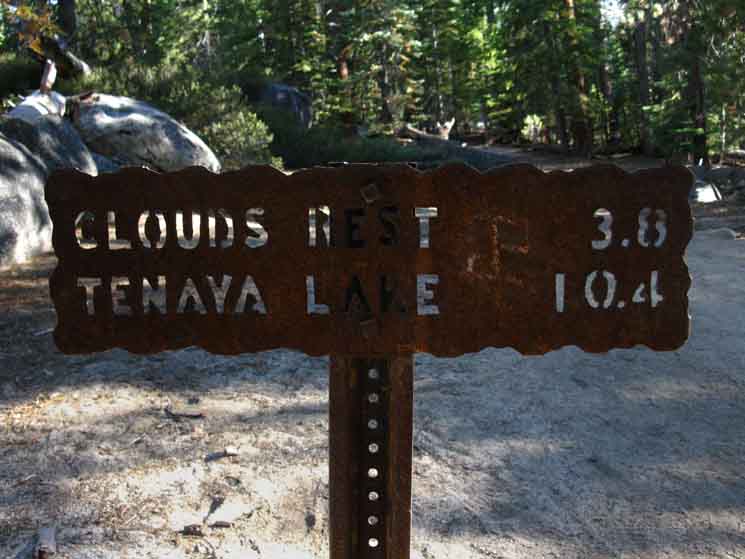 |
||
Miles North off the John Muir Trail climbing North to Clouds Rest and Tenaya Lake beyond.
|
Camping at the Junction
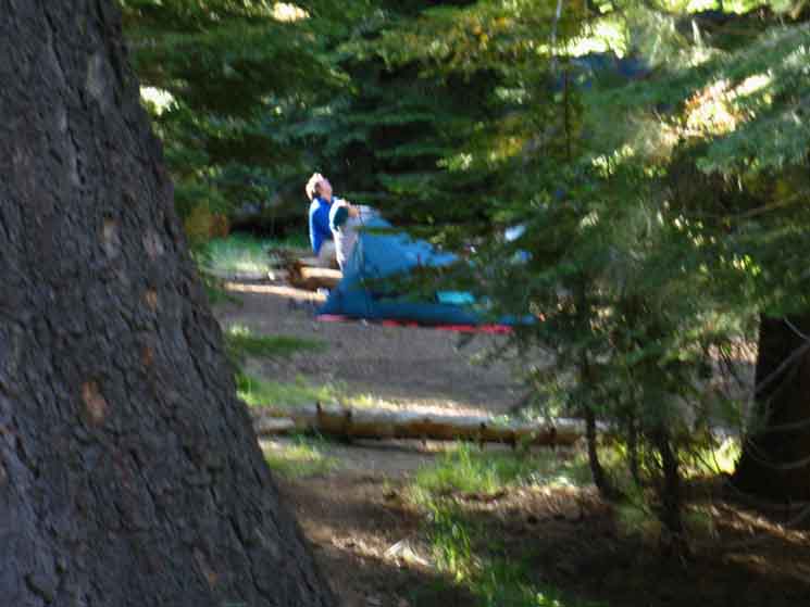 |
Noticing some stirring about sixty yards off the junction: some campers. I suspect they were inspecting Half Dome in the late morning light. |
Hiking South to Half Dome Trail Junction |
Under the Rock
 |
||
In shadow of Half Dome. Nose and Saddle.
|
 |
||||||
One of the delights of our type of travel is a close examination of various terrain features as we approach one side, pass over, through or around it, then inspect it from the other side as we depart. This gives us an engaged perspective, at least.
Miles & Elevations
|
Backside of Liberty Cap
 |
||
Our view of the backside of Liberty Cap locates Nevada Falls in relation to our position. Nevada Falls sit at the base of the Left side of Liberty Cap.
|
Terrain Challenge Shift
Climate Shift
 |
Nothing tells us of the climate change with changing elevation than manzanita. Though Yosemite's trails are clear, manzanita in the more remote parts of the Sierra marks the transition from the difficulties of sub-alpine travel to the difficulties of breaking through manzanita. With the manzanita also comes the heat, warning us of another transitioning challenge. This challenge is the opposite of our first struggles with acclimation, now we are transitioning from an environment of cool, thin air and high elevation exertion to dealing with the potential for serious high temp overheating issues. |
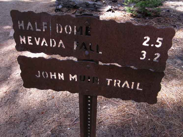
Half Dome Trail Junction Descending
7020 feet 16.35 miles South of Tuolumne Meadows 5.45 miles North of Yosemite Valley
to
Maps and Miles Map
Miles & Elevations Tuolumne Meadows to Yosemite Valley
|
JMT
Half Dome Trail Junction
UP JMT
 |
||
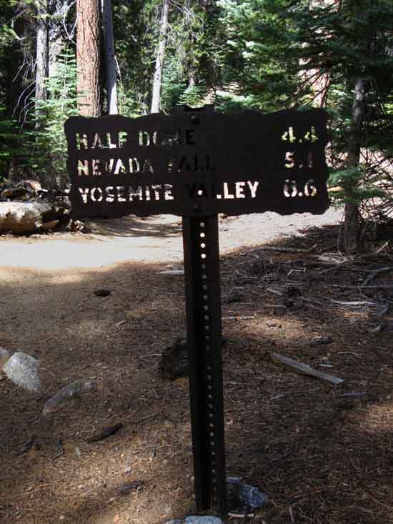
Northbound John Muir Trail sign at the Half Dome trail junction.
|
UP
HALF DOME
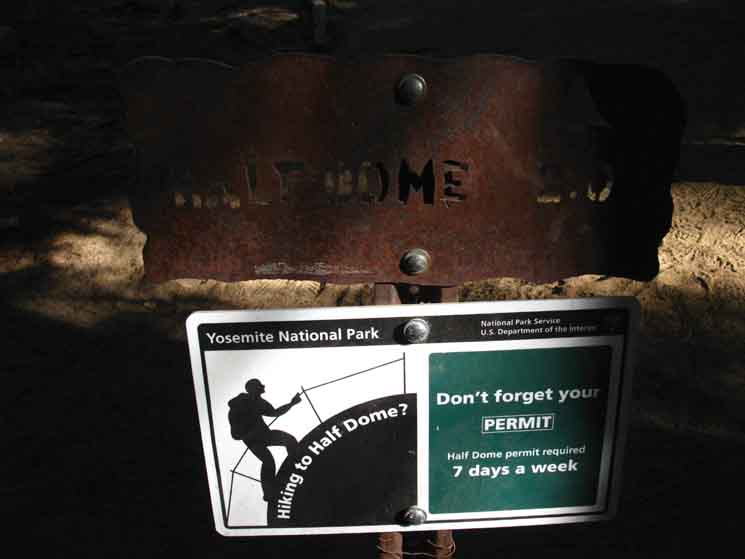 |
| NORTHWEST Two Miles to the top of Half Dome. |
Dudes on the Dome
 |
||
We see and meet a wide variety of folks hiking up to do the dome. Families, youths, students, dude and chick groups, circles of friends, solo adventurers, and so on. Kelly and Matt are a couple of buddies engaged. Engaged in doing things of merit, making them stronger while expanding their perspective and experiences. Other folks engage for some form of social validity, rather than the value of the experience itself. I find those hikers kind-of irritating while being somewhat entertaining. Most folks, like Kelly and Matt, are real good folks, a joy to meet, and great sources of information.
|
Hiking South to I have it as 1.3 miles from the Half Dome trail junction to the solar bathrooms in Little Yosemite Valley. Last Stop before Yosemite Valley |
Trail Conditions
CHANGE
 |
||
Huge Trail The character of the already heavily used trail changes below the Half Dome trail junction. The tread widens, and the surface shows all the signs of the very heavy traffic up the corridor of the John Muir Trail from Happy Isles Trailhead to Half Dome and back. But not in the sense of degraded wear, but a level of maintenance performed to maintain certain standards not applied to less used trails. This status indicates the application of lots of trail crew love. I takes lots of work to absorb high levels of hiker traffic without excessive surface degradation. We'll see the remnants of the paved path from Happy Isles up to Nevada Falls as we continue hiking down into the Heart of Yosemite Valley.
|
Plush Trail
 |
Very well trod trail between Little Yosemite Valley and the Half Dome trail junction along the John Muir Trail. The status of the trail almost looks like we are entering a manicured, curated bit of Nature. All indications are of a very high traffic zone. Half curated by Barnum & Bailey, as a three-ring circus, and the other half managed by Mother Nature Itself. It was be a crazy contradiction, if we were not crazy. It's just normal. |
Glimpse of Cascade Cliffs
 |
||
Fat view up Merced Canyon at Cascade Cliffs as we descend to a point just above Little Yosemite Valley. Our John Muir Trail route below us in Little Yosemite Valley intersects with the trail running up the bottom of the Merced Canyon to Merced Lake where we walk up to the North Bank of the Merced River. We will follow that trail up the Merced River hiking back out of The Valley on our way to rejoin the Southbound JMT in Lyell Canyon. Check out our view looking down on these Cascade Cliffs from high up along Sunrise Creek, above.
|
Hummm...
 |
| An old veteran at dealing with hikers and backpackers. |
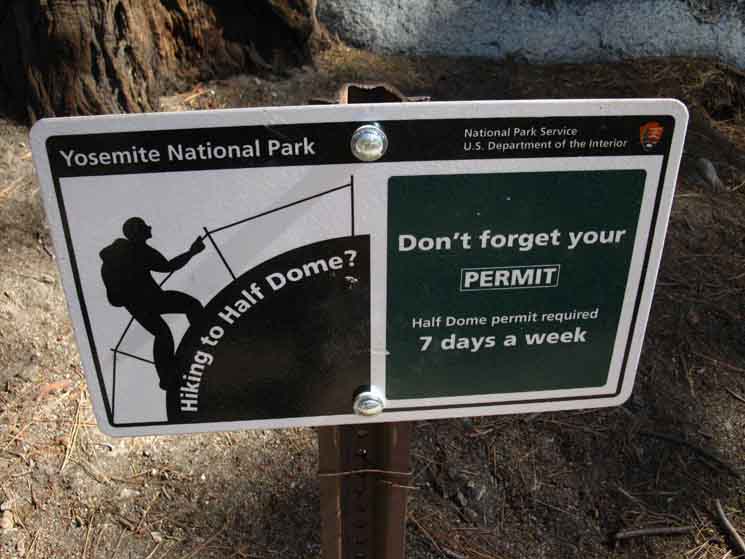
The Half Dome Trail Sign
 |
||
Yosemite National Park Half Dome Permit Sign. You can follow these along the trail to Half Dome. This one sits where the John Muir Trail climbs out of Little Yosemite Valley.
|
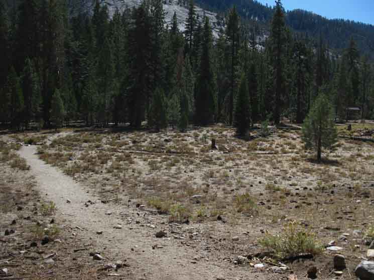
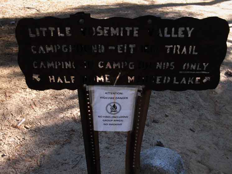
Little Yosemite Valley
 |
||
Entering Little Yosemite Valley. We are confronted with a Y trail junction dropping into this corner of Little Yosemite Valley. The actual John Muir Trail veers to our Left, to pass by the Little Yosemite Valley Backpackers Camp and associated solar toilets as we hike South across the narrow valley to the trail running East and West along the Merced River. Here our JMT turns Right towards the West end of Little Yosemite Valley and Nevada Falls beyond. We can see the solar toilet building in the distant-Right. The Little Yosemite Backpackers Camp is stashed in the forest to the Left of the solar toilet building.
|
Little Yosemite Valley
Descending Little Yosemite Valley
6140 feet 17.76 miles South of Tuolumne Meadows 4.64 miles North of Yosemite Valley
to
Maps and Miles Map
Miles & Elevations Tuolumne Meadows to Yosemite Valley
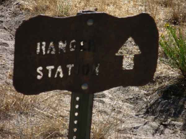
SOUTH: Final Plunge Dropping down onto the floor of Little Yosemite Valley along the JMT route below Half Dome we are confronted with a Y-junction in our trail. This would be the Northeastern corner of a big "Delta" trail junction covering the West end of Little Yosemite Valley. Check it out on the map: Cathedral Pass to Yosemite Valley The difference between these two options is fairly minimal. Both eventually run down to the West end of Little Yosemite Valley, where they join together for the final length of trail West to Nevada Falls. The trail to our Right, along the North edge of Little Yosemite Valley is more direct and shorter, but climbs a bit, is across dry and lots of unshaded terrain, but works its way through and around some cool big granite boulders strewn along that route. We would bend Right at the trail Y dropping into the corner of Little Yosemite Valley following the Ranger Station Sign below's prompt. West to Little Yosemite Valley Southbound Option South across Little Yosemite Valley The Merced River runs along the South side of Little Yosemite Valley here, along with the trail running East and West from Yosemite Valley up to Merced Lake, and on to Washburn Lake above Merced Lake. Our John Muir Trail route West towards Yosemite Valley turns to our right where it converges with the trail running down along the Merced River. Discuss Though the trail along the North side of Little Yos Valley is more direct, I'd take the route of the John Muir Trail along its South side not only because it is flatter, shadier, but mostly because it takes us to the beautiful beach on a deep, calm length of the Merced River. This killer beach is Great for swimming, obtaining water, and it is just a sweet spot to kick it for a few, and watch the sun sparkling off placid waters. Well, placid waters once we get past the Spring Thaw and well into Summer... Alternative Backpacking Tenaya, Merced, Washburn Lakes Woulda-Shoulda Those Merced Lake trail junctions are located at the top of Long Meadow and through the Merced-Washburn Lakes trail junction that we hiked through between the Forsyth trail junction and the trail junction to Clouds Rest as we were coming down the JMT. Alternative We can see that our planned route coming down the John Muir Trail from Tuolumne Meadow to Yosemite Valley, then back to the Sierra Crest via Vogelsang High Sierra Camp is complimented by a number of potential routes coming down from Tenaya Lake via Sunrise or Clouds Rest to Merced Lake, & then over Vogelsang to Lyell, to end at Tuolumne Meadows, if not hiking back to Tenaya Lake. Check out the triangle of trails where we land on the floor of Little Yosemite Valley, and finally access the Merced River itself, on the map below-Left.
Little Yos Valley It does not matter too much if we hike to our Right at the trail Y descending into Little Yosemite Valley pictured above, or continuing straight across the valley to make a Right at the the John Muir Trail junction along the Merced River. Each route shortly brings us to where these trails converge on the Westernmost end of Little Yosemite Valley. The reasons for veering Left across Little Yosemite Valley would be if we are camping at the Backpackers Camp, want to use the fancy solar toilet, or need water or a relaxing moment from the beach along the Merced River. For John Muir Trail hikers out of Happy Isles arriving at Little Yosemite Valley marks the completion of their typical "first station" of the JMT. The first station would be reaching their Little Yosemite Valley destination after their first day's rigorous climb off the floor of Yosemite Valley. Below we follow the trail along the North edge of Little Yosemite Valley to where our Westbound trails reconnect on the West end of Little Yos Valley. |

Trail
.57 of a mile
Veering Right through the Y after dropping onto the floor of Little Yosemite Valley brings onto a trail that rises and falls a bit as it runs West along the North edge of the valley to the Westernmost end of Little Yosemite Valley. Below are a few images of hiking along the Northern edge of Little Yosemite Valley down to its West end, signified by the trail sign marking the reunification of these two trails at the junction on the West end of Little Yosemite Valley.
The next page, Little Yosemite Valley to Big Yosemite Valley, explores the JMT route option through Little Yosemite Valley that swings by the Little Yosemite Backpackers Camp, the solar toilet building, which then turns downriver at the JMT trail junction above a very nice beach on the Merced River, to meet us at the trail junction sign at the bottom of this page.
The segment of the JMT swinging past the backpackers camp and following Merced River down to the junction on the West End of Little Yosemite Valley is
|
Sweet boulders below massive cliffs
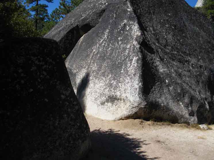 |
Trail around North edge of Little Yosemite Valley. We enter a bit of a labyrinth composed of massive boulder calved off the massive It's not so quiet when they are moving, but real pretty where they stop. |
Rocky Passage along North edge of Little Yosemite Valley
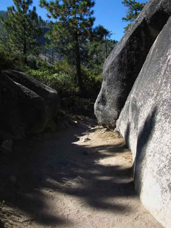 |
Very nice passage towards West end of Little Yosemite Valley. We're making our way over a little rise tailing off the back end of Liberty Cap. |
Under
Liberty Cap's South Flank
 |
Coming out of our obscured passages reveals a nice profile of Liberty Cap's sheer Southern face. We shortly drop down to the trail junction on the West end of Little Yosemite Valley. |
Trail Junction
on the
West End
of
Little Yosemite Valley
 |
|||
Little Yosemite Valley trail sign.
Looking East Right to the JMT Up.
Trail Guide
Two Routes We can see the backpackers camp from either trail, located about .42 of a mile East of the trail Y on the West end of Little Yosemite Valley. The JMT route along the Merced River is flatter, shadier, and has access to water. The other route along the North edge of Little Yosemite Valley is more direct, more exposed, and climbs a bit to bring us back down to the trail climbing to Half Dome out of Little Yosemite Valley. The sign above points out that both routes lead to the backpackers camp. WHY? That's good trail planning and management. Split the herd and divide the damages, keeping one or both routes from being unnecessarily overused.
|
Next
6120 feet 18.37 miles South of Tuolumne Meadows 3.43 miles North of Yosemite Valley
|
North: Cathedral Lakes to Sunrise HSC South: Little Yosemite Valley into Yosemite Valley
Backpacking |
||
The Golden Triangle Yosemite is a large National Park that I break down into North, Central, and South regions for the convenience of the Long Distance Backpacker. We hike into the most Northwestern region of Yosemite through Bond or Dorothy Lake Passes on the Tahoe to Yosemite or Pacific Crest Trails, respectively. To our East-Southeast are the Hoover Wilderness Trailheads, to our South-Southwest lays the Grand Canyon of the Tuolumne River terminating in Hetch Hetchy. After crossing the boundary entering Yosemite across Dorothy Lake Pass we executed a 56.23 mile hike across the North Yosemite Backcountry to Tuolumne Meadows. We arrive at roughly the center of the Sierra Nevada entering Tuolumne Meadows. Here the end of the Tahoe to Yosemite Trail is supplanted by the John Muir Trail heading South along the Sierra Crest from Tuolumne Meadows. Since I consider everything South of Tuolumne Meadow to be the South Sierra, our explorations of the center of Yosemite will be quite limited. We simply continue hiking South along the crestline from the combined routes of the TYT-PCT onto the combined routes of JMT-PCT. Unless we shake things up a bit. Unless we take an alternative route running us down to Yosemite Valley and a different route back up to the JMT that lands us into Lyell Canyon only 5.6 miles South of Tuolumne Meadows. This is the Golden Triangle Route. Hiking the Golden Triangle Route in addition to our normal route from Lake Tahoe to Mount Whitney imparts a much broader view of what this magnificent jewel of the Sierra, Yosemite National Park offers by exploring the world famous routes into and out of Yosemite Valley. And The Valley too! We will get a much fuller view than we would by staying up on the Sierra Crest across Yosemite. Let's hang a Golden Triangle off our crestline route as we THE GREAT DESCENT These granites descend from their lofty heights in wall, faces, valleys, and granite massifs measuring out dimensions of a block of granite showing four thousand feet of depth from the base of Yosemite Valley to the tops of the surrounding Cathedral and Clarks Range peaks. I figure the "Pluton" from which the Cathedral Range and the Central Yosemite Wilderness was carved from is at least forty miles in length, thirty miles in width, and four thousand feet thick. Those are the specifications I measure from observing the rough extent of the fine granites typical of Yosemite Valley and its surrounding terrain. A pink tinged granite of a very different texture than Yosemite's characterizes the different composition of the pluton to our North from which the topography of Emigrant Wilderness was cut. To our South the extensive volcanic activity we observe approaching Mammoth Mountain and Ritter and Banner Peaks marks the fiery Southern extent of Yosemite Granite. Well, those appear to be the rough dimensions of the particular blob of granite composing the Yosemite "Pluton," before the glaciers got ahold of it and carved it into the sweet set of configurations we recognize today. Yosemite Valley and the great granite gashes running down the mountains to it are the types of granite scenes and granite scenery which are typically restricted to hikers capable of, and willing to work hard to see them at much high altitudes. The wonder of Yosemite and its grand granite Valley are in making these types of high altitude wonders easily accessible to great urban masses of flat landers from the comforts of their cars. Despite that sad fact I figure no respectable long distance High Sierra backpacker worth their salt would miss experiencing both the grandeur of these monolithic features, or miss observing the spectacle of the vast oceans of people, of "consumers," consuming in the shadow of This Profound Valley. Consumers consuming Nature in the very heart of Nature. How Ironic. "Would you like some Hearts of Nature with that pizza?" Very Interesting, on all counts and from all points of observation. Approaching The Valley The Valley is all the contradictions of man and Nature packed into one unique, compact package. Like I said, I'm excited to explore its physical and cultural experiences, and talk to everyone I can. This will be a bit more difficult than on the trail, despite the abundance of people. "City" rules apply in Yosemite Valley, and the majority of tourists persist in pretending they don't see each other. I can be hard to ignore, so this could be a lot of fun...haha... "Why is that man talking to me?" Ha ha. This dull attitude of disengagement even reaches up the trails out of Yosemite Valley, at least for as long and far as it takes for a citiot to reengage with their fellow man and Nature. But all is not lost in Yosemite Valley. Alive Again! Ah, the dread excitement of approaching Yosemite Valley, that cold sweat of joy! Jeezee, I hear Chango is gone... He was hanging gear just above The Valley Rangers grasps, and pirate camping Oh, and Sammy Shannon also introduced me to technical climbing. This was fortuitous. Learning the fundamentals of rock climbing really improved my skills as a backpacker, backcountry backpacker, and scrambler. Thus I encourage backpackers to interact with climbers as possible through Yosemite, where we may come into close contact. Learn as much as possible about traction, flakes, and surfaces from them as possible. A climber's understanding of the nature of surfaces is a valuable possession. Plus, they are a very interesting group of folks.
THIS PAGE IS UNDER CONSTRUCTION: STAY TUNED FOR MUCH MORE!
7.5 Map:
30 min Map
|
Backpacking Trail Guide JMT Cathedral |
 |
Backpacking
|
Backpacker ForumsHave a great trip or story to relate about Yosemite or in the Sierra Nevada? Post it on Above we come to the Front Page of the High Backpacking Trails and Topics Forums. Below we break the forums down into categories:
The Trails Forum acts as your place to put up input, comments, relate your experiences, or ask questions about each segment and spot along the length of our combined TYT-PCT-JMT trails. The Forum is your place to supplement the trail guide. Anyone can post text comments in the existing forums, but only members can post up new topics, along with images, maps, and formatting. If you have experiences, comments, questions, or pictures and videos of the Pacific Crest Trail between Sonora Pass and Tuolumne Meadows, post up here as an unknown hiker or as a member: Forum Section
|
Trailhead
Contact
Alex Wierbinski

Backpacking Lake Tahoe to Mount Whitney
Your Guide to the High Sierra Crest, including the Tahoe to Yosemite, Pacific Crest, and John Muir Trails
