


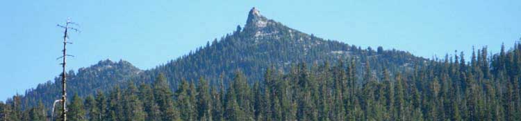
Backpacking Meeks Bay Trailhead, Desolation Wilderness
The Trails
Guide
Maps
Miles/Ele
Permits
Current Weather Conditions
Weather Notes
Northern High Sierras
Central High Sierras
Southern High Sierras
Gear
Gear List
Gettin Started
Layering
Discussion
Testing yourself and your gear
Gear Reviews
top of page
| traill guide section index | last: Finding Meeks Bay | next: Desolation Trail | this map | miles elevations | this forest-wilderness | all forest-wilderrness | trail guide index | all pages | maps index |
Meeks Bay Trail Head
Bulletin board at the Meeks bay Trailhead
 |
This Sign Board marks the beginning of the Tahoe to Yosemite Trail
Meeks Bay Topo: (Click the dots for related trail guide pages)
Last Page: finding Meeks Bay Trailhead next page: The Desolation Trail
Around the Meeks Trail Head
| 1>Below: "Log Cabin Road" sign as seen from 89 South bound, trail head in back | 2>Below: The trailer park across Hwy 89 from Meeks Bay Trail head |
 |
 |
 |
 |
| 3>Above: Meeks Bay Resort is 100 yards North of the trail head | 4>Above: Forest Service fire station 100 yards North of the trail head. |
| The Tehoma Store and Deli |
 |
| This Store, and a nearby pizza parlor, are the only food resources near the trailhead. They are about 4 miles North of the trail head |
Last Page: Finding Meeks Bay Next Page: The Desolation Trail
Trail Guide Index
Meeks Bay Trail head Discussion, continued (back)
Meeks Bay: Trailhead location and accessThe Meeks Bay Trail head in Desolation Wilderness is the hardest of all three trailhead options to get to, especially if you hitch hike and take public transportation as I do. Public transportation does come in from the North, if you come to Meeks Bay from the North side of Lake Tahoe on Highway 80, but the local bus line ends (pdf) a couple of miles North of the trailhead. There is no public transportation to Meeks Bay up Highway 89 North from South Lake Tahoe, for those backpackers who access Lake Tahoe by Highway 50 from the South. The Amtrack bus from the Bay Area will drop you off at the Tahoe Y, where Highways 89 and 50 intersect, but you will have to get from there to Meeks Bay yourself. But not to worry, hitch hiking is very easy in the Tahoe Basin. In Meeks Bay, the trail head itself is set-back off of the West side of Highway 89 directly across from a trailer park, and 100 yards South from the Meeks Bay Resort and a National Park Service fire station. If you are coming to Meeks Bay from the North, from Highway 80 to Highway 89 South, look for the tiny town of Tehoma. After passing about 4 miles South of Tehoma, you will see the Meeks Bay Resort and NPS fire station on your left about a 100 yards before you come upon Log Cabin Road, (Also known as Forest Route 14N42) and the trail head on your right. If you are coming to Meeks Bay from the South, from Highway 50 and South Lake Tahoe to Highway 89 North, the trail head appears on your left directly across Highway 89 from a trailer park less than a half-mile after you pass a little red two garage fire house in Rubicon Bay. If you reach the Meeks Bay Resort and the Forest Service fire station on your right, you have passed the trailhead. There is more info about local transportation on the Lake Tahoe Backpacker Resources page. Local ResourcesLocal resources are sparce in Meeks Bay, with the Meeks Bay Resort offering little more than candy bars and chips. But there is real food avaiable in Tehoma, consisting of Pizza and a Deli, about four miles North on Highway 89. There is decent pizza in Tehoma, but the real treat is the monster sanwiches avaiable in the deli in the Tehoma store, pictured above. They are kind of expensive, but they are huge. Map: Meeks to Lake Genevieve Map: Lake Genevieve to Susie Lake |
next page: Beginning the Desolation Trail to Lake Genevieve
Backpacker ForumsExperiences at Meeks Bay? Share them with others atTahoetoWhitney.OrgAdd your experiences, comments, or pictures about thisSection: Meeks Bay to Echo Summit /Segment: Meeks Bay |
Home Page
Trail Arts
The art of walking
Physical Preperation
Trail Skills
The trail
Off the trail
Scrambling
Maps
Navigation
Camp skills
Food
Resupply
Food
Other
Photo Catagories
Trail Stories
Trail Culture
News and Science
Links
Groups
Books