

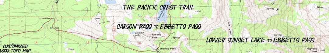

Backpacking Map
Lower Sunset Lake
to
Ebbetts Pass
Topo Hiking Map of The Pacific Crest Trail from Raymond Peak to Ebbetts Pass
One
7.5 minute USGS Backpacking Map, Mokelumne Wilderness, Toiyabe National Forest

| Pacific Crest Trail Maps and Mileages |
Pacific Crest Trail Trail Guide |
Tahoe to Whitney Indexes |
More Miles and Elevations |
Weather, Map Data | ||||||||||||||||||
PCT |
PCT Section Map |
Map North Blue Lakes to U. Sunset Lake |
Map South Ebbetts Pass to Tyron Peak |
PCT Miles and Elevations Carson Pass to Ebbetts Pass |
TYT-PCT SOUTH Mokelumne Wilderness Backpacking Map |
Section Carson Pass to Ebbetts Pass |
Page Blue Lakes Road to Mokelumne Wilderness |
Guide |
All Miles Tahoe to Whitney |
All Maps Tahoe to Whitney |
Trail Guide Index Tahoe to Whitney |
Topo Map |
Carson Pass to Ebbetts Pass |
Ebbetts Pass to Sonora Pass |
Sonora Pass to Tuolumne Meadows |
|||||||
| Colored dots on the maps link to related trail guide pages | Guide | Indexes | Miles and Elevations | |||||||||||||||||||
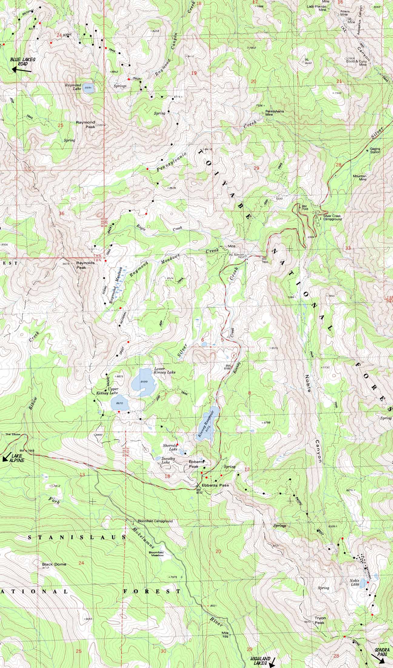
Topo Hiking Map
PCT MILES
Creek Campsite to Raymond Lake Junction: 3 miles
Raymond Lake Junction to Pennsylvania Creek: 3.68 miles
Pennsylvania Creek to Ebbetts Pass: 6.1 miles
12.78 Miles Total
| MAP North Blue Lakes to U. Sunset Lake |
click red dots | MAP South Tyron Peak to Wolf Creek Pass-Highland Lakes |
|
| MAP North Blue Lakes to U. Sunset Lake |
click red dots | MAP South Tyron Peak to Wolf Creek Pass-Highland Lakes |
Mapology |
||||
MAP NOTE What's important for our general reference purpose is that each side of a square is 1000 meters, or a Kilometer. From my point of view that is 1093.6 yards or .62 of a mile. Diagonal: 1414.22 meters, if my trig is correct. That converts the diagonal distance into 4,639.8 feet or .88 of a mile.
|
Location |
Main Terrain Features The slow movement of the massive mountainsides of eroded volcanic terrain across Raymond Peak's flanks are beautifully counterbalanced by the galleries of beautifully volcanic spires being slowly sculpted under Reynolds Peak. This is the alpha and omega of the local volcanic terrain: Seemingly delicate hard volcanic spires surrounded by billions of tons of red duff. Fresh Water When I water up good, meaning drink up, rest up, and fill up my 22 oz bottle I'm not quite good to get to Upper Kinney Lake. I'll pick up some water out of either Raymond, Pennslyvinia, or Eagle Creek. This means we can adjust down our carried water supply to suite the distance to our next watering. Unless we are hiking through to Kennedy Meadows Pack Station for our next resupply. The map above is linked to the trail guide reports on campsite on the stream just to the North of Raymond Peak as well as the campsites at Upper Kinney and Noble Lakes. Next Section of Trail Lake Alpine Lodge Boundaries The Toiyabe administers the Eastern sections of both the Mokelumne and Carson Iceberg Wilderness. The entirety of the Emigrant Wilderness lays on the West side of the Sierra Crest to the South of Sonora Pass, being the only wilderness between Tahoe and Yosemite that is not divided East and West between the Toiyabe National Forest on the East flank and either the El Dorado or Stanislaus National Forests on the West flank. |
Highway Four Corridor
ROAD MAP
Ebbetts Pass (PCT) and Lake Alpine (TYT)
EBBETTS PASS NATIONAL SCENIC BYWAY
Mapping, Miles, |
|
Mileages and Elevations Distance is measured South from Carson Pass Wet Meadow trail jnct 7880 14.52240 .2 Wilderness Boundary 8120 14.72-240 .38 Break at the Creek/camp 7880 15.1760 3.0 Raymond Lake Junction 8640 18.1-280 1.86 Raymond Canyon 8360 19.96-200 1.82 Pennsylvania Creek 8160 21.78360 1.56 Eagle Creek 8520 23.34 150 3.18 Upper Kinney Lake jnct 8670 26.5262 1.36 Ebbetts Pass 8732 27.88Check out the Carson to Ebbetts Mileage Forum to discuss these figures.
Tahoe to Alpine Trail Guide Carson Pass Ebbetts Pass |
USGS topo map information Map Name Compass Offset scale Contours Backpacking Permitting AuthoritiesToiyabe National Forest National Forest Contacts via TW National Forest web page Wilderness Area Ranger District
El Dorado National Forest National Forest Contacts via TW National Forest web page Wilderness Area Ranger Districts
|
| Elevations | More Information | ||
Carson Pass Ebbetts Pass Miles |
Trail Guide, Section Trail Guide Page Google Road Map Google Road Map |
||
MAP North: Blue Lakes to U. Sunset Lake MAP South: Ebbetts Pass to Tyron Peak
Map CreditThanks, USGS! |
U.S. Geological Survey, Department of the Interior Move the Map to the Sierras. Select size of Maps you wish to locate. Click "Mark Point" on map to see the USGS map grid of the selected map scale. USGS Topographic |