
The Trails
Guide
Maps
Miles/Ele
Permits
Resupply
Forum
Current Weather Conditions
Weather Notes
Northern High Sierras
Central High Sierras
Southern High Sierras
Gear
Gear List
Gettin Started
Layering
Discussion
Testing yourself and your gear
Gear Reviews
Backpacking
Mount Reba
to
Lake Alpine
Hiking the Tahoe to Yosemite Trail in the Stanislaus National Forest
Languages
Languages
Trail Arts
The art of walking
Physical Preperation
Trail Skills
The trail
Off the trail
Scrambling
Maps
Navigation
Camp skills
Food
Resupply
Food
Other
Photo Catagories
Trail Stories
Trail Culture
News and Science
Links
Groups
Books
Terms and Conditions of Use
| Trail Guide INDEX Carson Gap to Lake Alpine |
TYT North Camp Irene |
TYT South Lake Alpine |
7.5 Topo Map Lake Alpine |
Section Topo Map Echo Summit to Lake Alpine |
Map |
Carson Gap |
South BIG Map Lake Alpine to Saint Marys Pass |
Stanislaus National Forest | Tahoe to Whitney on You Tube |
Mount Reba to Lake AlpineElevation 5.24 miles from Camp Irene South to the top of Mount Reba. 3440 feet up. 2.78 miles South from the top of Mount Reba to the Bee Gulch Trail head on Highway 4. 1400 feet down. 8.02 miles total hiking from Camp Irene to Highway 4 at the Bee Gulch trail head. |
VIDEO
The Forest Above Camp Irene
to the
Top of Mount Reba
and on down
to
Lake Alpine
The previous video brings us climbing 1.98 miles up 720 feet of elevation South through and finally above the forest behind Camp Irene. The video above starts with the hike 3.26 miles from our position above the forest surrounding Camp Irene up another 2720 feet of elevation passing under the mouth of Underwood Canyon on our way to enter Lake Valley for the final length of our hike to the Top of Mount Reba. The total of our hike from Camp Irene to the top of Mount Reba crosses 5.24 miles of trail climbing 3440 feet of elevation. The end of the film above covers our 2.78 mile hike down 1400 feet of elevation from the top of Mount Reba to either the Bee Gulch Trailhead on the East shore of Lake Alpine or the backway into the Lake Alpine Lodge. This film, when combined with the previous film, covers the 8.02 miles between Camp Irene and the Bee Gulch Trailhead on Highway 4 at the East Shore of Lake Alpine.
|
South to the Top of Mount Reba
Weather Notes
|
||||||||||||||||||||||||||||||||
Southwest down Mount Reba
| The Jeep trail heading Southeast down towards our junction with the trail to Bee Gulch. The rock formation in the distance is the Dardanelles. | ||
 |
||
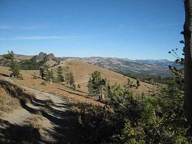
This dirt road reaches the Top of Mount Reba from the paved road to the Mount Reba Ski Area. This road runs along the ridgeline visible in the middle distance through the base of the line of trees. The Bee Gulch junction is out of sight along the Left side of that ridgeline. That's where we are hiking towards. |
 |
||
Mount Reba jeep road hiking down to the Southeast with the Dardenelles in the middle-foreground and the Sierra Crestline in the distance making up the horizon.
|
 |
The dardanelles viewed from Mount Reba. |
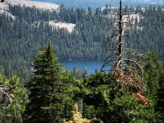
| Lake Alpine from near the Top of Mount Reba. | ||
 |
||
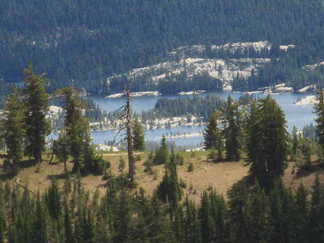
Note the strand of dirt road visible along the crest of the ridge line in the middle distance. This is the jeep road that we are now on after it turns 90 degrees South at the point where our trail continues straight where the jeep trail turns. As we see below, the junction is well maked. Lake Alpine is man made. Hey, I love Lake Alpine, but just look at those beautiful, deep granite channels that were drowned by Lake Alpine's creation. I'd love this area as well without the lake. But hey, California needs to keep doubling its population and halving its natural resources.... that can't end well... In any case, you don't get many views of Lake Alpine from the top of Mount Reba, as the lake is mostly hidden from view by ridge arms, trees, and the lay of the land for most of your hike down. This is the best view you get, though fleeting...
|
Expansive View Southeast
from the
top of Mount Reba
looking into our next trail section across the Carson Iceberg Wilderness
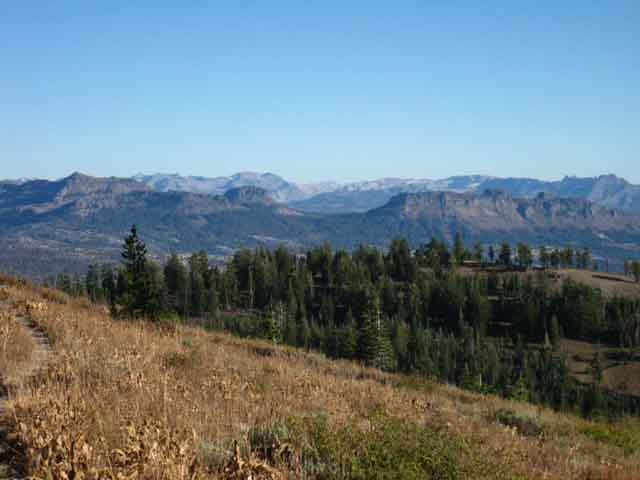
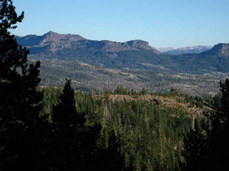
Thinking Ahead Below: The mountain range in the Left middle-distance with a cutaway section sitting beyond the hilltop in the foreground is the great volcanic structure of The Dardanelles. The Dardanelles are about thirteen trail miles distant from the our position on top of Mount Reba. The Tahoe to Yosemite Trail from here will run Southeast directly towards the middle of the Dardanelles, then swing Northeast along the West shore of Spicer Meadow Reservoir to pass around the top of the reservoir into Highland Creek. Along Highland Creek we shortly encounter a key trail junction, the Jenkins Canyon Trail Junction. At Jenkins Canyon we are either going to follow the Tahoe to Yosemite Trail around the Northeastern end of the Dardanelles over to Arnot Creek and on up the Clarks Fork of the Stanislaus, or we will follow the Highland Creek Trail up to Highland Lakes to intersect with the Pacific Crest Trail. Another trail connecting our Tahoe to Yosemite Trail route to the Pacific Crest Trail before the next untrailed section of the TYT is the Boulder Lake trail. If we did well with the unmaintained section of the Tahoe to Yosemite Trail through Summit City Canyon to the top of Mount Reba we should have no problems with the Clarks Fork-Saint Marys Pass section of unmaintained trail. Between these two alternative TYT-PCT trail junctions ahead of us in the Carson Iceberg Wilderness we are going to become aware that we have many options for local loops and short backpacking trips. The Carson Iceberg Wilderness is amazingly well-trailed. We could spend a lifetime here exploring them. Jenkins Canyon trail junction Boulder Lake trail junction Decisions, Decisions. How much food did you send yourself at Lake Alpine? If you have the time and the will you can add some serious sightseeing miles mixing up the TYT and PCT routes across the Carson Iceberg... In the far distance the line of mountains on the left side of the far horizon line composes the Sierra Crestline heading South (left to right) to Sonora Pass. I'm thinking That's Sonora Peak towering-no, DOMINATING that section of the Sierra crest line. I've got to think about it. Hummm... Leavitt Peak may be the next significant peak to the Right of Sonora Peak, I'm pretty sure. Right of the center of the horizon we can see the rolling ridges running up the Western flank of the Sierra Nevada mountain range. |
||
 |
||
From Lake Alpine South the compass point of our Tahoe to Yosemite Trail route points us Southeast towards The Dardanelles, then swings around the Northern shoulder of The Dardanelles through Jenkins Canyon. At the top the trail turns East across a low point of the ridgetop to access the Arnot Creek drainage. We're hiking a big frk'n "S" from Lake Alpine to the top of Jenkins Canyon. The lower sections of the Highland Creek drainage now holds the long expanse of Spicer Meadow Reservoir. The black lines on the map represent the current extent of Spicer Meadow Reservoir. I believe the great peak in the distance on the left side of the horizon is Sonora Peak. Highway 108 runs through Sonora Pass at the base of its Southern flank. The high point on the distant horizon, beyond The center-left of the Dardanelles formation, is Leavitt Peak, if I am not mistaken. But I may be. It's late... and that's a long view. In any case those are the mountains around Sonora and Saint Marys Passes, the location of Highway 108 end point of the next section along our trail. The end of this section of the trail, hot food, cold beer, and our next resupply package are all three miles ahead of us on Highway 4 sitting at the base of the next lowering hilltop in the near foreground. Woo-Hoo!
Carson Gap to Lake Alpine
|
Heading Southeast off of the Top of Mount Reba
View North-Northeast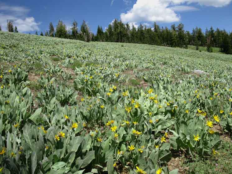 |
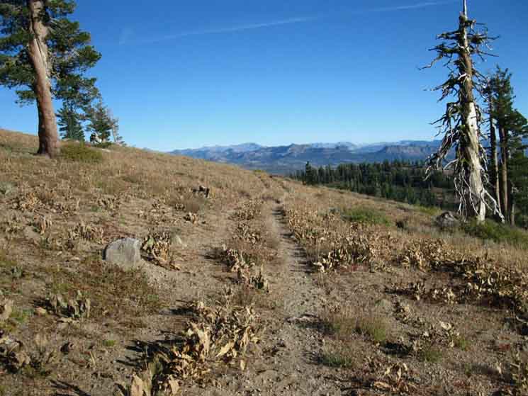
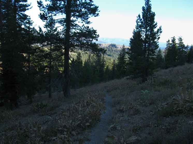
View to the Northeast, to our Left, while walking South down the jeep trail from the top of Mount Reba. Cutting down the jeep trail from the top of Mount Reba brings us across a vast field of Paper Plants, well, "Mule Ears," as they're commonly called. I call them "Paper Plants." When Fall's dry winds blow through their golden dried leaves later in the season they make a sound like the rustling of thousands of long dried loose paper blowing around an ancient library. Paper Plants. |
 |
||
The view West, looking back over our Right shoulder, down Horse Canyon, and down into the Canyon of the North Fork of the Mokelumne River. We are hiking across the same part of the jeep trail as the second image above, just looking in almost exactly the opposite direction. This perspective is looking West through Horse Canyon, into the canyon of the North Mokelumne River, further downstream from our fording point at Camp Irene. Note the bright green of paper plants visible on the distant hills. Note the Paper Plants run all the way down mountain, as far as I could see. The second picture above this one shows them covering the whole flank of the mountain above us, the picture at top shows them running down the mountain. I've never seen a bigger colony of Paper Plant.
Carson Gap to Lake Alpine
|
Mount Reba Jeep Trail
 |
||
We can see the faint signs where a spur off this road turns up to the Underwood Valley overlook in the middle distance and near the middle of the image above, but we will continue hiking South past that spur road to the edge of the forest where a short spur road marked by a trail post points us to our Left, down to Lake Alpine.
|
The Edge of the Forest
 |
Approaching Bee Gulch trail junction .87 of a mile down the Mount Reba jeep road from the top of Mount Reba. A very short spur road turns Left where the nose of the forest touches our dirt road, where we will see another trail post marking the point we begin a fairly steep descent to the East Shore of Lake Alpine. |
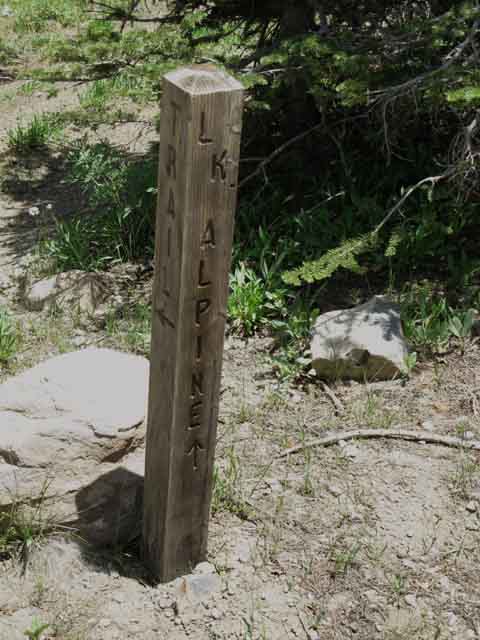
The Southbound Trail Junction to Bee Gulch
 |
||
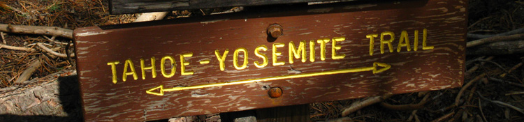
Trail Junction where the jeep road turns South and our trail continues Southeast (Left) down to Lake Alpine. "LK Alpine," with Arrow!
Carson Gap to Lake Alpine
|
A few steps East...
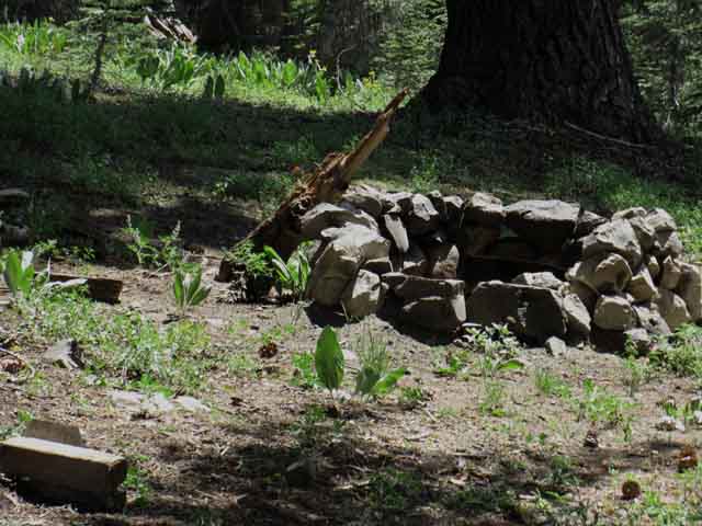 |
v Just a few feet down towards Lake Alpine you will find this fire ring, which looks allot like a place local kids will drive up to on a Friday Night. A North-South trail over to Underwood Valley cuts across your path here, but follow the trail Southeast across this junction. |
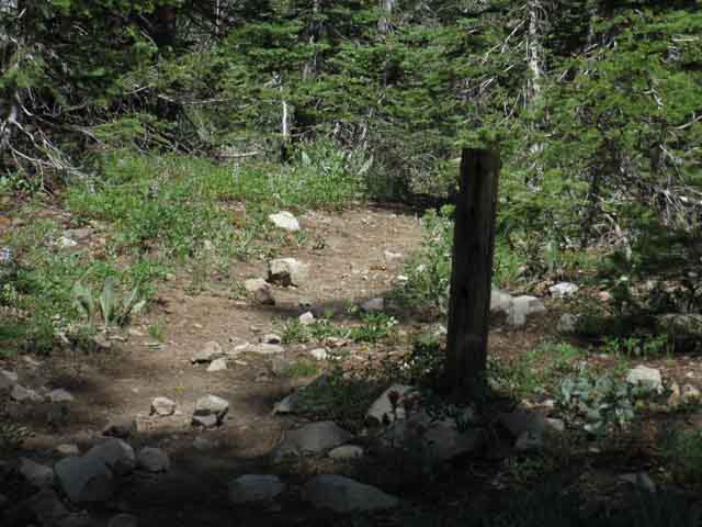
Second Trail Junction
 |
||
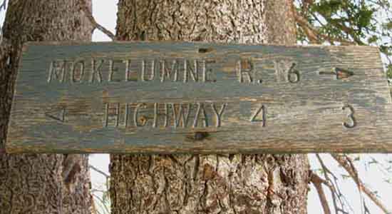
A North-South trail over to Underwood Valley cuts across your path here, but follow the trail Southeast across this junction. The marker at the second junction where the trail to Underwood Valley cuts through North and South. This post is bare. You can toss a rock from this second trail junction back to the jeep road.
Carson Gap to Lake Alpine
|
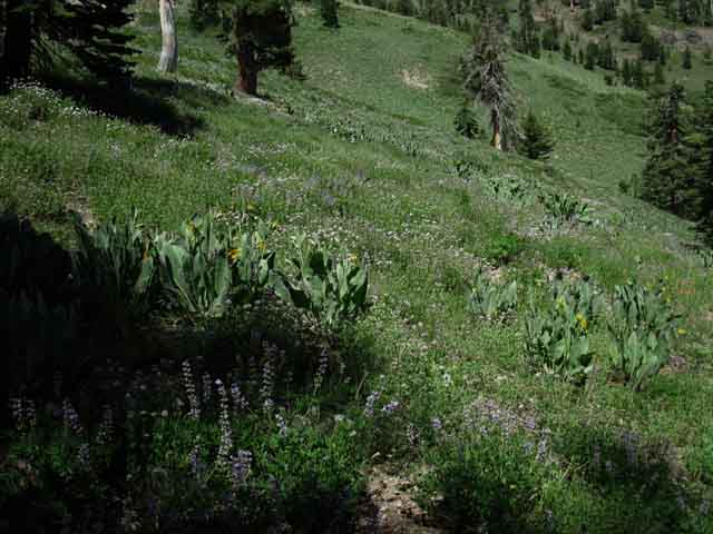 |
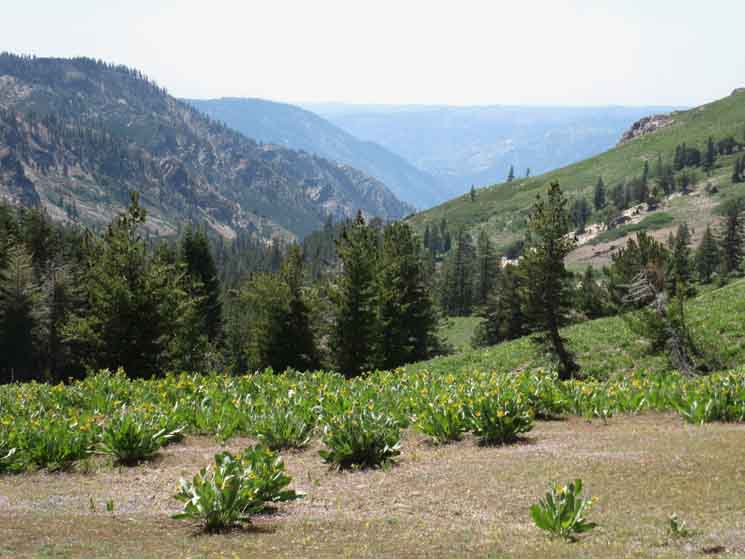
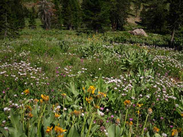
Bee Gulch A massive field of lupine. And everything else. |
 |
Another momentary glimpse of Lake Alpine. View of the Eastern shore. |
Bee Gulch in Bloom
| Bee Gulch's Flowers. That's why it's called Bee Gulch... | ||
 |
||
Bee Gulch's dense Flowers bloom deep into Summer. |
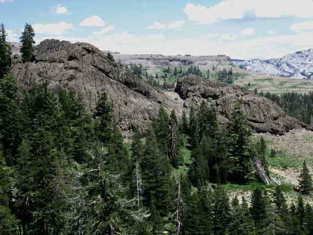
Volcanic Terrain
 |
||
Looking Northeast at fine volcanic structures parallel to our trail down Bee Gulch. Though the Sierras are famous for majestic granite formations, the volcanic terrain is more than half the show. And the upper half... As we continue South on the Tahoe to Yosemite Trail we will hike through The Dardanelles. The Dardanelles consist of a massive ancient volcanic remnant, much older than the last phase of activity which covered the granite we love so much. No problem. I love terrain.
Carson Gap to Lake Alpine
|
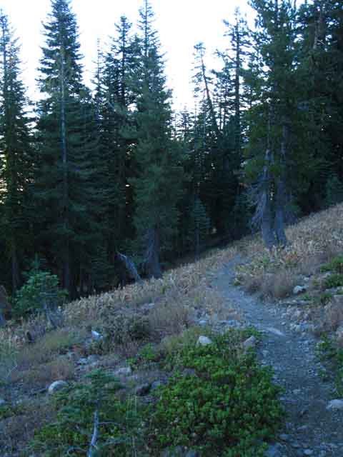 |
Hiking the trail down Bee Gulch. |
 |
Backpacking into the last light falling on Bee Gulch. Racing the shadows and losing. |
 |
||
Dardanelles viewed hiking Bee Gulch.
Carson Gap to Lake Alpine
|
 |
v |
Trail junction
between
Lake Alpine Lodge and the Bee Gulch trailhead
| Nearing the base of Bee Gulch we run into a trail running from the Lake Alpine lodge to the Bee Gulch Trailhead along and behind the Summer houses along Highway 4. I head Left, towards the East Side of Lake Alpine. I will drop my pack and make camp before I venture over to the Lake Alpine Lodge. | ||
 |
||
If we are hitting and running, I mean just picking up our resupply and continuing on down the trail, we may consider turning Right here, as this is the most direct route to the Lake Alpine Lodge. But not really, as this is not the best use of this resupply spot. We should spend a night here, camping near the Lake Alpine Lodge, maybe even two, if we want or need one full day off the trail without wearing a pack, and a rest from the impact of the trail. We've been on the trail between five and seven days to get down here, depending upon which Lake Tahoe trailhead we started from. It is likely that we're going to spend the remainder of this day, and the entirety of the next day, kicking back at Lake Alpine before continuing South into the Carson Iceberg Wilderness. So we continue South on the TYT through this junction towards Bee Gulch, and our hidden campsite behind the "official" expensive backpacker's camp on the East Side of Lake Alpine. There we will set up camp, stash our food, rest a bit, then hike .75 of a mile on a real scenic paved bike path West along the remarkably beautiful shore of Lake Alpine down to the Lake Alpine Lodge for lunch or dinner, check on our resupply, and have a beer and hang out. So I am going to take a Left here, and set up camp above the East Shore of Lake Alpine before I head down to The Lodge.
Carson Gap to Lake Alpine
|
The Bee Gulch Trail head
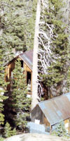
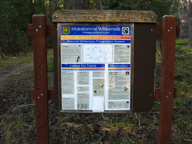
Look carefully if you are driving past the East side of Highway 4. The Bee Gulch Ttrailhead is nestled into the forest at the base of Bee Gulch on the Northeast side of Lake Alpine. It's hard to see from passing cars. There is parking for the trailhead at the day use area on the Northeast corner of Lake Alpine right across Highway 4 from the trailhead. |
||
 |
||
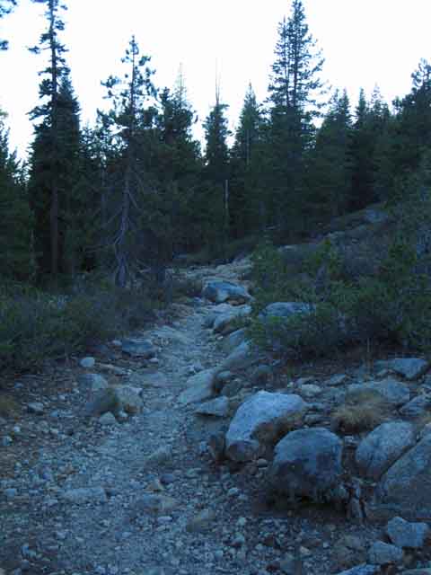
Coming South off of Mount Reba is a swift hike down through Bee Gulch's ample flowers and jagged volcanic outcroppings. Our hike through the Carson Gap to Lake Alpine section of the Tahoe to Yosemite Trail (The hardest part of the whole trail) ends when we exit the trail through the Bee Gulch trail head at the East end of Lake Alpine on Highway 4. Woo-Hoo! Good Work! After a next rest, relaxation, and resupply at the Lake Alpine Lodge we will be ready to tackle the next unmaintained-cross country hiking challenge presented by hiking out of the headwaters of the Clarks Fork of the Stanislaus River at the South end of the upcoming Carson Iceberg Wilderness.
|
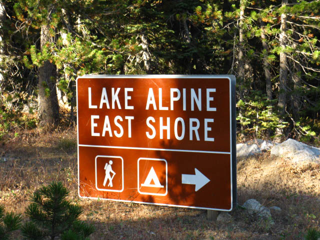
Entrance to East Shore Lake Alpine across Highway 4 from Bee Gulch
This paved road will bring you to the Silver-Highland Creek trail head where you will continue South on the Tahoe to Yosemite trail.
Lake Alpine's East Shore Road lays about three-quarters of a mile East of the Lake Alpine Lodge, and is right across Highway 4 from the Bee Gulch Trailhead. That's important because the Lake Alpine Lodge serves three meals a day, and has a Store. But so does Bear Valley, at the Bear Valley Store and Deli, which sits three and three-quarter miles West on Highway 4 from our location on the East shore of Lake Alpine. Check out the Lake Alpine Lodge and Bear Valley Resupply Page |
||
 |
||
Directly South across Highway 4 from the Bee Gulch trailhead is the East Lake Alpine Road, which leads South to our campsite. There is a backpacker's camp just down the paved road, but I've never camped there. South down the road beyond your campsite the paved road ends at the Silver-Highland Creek trailhead, where you will continue South on the Tahoe to Yosemite Trail. |
See the Lake Alpine Map to better determine your precise location
View Highway 4: Ebbetts Pass, Lake Alpine, and Bear Valley Road Map in a larger map |
As Highway 4 marks the end of this section hiking down the Tahoe to Yosemite Trail I have added this roadmap so we can put surrounding roadmarks into context. For instance, our Tahoe to Yosemite Trail route crossing Highway 4 is about 15 miles West of where the Pacific Crest Trail crosses Highway 4 at Ebbetts Pass. Between here and there we have a couple of good entry points along Highway 4 hiking South into the heart of the Carson Iceberg Wilderness through Pacific Valley and Highland Lakes Roads. These are great places to begin or end long backpacking trips looping around the Carson Iceberg. The upcoming Carson Iceberg Wilderness is as fun to walk loops around as it is to walk across... Carson Iceberg Wilderness See all |
Bathrooms, Water, and Campsite
Resources on the East Shore of Lake Alpine There are seasonal flush bathrooms, bear proof dumpsters, and a fresh water tap about a hundred yards East of Highway 4 down the paved road to the Pine Marten and Silver federal car campgrounds. A few feet further East down the road we see the crappy campsites for the "backpackers" camp. I never have camped here, though I have a favorite campsite a little further up Silver Creek, up behind the backpackers camp. It is not worth it for me to pay fifteen dollars for a campsite with a table next to a road. I would rather camp for free without table or road. |
Road to Pine Marten Campground
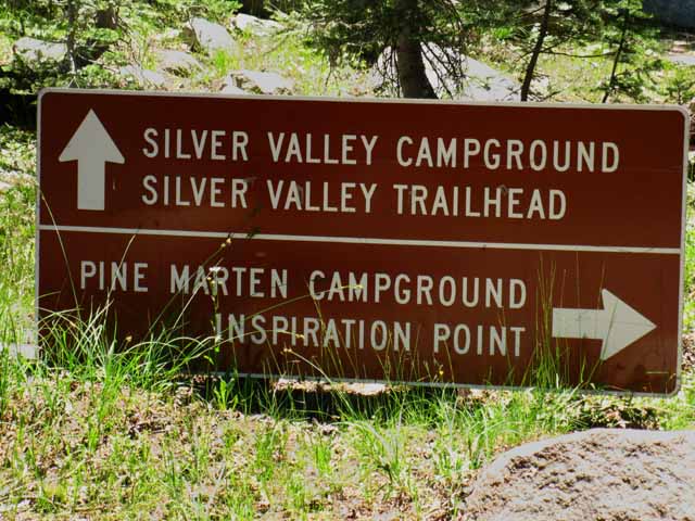 |
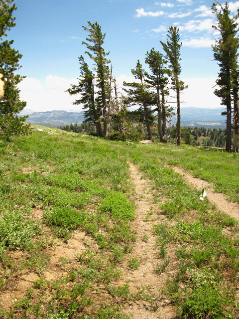
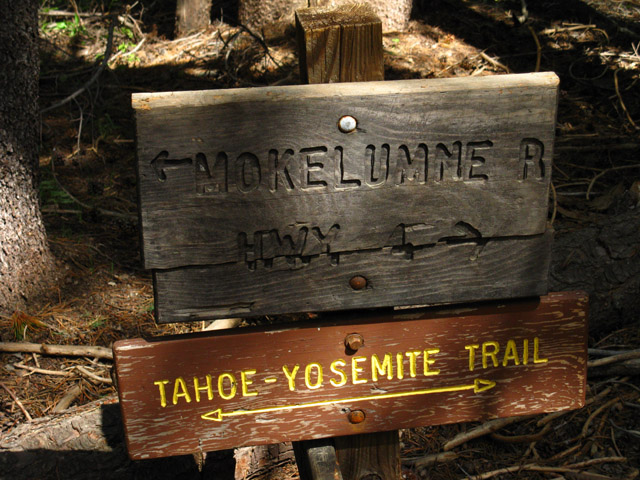
Hiking South along the East Shore of Lake Alpine. We are hiking South on the Tahoe to Yosemite Trail down the paved road along the East Shore of Lake Alpine from exiting through the Bee Gulch Trailhead down to where we reenter trail through the Silver Valley Trailhead. We hike past the road to Pine Marten Campground along the way. We continue hiking Southeast straight past this paved road to Pine Marten off to our Right. Our Silver Valley Trailhead is located where the paved road we are following bends Right to the Silver Valley Campground. The Tahoe to Yosemite Trail continues South into the Carson Iceberg Wilderness where the road bends Right. |
North: Mount Reba top of page South: Lake Alpine
Lake Alpine |
Trail Section Completed Arriving at Lake Alpine marks the end of the most difficult section of the Tahoe to Yosemite Trail, the section between Carson Pass on Highway 88 and Lake Alpine on Highway 4. Overall, we've covered around 67.18 miles hiking down the Tahoe to Yosemite Trail from Meeks Bay to Lake Alpine on Highway 4. Good work. Our route so far has crossed the Desolation Wilderness, the Meiss Country Roadless Area, and now we have finished hiking the tough and remote unmaintained section of the Tahoe to Yosemite Trail through the Mokelumne Wilderness between Carson Pass and Lake Alpine. This section contained the most difficult challenge of the whole Tahoe to Yosemite Trail by my measure, the 9.5 mile section of unmaintained trail between Summit City Creek and Camp Irene. This is quite a compliment, as most Pacific Crest Trail hikers rate the section of trail between Jack Main Canyon and Tuolumne Meadows as the hardest section of the whole Pacific Crest Trail. The section between Jack Main and Tuolumne Meadows is the second hardest part of the Tahoe to Yosemite Trail. However you assess each section of the Tahoe to Whitney Trails (and you will), every trail section of these trails are worthy of hiking on their own merits, without having to be part of a longer trip. Work yourself up to do a hard section of one of these classic trails. This section down Summit City Creek is a hard section taken alone or as part of the TYT. The Next trail Section South Next, after a nice rest, resupply, and feast at Lake Alpine we are heading South into the Carson-Iceberg Wilderness of the Stanislaus National Forest towards Saint Marys Pass on Highway 108. Upcoming Route Options A little less than half-way down to Saint Marys Pass from Lake Alpine we will examine the Highland Creek Trail option at the Jenkins Canyon Trail Junction. Following Highland Creek brings us up to the Pacific Crest Trail at Wolf Creek Pass. From Wolf Creek Pass I follow the Pacific Crest Trail South down to Sonora Pass through the East Fork of the Carson River. This custom route adds mileage, elevation, and distance to the section of trail between Highways 4 and 108. South from Highland Creek through Jenkins Canyon along the Tahoe to Yosemite Trail we can also cut up to the Pacific Crest Trail through Arnot Creek, Disaster Creek, and finally Boulder Creek. The Carson Iceberg is unique in that it offers a web of trails connecting the Pacific Crest and Tahoe to Yosemite routes. The upcoming Carson Iceberg Wilderness offers a wide range of amazing backpacking loops for short and medium distance backpackers, as well as classic sections of both the Tahoe to Yosemite and the Pacific Crest Trail routes for long distance backpackers. Loop the Mokelumne Wilderness? Here at the Southern edge of the Mokelumne Wilderness I appreciate that. We can do a big PCT-TYT almost-loop through the Mokelumne from Lake Alpine to Ebbetts Pass. But the Mokelumne Wilderness, though beautiful, does not sport a web of trails like the trails across the Carson-Iceberg Wilderness. We can make a great "crescent" route, not quite a loop, through the Mokelumne between the PCT and TYT if we push a Northbound TYT trip from Lake Alpine past the Fourth of July Lake junction in Summit City Creek to Blue Lakes, where we have many options on just how we will link up with the Southbound PCT to Ebbetts Pass. Map. Trail Guide Page.
7.5 Hiking Topo Map 30 min Regional Topo Hiking Map South on the Tahoe to Yosemite Next page South |
Backpacking Trail Guide North |
 |
Backpacking Trail Guide South |
Backpacker ForumsHave a great Sierra Nevada route or trip to relate?Post it on:
|
North: Camp Irene South: Lake Alpine
Trailhead
Contact
Alex Wierbinski

Backpacking Lake Tahoe to Mount Whitney
Your guide to the High Sierra Crest, including the Tahoe to Yosemite, Pacific Crest, and John Muir Trails
