


Backpacking
Saint Marys Pass
Topo Hiking Map
Including
Sonora Pass and Highway 108
Hiking
Backpacking the Tahoe to Yosemite Trail up the Clarks Fork of the Stanislaus River through Clarks Fork Meadow to Saint Marys Pass Trailhead
Four
7.5 minute USGS Topo Backpacking Maps of the South End of the Carson Iceberg Wilderness

| TYT Tahoe to Yosemite Trail MAPS and MILEAGES |
PCT Pacific Crest Trail MAPS and MILEAGES |
Tahoe to Whitney INDEXS |
More Tahoe to Yosemite Trail MILES and ELEVATIONS |
Link up with the PCT |
Weather, Map Data | |||||||||||||||||||
Map |
Backpacking |
Backpacking |
TYT |
Region |
NORTH |
SOUTH |
SOUTH |
All Miles Tahoe to Whitney |
TYT MAPS Lake Alpine to Saint Marys Pass |
All Maps Tahoe to Whitney |
TYT Carson Gap to Lake Alpine MILES |
TYT Lake Alpine to Saint Marys Pass MILES |
PCT Sonora Pass to Tuolumne Meadows MILES |
PCT |
PCT |
Sonora Pass |
||||||||
3.91 miles
from the
End of Trail at the North End of Clarks Fork Meadow
to the
Saint Marys Pass Trailhead on Highway 108
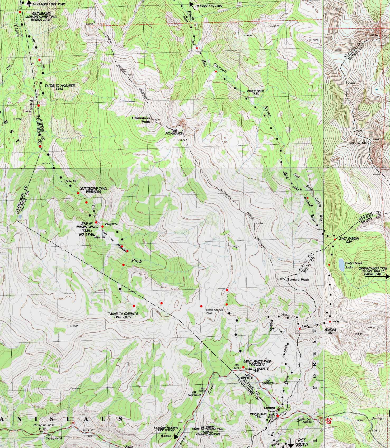
| CLICK RED DOTS FOR TRAIL GUIDE INFORMATION |
CLICK ARROWS-LABELS TO SEE ADJACENT TOPO HIKING MAPS |
Two Trails South
| NORTH TYT Map Clarks Fork Road |
SOUTH TYT Map Kennedy Meadows to Relief Reservoir |
Click Red Dots Resupply |
NORTH PCT Map Asa Lake to East Carson River |
South PCT Map Sonora Pass over Leavitt Peak |
|
| NORTH TYT Map Clarks Fork Road |
SOUTH TYT Map Kennedy Meadows to Relief Reservoir |
Click RED Dots Resupply |
NORTH PCT Map Asa Lake to East Carson River |
South PCT Map Sonora Pass over Leavitt Peak |
|
|
| Recent History of Maps Depicting the Headwaters Bowl of the Clarks Fork of the Stanislaus River Also check out the History of Western Travelers over "The Sonora Road." |
||||||
Tahoe to Yosemite Trail Map |
The 1987 Department of Agriculture NATIONAL FOREST Carson Iceberg Wilderness Map 1987 The "Up the Center" of the Headwaters Bowl Route |
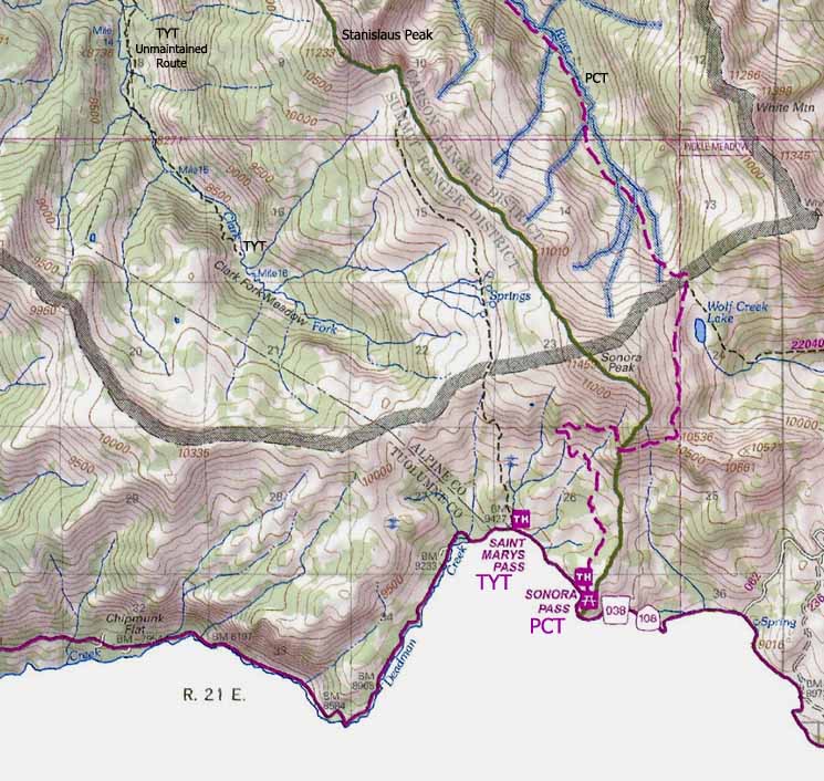
The 2009 Department of Agriculture NATIONAL FOREST Carson Iceberg Wilderness Map 2009 No Way Out Shown |
||||
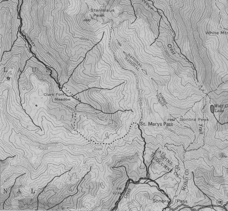 Though my copy of Tahoe to Yosemite Trail is dated 1989, this map was first published in 1970. |
|
 |
||||
Winett's text accompanying the above map talks about Saint Marys Pass in its correct location, although his map above mis-labels its location. The dotted-route is today's "route," being defined as a navigational line through the terrain who's specific course must be determined through personal route finding without support of ducks, blazes, or other indications of the presence of a trail. |
This map puts Saint Marys Pass into its proper location, but runs a trail up the center of the I hiked this difficult route in the mid 90's. |
Saint Marys Pass is not even labelled on this latest map. Other than that, it is the most accurate map of the three, though the Winnet map is a bit more precise because of its depiction of the "route" of the TYT through the upper headwaters bowl. The TYT's route links up with the maintained trail accessing Sonora and Stanislaus Peaks from the Saint Marys Pass Trailhead. | ||||
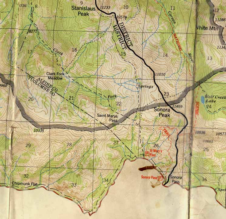
| Carson Iceberg Wilderness Map | ||||||
Location Information
|
Main Topo MAP Features Under the Digital Ink This map of the Tahoe to Yosemite Trail features the final and most difficult miles of this section between Lake Alpine and Saint Marys Pass, and the hardest part of the whole Tahoe to Yosemite Trail between Lake Tahoe and Tuolumne Meadows. Once we climb out of the Headwaters Bowl of the Clarks Fork of the Stanislaus River and pass through Saint Marys Pass we will finally re-acquire trail on the South side of Saint Marys Pass. The rest of our trail down to Tuolumne Meadows from here is all well maintained. But we aren't there yet... The map above features the deterioration of the already unmaintained trail along the Tahoe to Yosemite Trail South from the Eureka Valley Trail junction through the lower to the Upper ford of the Clarks Fork of the Stanislaus River. Though remnants of the trail bed disappear from much of the higher section between the Lower and Upper Fords, there can be light duckage. Blazes stop halfway between the Lower and Upper Fords. South past the Upper Ford the unmaintained trail deteriorates into little more than a potential route through the terrain. Though the trail disappears the terrain around the meadow is gentle compared to the climb up to it between the fords. Route Vs. Unmaintained Trail My definition of a route and its difference from an unmaintained trail is potential. A route is a potential way of getting through a stretch of terrain, while an unmaintained trail formalizes a successful route with remnants of its trailbed, old blazes, and mostly new ducks. A route may or may not have these advantages, and they will be incidental (but very helpful) to the primary responsibility of the hiker to self-navigate through the terrain. Routes contain both the potential to fail and to succeed. A route requires that you know how to retreat, to back off and try another variant, and at worse, to admit there is no route, and get out. Routes are potentially dangerous. Legal Disclaimer Moral Disclaimer Just South of the lower ford the unmaintained trail degrades into little more than a route for the difficult .66 of a mile climb up to the Northern edge of the Clarks Fork Meadow. From this edge of the Clarks Meadow there is no trail connecting our proposed route South to where we hook up with the trail from the Saint Marys Pass Trailhead. Options-Options, and More Options We did not have to come through the brutal upper section of the Tahoe to Yosemite Trail through the Clarks Fork of the Stanislaus River. We could have gone around by four major detours we passed hiking South through the Carson Iceberg Wilderness. The last one was the very short and not too steep spur trail up Boulder Creek past Boulder Lake and up to the Pacific Crest Trail just North of where Southbound hikers drop down to the East Fork of the Carson River on the way up to Sonora Pass. Backpacking South from Lake Alpine on the Tahoe to Yosemite Trail we can hike up to the Pacific Crest Trail via Highland Creek, Arnot Creek, Disaster Creek, or Boulder Creek to link up with the Pacific Crest Trail. This series of trails links the roughly parallel, and then converging routes of the Southbound Tahoe to Yosemite and Pacific Crest Trails between Highways 4 and 108. We can see that these trails open up a wide range of loop and trailhead to trailhead backpacking trips that can be hiked out of the trailheads anchoring this web of trails. Exploring the Carson Iceberg Wilderness is fun and rewarding. Next Finishing this section at Highway 108 brings up our next trail section along the Tahoe to Yosemite Trail, the 71.76 mile hike from Kennedy Meadows Pack Station to the end of our trail at Tuolumne Meadows in Yosemite National Park. On this next section the TYT again drops thousands of feet of elevation by descending the Western Flank of the Sierra down to Kennedy Meadows only to regain them by climbing back up the Western Flank to the Sierra Crest again, to the top of the stunningly beautiful Emigrant Wilderness. The upcoming section is frkn great. This means that our TYT route now offsets itself by nine miles West down the Sonora Pass Road to continue its Southbound journey into the beauties of Emigrant Wilderness through the totally delightful Kennedy Meadows Pack Station. I really don't recommend hiking West down Highway 108 to Kennedy Meadows Pack Station. Primarily because this is a narrow winding road among who's Summertime drivers are a significant number of tourists. I'd hate to have getting run over along a Highway be the ironic end to my High Sierra Backpacking Trip... Ha-ha. I hitch down. At Kennedy Meadows Pack Station we will also pick up the resupply package we sent to ourself, take a nice long hot shower and wash our clothes, and eat a bunch of good food, all in preparation for the next 70 miles of hiking down to Tuolumne Meadows. I should say up and down to Tuolumne Meadows. There's a roller coaster of High Mountains coming up between us and Tuolumne Meadows. Charge your batteries at Kennedy Meadows. From the Sonora Pass link on the map above we can review all the information about the trails North and South on both the Tahoe to Yosemite and Pacific Crest Trail routes, so click on the Sonora Pass dot on the map to see the maps, miles & elevations information, as well as the trail guide pages to the North and South along both these fine trails. |
Information for Hiking and Backpacking in the South Carson Iceberg Wilderness
Road MapRoads and Highways in Relation to Sierra Trails |
Miles and Guide Page Information |
Mapping, Miles, and Permit Information |
|
MAP NOTE What's important for our general reference purpose is that each side of a square is 1000 meters, or a Kilometer. |
Tahoe to Yosemite Trail Mileages and Elevations North
South
Tahoe to Yosemite Trail Trail Guide North
South
|
4
Backpacking Map Information Northwest Map 80 foot Contours Southwest Map 80 foot Contours Northeast Map 40 foot Contours Southeast Map 40 foot Contours
Compass Offset scale |
|
||
Tahoe to Whitney |
|
Trail Guide Information Opens in Same Tab |
|
| Stanislaus National Forest | Toiyabe National Forest |
Tahoe to Yosemite Trail Information Contact information Ranger Districts |
Pacific Crest Trail Information Contact Information |
| National Forest FEDERAL Permit, National Forest, and Wilderness Information |
|
Federal Websites |
|
| Stanislaus National Forest All Ranger Districts |
Toiyabe National Forest |
Wilderness Area Wilderness Area Ranger District |
Wilderness Area Ranger District Ranger District |
| Our Physical Location Approaching Highway 108 from the Northwest, Hiking Southbound through Saint Marys Pass on the Tahoe to Yosemite Trail. |
|
Topo Hiking Map NORTH TYT: Clarks Fork Road Topo Hiking Map SOUTH TYT: Kennedy Meadows to Relief Reservoir
| Elevations | More Information | ||
End of Clarks Fork Road TYT at Boulder Creek End of Marked Trail Saint Marys Pass Trail Saint Marys Pass Trailhead |
Trail Guide Section Trail Guide Page North Trail Guide Page South Google Map: North and South |
||
Map Credit: |
U.S. Geological Survey, Department of the Interior The
|
Major Trailheads along the Tahoe to Yosemite Trail
Between Lake Alpine to Saint Marys Pass
Disaster Creek & Clarks Fork River
Trailheads
Sonora and Saint Marys Pass
Trailheads