
El Dorado National Forest
The Trails
Guide
Maps
Miles/Ele
Permits
Current Weather Conditions
Weather Notes
Northern High Sierras
Central High Sierras
Southern High Sierras
Gear
Gear List
Gettin Started
Layering
Discussion
Testing yourself and your gear
Gear Reviews
| permitting authorities index | last page: LTBAU | next: Hum-toiyabe NF | all NF/Wilderness list | Carson to Ebbetts: PCT | Carson to Alpine: Tahoe Yosemite | Map | contacts |
The Carson Pass Management Area |
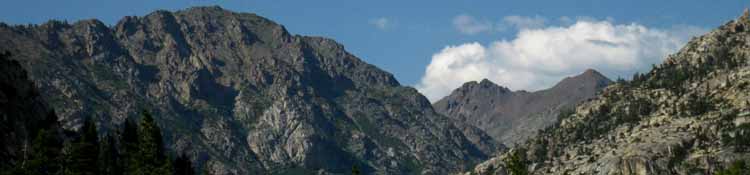
After backpacking South out of the Lake Tahoe Basin Administrative Unit at the top of the Carson Gap, the trail junction that divides the Pacific Crest Trail backpackers from the Tahoe to Yosemite backpackers sits just below you within the Carson Pass Managment Area. Within the Carson Pass Management Area are the two trail junctions where the Southbound Tahoe to Yosemite backpacker turns either Southwest into the El Dorado NF Administered Western Mokleumne Wilderness, or stays on the Pacific Crest Trail and passes into the Toiyabe NF administered Eastern Mokleumne Wilderness. If you begin your trip at Carson Pass and want to follow the Tahoe Yosemite route over The Sisters and Round Top towards Lake Alpine on Highway 4, you are entering into the Amador Ranger District of the El Dorado National Forest. If you are starting a Southbound backpacking from Carson Pass trip along the Pacific Crest Trail, you are entering into the Carson Ranger District of the Toiyabe National Forest. You will pass Southeast of the Sisters and Round Top heading towards Ebbetts Pass on Highway 4. Pacific Crest Trailers just graze the CPMA's Eastern edge as they hike by the Carson Pass Cabin on their way to Ebbetts Pass. The Pacific Crest Trail route traces the strange gap along the Sierra Crest that divides the Mokleumne Wilderness' Eastern dry side from the more heavily forested Western sections. The Pacific Crest Trail route overlooks the even drier mountains to the east of the Sierras.
On the other trail, the Tahoe to Yosemite trail backpacker cuts Southwest through the heart of the CPMA, to get around Round Top and The Sisters to access the deep granite canyons of Summit City Creek and the Mokelumne River which lay on the Southern side of Round Top and The Sisters. The Summit City Creek and Mokelumne River canyons are typical of the massive granite valleys that drain the Western Sierras. When you reach Summit City Creek on the South side of Round Top and the Sisters, you will find that the Lake Tahoe to Yosemite trail to Camp Irene has not been maintained for many years, and you are in for a bit of rough going. A couple of miles before Camp Irene the route is again marked. At Camp Irene the Tahoe to Yosemite route fords the Mokelumne, and after a bit of scouting about (hint: look right!) you will find the barely-maintained trail that cuts South over Mount Reba to your first resupply point at Lake Alpine. The Carson Pass Management Area administers a very small, but very popular area, that only covers Winnamucca Lake, Round Top Lake, and 4th of July Lake. This special management area only affects Tahoe to Yosemite backpackers, who's route crosses the heart of this area as you pass by Round Top Lake. Although tightly regulated because of the heavy use by locals, even assigning campsites, your permit from other Ranger Districts specifying Round Top or Fourth of July Lake as your planned campsite should be honored. Permits for short backpacking trips that start and stay within this small zone centered around Carson Pass can only be had at the Carson Pass Cabin. (contacts) |
 |
| Carson Pass Cabin |
| Your permit from outside the Carson Pass Managment Area will be honored here if you are a thru backpacker, but to begin a long distance backpacking trip from here, within the El Dorado National Forest, you can either obtain a permit at the Carson Pass Cabin, or, as I recommend, order one over the phone from the Amador Ranger District station in Pioneer. In any case, call the Amador Ranger District for details. The Carson Pass Cabin is now open year round. |
 |
| Sign on the way to Winnamucca Lake from Woods Lake |
Carson Pass to Ebbetts Pass: The PCT route |
The Pacific Crest Trail route roughly follows the Eastern side of the Sierra Crest between the Carson Pass Management Area to Ebbetts Pass. The Pacific Crest Trail route also roughly marks the boundary between the Toyiabe NF Carson Ranger District, on the east side of the Sierra Crest, from the El Dorado NF, Amador Ranger District, which administers the western side of the Sierra Crest. The Moklelumne wilderness is roughly bounded between Highway 88 on the North, and by Highway 4 on the South. (maps) The Mokleumne Wilderness straddles this section of the Sierra Crest between the Carson and Ebbetts Passes, with its Western side administered by El Dorado NF, and its Eastern side by the Toiyabe NF. Because of the strange shape of the Mokelumne Wilderness, the Pacific Crest Trail loops in and out of the Moklumne Wilderness, and between the El Dorado and Toyiabe NFs, as it follows the Sierra Crest between the Carson and Ebbetts Passes. |
 |
|
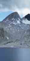
| Just South of the Carson Cabin you enter the Mokelumne Wilderness. map |
Local Backpacking |
Short Backpacking trips beginning into the Mokleumne Wilderness from the East will need to contact the Carson Ranger District in the Toyiabe NF for permits. Trips into the Mokleumne from the North and West must contact the Amador Ranger District in the El Dorado NF for permits. For backpacking trips into the Molkumne Wilderness from the South on Highway 4, note that everything West of Ebbetts Pass is within the Stanislaus NF, Calvaras Ranger District, whle everything to the East of Ebbetts Pass is part of the Toiyabe NF, Carson Ranger District. |
PCT Route: Carson Pass to Ebbetts Pass National Forest and Wilderness Links |
|
El Dorado NF, Home Page El Dorado NF, Amador Ranger District El Dorado NF, Carson Pass Managment Area Mokleumne Wilderness, Permit information. Mokleumne Wilderness, Information. Mokleumne Wilderness, Map |
Toyiabe NF, Home page Toyiabe NF, Carson Ranger District Toyiabe NF, Bridgeport Ranger District Toyiabe NF paper Maps (for sale) |
| last: Lake Tahoe Basin Administrative Unit | back: permitting authorities index | next: Toyiabe National Forest |
list of National Forests-Wilderness between Lake Tahoe and Mount Whitney
Carson Pass to Lake Alpine: The Tahoe to Yosemite Trail route
From Carson Pass to Camp Irene the backpacker is hiking South through the El Dorado National Forest, Mokelumne Wilderness, Amador Ranger District. Note: when you turn onto the Summit City Creek trail maintenance ends until Camp Irene.
At Camp Irene the Tahoe-Yosemite Trail departs the El Dorado NF, Amador Ranger District, and enters into the Stanislaus NF forest, Calaveras Ranger District, but stays within the Mokelumne Wildenrness until the Wilderness boundary at the top of Mount Reba, but remains within the Stanislaus NF, Calaveras Ranger District, to, and through, Lake Alpine.
Lake Tahoe to Yosemite Route: Carson Pass to Lake Alpine National National Forest and Wilderness Links |
|
El Dorado NF, Home Page El Dorado NF, Mokelumne Wilderness Mokleumne Wilderness, Map El Dorado NF Amador Ranger District |
Stanislaus NF, Home Page Stanislaus NF, Calaveras Ranger District |
Carson Pass to Lake Alpine or Ebbetts PassAll National Forest and Wilderness Contact Information |
|
EL DORADO NATIONAL FORESTmain officeEl Dorado National Forest100 Forni Road Placerville, CA 95667 (Highway 50) (530) 622-5061 All El Dorado Contact Information
CARSON CABINCarson Pass, Highway 88
AMADOR RANGER DISTRICTDOUG BARBER, DISTRICT RANGER 26820 Silver Drive Pioneer, CA 95666 (Highway 88) Phone: 209-295-4251, TTY 209-295-5996, FAX 209-295-5998
Office Hours: 8:00 AM - 4:30 PM Summer Schedule: Monday - Saturday from Memorial Weekend to Labor Day. Winter Schedule: Monday - Friday. Closed Holidays
Entering Desolation Wilderness from the El Dorado National Forest |
TOIYABE NATIONAL FORESTmain officeToiyabe National Forest1200 Franklin Way Sparks, NV 89431 (The main access to Toiyabe NF is along Hwy 395) (775) 331-6444 Monday through Friday 8:00 am to 4:30 pm
CARSON RANGER DISTRICTGenny Wilson, District Ranger1536 South Carson Street Carson City, NV 89701 (775) 882-2766 Monday through Friday 8:00 am to 4:30 pm BRIDGEPORT RANGER DISTRICT(Eastern Sierra flank from Sonora Pass to NE border of Yosemite, then South along E. edge of the Hoover Wilderness) Cheryl Probert, District RangerHC 62 Box 1000 Bridgeport, CA 93517 (760) 932-7070 Winter: Monday through Friday 8:00 am to 4:30 pm Summer: Seven days a week 8:00 am to 4:30 pm |
STANISLAUS NATIONAL FORESTStanislaus National Forest main office 19777 Greenley Road Sonora, CA 95370, (Highway 108) (209) 532-3671 ... ... CALAVERAS RANGER DISTRICT5519 Highway 4, P.O. Box 500 Hathaway Pines, CA 95233 (Highway 4) Phone: (209) 795-1381 TDD: (209) 795-2854 Fax: (209) 795-6849
Summer Hours (May - October) M-F: 8:00am to 5:00pm Sat: 8:00am to 2:00 pm Winter Hours (November - April) M-F: 8:00am to 4:30pm Sat: 8:30am to 2:00pm SUMMIT RANGER DISTRICT#1 Pinecrest Lake Road Pinecrest, CA 95364 (209) 965-3434 Summer Hours (Memorial Day - Labor Day) M-Sun 8:00am to 5:pm (holidays included) Fall/Spring Hours M-Sat: 8:00am to 4:30 pm (closed holidays) Winter Hours (December through mid-January) M-F: 8:00am to 4:30pm (closed holidays) |
|
T A H O E
T o
W H I T N E Y
|
|
| last: Lake Tahoe Basin Administrative Unit | back: permitting authorities index | next: Toyiabe National Forest |
 |
| The National Forests and Wilderness between Lake Tahoe and Mount Whitney |
list of ALL National Forests-Wilderness between Lake Tahoe and Mount Whitney
Trail Arts
The art of walking
Physical Preperation
Trail Skills
The trail
Off the trail
Scrambling
Maps
Navigation
Camp skills
Food
Resupply
Food
Other
Photo Catagories
Trail Stories
Trail Culture
News and Science
Links
Groups
Books