Late July to Early August 2010: High Sierra Trail Culture Report II |
The Trails
Guide
Maps
Miles/Ele
Permits
Resupply
Forum
Current Weather Conditions
Weather Notes
Northern High Sierras
Central High Sierras
Southern High Sierras
Gear
Gear List
Gettin Started
Layering
Discussion
Testing yourself and your gear
Gear Reviews
Heading Up the Eastern Flank of the Sierras on Mill Canyon and Golden Gate Roads to the Corral Valley Trail head in Rodriquez Flat
Friday, July 23, and Saturday, the 24thNo Company! No Trail Culture! Just Me! After leaving Stroker at the junction between Hwys 395 and 108, so he could head South to Bridgeport, my ride brought me North on Highway 395 to Mill Canyon Road. Mill Canyon Road shortly intersects with the Golden Gate (Mine) Road, where you veer right to follow the Golden Gate Road up to Rodriquez Flat, where our Corral Valley trail head is located. The Golden Gate Road is a high quality dirt road leading 6.75 miles in distance and 3000 feet up in elevation to both my trail head at Corral Valley, as well as the Little Antelope Pack Station. I would have no company on this remote, 2 day long, section of my trip between Hwy 395 and the Pacific Crest Trail. That's because I was entering the Sierras by hiking up through a remote section of the Eastern Flank of the Sierras. Yes, I walked the whole length and elevation of Golden Gate Road from Highway 395 to the trail head. It is pretty remote, so I was not surprized that I did not get a ride up. It happens. But it put me a half-day behind schedule. To reach the main North-South trail, the Pacific Crest Trail, I was required continue West, to cross two river valleys, the Silver King and the East Carson River, as well as navigate through a significantly difficult cross-country section along the East Fork of the Carson River, before I could finally join up with the Pacific Crest Trail. I reached the junction of the East Carson River "Trail" and the Pacific Crest Trail as evening fell on Saturday, July 23, after a grueling hike. The PCT was quiet. There are two campsites at the East Fork of the Carson River and the Pacific Crest Trail junction. One is on the Pacific Crest Trail itself, a rather small and uneven site, and the other is about 100 yards down the East Carson Trail. This site is rather expansive, with numerous flats for tents or sleeping bags. The next day, Saturday the 24th of July, I started South on the Pacific Crest Trail, and soon ran into a whole bunch of Pacific Crest Trailers heading North. For more about this part of the trip, from Rodriquez Flat to the Pacific Crest Trail, see Walker to Sonora Pass: A Great Three Season Backpacking Trip. Marines, Leavitt Peak, and Snow Trips Too! June 1, 2010 Update... Index By PageHwy 395 to Corral Valley Corral Valley to PCT at East Carson River The E Carson Headwaters to the Sonora Pass Hiking towards Brown Bear Pass Brown Bear Pass to Stubblefield Canyon |
Map Eastern Flank Sierra Entry through Mill Canyon Golden Gate Road to Rodriquez Flat and the Corral Valley trail head |
|
|
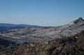
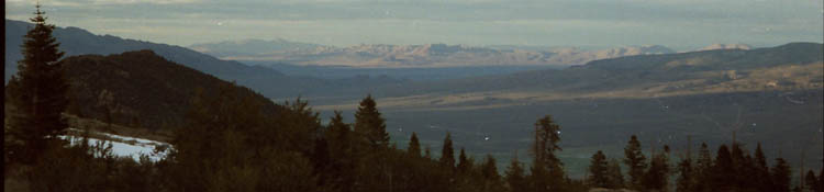
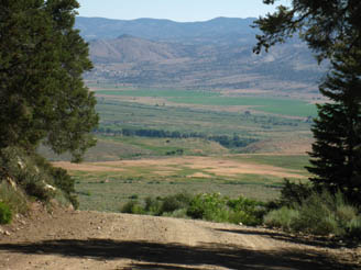
Looking East at Antelope Valley from Golden Gate Road. Unlike the extensive Western Sierra Foothills, The Sierra's Eastern flank ends abruptly, and steeply. |
 |
||
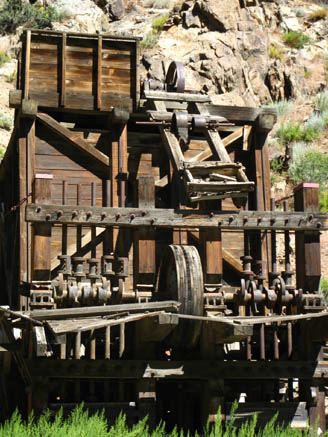
The Golden Gate Mine's Mill. About a mile past the mill a "scruffy" bear crossed the road. It got into the forest again before I could get a picture. A "scruffy" is a three or four year old bear who is no longer protected by mom, and not yet established. |
 |
||
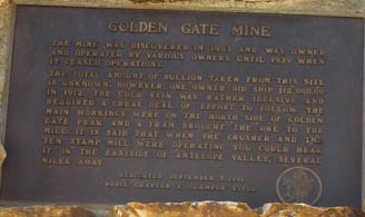
Clamper Monument about the Golden Gate Mine see enlarged version |
 |
||
| The trail sign at Rodriquez Flat, 8000 feet elevation, at the end of the Golden Gate Road. | 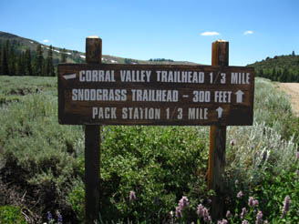 |
||
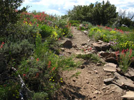
Spring flowers bloom on trail heading West from Rodriquez Flat, July 22, 2010. Large View. |
Vic Bergstrom was getting close to retirement, and the Little Antelope Pack Station was pretty quiet, until Joe Cereghino bought it from Vic. Joe has really revved up activity there. Good Luck, Joe! | 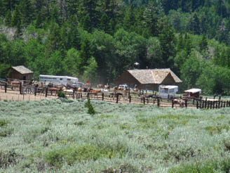 |
|
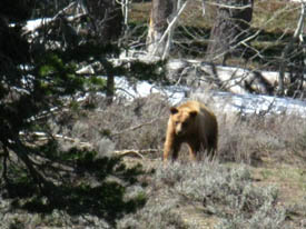
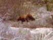
Bear in Poison Flat, between Silver King and E Carson Rivers, June 2, 2010. Not a scruffy. A fine looking young adult. It was not happy to see me at all. |
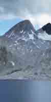
Behind the Pack Station and just down the trail from the Corral Valley trail head, you enter the Carson Iceberg Wilderness, heading West towards the Sierra Crest. | 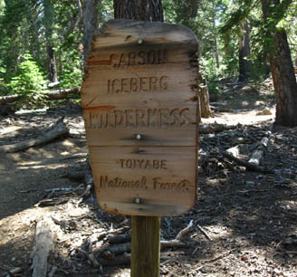 |
Post comments or more information
Next Page: East Carson River Junction to East Carson Headwaters
Last Page: Trail Culture Index
Contact: Alex Wierbinski
Languages
Languages
Trail Arts
The art of walking
Physical Preperation
Trail Skills
The trail
Off the trail
Scrambling
Maps
Navigation
Camp skills
Food
Resupply
Food
Other
Photo Catagories
Trail Stories
Trail Culture
News and Science
Links
Groups
Books
Terms and Conditions of Use
Lake Tahoe to Mount Whitney: your backpacking guide to the Sierra Crest, including the Tahoe to Yosemite, the Pacific Crest, and the John Muir Trails