High Sierra Trail Culture Report III: Late July to Early August 2010 |
The Trails
Guide
Maps
Miles/Ele
Permits
Resupply
Forum
Current Weather Conditions
Weather Notes
Northern High Sierras
Central High Sierras
Southern High Sierras
Gear
Gear List
Gettin Started
Layering
Discussion
Testing yourself and your gear
Gear Reviews
Pacific Crest Trail South from the East Fork of the Carson River Trail Junction to the East Carson Headwaters Bowl
Saturday, the 24th of JulyJoining up with the Pacific Crest Trail at its junction with the East Carson River. Heavy Pacific Crest Trail Hiker Traffic encountered! I rejoined the Pacific Crest Trail at its junction with the East Carson River Trail. Map. This junction sits about 9 miles to the North of Sonora Pass on the Pacific Crest Trail. At Sonora Pass I am planning on hitching down to Kennedy Meadows where I will follow a section of the Tahoe to Yosemite Trail route across the Emigrant Wilderness into the Yosemite Back Country. Big Map. |
Stacks, who hails from Ohio, was rolling and smoking on down The Long Trail. He was averaging 20 miles a day throught the difficulties of the High Sierras. Stacks noted that the extremes of the trip, from Hot Desert to High Snowy Mountains, was exhilerating. |
 |
||
This map is not yet finished, but the route heads from Kennedy Meadows to Bond Pass. Do you have questions or comments about trail culture? Are you featured in this section, and want to add biolographical or trip information? Do you want to leave a message for another hiker? Then get your ass to the High Sierra Trail Culture 2010 Backpacker's Open Thread, Bulliten/Message Board, Information Exchange |
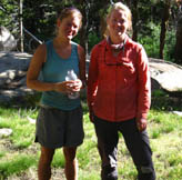
Seth and Merlin in East Carson heading South towards Tuolumne Meadows from Donner Summit, where they began their trip. Seth is from Humboldt County, California. They were on their 11th day, with one resupply along the way. They too were headed to Kennedy Meadows, to meet Seth's Dad, resupply, and continue on down the Pacific Crest Trail to Tuolumne Meadows. I had a nice talk with Seth's Dad at Kennedy Meadows. Good people, all. |
 |
||
Index By PageCorral Valley to PCT at East Carson River The E Carson Headwaters to the Sonora Pass Hiking towards Brown Bear Pass Brown Bear Pass to Stubblefield Canyon Stubblefield Canyon to Cold Canyon Cold Canyon to Tuolumne Meadows
|
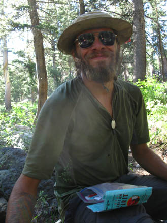
Wiffel-Chicken WC is a PCTer from San Jose, California. Wiff related he was really was impressed by the massive mountain passes, and watching the trail make the transition from Spring to Summer conditions as he hiked North. |
Sorry, I can't find Wiffel Chicken's Picture |
||
Back to the Last Page On to the Next Page |
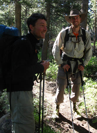
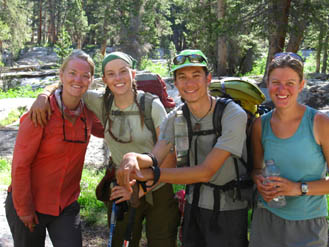
This is what I call a "PCT 2+2." This is when a group of two hikers joins up with another group of 2 hikers. You see it all the time on the long trail, as people covering the same mileage every day start hiking together. I know Gouda is from North Carolina, but I would love to hear from you guys about all the facts I missed. Gouda and Man Up quote: "A month is a short trip" |
 |
 |
|
 |
||||
|
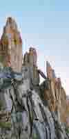
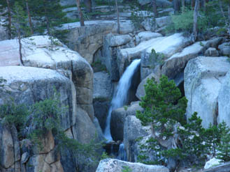
The real star of this show is the beautiful terrain. This is a waterfall through a granite pocket gorge along the East Fork of the Carson River. |
 |
|||
|
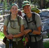
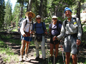
Big Foot, Wide Angle, Stanimal, and Turbo. Turbo, at Right, is from New Zeland. Trail Journals |
 |
||
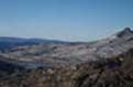
All of the hikers I met on this page were hiking below the headwaters bowl of the East Carson. They had already seen the long view from the top, and were now traveling South through the forest. I, on the other hand, was heading South, up to the headwaters bowl, where you can get a long view of this valley cut by Ancient Glaciers, now filled by the East Carson River. |
||||
 |
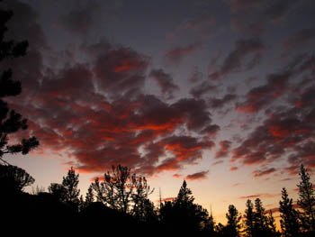 |
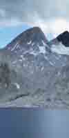
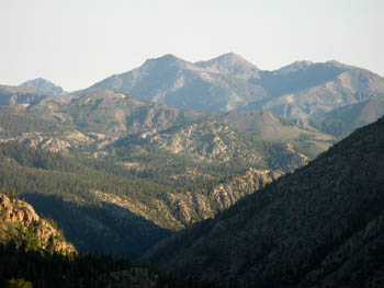
| Looking Back, North, at the Valley of the East Carson River that we have just climbed out of, still draped in a few early morning shadows. | Sunset from a nice camp in the East Carson River's headwaters bowl, situated right at the top of the treeline. |
On to the Next Page South: The E Carson Headwaters to the Sonora Pass
Back to the Last Page North: Hiking to the PCT from the Eastern Sierras
Contact: Alex Wierbinski
Languages
Languages
Trail Arts
The art of walking
Physical Preperation
Trail Skills
The trail
Off the trail
Scrambling
Maps
Navigation
Camp skills
Food
Resupply
Food
Other
Photo Catagories
Trail Stories
Trail Culture
News and Science
Links
Groups
Books
Terms and Conditions of Use
Lake Tahoe to Mount Whitney: your backpacking guide to the Sierra Crest, including the Tahoe to Yosemite, the Pacific Crest, and the John Muir Trails