The Trails
Guide
Maps
Miles/Ele
Permits
Resupply
Forum
Weather Conditions
Weather Notes
Northern High Sierras
Central High Sierras
Southern High Sierras
Gear
Gear List
Gettin Started
Discussion
Layering
Testing yourself and your gear
Gear Reviews
top of page
The character of your first step onto the trail determines the nature of your last step off the trail
Winter Report Massive snow storms blowing South out of the Tropics, rather than out of the North, as is traditional in the Sierras, have dumped record snows from Lake Tahoe to Mount Whitney. I'm heading for the Tahoe Basin for a 4 or 5 day trip ASAP, and I'll give a more detailed report on conditions. See below for some basic information on prepping for a snow trip. As building trail guide content has priority over the gear section, I have not yet laid out a comprehensive snow camping section. The gear section has a list that defines your basic Winter Gear. Post your comments or experiences. |
Real Time weather Reporting Stations |
Website Update I've completed the trail guide, maps, mileages, and elevation pages for both the Tahoe to Yosemite and Pacific Crest Trail routes from Lake Tahoe to Highway 4, the Ebbetts Pass Highway. The Trail Guide and Maps indexes have been updated to reflect the new content. I'm now editing all of this up for easy use by backpackers and hikers. Much work remains to be done, but progress has been steady. |
|
As I complete the trail guide I will expand the weather maps to cover the trails between Lake Tahoe and Mount Whitney. Coming Soon: Gear for Backpacking the High Sierra during mid-Winter |
||
 |
High Sierra Winter Backpacking Information
Get ready, snow is coming HERE!
Late Winter, Early Spring Conditions, Snow information and Travel, and links to Site Features
|
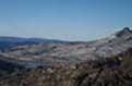
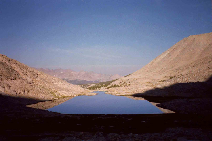
Relax by Rae Lakes A pleasing loop |
||||||
|
welcome to your wilderness window |
||||||
There are 69 more videos of wilderness shot between Meeks Bay and Ebbetts Pass at TaheotoWhitney on YouTube |
|||||||
| The Trip | Planning a Snow Trip | ||||||
| To the Trailhead | Planning I: Outline | Tahoe to Whitney Site Features: | |||||
 |
 |
||||||
| See the BIG version, with text and Related Links | See the BIG version, with text and Related Links | Trail Guide with Pictures, Videos, Directions, and a complete trail guide for long and short distance High Sierra backpackers |
Maps with embedded links to Trail Guide pages with Pictures, Videos, Mileages, and Elevations. Click the Colored Points! | ||||
| Trail head to Camp I | Planning II: FOOD | ||||||
 |
 |
||||||
| See the BIG version, with text and Related Links | See the BIG version, with text and Related Links | Elevations and Mileage The Distances and Elevations separating all points between Tahoe and Whitney | Permits for long or short distance backpacking in the High Sierras | ||||
| Camp One to Round Lake | Planning III: Food 2 | ||||||
 |
 |
||||||
| See the BIG version, with text and Related Links | See the BIG version, with text and Related Links | The Gear Section is coming on line: A work in progress.... |
Winter is the perfect time to open up the New Weather Section of the Trail Guide | ||||
| Round Lake to Meiss Meadow | Planning IV: 5 day's food | ||||||
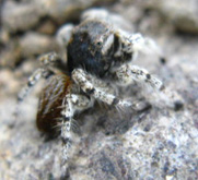
| Wild Image of the Week | |||||||
Jumping Spider, family Salticidae, in granite camouflage, at 10,000 feet, Big Sam Emigrant Wilderness. Thanks to Dr John Hafernik, San Francisco State University, for the identification. |
|||||||
| See the BIG version, with text and Related Links | See the BIG version, with text and Related Links | ||||||
See a list of all the Snow Camping Articles and Videos at |
|||||||
| Wild Image of Yesterday | |||||||
| Meiss Meadow to Woods Lake | Woods Lake to Round Top |
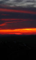
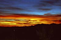
High Emigrant Wilderness Sunset |
|||||
| See the BIG version, with text and Related Links | See the BIG version, with text and Related Links | Let's put your pictures or Videos Here! |
|||||
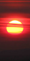
| Above: Planning and Executing a Spring Snow Trip, March 2010 | |||||||
|
Submit your videos, pictures, and trail stories to be featured here at |
||||||
Weekly Image: Can you Name this Feature?
Two Shakes got it on his first riff: Guitar Lake, at the Western Base of Mount Whitney in the Kings Canyon National Park, with the Great Western Divide in the background.
| Sierra Reports | Views of the High Sierras in September | |||||
September on the High Sierra Crest The short video to the right was shot in early September between Kennedy Meadows Pack Station (the one on Highway 108) and Tuolumne Meadows. A brief written report on trail conditions, water availabiltiy, mosquitoes, and weather conditions can be seen at September Open Thread: High Sierra Trail Condition ReportsPlease add your experiences in the High Sierras to expand the September Report! Disclaimer: BACKPACKING IS DANGEROUS! |
||||||
| Emigrant Wilderness, Stubblefield Canyon, and Seavy Pass in early September, 2010 | ||||||
A moment in the Life of a Yosemite Backcountry Trail Crew
| Yosemite Trail Crew members Scott and Billy chopping wood while Becky is chopping veggies. Our ability to travel through the High Sierras would be really limited without the hard work of these amazing people. From an upcoming article on Trail Crew in the High Sierras. |
Free Range High Sierra Horses
Progress building the Trail Guide continues New Trail Guide Pages are being constructed every day. Old Maps are being linked to the new guide pages. New videos are being constructed for the guide pages, the Sierra Updates, and just for fun. |
Trail Guide Videos, PCT Tahoe-Yosemite Trail Junctions North of Carson Pass Latest: Raymond Peak Latest: Carson Pass to Ebbetts Water info
Trail Guide Videos, TY Trail |
|||||
New Videos General Videos September Sierras update video (above) Trail Crew video (above) Latest: Coyote |
||||||
 |
New Trail Guide Pages The Pacific Crest Trail The Carson Gap to the Carson Pass Carson Pass to Forestdale Divide Forestdale Divide to Blue Lakes Road Blue Lakes Road to the Mokelumne Wilderness Boundary Mokelumne Wilderness Boundary to Raymond Lake Junction Raymond Lake Junction to Ebbetts Pass New Forum Section: Carson Pass to Ebbetts Pass on the Pacific Crest Trail The Tahoe to Yosemite Trail New Forum Section: Carson Gap to Lake Alpine on the Tahoe to Yosemite Trail |
|||||
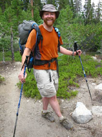
Mighty Mike, loving the Tahoe Rim Trail, just South of Echo Summit |
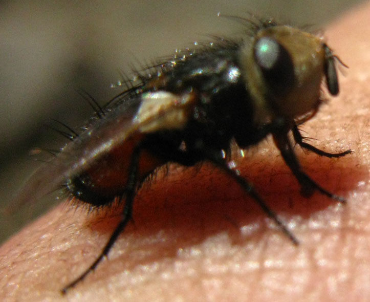 |
| This little guy lit on my finger when I was sitting by Round Lake on June 6, 2010. The soft-frozen lake was completely surrounded by our massive late-Spring snow. I was impressed by his fortitude. He also looked like he needed a little break. In any case, this is not a common housefly. Note how the eyes are attached to his head. He actually has a furry head! I figured if he could dry off and warm up, he'd have a better chance to make it to dry land, if not a nice tree. |
High Sierra Trail and Culture ReportThe Summer of 2010Elements of trail culture on the High Sierra Trails |
||
Summer has begun on the High Sierra TrailsI just completed a 100 mile trip along the Sierra Crest. The following Reports were generated during this trip Physical Report: Mosquitoes, Weather, Fording, and Snow Tongue Reports for August 2010: Read others. Add Yours! Cultural Report '10 : Trail Culture in the High Sierras. Long Distance Backpackers, Pacific Crest Trailers, Trail Workers, Scientists in the Sierras, Resupply points and their Crews. Insects, fish, and wildlife as well. Review a sample of High Sierra Backpackers. |
Are you hiking the long trails? Are you featured in the trail culture section? Do you want to leave a message for a hiker? |
Then go to the High Sierra Trail Culture 2010: Backpacker's Open Thread, Bulliten/Message Board, Information Exchange and leave a message. |
| High Sierra Trail Culture Index | ||
Bear in late Spring, Eastern Sierras
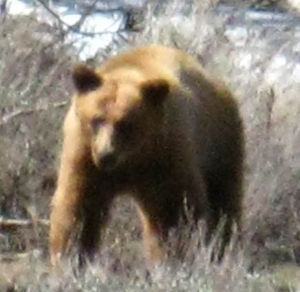
Bear in Poison Flat, June 2, 2010. see the full image
| 1 | ||||
Trail Conditions Open ThreadHave you been in The Sierras lately? Are you a horse packer, trail worker, backpacker, or work in a High Sierra Resupply point? Post your observations on the trail conditions you experienced for all your fellow Sierra Travelers. I am currently surveying a number of High Sierra Sources for trail reports when I'm not hiking myself. Add your information too. |
||||
Browser Problems? Videos not Displaying? Page displaying Funky? If the videos on this site are not available to you, this is likely a problem with your Microsoft Internet Explorer browser. Click here for more information on this problem, and solutions that may suit your needs. |
||||
News and Information
| Spring Waterflall under Round Top | Recent Backpacking Articles | |||||
|
Environment News: NOAA: June, April to June, and Year-to-Date Global Temperatures are Warmest on Record Introduction to Backpacking Food by AnalyticalSurvival |
||||||
| Recent News and Information | ||||||
Adam Blauert: Wild times in the Sierra Rabid Bobcat Attacks Hikers Near Tucson Extreme skier Fredrik Ericsson falls to his death scaling K2 |
||||||
West of the Carson Pass A pleasing loop |
||||||
|
Meet Alex: Why this site is here, a Statement of Purpose of sorts... |
||
Backpacking the Sierra Crest on the internetA Trail Guide in Progress... As you can see, this site is a work-in-progress trail guide designed for one purpose: to get you the best information about the long-distance High Sierra backpacking trails between Lake Tahoe and Mount Whitney. Though this is a work in progress, I'm just getting started and warmed up. Section 2, between Carson Pass and Ebbetts Pass in just ready to come online. The resupply section is coming together, and I am working on an early July High Sierra Report to compliment the May and June reports. If you've been hiking Sierra Trails, PLEASE post your trail condition reports across your route, especially any snow and water obstacles. In any case, we already are covering the Tahoe Yosemite and Pacific Crest trail routes in the Northern Sierras with maps, mileages, and elevations pages, and I cannot wait to bring this guide down the John Muir Trail in the Southern Sierras. How does this relate to you? You should do a big chunk of the Tahoe to Whitney this Summer, (and another next Summer) or the whole Tahoe to Whitney trip itself this Summer. Really. It can change your life. Presently, only the very first part of this trail guide, covering Meeks Bay to Carson Pass , is complete. Check it out. As I said, right now I am really busy putting up the Carson Pass to highway 4 sections covering both the PCT and TY trails. So stay tuned! I will have the miles, elevations, and route information you need for the whole trip up soon. In the mean time, make sure you check out the maps and the miles_and_elevations pages. From each of these pages you can click the colored points on the map linking to that particular position's information, including pictures, miles, elevations and videos. You should add your experiences and comments as well. And from here you can also easily track the progress of the website as it is constructed. Many of the sidebar topics are presently recolored, but still linked to placeholder pages. Digital issues always seem to pop up, but Large chunks of the trail guide are getting close to appearing online, and the sidebar links will also be filled in during the next few months. Backpackers, Keep in touch. Observe the trails and help to expand this small window into the beauty of the High Sierras by adding your observations to this guide as it continues on down the trail towards Mount Whitney. In any case, if you want to learn how to backpack, find new routes, or expand our knowledge of the routes on this site, then please write me or post your mind on TahoetowWhitney.org, the backpacker's forum. Stay tuned for an exploration of all topics related to long distance four-season backpacking in the High Sierras. In the meantime, the backpacker forum at TahoetoWhitney.org is open for general comments on all backpacking issues, your past and future trips, or any comments you have about the completed parts of the trail guide. |
|||
above: Le Conte Canyon below: The Philosophy: Be nice, People |
|||
| Observations on Bears and People taken from the Carson Gap. Meeks Bay to Tuolumne Meadows. Sept, 2009 | |||
Recent Backpacking Articles, information, and perspectives... |
||
What's Physically Important in the Sierras The Seasonal temperture Shifts, and the Mosquito Cycle |
What's Psychologically Important in the Sierras Seclusion, the Sierras, and the Scraper |
|
Let's Fire it Up! Backpacking Trail Tips: Fires, Tents, and Company in the High Sierras |
||
Do you have questions about the long trails between Tahoe and Whitney? I would be pleased to assist. Email me, or post your Issues on the TahoetoWhitney forum... |
||
TahoetoWhitney.Org |
||
2010 Backpacking Trips: What have you done?What are You Planning for 2010? Spark Imaginations: post notes, articles, videos and pictures on your past and about future trips on: TahoetoWhtiney will feature your killer trips!! And I will answer any questions you may have about hiking the routes between Lake Tahoe and Mount Whitney, or backpacking in general. |
Tahoe to Whitney 2010 Backpacking Trips |
| Winter, through the first day of Spring, 2010 |
| Lake Tahoe to Round Top, March 18 to 21, see the video reports above, and the series of related articles linked below the videos. Post notes, videos, and pictures from your Winter and Spring trips on the Lake Tahoe to Mount Whitney forum. |
| Spring, Part I: East Fork of the Carson River from Walker |
| Rodriquez Flat to Falls Meadow, East Fork of the Carson River, June 1 to June 3. The plan was to finish at Sonora Pass, but a very high runoff surge through Murry Creek feeding the East Carson River at Falls Meadow was not safely passable. This was my call, and I decided that the risk was not worth the reward. |
| Spring, Part II: South Upper Truckee to Showers Lake, Round Top Lake, and Round Lake on the way back to the South Upper Truckee |
| South Upper Truckee Loop. June 5 to June 9. A fine snowshoe trip through the Meiss Roadless area. The Pacific Crest Trail was almost completely snowbound between Carson Pass to Showers Lake, and on to Echo Summit. My loop went from the South Upper Truckee Trail head past Round Lake, around Meiss Lake to Showers Lake. The next day we exited the Tahoe Basin and spent the night at Round Top Lake below Round Top. The following day we reentered the Tahoe Basin and spent the third night at Round Lake, departing the next day. |
| Summer 2010 |
Walker to Tuolumne Meadows. July 21 to August 1. A 6.75 mile hike climbing up the East flank of the Sierras via Mill Canyon Road from Antelope Valley to the Corral Valley Trail head began this 100 mile to Tuolumne Meadows. This hard start was followed by a day working myself West across the Silver King drainage to an untrailed section along the rugged East Carson River, which finally brought me to the Pacific Crest Trail about 10 miles North of Sonora Pass. From the Sonora Pass I hitched to Kennedy Meadows Pack Station, where I resupplied and fed up on their fine food. From KM I followed a section of the Tahoe to Yosemite Trail through Brown Bear Pass into the Emigrant Basin, crossing into the Yosemite Backcountry via Bond Pass. Bond Pass leads to the Jack Main Canyon, where I again hooked up with the Pacific Crest Trail for the rest of the hike to Tuolumne Meadows, excepting the short loop of the Tahoe to Yosemite Trail I followed to see Tilden Lake. I met many fine folk and saw many beautiful things on this trip. I was also eaten alive by mosquitoes, almost lost a big toenail, (It's on its way out) and punched a bunch of holes into my feet. But this is why you pack a good first aid kit! It was a great trip. Kennedy Meadows to Tuolumne Meadows. September 1 to 8. September 1 hitch hiking to Kennedy Meadows up 108 from Berkeley. 11 hours hitching across the Valley to Kennedy Meadows Pack Station in 100 degrees without shade. Departed Kennedy Meadows September 2, arriving at Glen Aulin on September 5. Two nights with Trail Crew at Glen Aulin, to Tuolumne Meadows on the 7th, hitching out on the 8th. About 87 miles total. |
Backpacking Trips in 2009: What Did You Do?Spark our imaginations: post notes on your past and future trips on |
| Alex's 2009 backpacking trips |
| Fall 2009 |
Lake Tahoe to Tuolumne Meadows, Sept 15 to Oct 2, 181 miles. I saw a 35 degree temperture drop during the span of one day, and caught a few 19° degree mornings.
|
| Summer 2009 |
Lake Tahoe to Mount Whitney, July 15 to Aug 28, 2009, 470 miles, +/-, I took the long way. Blazing heat early, a bit of rain in the middle, and a couple of days of snow towards the end.
|
| Last Spring 2009 |
A Double-Header; Two Trips in one... #1>Tahoe to Round Top/Sisters, snow, June, 2009. 24 miles, mud and flowing trails down low, wet snow up high, caught some rain. Exited the mountains after a four-day trip, and hitchiked East out of the Tahoe Basin over to, and South on Hwy 395, to Walker California, then hiked up to Little Antelope Pack Station. #2>Walker Ca, to the Headwaters of the E. Fork of the Carson, exited Sonora Pass, June, 2009, 41 miles, snow. This early of an exit to Sonora Pass from the North on the Pacific Crest Trail is a very recent thing. The big red wall to the North of Sonora Pass has been packed with impassable verticle snow into mid to late June until recent years. It is one of the "timers" for northbound Pacific Crest Trai hikers. This cliff must clear of snow, or you must hike the long way around it. Only backpackers with serious ice/snow skills could get through before the trail along the cliff cleared of snow. This year (2009) I was amazed. The trail was completely clear in mid-June! 9 out of 9 previous Springs I was forced out to the East through the backside of the Marine Base. It was exceptional to be able to hike down to Sonora Pass in mid-June last Spring.
|
| Out of the Sierras, Spring 2009 |
Lost Coast, BLM and State, and parts of the Kings Range, May, 2009, 131 miles, Big rain. Biggest storm for the date on the Mendicono Coast in the region's recorded history. Massive waves thundered on-shore. The wave action piled up massive rock and gravel ramparts along the coast that were up to 25 feet tall. Crab traps and other relics of the sea were pushed ashore. A week later, when I returned Southbound across the same coastal section, I saw that the ocean had already torn down most of these same walls that it had put up during the storm a week earlier.
|
Contribute your Wilderness ExperiencesPost about the Tahoe to Whitney Trails: The All-Topic Backpacking Forums All backpacker's trail notes: TahoetoWhitney.Org |
Contact: Alex Wierbinski
Translate
Languages
Trail Skills
The art of walking
Physical Preperation
Trail Skills
The trail
Off the trail
Scrambling
Maps
Navigation
Camp skills
Food
Resupply
Food
Other
Photo Catagories
Trail Stories
Trail Culture
News and Science
Links
Groups
Books
top of page
Lake Tahoe to Mount Whitney: your backpacking guide to the Sierra Crest, including the Tahoe to Yosemite, the Pacific Crest, and the John Muir Trails