

High Sierra
Backpacking
Trail Guide
Forums
Sierra
Weather
WeatherNotes Northern
Sierra Weather
Gear
The Tahoe to Yosemite Trail
Backpacking to
Crag Lake out of Meeks Bay
Backpacking North Desolation Wilderness
Languages
Trail Skills
Mountain
Safety
Food
Planning
Trail Arts
More
Information
Social
Desolation Wilderness Trail Guide
North Shore
|
| Meeks Bay to Dicks Pass 15 minute Backpacking Map |
Desolation Wilderness 30 minute Backpacking Map |
Meeks Bay to Echo Summit
Backpacking Miles and Elevations
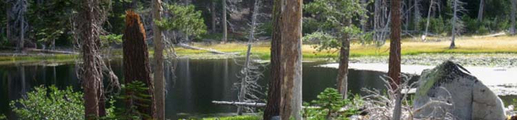
Crag Lake is the second lake in the chain of lakes following the Tahoe to Yosemite Trail South out of Meeks Bay.
Crag Lake appears after a very brief .4 mile hike South up from Lake Genevieve, on the way up to Phipps Pass.
Walking South .58 of a mile brings us to the South Shore of Crag Lake and the trail branching off to our Southbound Right, Southwest by the compass, to Hidden Lake.
Video
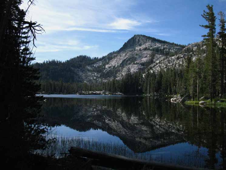
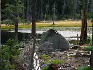
Peak 9054 behind Crag Lake in morning light
Crag Lake, Desolation Wilderness. Duration 1:37. |
| The whisper of wind rippling across the crystal blue waters of Crag Lake produced a stunningly serene visual effect, barely caught in the still pictures. |
Desolation WildernessMeeks Bay to Crag Lake
Crag Lake
+1201
Mileage 4.77 miles from Meeks Bay trail head 4.11 miles to Phipps Pass climbing 1360 feet
Meeks Bay to Echo Summit
|
Peak 9054
well frames Crag Lake
Desolation Wilderness
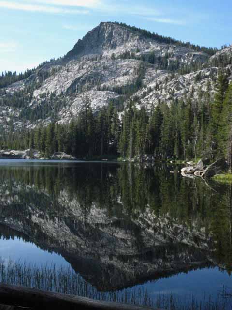 |
A calm morning along the chain of Lakes between Lake Genevieve and Phipps Pass presents a series of stunning reflective lakes. |
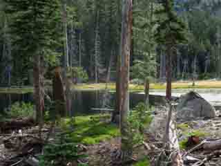
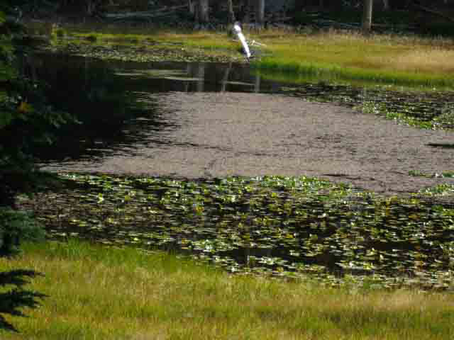
Interesting sights on the South Side of Crag Lake, Desolation Wilderness
 |
 |
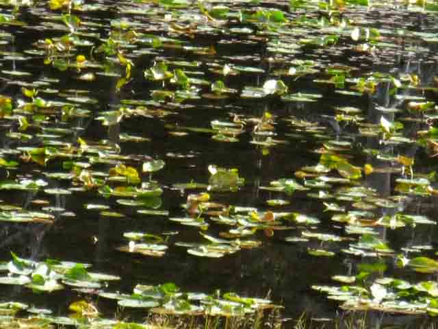
| Above: lilies on Crag Lake? | Above: Yes, Water Lilies on Crag Lake |
 |
|
| Above and Below There's something hypnotic about Lilies, and Desolation Wilderness is full of entrancing Surprises. |
|
 |
| Every step brings another relaxing scene in the Desolation Wilderness |
A fine Series of Terrains Along a dry sandy meadow-side trail to the ridge, through dry forest into a little temperate zone, and now into this narrow valley containing a chain of lakes. The series of sights, sounds, smells and feelings along these first miles on the trail are a fine sensory transition from "civilized" to natural environment. |
Walking South .58 of a mile brings us to the South Shore of Crag Lake and the trail branching off to our Southbound Right, Southwest by the compass, to Hidden Lake. To the South End of the Valley Genevieve and Crag Lakes are at roughly the same altitude in the bottom of this valley. Passing around the North Shore of Crag Lake we begin climbing towards the Hidden Lake trail junction, which marks the beginning of a gentle ramp in the terrain up past Shadow Lake, off to our Southbound Left, North, with Hidden Lake to our South, Right, as we begin our hike up to Stony Ridge Lake wedged into the upper end of this valley of lakes. Both lakes are effectively hidden by the shape of the terrain and forest cover from the trail. |
Weather Information
Local Temp and Snow Reporting Stations
Click the Big Red Dots.
| Tahoe Basin Weather | All High Sierra Weather |
Lake Tahoe Basin 7-Day Weather Forecast
Desolation Wilderness Meeks Bay to Crag Lake to Phipps Pass Meeks Bay Trailhead Crag Lake 4.77 miles from Meeks Bay trailhead
Meeks Bay to Dicks Pass
Phipps Pass 4.11 miles to Phipps Pass from Crag Lake
Phipps Pass
|
Desolation Wilderness |
From Meeks Bay trail head to Phipps Pass we will be climbing a total of 2561 feet of vertical elevation over 8.88 miles of distance. Crag Lake is the second in the series of lakes along the TYT to Phipps Pass. As the area between Lake Genevieve to Stony Ridge Lake represents the last relatively flat places (a gentle incline) before we begin climbing steeply towards Phipps Pass at the South end of Stony Ridge Lake, we may want to stop at this scenic location for a snack or a bit of lunch, depending on our plans. Crag Lake is 4.77 miles South of Meeks Bay Trailhead
We'll notice Rubicon Lake gives u a sweet place to take a break between the low & high points of this segment of our trail, between Stony Ridge Lake and Phipps Pass. Topo Map: Meeks to Dicks Pass Topo Map: Genevieve to Phipps Pass
Next page |
North: Lake Genevieve South: Stony Ridge Lake
Tip: |
This trail guide, like the High Sierra, divides itself into ups and downs. We are generally doing one or the other, hiking up or down, and the distances vertical and linear distances between our respective peaks and valleys is going to be important in determining what we are up against every day, and therefore how many miles we can reasonably expect to backpack that day, and how much energy it is going to take out of us. The miles we can reasonably expect to hike each day will be instrumental in determining where we are going to camp every night, and ultimately this information will determine how many days it will take us to cover a given distance. This in turn determines your proper food load. For instance, the Desolation Trail from the Meeks Bay trailhead to Phipps Pass rises 2561 feet of elevation in 8.88 miles. This would not be a difficult incline if it was taken in one constant grade. But it is not. From Stony Ridge Lake a set of steep switchbacks leads us up to Rubicon Lake, and shortly thereafter to Phipps Pass. Each trail guide page will list the elevation for the location, the mileage back to the trailhead or important previous trail junctions, and the mileage from that location to the top of the next peak, pass, or crestline, then to the bottom of the next valley. I am hopeful this approach will help us accurately plan and effectively execute our trips. Backpacking Topo Map: Meeks to Dicks Pass Backpacking Topo Map: Genevieve to Phipps Pass next: |
Hiking North |
 |
Hiking South |
Backpacker Forums Post it on Welcome to Tahoe to Whitney
Anyone can post text comments in the existing forums, but only members can post up new topics, along with images, maps, and formatting. As we addressed some gear issues on the page above,
If you have experiences, comments, questions, trip reports, trail conditions updates or pictures and/or videos of the Tahoe to Yosemite Trail from Meeks Bay to Lake Genevieve, and camping around Lake Genevieve and up the valley, post up your images, experiences, notes, and advice here as an unknown hiker or as a member: Section
|
North: Lake Genevieve South: Stony Ridge Lake
Trailhead
Contact
Alex Wierbinski

Backpacking Lake Tahoe to Mount Whitney
Your guide to the High Sierra Crest, including the Tahoe to Yosemite, Pacific Crest, and John Muir Trails
