


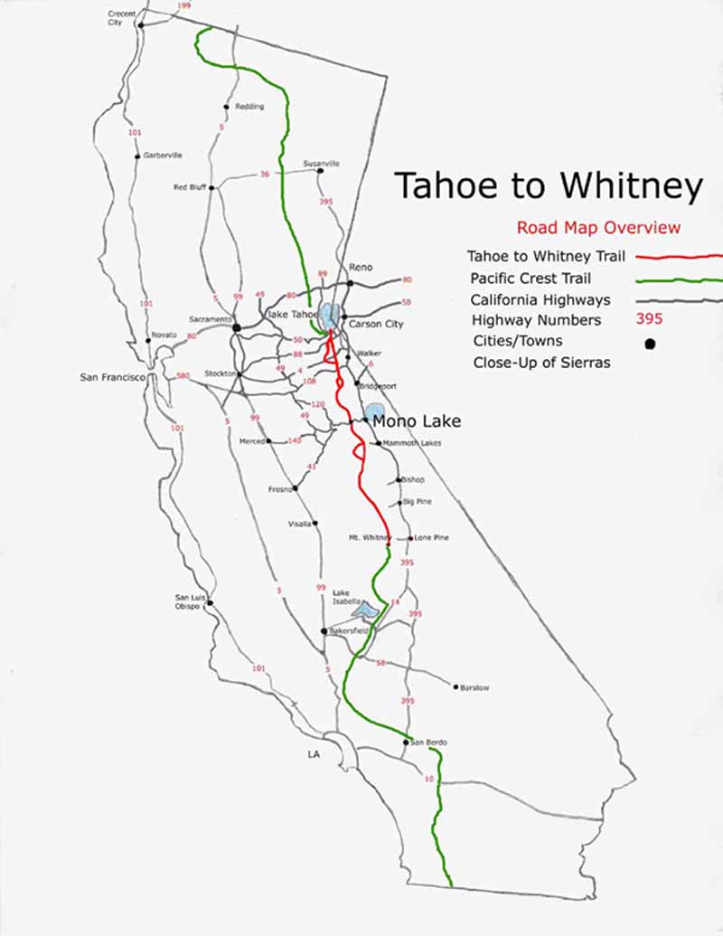
Lake Tahoe to Mount Whitney Trails
on a
California Map
The Pacific Crest, Tahoe to Yosemite, and John Muir Trails across the Sierra Nevada Mountian Range

Mount Whitney on a Map
Detail
Tahoe to Whitney Trail
|
Main Feature(s): Tahoe to Whitney and Pacific Crest Trails on California Map
Map Name: California with Lake Tahoe to Mount Whitney Trails
Backpacking permitting authorities
Starting from Lake Tahoe:
Lake Tahoe Basin Management Unit
Physical location
California, USA
scale:
Hand Drawn
trail mileage
Between 420 and 470, depending on the route
base elevations
Lake Tahoe
6226 feet
Mount Whitney
14, 500 feet
Trail Guide, Section
All, see Trail Index
Trail Guide, Segment
All
(use search term "XXX," and "Address" search type to locate this USGS map)
Comments on this