The Trails
Guide
Maps
Miles/Ele
Permits
Resupply
Forum
Current Weather Conditions
Weather Notes
Northern High Sierras
Central High Sierras
Southern High Sierras
Gear
Gear List
Gettin Started
Layering
Discussion
Testing yourself and your gear
Gear Reviews
Backpacking
Kennedy Lake Trail
East & West
between
TYT at Summit Creek
and
PCT atop Kennedy Canyon
Hiking
The Tahoe to Yosemite Trail in the Emigrant Wilderness to the Pacific Crest Trail in the Toiyabe Forest
Languages
Languages
Trail Arts
The art of walking
Physical Preperation
Trail Skills
The trail
Off the trail
Scrambling
Maps
Navigation
Camp skills
Food
Resupply
Food
Other
Photo Catagories
Trail Stories
Trail Culture
News and Science
Links
Groups
Books
Terms and Conditions of Use
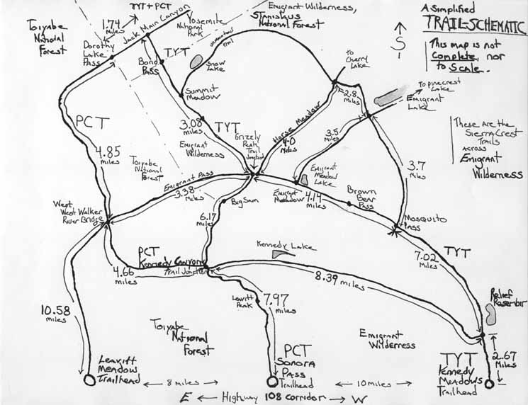
| Trail Guide INDEX Highway 108 to Highway 120 |
West TYT Kennedy Meadows to Relief Reservoir |
East PCT Kennedy Canyon Trail Junction |
7.5 Map Kennedy Lake |
30 min Map Sonora Pass to Bensen Lake |
Kennedy Meadows to Tuolumne Meadows MILES AND ELEVATIONS |
TOPO MAP INDEX Kennedy Meadows to Tuolumne Meadows |
Resupply South |
National Forest PERMITS Toiyabe & Stanislaus |
all maps index |
Kennedy Lake
Overview
Located along an East-West oriented trail between the Tahoe to Yosemite and Pacific Crest Trails |
Below
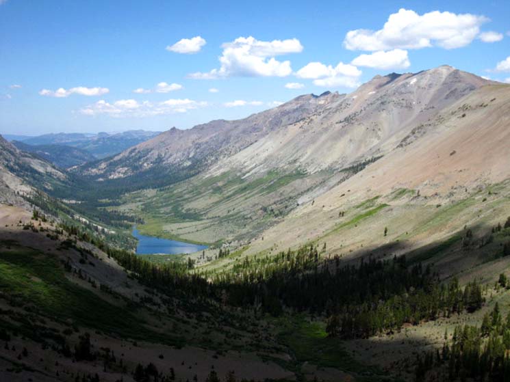
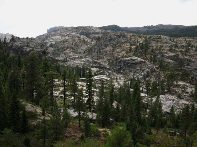
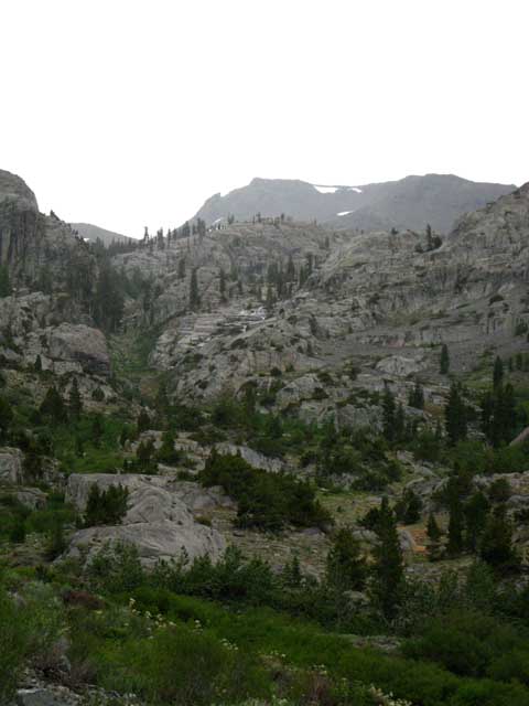
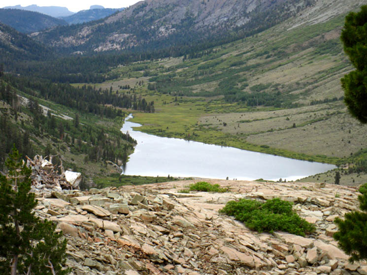
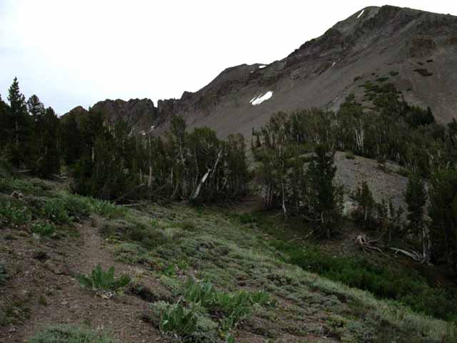
View West of the Majority of Kennedy Lake Trail's
Terrain
between the
TYT and PCT
 |
||
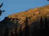
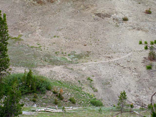
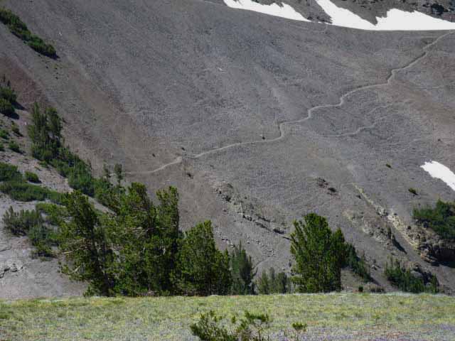
Kennedy Lake This view above of Kennedy Lake and its surrounding to our Northwest opens up as we climb South higher up Big Sam. The trail coming East up Kennedy Lake's valley starts from the Tahoe to Yosemite Trail along Summit Creek, a bit South of, and above the Kennedy Meadows Pack Station Trailhead along Highway 108. That trail junction location is in the scope of the picture above, but out of view at the far end of the S-turn at the bottom of Kennedy Lake's valley. The view above gives us a fair view of the moderate terrain that the Kennedy Lake Trail crosses from the Directly below our vantage point in the image above we can see the terrain from the upper shore of Kennedy Lake up towards us and the PCT. Down there is where a good-quality unmaintained trail route finishes linking these two classic trails. The page below traces the Kennedy Lake Trail West from its Western Start along the TYT to its Eastern end at the Kennedy Canyon trail junction along the PCT.
|
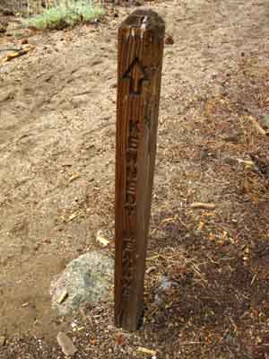
Kennedy Lake Trail Junction
on the
Tahoe to Yosemite Trail
Miles and Options Long Hiker Options Northbound PCT Hikers The trail to Kennedy Lake does not directly assist hikers on the Tahoe to Yosemite Trail. Knowledge of this route option could be put to good use by Northbound hikers on the Pacific Crest Trail, and any backpackers looking for fine loop and Trailhead to Trailhead backpacking in Emigrant Wilderness.
PCT End of Trail PCT hikers have another option.
TYT End of Trail This route is virtually all downhill. The page below describes the trail linking the PCT and TYT via Kennedy Lake.
Local Loops The next four-way junction to our South is located at Grizzly Peak. The Kennedy Canyon trail junction could be very helpful in planning long distance loops or trailhead to trailhead backpacking trips around the Emigrant Wilderness. Or crafting alternative route backpacking across Emigrant Wilderness on our series of |
Emigrant Wilderness What
On the TYT
Kennedy Meadows to Bond Pass
Our Variation to the PCT at the
MILES LINKING
Next "Alt-Route" Steps South? On the PCT
|
|
PCT to TYT Just the Facts TYT-PCT Connector Trail Length TYT West End Trail Junction Location PCT East End Trail Junction Location Unmaintained Trail How do YOU Let's look at our hiking options on both the East and West sides of Kennedy Lake. |
| East & West Ends of the Kennedy Lake Trail |
||
West End: Kennedy Lake Trail Guide Pages Backpacking Options 8.39 miles
Related TYT TYT
West Flank Kennedy Lake
|
East End: Kennedy Canyon Trail Guide Pages Backpacking Options Related PCT Southbound PCT
PCT North PCT
PCT to TYT South PCT
TYT to PCT West |
|
BIG VERSION
Kennedy Meadows South to Kennedy Lake Trail Junction2.67 Hard Hot miles
|
||||||||||||||||||||||||||||||
The Tahoe to Yosemite and Pacific Crest Trail routes act like different sides of a triangle laid North and South across the opposite sides of the Emigrant Wilderness. The trail through Kennedy Lake depicted on the page below is the first trail that connects these two trails on their respective routes just South of Highway 108. A bit further to the South the trail over Big Sam also connects the TYT and PCT routes, as does the Emigrant Pass trail junction near Grizzly Meadow and Grizzly Peak. The furthest and final intersection between the TYT and the PCT South of Sonora Pass sits just East of the Emigrant Wilderness boundary at the Eastern bases of Bond and Dorothy Lake Passes. My point is that all of these connector trails allow backpackers to construct loops hiking either the PCT or TYT South into Emigrant Wilderness from Highway 108 to pivot and change directions by hiking onto the other trail to begin looping back to your starting trailhead, or to of the other trailheads accessible from Highway 108. Once you reach Highway 108 it is fairly easy to hitch a ride any of the other trailheads along Highway 108, if you left you car there. Viewed as part of a longer loop the trail through Kennedy Lake allows us to hike a nice semi-circle route from Kennedy Meadows to Sonora Pass via Kennedy Lake. More aggressive hikers will push further South, and not turn North towards Sonora Pass until reaching Grizzly Peak while the strongest hikers, or those with the most time, will hike all the way South to Bond Pass before changing directions and trails to hike back to Highway 108. There are endless options for exploring the Emigrant Wilderness on short in-and-out backpacking trips or via grand loops swinging back to your starting trailhead or by plotting sweeping arcs from one Highway 108 trailhead to another. This trail connecting the TYT and PCT via Kennedy Lake is the first PCT-TYT connector trail South of Sonora Pass. The next connector trail brings us South from Kennedy Canyon down to the trail junction at Grizzly Peak, and our Southernmost link between the PCT & TYT is their final junction in Jack Main Canyon. |
| Trail
MAP |
Road MAP |
Backpacker Resources and Hiker Information
| Trail Index | ||||||||||||||||||||
Miles
TYT-PCT
Video
Kennedy Lake trail junction on TYT
|
Emigrant Wilderness Weather and Road Information
all Weather and Fire Information |
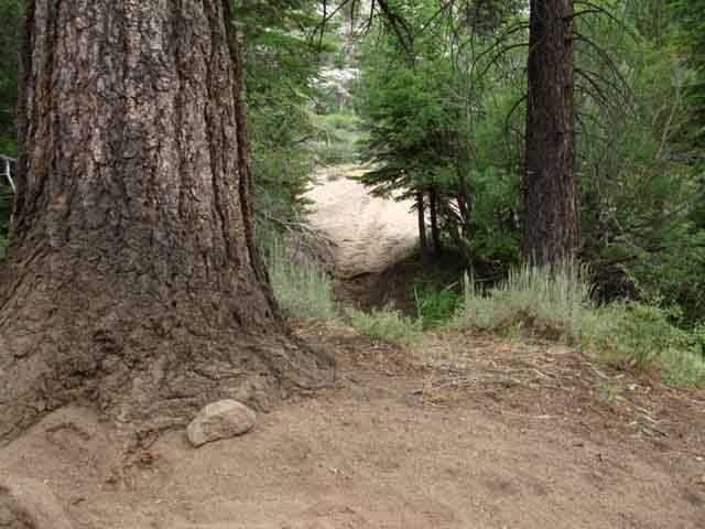
Faint Trail West from Kennedy Canyon trail junction
|
||||||||||||||||||
| > Forum < | ||||||||||||||||||||
| Video of 8.39 miles hiking West from the Kennedy Canyon trail junction on the Pacific Crest Trail to the Kennedy Lake trail junction on the Tahoe to Yosemite Trail North of Relief Reservoir. |
15:32 |
Hiking South to the Kennedy Lake Trail Junction along the Tahoe to Yosemite Trail
 |
Hiking South up to the Kennedy Lake trail junction along the Tahoe to Yosemite Trail. This is the start point of this 8.39 mile length of trail connecting the TYT to the PCT at the Kennedy Canyon trail junction. Right continues South to Relief Reservoir along the Tahoe to Yosemite Trail. Left turns East to Kennedy Lake and the termination of this trail at the Kennedy Canyon trail junction along the Pacific Crest Trail. |
 |
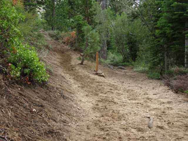
| Less than a hundred yards East of Kennedy Lake trail junction we see big trail to what looks like a big campsite. |
Hiking East and up the diversity of the surrounding terrain reveals itself
 |
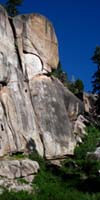
Climbing up into Kennedy Creek's canyon we climb through a saddle in the Eastern ridge above us. We begin to get views to the Southwest from a high point on the West side of the saddle looking at the top of the Turtle Rock feature on the Southwest side of Relief Reservoir peeking up over the granite in the middle distance. Relief Reservoir sits between the two. Here we can begin to see the fingers of gray to pinkish granite terrain slashing into the ocean of volcanic terrain defining the complex interface between the two that gives Emigrant Wilderness such a spectacular character. |
I spy a pool along Kennedy Creek far below
 |
Coming through the saddle we are high above Kennedy Creek where it turns Northwest through a deep canyon above its confluence with Summit Creek. As we hike East we come down to Kennedy Creek as it flows down a fairly gentle descent below Kennedy Lake. Before we rejoin Kennedy Creek we see that these sheer granite canyons shelter many delights. Fine blue and green pools like the one above can be spied out at the bottom of the deep and steep gorge Kennedy Creek flows through at its Western end. If you are looking for some real adventurous fishing where the best part is getting to the fish, you've found a little piece of heaven here in the Emigrant Wilderness. |
 |
A Top Rock in the saddle between Kennedy and Summit Creek valleys. Remember, we observed where Kennedy Creek falls into Summit Creek just below the upper footbridge. Now we are cutting over to the Kennedy Creek canyon from higher up Summit Creek's canyon. Below we can see where Kennedy Creek falls into Summit Creek far below, where the low arm of white granite appears to block the valley. That's where the wishbone split of the canyons brings these two creeks, Summit and Kennedy Creeks together. |
View Northwest down Kennedy Creek
 |
From the position above we are hiking West towards the canyon holding Summit Creek with a view Northwest down the narrow valley carrying Kennedy Creek down to Summit Creek through the larger valley beyond down to Kennedy Meadows Pack Station and Resort. |
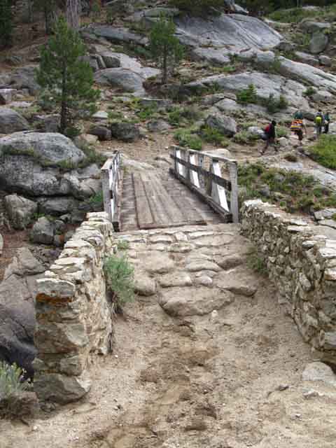 |
View looking West across bridge. The hikers are Charlie, Max, Ian and Joey who you will meet just a bit lower down this page towards Kennedy Lake. Once we reach the Kennedy Creek Bridge the steep climb West up from Summit Creek is over. A moderate 4.76 mile climb separates the Kennedy Creek Bridge from campsite on the Northeast side of Kennedy Lake. East of Kennedy Lake the trail again steepens for the 3.05 mile hike up to the Kennedy Canyon trail junction with the Pacific Crest Trail which is situated on a low point along the Sierra crestline. |
| Kennedy Creek Footbridge. |
:50 |
 |
| The terrain here screams "Western," imparting the feeling of being transported back to the days of gold and silver. |
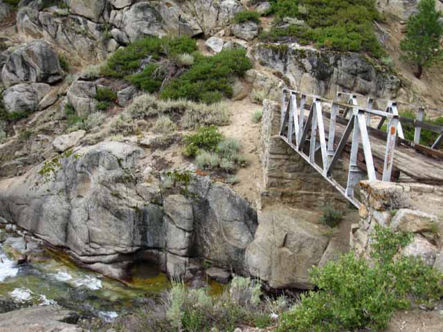
View of footbridge from East of Bridge
 |
| View of the footbridge from the East, upstream. |
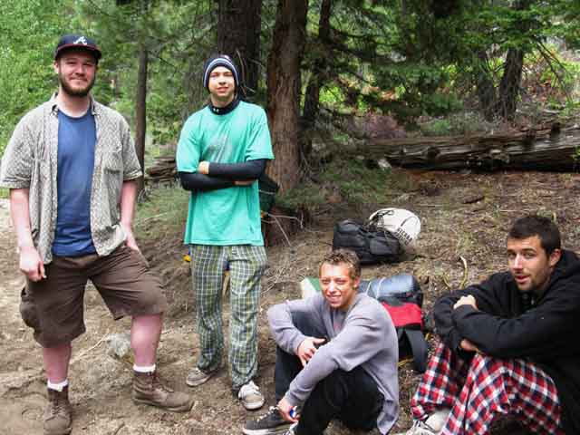 |
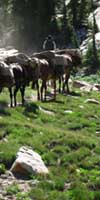
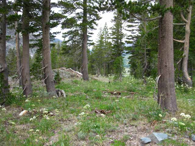
Charlie, Max, Ian and Joey below Kennedy Lake. Hiking West I encountered these dudes taking a break along the trail. After an awkward moment during the first seconds of our encountering each other we realized our difference in age (I'm old-they young) and our differences in gear and hiking styles (I am a heavy-weight, they were lightly geared), and group size (solo vs group), was nothing compared to our mutual enjoyment of the experiences we shared on the trail and in the terrain. Nature is everyone's common denominator. |
 |
 |
|
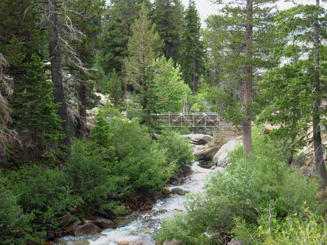
| Meadow on West Side of Kennedy Lake. |
:44 |
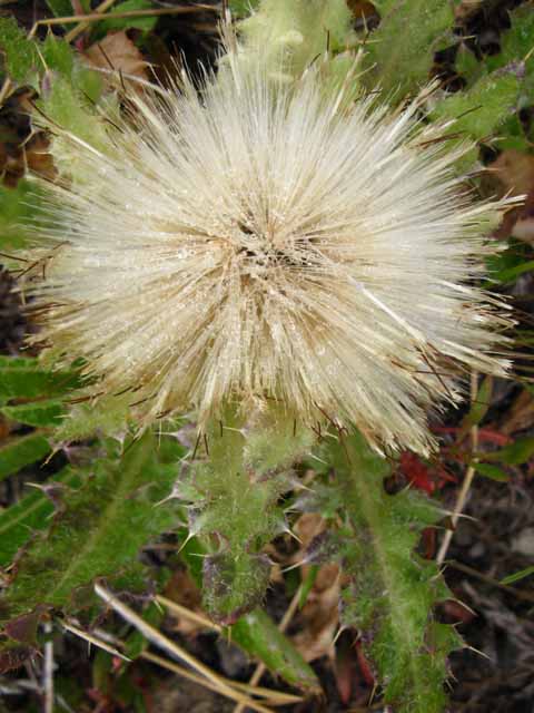 |
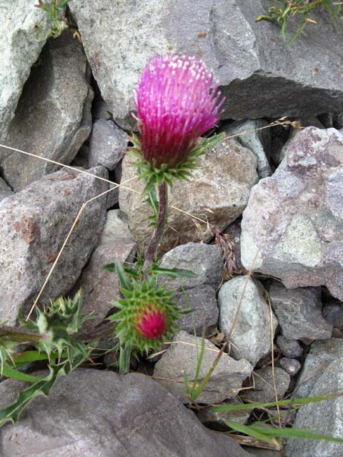
White Thistle in meadow below Kennedy Lake. See thistle forum Calflora genus: Carduus |
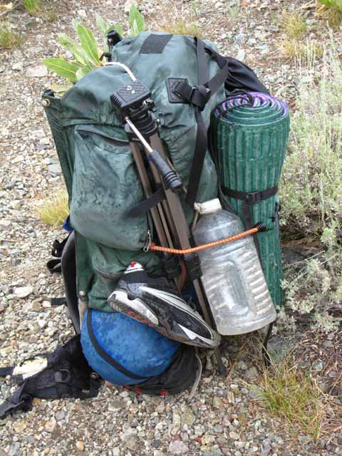 |
Harness of Pain in the Rain. It's the Harness of Pleasure too... Note the Marmot Damage on the Hip Belt. Every chew mark tells a story... It looks like the Joads went broke and took to foot. |
| A fine campsite sits on the Northernmost corner of Kennedy Lake in a stand of fine Junipers. |
1:05 |
Molo Mountain to the Southwest towering over Emigrant Meadow
 |
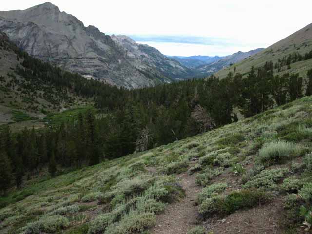
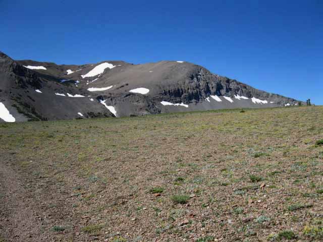
A great canyon opens up to the Northwest of Big Sam's crest, Southeast of the upper part of the valley above Kennedy Lake. A great granite basin surrounded by massive mountains of volcanic debris. This canyon is essentially a channel of granite spilling down into this volcanic valley above Kennedy Lake. This canyon leads over to the High Emigrant Basin on the other side, via Lost Lake. This looks like an exceptional scrambler's route, though I have not explored it. Check out this Emigrant Wilderness topo hiking map showing this potential route up through Kennedy Creek and over Big Sam to Emigrant Meadow. We enter Emigrant Meadow from the North, just a way Northeast of Brown Bear Pass. We see Molo Mountain peeking over from its position towering over Emigrant Meadow to our South, over our Right Shoulder. |
 |
| I believe this is an invasive plant. |
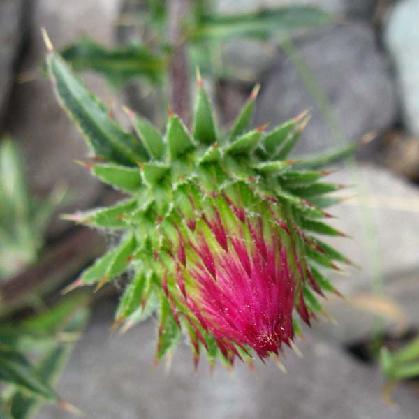 |
Detail. Correct about the invasive. A little research revealed... Scientific Information Carduus pycnocephalus L., Italian Thistle? Genus: Carduus |
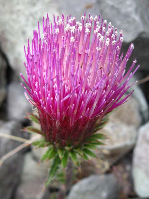 |
High Sierra Plants, Thistle, red, flower, detail. |
 |
| The course of Kennedy Creek flowing West down to Summit Creek is visible in the shape of lower canyon below Kennedy Lake. We can see Kennedy Creek's route is a grand "S" turn down to Summit Creek. In the distance beyond we can see the massive hulk of the Dardanelles shaping the horizon. |
Lodgepole Flats divide and smooth out our angled transitions
 |
| Lodgepole pines in flat space above Kennedy Lake. |
The route between East side of Kennedy Lake and the Sierra Crestline
 |
| West view down canyon holding Kennedy Lake. Again note the Dardanelles in the far distance. As Kennedy Creek's canyon steepens on it 's climbs towards its headwaters, and the PCT, the trail moves higher up the North bank of Kennedy Creek to avoid the deepening canyon. |
Approaching the top of the Canyon and the Headwaters of Kennedy Creek
Big Sam to the South-Southeast
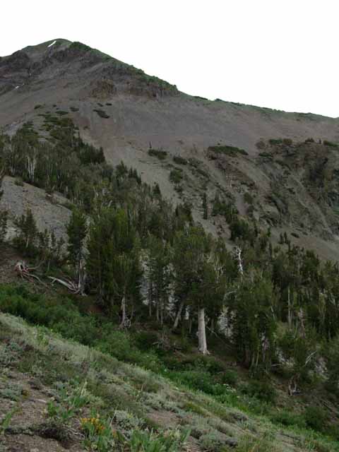 |
| Northwest flank of Big Sam. Kennedy Creek flows down through a channel cut in the slope behind the trees. |
Southeast View from near the top of the Valley
 |
Almost to the top. Northwest side of Big Sam towers over us from our position on the North side of Kennedy Creek just below the Headwaters of Kennedy Creek at the base of the North Flank of Big Sam. |
Looking West from our High Vantage Point at the top of the Canyon above Kennedy Lake
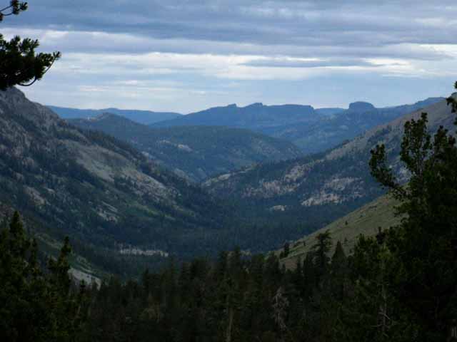 |
The far West end of Kennedy Creek's Canyon draining into Summit Creek at a position below Relief Reservoir and above Kennedy Meadows. Outline of the Dardanelles is clear in middle distance. The Dardanelles divides Spicer Meadow Reservoir, under its far Western Flank along the TYT route to Lake Alpine, from the drainage of the Clarks Fork of the Stanislaus River, under its Eastern Flank. |
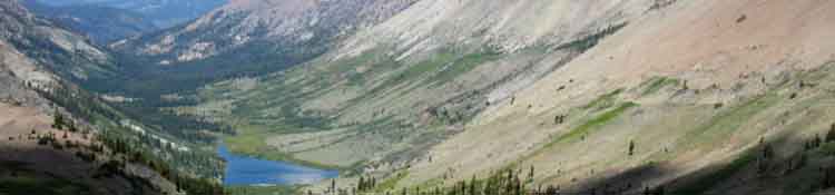
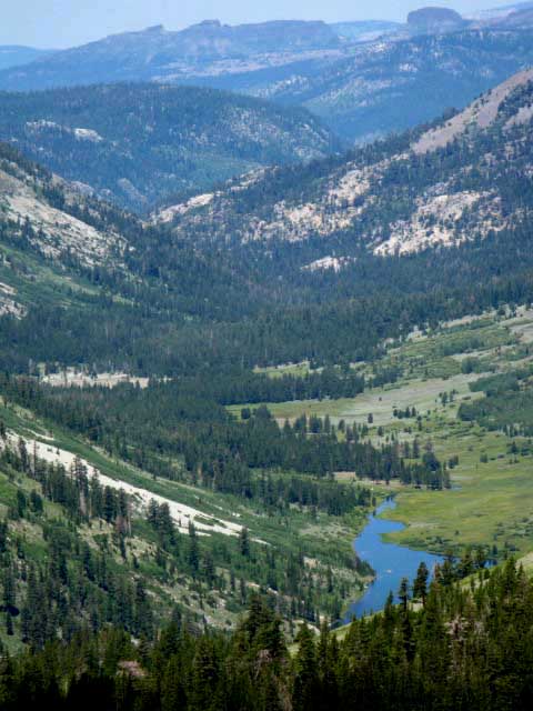
Long View of Kennedy Lake in its valley draining West to Summit Creek
Kennedy Lake under Leavitt Peak |
| Climbing South over Big Sam into Emigrant Meadow brings expansive views of Kennedy Lake and its position nestled in under Leavitt Peak. |
Looking West:
Detail of Lower Valley intersecting with Summit Creek
 |
Tail end of Kennedy Lake with terrain beyond revealing the shape of Kennedy Creek Canyon down to Summit Creek's canyon, where the East-West trail from Kennedy Lake intersects with the North-South route of the Tahoe to Yosemite Trail. The unique shape of the Dardanelles are visible beyond Summit Creek's canyon. Tail-like West end of Kennedy Lake visible at bottom of image. |
At the top of Kennedy Creek's Headwaters
Looking East at Kennedy Creek flowing West out of its Headwaters
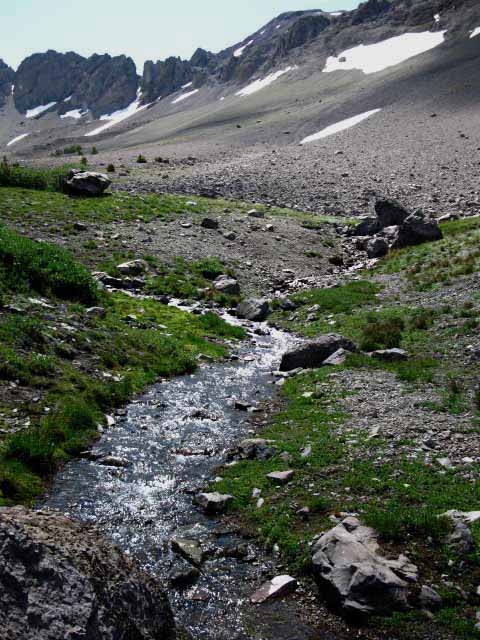 |
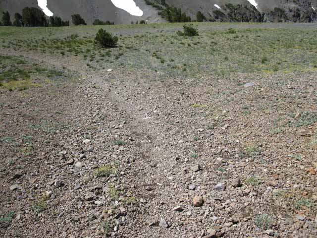
Kennedy Creek where the shortcut crosses South, Right, to Big Sam. Hikers East and West between Kennedy Lake and Kennedy Canyon do not hike down to Kennedy Creek. Where Westbound hikers heading to Kennedy Lake can see Kennedy Creek and the shortcut South up to Big Sam on the South side of Kennedy Creek is where the route down to Kennedy Lake stays high up on the North bank of Kennedy Creek. Don't go down to cross the creek unless you are hiking South over Big Sam into the High Emigrant Basin. Or you are thirsty and need water. The hiker coming up from Kennedy Lake to the PCT begins to turn Northeast (veering to our Left from the perspective of the image above) towards the PCT at the Kennedy Canyon trail junction as we approach the headwaters of Kennedy Creek sitting between Leavitt Peak to the North and Big Sam to the South. The Kennedy Canyon trail junction we are hiking towards sits in the low-flat gap on the Sierra Crestline between Kennedy Lake on the Western Flank of the Sierra Nevada and the Southbound PCT route heading down Kennedy Canyon on the Eastern flank of the Sierra. |
The Trail up to Big Sam Climbing the South Side of the Ravine holding Kennedy Creek
 |
Note our position off of and above the North bank of Kennedy Creek running West down to Kennedy Lake. Hikers hiking East and West along Kennedy Creek must remain above the North side of the ravine holding Kennedy Creek. The remnants of trail linking the Kennedy Canyon trail junction West down to Kennedy Lake are located to the North of the creek out of its ravine. Eastbound hikers coming up from Kennedy Lake will be bending to their Left, to the North, to join with the Pacific Crest Trail passing through the Kennedy Canyon trail junction. The Kennedy Canyon trail junction is located on the low flat between these two back to back valleys down the Eastern and Western flanks of the Sierra Nevada. Southbound hikers on the way to Emigrant and Grizzly Meadows will cross Kennedy Creek to catch the shortcut trail in the picture above, South up to the Tungsten Road over Big Sam. Northbound hikers will turn North on the Pacific Crest Trail at the upcoming Kennedy Canyon trail junction towards Sonora Pass. Southbound hikers along the PCT route will head East down Kennedy Canyon. |
View Southwest at terrain sloping off to the West down to Kennedy Creek and the Shortcut trail up Big Sam
 |
Looking Southwest at the terrain sloping off down into Kennedy Creek in its deepening canyon and the Kennedy Canyon trail junction. In the background is the shortcut trail up the massive rising North flank of the Big Sam Massif. On the other side of the ravine holding Kennedy Creek we can see the shortcut trail heading up to the Tungsten Road, which is holding the line of snow on its roadbed across the top Right of the image. Following the Tungsten Road route South over Big Sam brings us to the Emigrant and Grizzly Meadows on the South Side of Big Sam in the High Emigrant Basin. There we find the Tahoe to Yosemite Trail crossing these meadows on its route across Emigrant Wilderness from Kennedy Meadows Pack Station to Bond Pass. From Grizzly Meadow we can cross Emigrant Pass to hike Northeast down to the base of Kennedy Canyon, below us to the East from our current position near the Kennedy Canyon trail junction. If we continue South through Grizzly peak to Bond Pass we can turn our hike North on the Pacific Crest Trail route back to our current position near the Kennedy Canyon trail junction. The Emigrant Wilderness has a huge amount of beautiful terrain to explore. Check out the Topo Hiking Map of the trail between the Kennedy Canyon trail junction at the top of Kennedy Canyon over Big Sam to the TYT trail junction in Grizzly Meadow and South to Bond Pass and the Pacific Crest Trail. |
View Southwest at terrain sloping down to Kennedy Creek from the Kennedy Canyon Trail Junction
 |
Big Sam in background. Trail to Big Sam crosses creek to hike shortcut trail. Our route to Kennedy Lake bends right as we hike down to the top of the steep bank along North side of Kennedy Creek while hunting for bits of the faint trail to our Right heading down to Kennedy Lake. |
View Southwest at faint crease in terrain marking junction point of Tungsten Road and Trail to Kennedy Lake
 |
The Tungsten Road just South of the Kennedy Canyon Trail Junction. Very faint trail to the Right towards both the shortcut up Big Sam and the route West down to Kennedy Lake. The Tungsten Road bending off to the Left has narrowed to trail width here while a faint crease in the terrain heads Right towards Kennedy Creek. |
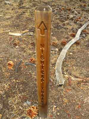
Kennedy Canyon Trail Junction Broken
 |
| As of July 2012 the Kennedy Canyon trail junction marker was down. |
Better Days of the Kennedy Canyon Trail Junction
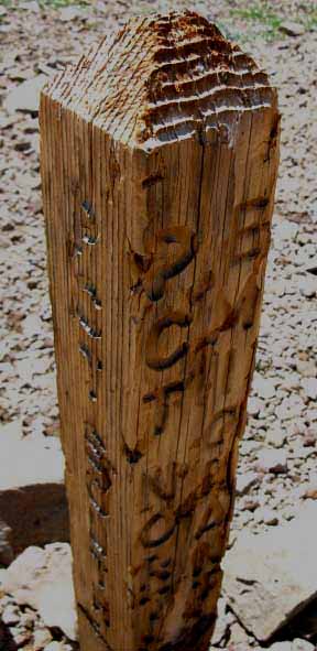 |
| This old trail post has been knocked down and reset for decades. Actually this is the second trail post I've seen here over the years. |
Four Backpacking Options from Kennedy Canyon Trail Junction
1> North on the PCT. 2>South on the PCT. 3> South to the TYT. 4> West to the TYT.Emigrant Wilderness Hiking MapThe Kennedy Canyon Trail junction opens up local route options exploring all points of the Emigrant WildernessTrail Guide PagesPCT NORTH PCT SOUTH SOUTH TO EMIGRANT BASIN WEST to TYT
MILEAGE TO 6.17 miles South from the Kennedy Canyon trail junction 9.51 miles East from the Kennedy Canyon trail junction 11.06 miles West from the Kennedy Canyon trail junction |
Long Distance backpacking Where the Hell are We, In the video below we'll take a bird's eye view looking down at the little flat area along the Sierra Crestline that separates the two canyons descending down both East and Western flanks of the Sierra, and the two mountains that bracket this tiny flat to its North and South. Those are the four possible directions of travel and the features of each from the Kennedy Canyon trail junction down there on that flat. Mountains North and South with valleys East and West. West and East South and North Four Ways to Fun South on the PCT South to TYT over Big Sam At the base of Bond Pass the TYT and PCT's divergent routes across the Emigrant Wilderness and Toiyabe National Forest come together for most of the remaining 55 miles between us and our next resupply spot to our South at Tuolumne Meadows. Local Loops and Trailhead to Trailhead Arcs First Crossroads Trail Second Crossroads Trail Hiking down to Grizzly Peak and the TYT from any of the trailheads along Highway 108 allows us to either craft long hiking loops back to our original trailhead that take in sizable chunks of the Emigrant Wilderness (30 to 50 miles), or we can bend our route to hike long trailhead to trailhead backpacking arcs across the many faceted beauties of Emigrant Wilderness (20 to 40 miles). If you push your turnaround point even further South to thread your route through Bond and Dorothy Lake Passes your grand circle hikes around Emigrant Wilderness can range from 30 to 90 miles in length hiking out of any of our Highway 108 trailheads. Way Down the West Flank |
| Kennedy Canyon trail junction and major trails with their associated features reaching out North, South, East, and West. |
| 1:13 |
Kennedy Canyon Trail JunctionOptions for Local backpackers Now that we've gotten here, to the Kennedy Canyon Trail junction, we have some decisions to make, or we are executing plans already laid out and packed for. 7.5 hiking map Do we head South on the PCT or South over Big Sam to the TYT? Either one of these two options require we eventually turn back towards our original trailhead from Grizzly Peak or Bond Pass, considerably lengthening our trip. 7.5 hiking map Or we can hike the PCT North to Sonora Pass, and end our trip there. 7.5 hiking map My suggestion is that you start with shorter trips, then build the length and duration of your trips as you become more comfortable with the altitude, the rigors of hiking long distances with a pack, and adept at using your gear to fend off rain, cold, mosquitoes, hunger, and fatigue. |
West TYT: Kennedy Meadows to Relief Reservoir East PCT: Kennedy Canyon Trail Junction
Kennedy Lake |
||
Linking For many years I had looked down at Kennedy Lake hiking up Big Sam on my way South to Yosemite. Likewise I had looked up at the trail to climbing to Kennedy Lake while I was climbing the Tahoe to Yosemite Trail out of Kennedy Meadows Pack Station. Yet I had never hiked the trail linking the TYT on the West end of the Kennedy Lake Trail to the PCT on its Eastern end at the Kennedy Canyon trail junction. This changed after I hiked a big circle backpacking trip around the higher elevation sections of the Emigrant Wilderness mostly using the TYT and PCT routes. I figured I'd thow in as many of the trails I had hiked on less, or not at all. Some trips are to reinforce old knowledge, others are to learn new things. High Emigrant Wilderness Backpacking Loop From Bond Pass we hike North through Dorothy Lake Pass along the PCT route to the Kennedy Canyon trail junction. Kennedy Canyon trail junction West past Kennedy Lake to the junction with TYT 2.67 miles South of Kennedy Meadows Pack Station. North to Kennedy Meadows. This was a good trip. I recommend it highly. Topo Hiking Maps
30 min Map |
Backpacking Trail Guide PCT |
 |
Backpacking Trail Guide PCT South |
Backpacker Forums Have a great Sierra Nevada trip or story to relate?
Post it on |
| High Sierra Trails | High Sierra Topics |
If you have experiences, comments, questions, or pictures and videos of the Tahoe to Yosemite Trail between Kennedy Meadows to Tuolumne Meadows, Post up here:
Forum Section
Kennedy Meadows to Tuolumne Meadows
Forum Segment
Kennedy Lake
Trailhead
Contact
Alex Wierbinski
Backpacking Lake Tahoe to Mount Whitney
Your Guide to the High Sierra Crest, including the Tahoe to Yosemite, Pacific Crest, and John Muir Trails