

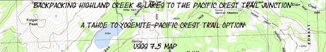

Backpacking
Highland Creek on the Tahoe to Yosemite Trail
to
Wolf Creek Pass
on the Pacific Crest Trail
via
Highland Lakes
Hiking
A Tahoe to Yosemite Trail Route Option
7.5 minute USGS Backpacking Topo Map of the Carson Iceberg Wilderness

| Tahoe to Yosemite Maps and Mileages |
Trail Guide | Tahoe to Whitney Indexes |
More Miles and Elevations |
Permits | Weather, Map Data | |||||||||||||||||
| Maps INDEX Tahoe to Yosemite Trail |
TYT Trail Highland Creek |
North |
BIG Maps |
Miles and Elevations |
TYT Jenkins Canyon |
PCT Wolf Creek Pass |
TYT-PCT Link Highland Lakes |
All Miles Tahoe to Whitney |
Local Maps Highway 4 to Highway 108 |
All Maps Tahoe to Whitney |
TYT |
Lake Alpine to Saint Marys Pass |
PCT |
West |
East |
map info | ||||||
Trailheads
HUB of TRAILS
6.46 miles Northeast from TYT at Jenkins Canyon via Highland Lakes Trailhead.
3.72 miles from Highland LakeTrailhead Northeast to PCT at Wolf Creek Pass.
TYT to PCT
10.18 miles
Context
The Carson Iceberg Wilderness Map
Click RED DOTS and BLACK LABELS below for
Associated Guide Pages and Backpacking Maps
| TOPO MAP CONNECTOR TYT-PCT Spicer Reservoir via Highland Creek |
TOPO MAP North PCT Ebbetts Pass to Tyron Peak |
TOPO Map South PCT Wolf Creek to Swampy Lake |
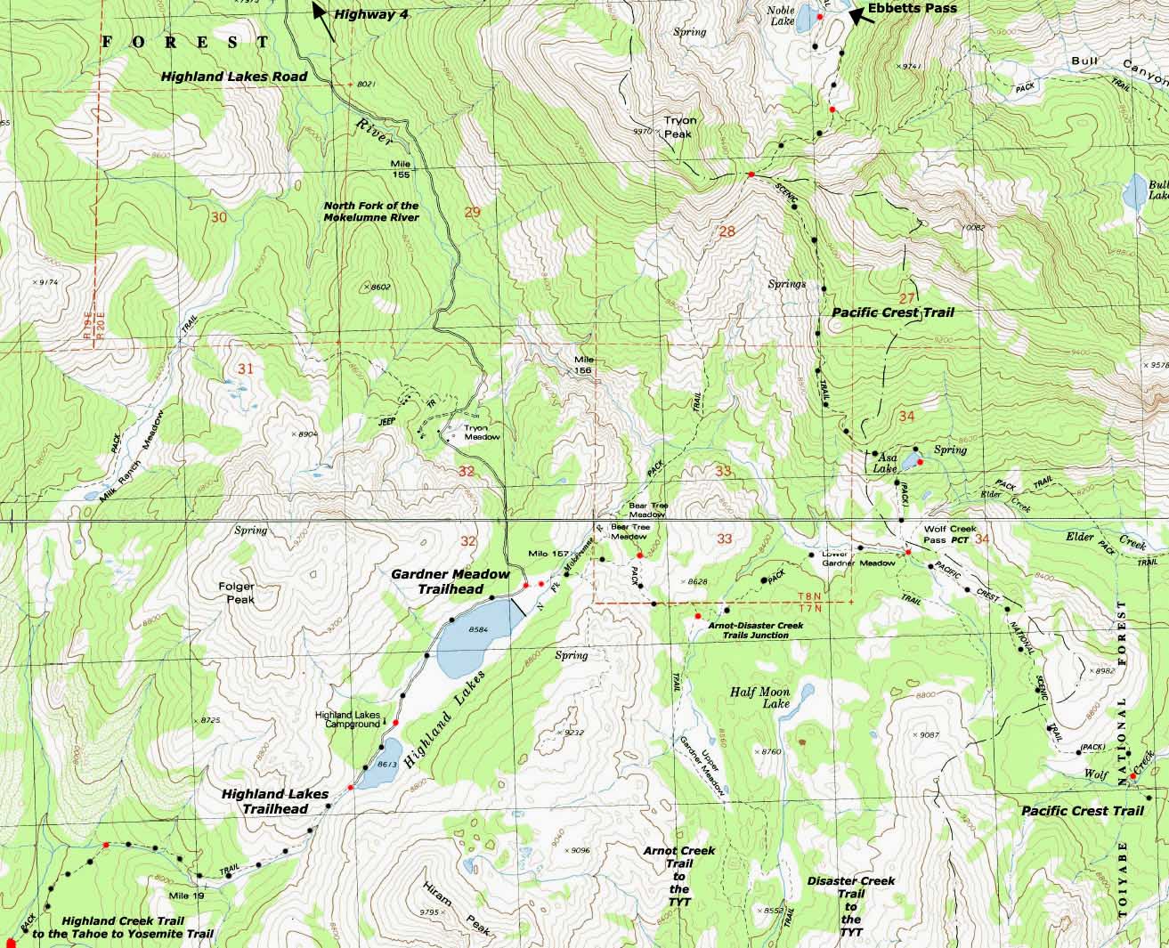
|
| Spicer Reservoir via Highland Creek TOPO MAP TYT-PCT CONNECTOR TRAIL |
Ebbetts Pass to Tyron Peak TOPO MAP PCT North |
Wolf Creek to Swampy Lake TOPO Map PCT South |
The Carson Iceberg Wilderness Map
Mapology |
||||
MAP NOTE What's important for our general reference purpose is that each side of a square is 1000 meters, or a Kilometer. From my point of view that is 1093.6 yards or .62 of a mile. Diagonal: 1414.22 meters, if my trig is correct. That converts the diagonal distance into 4,639.8 feet or .88 of a mile.
|
Location |
Main Features Local Hikers This road gives us access to a set of trailheads and trails located just West of the route of the PCT and maybe ten miles Northeast of the route of the TYT. These are fine access points for local backpackers to areas near and on the Sierra Crestline which also gives day hikers and car campers excellent access to a remote segment of the Sierra Crest to observe and explore. Long Distance Hikers Or visa-versa. The best route is the best route no matter which direction you hike it. From Highland Lakes the Tahoe to Yosemite Trail is to our South, the Pacific Crest Trail to our Northeast. The reason for tying the TYT and PCT routes together through Highland Lakes is simple: just a bit further North of Lake Alpine on Highway 4 the Tahoe to Yosemite Trail between Carson Pass through the North Mokelumne River and Summit City Creek is not to be missed, in my opinion. It is a beautiful route. This section also contains a long section of unmaintained trail. On the other hand, the section of the Pacific Crest Trail through the East Fork of the Carson River from Wolf Creek Pass to Sonora Pass is also especially beautiful. Humm, OK, my question is how can we pull this off? On one hike? A few hikes? Many many backpacking trips... My simple solution is to stitch these sections together via the Highland Creek trail. The Highland Creek trail parts from the Tahoe to Yosemite Trail just to the Northeast of Spicer Meadow Reservoir at the Jenkins Canyon trail junction. We must understand that we have a menu of route selections backpacking across the length of the Carson Iceberg Wilderness. This is a little bit of backpacker heaven. So I got a little bit of map here depicting it's heart, or Hub of Trails... On Down the Trail These all look like good options to me... Your route through the High Sierra Nevada Mountains has many options that only time on trail will clarify. Highland Lakes can be a start point for great hiking loops around the Carson Iceberg Wilderness using both the PCT and TYT routes, or you may just be hiking by, connecting up these two beautiful trails around the Carson Iceberg. Rather than exclusively following either the Tahoe to Yosemite or the Pacific Crest Trail, Highland Lakes is one of the connectors trails you can use to stitch together custom parts of each trail to craft your own unique route between Tahoe and Whitney. We will continue to discuss the various trail options as we hike South. If you have any questions or comments, don't hesitate to contact me. I'll have all of these maps, as well as the trail guide pages, linked to a forum where you can soon leave your bits of wisdom about this section. |
Mapping, Mileage, and National Forest Permit Information |
|||||
Miles and Elevations
Physical Location Mileages TYT Route Jenkins Canyon to Highland Lake Jenkins Canyon to Saint Marys Pass
Mileages PCT Route Ebbetts Pass to Wolf Creek Pass Wolf Creek Pass to Sonora Pass
Trail Guide Topo Maps
|
USGS Topo Map Information
Top
scale Contours
Bottom
scale Contours
Compass Offset |
||||
|
|||||
Backpacking permitting authorities |
|||||
West Flank Stanislaus National Forest Wilderness Contacts National Forest website
|
East Flank Toiyabe National Forest Wilderness Contacts National Forest website Carson-Iceberg Wilderness |
||||
| NF links are all dead from local NF sites...(FIXED AGAIN, 5-28-2012) they do that sometimes. I am constantly trying to keep up with their changes. email me. | |||||
Region map, North & South: The Pacific Crest Trail last map, TYT: Spicer Reservoir up Highland Creek
| Elevations | More Information | ||
Upper Highland Lake: 8613 feet Lower: 8584 feet Wolf Creek Pass : 8400 feet Tyron Peak: 9320 feet |
Trail Guide: Jenkins Canyon Trail Guide: Highland Lakes Trail Guide: Wolf Creek Pass Google Map: Highland Lakes and Ebbetts Pass |
||
Map Credit: Thanks, USGS ! |
U.S. Geological Survey, Department of the Interior The
|